


Rick Thoman
@alaskawx.bsky.social
Climate specialist with ACCAP/IARC at UAF, highlighting Alaska and Arctic climate, environment & Indigenous cultures. Opinions are my own.
Alaska and Arctic Climate Newsletter: https://alaskaclimate.substack.com/
Alaska and Arctic Climate Newsletter: https://alaskaclimate.substack.com/
Pinned
Rick Thoman
@alaskawx.bsky.social
· Dec 3

Hot off the digital press: Alaska’s Changing Environment 2.0 is now online! Focused on observations and impacts to Alaskans. From warming air & ocean, ice & snow to salmon & berries. Please check it out. #akwx #Alaska #Climate #ClimateChange @climatologist49.bsky.social
uaf-accap.org/alaskas-chan...
uaf-accap.org/alaskas-chan...
Reposted by Rick Thoman
huge wall of hail heading towards the volcano over some moody seas this afternoon
📍sheet’ka, lingit aani
📍sheet’ka, lingit aani

December 15, 2025 at 11:55 PM
huge wall of hail heading towards the volcano over some moody seas this afternoon
📍sheet’ka, lingit aani
📍sheet’ka, lingit aani
Reposted by Rick Thoman
My favorite thing about Fairbanks this time of year is the light. Long sunrises stretch into sunset on the shortest days of the year, turning even brief mornings into something worth stopping for.
Prints and wall art available:
photos.lwpetersen.com/Portfolio-Im...
#alaska #sunrise #sunset #winter
Prints and wall art available:
photos.lwpetersen.com/Portfolio-Im...
#alaska #sunrise #sunset #winter

December 15, 2025 at 6:02 PM
My favorite thing about Fairbanks this time of year is the light. Long sunrises stretch into sunset on the shortest days of the year, turning even brief mornings into something worth stopping for.
Prints and wall art available:
photos.lwpetersen.com/Portfolio-Im...
#alaska #sunrise #sunset #winter
Prints and wall art available:
photos.lwpetersen.com/Portfolio-Im...
#alaska #sunrise #sunset #winter
Fairbanks Airport Monday morning down to -40F/C for the first time this winter and first time since February 2024. Record low temperature for December 15 is -55F in 1946. #akwx #Winter2026 @carrieinfbx.bsky.social @jenniferschell16.bsky.social

December 15, 2025 at 4:43 PM
Fairbanks Airport Monday morning down to -40F/C for the first time this winter and first time since February 2024. Record low temperature for December 15 is -55F in 1946. #akwx #Winter2026 @carrieinfbx.bsky.social @jenniferschell16.bsky.social
The Fairbanks area has strong temperature inversion Monday morning but it's not sharp. Above about 1500 ft MSL about 30F higher than the valley floor cold spots. Highest temperature on the 3am upper air observation at the airport was +3F at about 3000 ft MSL. #akwx @leahwrenn.bsky.social

December 15, 2025 at 4:28 PM
The Fairbanks area has strong temperature inversion Monday morning but it's not sharp. Above about 1500 ft MSL about 30F higher than the valley floor cold spots. Highest temperature on the 3am upper air observation at the airport was +3F at about 3000 ft MSL. #akwx @leahwrenn.bsky.social

Reposted by Rick Thoman

Photos from my daughter on the campus of Rutgers University.


December 14, 2025 at 4:46 PM
Photos from my daughter on the campus of Rutgers University.
Reposted by Rick Thoman
Woke up to this excellent roundup.
www.npr.org/2025/12/15/n...
www.npr.org/2025/12/15/n...

Houses floated away in this Alaska Native village. Now residents want to move
Kwigillingok, Alaska, has long grappled with erosion and flooding. Residents want to move to higher ground, further inland, especially after the remnants of Typhoon Halong damaged nearly every house.
www.npr.org
December 15, 2025 at 3:16 PM
Woke up to this excellent roundup.
www.npr.org/2025/12/15/n...
www.npr.org/2025/12/15/n...
In the ACCAP Extreme Events library we've got a 4-pager about past high wind events in the Anchorage area. We'll need to add the ongoing wind storm to the timeline. #akwx #ExtremeWeather @climatologist49.bsky.social
uaf-accap.org/projects/ext...
uaf-accap.org/projects/ext...

Anchorage Winds | ACCAP
Overview Anchorage is the largest population center in Alaska with 228,000 people in 2021. The city is positioned on the Gulf of Alaska and is buffered by the Chugach mountains to the east and Cook…
uaf-accap.org
December 15, 2025 at 3:17 PM
In the ACCAP Extreme Events library we've got a 4-pager about past high wind events in the Anchorage area. We'll need to add the ongoing wind storm to the timeline. #akwx #ExtremeWeather @climatologist49.bsky.social
uaf-accap.org/projects/ext...
uaf-accap.org/projects/ext...
Reposted by Rick Thoman
Short post from the Alaska and Arctic Climate Newsletter on an active early December, including some details about the Mat-Su wind storm and Interior/Yukon cold snap. #akwx #ytwx #weather
alaskaclimate.substack.com/p/alaska-ear...
alaskaclimate.substack.com/p/alaska-ear...

December 15, 2025 at 2:51 AM
Short post from the Alaska and Arctic Climate Newsletter on an active early December, including some details about the Mat-Su wind storm and Interior/Yukon cold snap. #akwx #ytwx #weather
alaskaclimate.substack.com/p/alaska-ear...
alaskaclimate.substack.com/p/alaska-ear...
Reposted by Rick Thoman
Snowfall 14.5 cm through 11am in #GanderWest, with ice pellets now into the mix. Getting more dense with water equivalent 15.8 mm. #nlwx

December 15, 2025 at 2:37 PM
Snowfall 14.5 cm through 11am in #GanderWest, with ice pellets now into the mix. Getting more dense with water equivalent 15.8 mm. #nlwx
Short post from the Alaska and Arctic Climate Newsletter on an active early December, including some details about the Mat-Su wind storm and Interior/Yukon cold snap. #akwx #ytwx #weather
alaskaclimate.substack.com/p/alaska-ear...
alaskaclimate.substack.com/p/alaska-ear...
December 15, 2025 at 2:51 AM
Short post from the Alaska and Arctic Climate Newsletter on an active early December, including some details about the Mat-Su wind storm and Interior/Yukon cold snap. #akwx #ytwx #weather
alaskaclimate.substack.com/p/alaska-ear...
alaskaclimate.substack.com/p/alaska-ear...
Reposted by Rick Thoman
We recently reviewed a magnitude 3.2 earthquake felt across the Fairbanks area at about 2 pm Alaska time. If YOU felt it, you can describe your experience here: https://earthquake.alaska.edu/event/ak2025yoszov

Ester M3.2 | Alaska Earthquake Center
Alaskan Earthquake Center
earthquake.alaska.edu
December 14, 2025 at 11:47 PM
We recently reviewed a magnitude 3.2 earthquake felt across the Fairbanks area at about 2 pm Alaska time. If YOU felt it, you can describe your experience here: https://earthquake.alaska.edu/event/ak2025yoszov
Reposted by Rick Thoman
1976, Owen David crouches against the wind in Bethel. Photo by James Barker and via Anchorage Museum. #alaskahistory #alaska

December 14, 2025 at 9:01 PM
1976, Owen David crouches against the wind in Bethel. Photo by James Barker and via Anchorage Museum. #alaskahistory #alaska
Reposted by Rick Thoman

Dec. 14 snowpack situation at 6,900 feet at Palisades Tahoe

December 14, 2025 at 9:11 PM
Dec. 14 snowpack situation at 6,900 feet at Palisades Tahoe
Alaska and vicinity seasonal 50-year temperature changes (ºF) updated through autumn 2025, all in one graphic for your convenience. That's a whole lot of warming going on. #akwx #Alaska #ClimateChange #Arctic

December 14, 2025 at 9:44 PM
Alaska and vicinity seasonal 50-year temperature changes (ºF) updated through autumn 2025, all in one graphic for your convenience. That's a whole lot of warming going on. #akwx #Alaska #ClimateChange #Arctic
Reposted by Rick Thoman
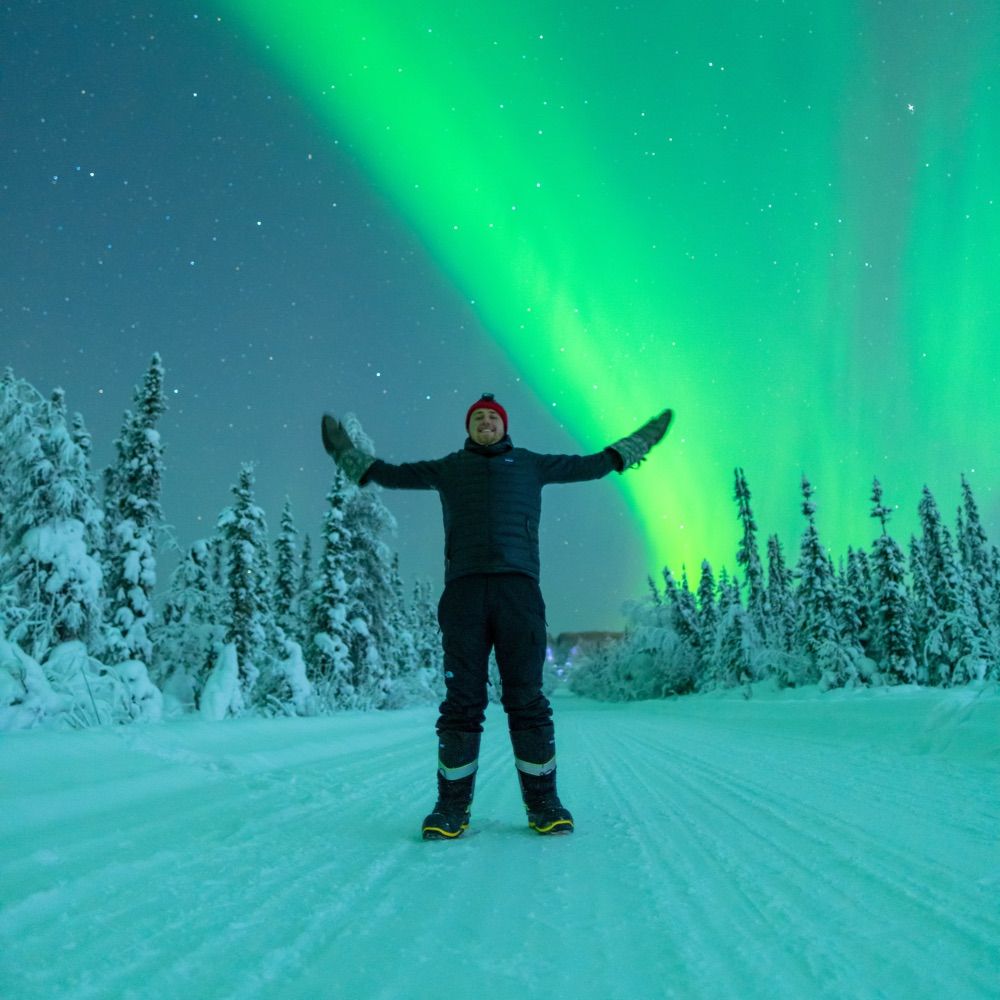
The aurora last night from Fairbanks with Maia. Check out my website for our aurora tour offerings for this season: theauroraguy.com/pages/maias-...
Limited availability throughout Feb-April, but Dec-Jan are fairly open!
See you in Fairbanks!
Limited availability throughout Feb-April, but Dec-Jan are fairly open!
See you in Fairbanks!


December 14, 2025 at 2:43 PM
The aurora last night from Fairbanks with Maia. Check out my website for our aurora tour offerings for this season: theauroraguy.com/pages/maias-...
Limited availability throughout Feb-April, but Dec-Jan are fairly open!
See you in Fairbanks!
Limited availability throughout Feb-April, but Dec-Jan are fairly open!
See you in Fairbanks!
Sea ice extent in the Bering Sea slightly above the 1991-2020 median for mid-December in NSIDC data. Storminess late last week wiped out most of the ice near the Russian coast southwest of Cape Navarin and opened up the area between St. Lawrence Island and the Bering Strait. #akwx #Arctic #SeaIce

December 14, 2025 at 6:11 PM
Reposted by Rick Thoman
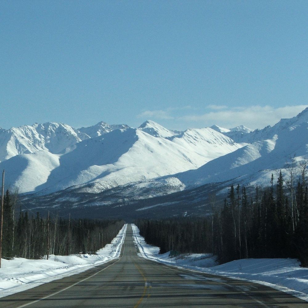
High peaks of the Hayes Range in the Alaska Range, seen from the Loket, a broad tributary of the Black Rapids Glacier, photographed in April. A cold, clear view of scale and distance deep in the Alaska Range.
Prints, wall art, and digital images available here:
photos.lwpetersen.com/Portfolio-Im...
Prints, wall art, and digital images available here:
photos.lwpetersen.com/Portfolio-Im...

December 14, 2025 at 5:22 PM
High peaks of the Hayes Range in the Alaska Range, seen from the Loket, a broad tributary of the Black Rapids Glacier, photographed in April. A cold, clear view of scale and distance deep in the Alaska Range.
Prints, wall art, and digital images available here:
photos.lwpetersen.com/Portfolio-Im...
Prints, wall art, and digital images available here:
photos.lwpetersen.com/Portfolio-Im...
High temperatures (ºF) in and around Alaska on Saturday. Cooler across western and northern Alaska. Milder in Southeast though still below normal except in southern-most areas. #akwx #weather @climatologist49.bsky.social

December 14, 2025 at 4:53 PM
High temperatures (ºF) in and around Alaska on Saturday. Cooler across western and northern Alaska. Milder in Southeast though still below normal except in southern-most areas. #akwx #weather @climatologist49.bsky.social
No solar heating within a month of winter solstice means that the time of daily high and low temperatures has no relation to clock time. So a Fairbanks high temperature occurring near midnight and a low temperature occurring near Noon is perfectly reasonable. #akwx @climatologist49.bsky.social

December 14, 2025 at 4:18 PM
No solar heating within a month of winter solstice means that the time of daily high and low temperatures has no relation to clock time. So a Fairbanks high temperature occurring near midnight and a low temperature occurring near Noon is perfectly reasonable. #akwx @climatologist49.bsky.social
Reposted by Rick Thoman
Monthly carbon dioxide concentration since 1958 from the NOAA Mauna Loa Observatory, Hawai'i. Last month's average concentration of 426 parts per million is 36 percent higher than in November 1958. The 10-year forecast is based on nothing but the recent trajectory of CO₂ concentrations. #Climate

December 14, 2025 at 12:37 AM
Monthly carbon dioxide concentration since 1958 from the NOAA Mauna Loa Observatory, Hawai'i. Last month's average concentration of 426 parts per million is 36 percent higher than in November 1958. The 10-year forecast is based on nothing but the recent trajectory of CO₂ concentrations. #Climate
Reposted by Rick Thoman
Another snow day, with just over an inch at the office and in town. The snow changed to rain during the morning as temperatures rose, leading to a slippery mess.


December 14, 2025 at 6:01 AM
Another snow day, with just over an inch at the office and in town. The snow changed to rain during the morning as temperatures rose, leading to a slippery mess.
Reposted by Rick Thoman
The temperature at the Juneau Intl Airport dropped to -2F yesterday. This is only the 4th sub-0F day there in 15 years. Prior to the 1980s, it used to happen about 10 days per year. @alaska.bsky.social @alaskawx.bsky.social

December 14, 2025 at 3:52 AM
The temperature at the Juneau Intl Airport dropped to -2F yesterday. This is only the 4th sub-0F day there in 15 years. Prior to the 1980s, it used to happen about 10 days per year. @alaska.bsky.social @alaskawx.bsky.social
The sorry state of upper air observations in western Alaska continues. Kotzebue, Nome, Bethel, McGrath, King Salmon and Saint Paul all missed the Saturday afternoon launch. 😡 #akwx #weather @wxmanms1.bsky.social @brunota2003.bsky.social @climatologist49.bsky.social

December 14, 2025 at 3:46 AM
The sorry state of upper air observations in western Alaska continues. Kotzebue, Nome, Bethel, McGrath, King Salmon and Saint Paul all missed the Saturday afternoon launch. 😡 #akwx #weather @wxmanms1.bsky.social @brunota2003.bsky.social @climatologist49.bsky.social