


Joe Mason
@moreorloess.bsky.social
UW Madison Geography, opinions are mine. Geomorphology, soils, dunes, loess, in the Midwest, Great Plains, northern China. He/him. Living on Ho-Chunk lands.
On state smells: Wisconsin will claim the pulp mill smell in Mosinee and Kaukauna if Colorado acknowledges the beet sugar refinery smell in Fort Morgan and Nebraska owns up to the feedlot smell in Broken Bow.
November 21, 2025 at 3:54 AM
On state smells: Wisconsin will claim the pulp mill smell in Mosinee and Kaukauna if Colorado acknowledges the beet sugar refinery smell in Fort Morgan and Nebraska owns up to the feedlot smell in Broken Bow.
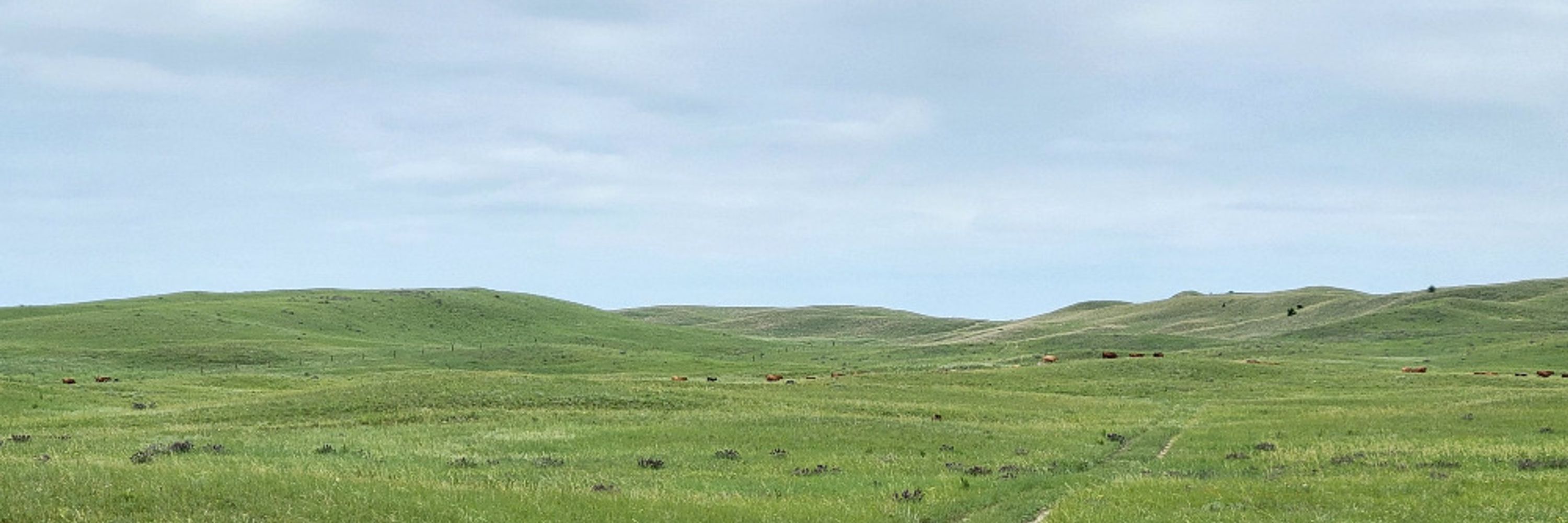
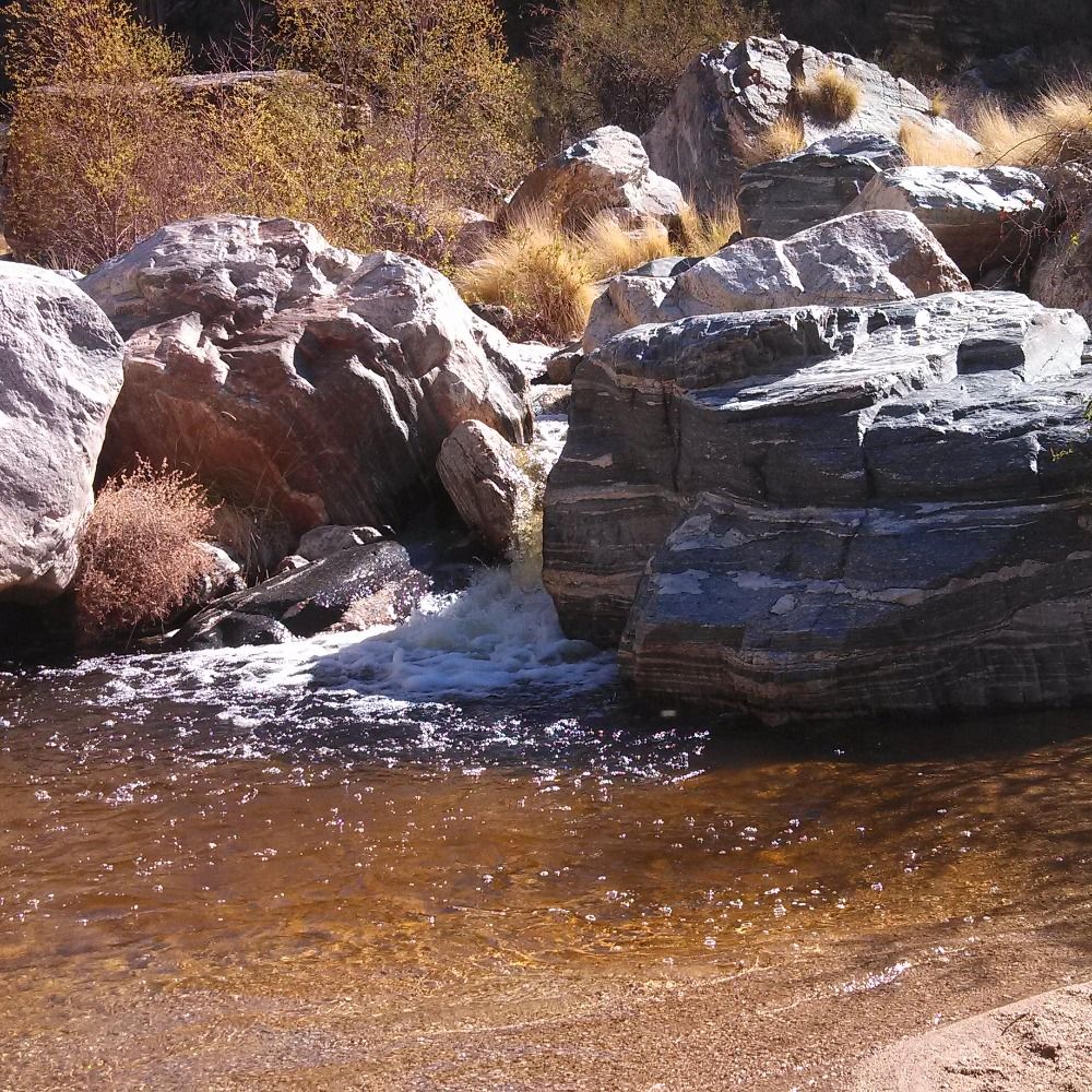
Moraines, one with a debris flow channel cutting through it at the mouth of the canyon where Clark's Fork of the Yellowstone flows out of the Beartooth Plateau. For three years I taught a Quaternary/geomorph unit in the IA State/UNL/UNO field camp, including a mapping exercise here. I miss that.


November 21, 2025 at 12:10 AM
Moraines, one with a debris flow channel cutting through it at the mouth of the canyon where Clark's Fork of the Yellowstone flows out of the Beartooth Plateau. For three years I taught a Quaternary/geomorph unit in the IA State/UNL/UNO field camp, including a mapping exercise here. I miss that.
Reposted by Joe Mason
Yeah, I think the problem is right for some interesting simulation exercises. A colleague and I did something a little bit similar a few years ago where we knocked out the peak flow from every USGS gauge in the country and then re-computed the FFA: onlinelibrary.wiley.com/doi/epdf/10....
The weight of the flood‐of‐record in flood frequency analysis
onlinelibrary.wiley.com
November 20, 2025 at 1:28 PM
Yeah, I think the problem is right for some interesting simulation exercises. A colleague and I did something a little bit similar a few years ago where we knocked out the peak flow from every USGS gauge in the country and then re-computed the FFA: onlinelibrary.wiley.com/doi/epdf/10....
Reposted by Joe Mason
In this example from Bulletin 17C, the estimated discharge for the 100-yr flood (aka 1% AEP) is somewhere between *squinting* 4,000 cfs and 20,000 cfs. Even with an actual observed flood close to 10,000 cfs to act as a reality check for the estimate, that is just a massive range.

November 20, 2025 at 3:03 AM
In this example from Bulletin 17C, the estimated discharge for the 100-yr flood (aka 1% AEP) is somewhere between *squinting* 4,000 cfs and 20,000 cfs. Even with an actual observed flood close to 10,000 cfs to act as a reality check for the estimate, that is just a massive range.
Reposted by Joe Mason
In the US, the go-to reference for flood frequency analysis is Bulletin 17C from the US Geological Survey: pubs.usgs.gov/tm/04/b05/tm...
My point about the uncertainty in the 1:100 year of event is not stated explicitly, but it’s obvious if you know what to look for.
My point about the uncertainty in the 1:100 year of event is not stated explicitly, but it’s obvious if you know what to look for.
pubs.usgs.gov
November 20, 2025 at 2:58 AM
In the US, the go-to reference for flood frequency analysis is Bulletin 17C from the US Geological Survey: pubs.usgs.gov/tm/04/b05/tm...
My point about the uncertainty in the 1:100 year of event is not stated explicitly, but it’s obvious if you know what to look for.
My point about the uncertainty in the 1:100 year of event is not stated explicitly, but it’s obvious if you know what to look for.
Reposted by Joe Mason
This is a terribly misunderstood point, even in insurance circles.
Our estimates of the 1 in 100 flood are almost always extrapolations and depend heavily on our assumptions and a few (or zero) real events. In most cases, the 'actual' 1:100 flood could be ~20% lower or higher (at least).
Our estimates of the 1 in 100 flood are almost always extrapolations and depend heavily on our assumptions and a few (or zero) real events. In most cases, the 'actual' 1:100 flood could be ~20% lower or higher (at least).
The defense that this was just an adjustment based on better data is self-serving BS.
We do *not* know what the 100-yr flood level is - even if we had perfect DEMs.
Even if we had perfect historical data, non-stationarity means we don’t know what the level is *now*, let alone in the future.
We do *not* know what the 100-yr flood level is - even if we had perfect DEMs.
Even if we had perfect historical data, non-stationarity means we don’t know what the level is *now*, let alone in the future.

November 20, 2025 at 1:48 AM
This is a terribly misunderstood point, even in insurance circles.
Our estimates of the 1 in 100 flood are almost always extrapolations and depend heavily on our assumptions and a few (or zero) real events. In most cases, the 'actual' 1:100 flood could be ~20% lower or higher (at least).
Our estimates of the 1 in 100 flood are almost always extrapolations and depend heavily on our assumptions and a few (or zero) real events. In most cases, the 'actual' 1:100 flood could be ~20% lower or higher (at least).
Reposted by Joe Mason

Research by the University of Minnesota's Mapping Prejudice Project has uncovered hundreds of racist property deeds in Sherburne County. Nearly all the properties were clustered around lakes, and 90 percent were added after 1948. Racial covenants became illegal in Minnesota in 1953.

U of M’s Mapping Prejudice Project reveals racist deeds around Sherburne County lakes
Researchers found 356 properties with racial covenants in Sherburne County, nearly all clustered around lakes. Most were added after 1948, when the U.S. Supreme Court ruled such restrictions were unen...
www.mprnews.org
November 20, 2025 at 12:21 AM
Research by the University of Minnesota's Mapping Prejudice Project has uncovered hundreds of racist property deeds in Sherburne County. Nearly all the properties were clustered around lakes, and 90 percent were added after 1948. Racial covenants became illegal in Minnesota in 1953.
Another simpler example, one water year on the Beartooth Plateau and the Clarks Fork and Yellowstone rivers downstream, no dams or reservoirs in this case but use for irrigation along the river valleys. Peak flow at Miles City integrates snowmelt over multiple mountain ranges.

November 20, 2025 at 1:52 PM
Another simpler example, one water year on the Beartooth Plateau and the Clarks Fork and Yellowstone rivers downstream, no dams or reservoirs in this case but use for irrigation along the river valleys. Peak flow at Miles City integrates snowmelt over multiple mountain ranges.
The Mississippi cuts through a bedrock ridge here in a relatively narrow gorge. The last place it flows over bedrock is just downstream at the even narrower Thebes Gap, which formed only in the Late Pleistocene.

The fabled Tower Rock walkway has defied expectations and emerged from the Mississippi River's depths, triggering worries among water experts.

'Once in a lifetime' tourist destination back for 4th year in a row, thanks to chronically low Mississippi River
The fabled Tower Rock walkway has defied expectations and emerged from the Mississippi River's depths, triggering worries among water experts.
www.kare11.com
November 20, 2025 at 2:54 AM
The Mississippi cuts through a bedrock ridge here in a relatively narrow gorge. The last place it flows over bedrock is just downstream at the even narrower Thebes Gap, which formed only in the Late Pleistocene.
Reposted by Joe Mason
New grad student collecting her first fire scar data along the shore of Lake Superior today.


November 20, 2025 at 2:19 AM
New grad student collecting her first fire scar data along the shore of Lake Superior today.
Reposted by Joe Mason
Neither science nor scientists need to "win back" trust in the US--we need to use society's really incredibly high level of trust in us to oppose deeply unpopular policies like fucking over NASA or halting cancer prevention and treatment research.
November 20, 2025 at 2:13 AM
Neither science nor scientists need to "win back" trust in the US--we need to use society's really incredibly high level of trust in us to oppose deeply unpopular policies like fucking over NASA or halting cancer prevention and treatment research.
Had the best day I've had in awhile, and it didn't even have much to do with Larry Summers.
November 20, 2025 at 2:16 AM
Had the best day I've had in awhile, and it didn't even have much to do with Larry Summers.
Reposted by Joe Mason

Definitely a large sedge of Sandhill Cranes. I rarely get to use the term "sedge", it's used for when a large group of cranes have gathered and are feeding or are in community together.
These are the at the two farms I frequent to spot migration near the WI River.
#birds #SandhillCranes
These are the at the two farms I frequent to spot migration near the WI River.
#birds #SandhillCranes


November 20, 2025 at 12:12 AM
Definitely a large sedge of Sandhill Cranes. I rarely get to use the term "sedge", it's used for when a large group of cranes have gathered and are feeding or are in community together.
These are the at the two farms I frequent to spot migration near the WI River.
#birds #SandhillCranes
These are the at the two farms I frequent to spot migration near the WI River.
#birds #SandhillCranes
NAGPRA was passed in 1990. These remains were returned in 2025. From what I've observed, institutions finally comply with NAGPRA only when someone with authority commits to overcoming internal resistance and takes on this responsibility. www.jsonline.com/story/news/l...
Remains of 67 ancient Menominee ancestors reburied by tribe after excavation by Milwaukee Public Museum
The ancestors are thousands of years old and were excavated in the 1960s.
www.jsonline.com
November 20, 2025 at 1:04 AM
NAGPRA was passed in 1990. These remains were returned in 2025. From what I've observed, institutions finally comply with NAGPRA only when someone with authority commits to overcoming internal resistance and takes on this responsibility. www.jsonline.com/story/news/l...
Even 31 years after submitting my first peer-reviewed paper, it's still great to see an acceptance or minor revision email (used to be a letter). Two in one day today, both years in the making.
November 20, 2025 at 12:37 AM
Even 31 years after submitting my first peer-reviewed paper, it's still great to see an acceptance or minor revision email (used to be a letter). Two in one day today, both years in the making.
The nhdplusTools R package from USGS can generate simple interactive Leaflet maps of river basins and networks with one line of code. Here is the North Platte above the WY-NE state line, which I've used for almost two decades as a case study of mountain snowmelt and stream discharge.

November 19, 2025 at 11:28 PM
The nhdplusTools R package from USGS can generate simple interactive Leaflet maps of river basins and networks with one line of code. Here is the North Platte above the WY-NE state line, which I've used for almost two decades as a case study of mountain snowmelt and stream discharge.
Hecla mines, based on a quick google maps search. B, Calumet and Hecla, is mislocated, that was the name of the main copper mining company in the Keweenaw Peninsula, run by Louis Agassiz's son Alexander.

November 19, 2025 at 9:13 PM
Hecla mines, based on a quick google maps search. B, Calumet and Hecla, is mislocated, that was the name of the main copper mining company in the Keweenaw Peninsula, run by Louis Agassiz's son Alexander.
Reposted by Joe Mason

Nov. 19, 1925: The Hecla silver mine in Gem, Idaho.

November 19, 2025 at 9:02 PM
Nov. 19, 1925: The Hecla silver mine in Gem, Idaho.
Walking by new coffee shops, fast food, and apparel stores that replaced failed coffee shops, fast food, and apparel stores in the campus area, and thinking:
Brand names have been sounding like AI slop since way before that was a thing.
Brand names have been sounding like AI slop since way before that was a thing.
November 19, 2025 at 9:01 PM
Walking by new coffee shops, fast food, and apparel stores that replaced failed coffee shops, fast food, and apparel stores in the campus area, and thinking:
Brand names have been sounding like AI slop since way before that was a thing.
Brand names have been sounding like AI slop since way before that was a thing.
Walking past the assigned parking places around the Capitol and wondering how accurately I could guess R vs. D.
November 19, 2025 at 3:41 PM
Walking past the assigned parking places around the Capitol and wondering how accurately I could guess R vs. D.
The original Wyoming constitution includes a provision limiting irrigation water rights to a maximum of one cubic foot per second for each 70 acres. The obvious question is one cfs for how long?
(probably intended to apply during peak snowmelt flow in late spring to early summer)
(probably intended to apply during peak snowmelt flow in late spring to early summer)
November 19, 2025 at 1:52 PM
The original Wyoming constitution includes a provision limiting irrigation water rights to a maximum of one cubic foot per second for each 70 acres. The obvious question is one cfs for how long?
(probably intended to apply during peak snowmelt flow in late spring to early summer)
(probably intended to apply during peak snowmelt flow in late spring to early summer)
Reposted by Joe Mason

#30DayMapChallenge · Day 18 · Out of this world. So here's valley networks of Mars.
#rayshader adventures, an #rstats tale
#rayshader adventures, an #rstats tale

November 19, 2025 at 3:22 AM
#30DayMapChallenge · Day 18 · Out of this world. So here's valley networks of Mars.
#rayshader adventures, an #rstats tale
#rayshader adventures, an #rstats tale
Terraces in North Park and the Rabbit Ears, Colorado, September, 1979. I've been thinking North Park for a long time. It works its way into many class lectures under various pretexts, along with the Laramie and Bighorn basins, South Park, and the San Luis Valley.


November 19, 2025 at 2:37 AM
Terraces in North Park and the Rabbit Ears, Colorado, September, 1979. I've been thinking North Park for a long time. It works its way into many class lectures under various pretexts, along with the Laramie and Bighorn basins, South Park, and the San Luis Valley.
Reposted by Joe Mason

"Pika rely on a thick blanket of snow over their rocky homes to provide as insulation, but increasing temperatures lower annual snowfall, thus preventing Pika from getting the insulation the need to protect them against winter temperatures."
storymaps.arcgis.com/stories/c375...
storymaps.arcgis.com/stories/c375...
November 19, 2025 at 2:06 AM
"Pika rely on a thick blanket of snow over their rocky homes to provide as insulation, but increasing temperatures lower annual snowfall, thus preventing Pika from getting the insulation the need to protect them against winter temperatures."
storymaps.arcgis.com/stories/c375...
storymaps.arcgis.com/stories/c375...
Park Range and Front Range, Colorado, with North Park and Middle Park between them, separated by the lower east-west Rabbit Ears Range. 11/4-9/2025 (left) and 11/1/2024 (right). Note snow even in higher parts of North Park in 2024. Marker is at Tower SNOTEL station. Sentinel 2 images.


November 19, 2025 at 2:21 AM
Park Range and Front Range, Colorado, with North Park and Middle Park between them, separated by the lower east-west Rabbit Ears Range. 11/4-9/2025 (left) and 11/1/2024 (right). Note snow even in higher parts of North Park in 2024. Marker is at Tower SNOTEL station. Sentinel 2 images.