


Joe Mason
@moreorloess.bsky.social
UW Madison Geography, opinions are mine. Geomorphology, soils, dunes, loess, in the Midwest, Great Plains, northern China. He/him. Living on Ho-Chunk lands.
Extra buses to O'Hare, long lines, drivers shouting instructions. Looks like Thanksgiving week on the Madison campus.

November 24, 2025 at 11:29 PM
Extra buses to O'Hare, long lines, drivers shouting instructions. Looks like Thanksgiving week on the Madison campus.
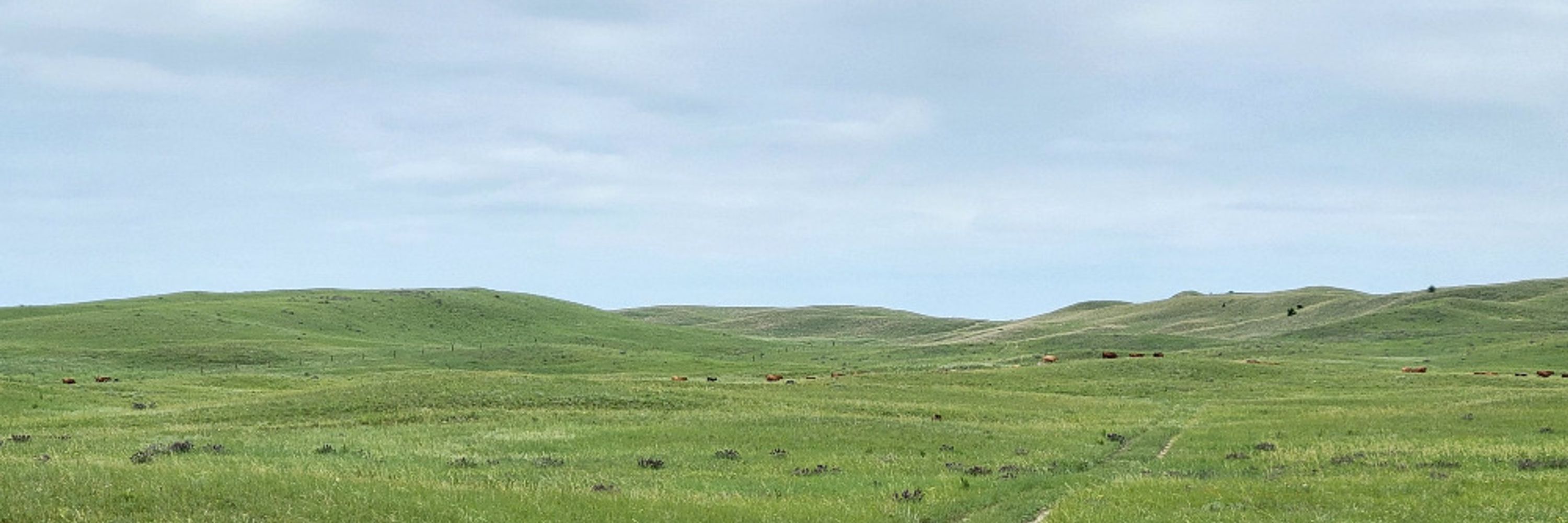
Holocene meander belts of the Mississippi around Ferriday, LA (also Natchez, MS, in southeast corner). Going to discuss a paper that's more than 25 yrs old but in my opinion still one of the best on using modern analogues to interpret pre-Quaternary paleosols formed in alluvial settings.

November 23, 2025 at 3:26 PM
Holocene meander belts of the Mississippi around Ferriday, LA (also Natchez, MS, in southeast corner). Going to discuss a paper that's more than 25 yrs old but in my opinion still one of the best on using modern analogues to interpret pre-Quaternary paleosols formed in alluvial settings.
Reservoirs filling with sediment, northwest Mississippi (could also be low water because of the time of year or drought, but you can see deltas building in both cases). Soils mostly formed in Eocene coastal plain sediment with some loess cover. Sentinel 2, Nov 15, 2024.


November 23, 2025 at 3:49 AM
Reservoirs filling with sediment, northwest Mississippi (could also be low water because of the time of year or drought, but you can see deltas building in both cases). Soils mostly formed in Eocene coastal plain sediment with some loess cover. Sentinel 2, Nov 15, 2024.
Milwaukee was machinist and metalworker to the world. Falk Corporation, Wisconsin Historical Society image 50858.

November 23, 2025 at 2:08 AM
Milwaukee was machinist and metalworker to the world. Falk Corporation, Wisconsin Historical Society image 50858.
Fall colors of a different kind.


November 22, 2025 at 4:51 PM
Fall colors of a different kind.
The big picture: Before and after closing of the Glen Canyon Dam, and the remarkable 1982-83 El Niño, among other things.

November 22, 2025 at 2:16 PM
The big picture: Before and after closing of the Glen Canyon Dam, and the remarkable 1982-83 El Niño, among other things.
Here is the channel that's in one of the photos, Google Maps image.

November 21, 2025 at 12:14 AM
Here is the channel that's in one of the photos, Google Maps image.
Moraines, one with a debris flow channel cutting through it at the mouth of the canyon where Clark's Fork of the Yellowstone flows out of the Beartooth Plateau. For three years I taught a Quaternary/geomorph unit in the IA State/UNL/UNO field camp, including a mapping exercise here. I miss that.


November 21, 2025 at 12:10 AM
Moraines, one with a debris flow channel cutting through it at the mouth of the canyon where Clark's Fork of the Yellowstone flows out of the Beartooth Plateau. For three years I taught a Quaternary/geomorph unit in the IA State/UNL/UNO field camp, including a mapping exercise here. I miss that.
Another simpler example, one water year on the Beartooth Plateau and the Clarks Fork and Yellowstone rivers downstream, no dams or reservoirs in this case but use for irrigation along the river valleys. Peak flow at Miles City integrates snowmelt over multiple mountain ranges.

November 20, 2025 at 1:52 PM
Another simpler example, one water year on the Beartooth Plateau and the Clarks Fork and Yellowstone rivers downstream, no dams or reservoirs in this case but use for irrigation along the river valleys. Peak flow at Miles City integrates snowmelt over multiple mountain ranges.
Deflation basins visible within most of the areas delineated in the Laramie Basin too.

November 20, 2025 at 1:37 AM
Deflation basins visible within most of the areas delineated in the Laramie Basin too.
This one is fascinating. A stream from Green Mountain almost making it to the Sweetwater River and getting disrupted/blocked/trapped by some very nice small deflation basins and maybe some irregularly shaped dunes. I would like to look around here on the ground.

November 20, 2025 at 1:33 AM
This one is fascinating. A stream from Green Mountain almost making it to the Sweetwater River and getting disrupted/blocked/trapped by some very nice small deflation basins and maybe some irregularly shaped dunes. I would like to look around here on the ground.
The ones on the right aren't obvious, but I think these involved deflation basins as well, and you would probably be able to see it with a lidar DEM. NHPlus basins aren't perfect, the boundaries sometimes seem off, but I think these are real.


November 20, 2025 at 1:25 AM
The ones on the right aren't obvious, but I think these involved deflation basins as well, and you would probably be able to see it with a lidar DEM. NHPlus basins aren't perfect, the boundaries sometimes seem off, but I think these are real.
And here's an updated version of my figure showing how snowmelt, first at lower elevations, later at higher, produces a discharge peak on the North Platte at Northgate, CO. A later peak downstream at WY-NE state line is reduced by reservoir storage and release through the growing season, plus

November 19, 2025 at 11:28 PM
And here's an updated version of my figure showing how snowmelt, first at lower elevations, later at higher, produces a discharge peak on the North Platte at Northgate, CO. A later peak downstream at WY-NE state line is reduced by reservoir storage and release through the growing season, plus
The nhdplusTools R package from USGS can generate simple interactive Leaflet maps of river basins and networks with one line of code. Here is the North Platte above the WY-NE state line, which I've used for almost two decades as a case study of mountain snowmelt and stream discharge.

November 19, 2025 at 11:28 PM
The nhdplusTools R package from USGS can generate simple interactive Leaflet maps of river basins and networks with one line of code. Here is the North Platte above the WY-NE state line, which I've used for almost two decades as a case study of mountain snowmelt and stream discharge.
Hecla mines, based on a quick google maps search. B, Calumet and Hecla, is mislocated, that was the name of the main copper mining company in the Keweenaw Peninsula, run by Louis Agassiz's son Alexander.

November 19, 2025 at 9:13 PM
Hecla mines, based on a quick google maps search. B, Calumet and Hecla, is mislocated, that was the name of the main copper mining company in the Keweenaw Peninsula, run by Louis Agassiz's son Alexander.
Terraces in North Park and the Rabbit Ears, Colorado, September, 1979. I've been thinking North Park for a long time. It works its way into many class lectures under various pretexts, along with the Laramie and Bighorn basins, South Park, and the San Luis Valley.


November 19, 2025 at 2:37 AM
Terraces in North Park and the Rabbit Ears, Colorado, September, 1979. I've been thinking North Park for a long time. It works its way into many class lectures under various pretexts, along with the Laramie and Bighorn basins, South Park, and the San Luis Valley.
Park Range and Front Range, Colorado, with North Park and Middle Park between them, separated by the lower east-west Rabbit Ears Range. 11/4-9/2025 (left) and 11/1/2024 (right). Note snow even in higher parts of North Park in 2024. Marker is at Tower SNOTEL station. Sentinel 2 images.


November 19, 2025 at 2:21 AM
Park Range and Front Range, Colorado, with North Park and Middle Park between them, separated by the lower east-west Rabbit Ears Range. 11/4-9/2025 (left) and 11/1/2024 (right). Note snow even in higher parts of North Park in 2024. Marker is at Tower SNOTEL station. Sentinel 2 images.
Snow water equivalent and accumulated water year precip at the same station. It's hard to see at this scale, but the lack of much snow so far this year looks to be the result of both substantially less precip (48% of 30-yr median value) and warmer temps through late October and November.

November 19, 2025 at 1:01 AM
Snow water equivalent and accumulated water year precip at the same station. It's hard to see at this scale, but the lack of much snow so far this year looks to be the result of both substantially less precip (48% of 30-yr median value) and warmer temps through late October and November.
Here are the soil temps separated out by depth, showing the steep drop in recent days is all at shallower depths.

November 19, 2025 at 1:01 AM
Here are the soil temps separated out by depth, showing the steep drop in recent days is all at shallower depths.
I really shouldn't even start looking at data like this. But it's fascinating. Here's a high-elevation SNOTEL site in the Front Range where limited snowpack has led to shallow soil temps plummeting in recent days, which didn't happen in previous years with more snow by now.

November 19, 2025 at 1:01 AM
I really shouldn't even start looking at data like this. But it's fascinating. Here's a high-elevation SNOTEL site in the Front Range where limited snowpack has led to shallow soil temps plummeting in recent days, which didn't happen in previous years with more snow by now.
For example, data from Berthoud Summit SNOTEL in the Front Range (code is all in the tutorial by @dylanbeaudette.bsky.social linked below).


November 18, 2025 at 1:55 AM
For example, data from Berthoud Summit SNOTEL in the Front Range (code is all in the tutorial by @dylanbeaudette.bsky.social linked below).
Doesn't look like a good start to the snow season (green line in the plot on the right is 1991-2020 median snow water equivalent, black line is this year). This week (mostly) midwestern students will learn about snowpack and SNOTEL. Tower station is on the divide between Colorado and Platte basins.


November 17, 2025 at 4:12 PM
Doesn't look like a good start to the snow season (green line in the plot on the right is 1991-2020 median snow water equivalent, black line is this year). This week (mostly) midwestern students will learn about snowpack and SNOTEL. Tower station is on the divide between Colorado and Platte basins.
Timeless view of Bascom Hill from Park Street.

November 17, 2025 at 4:23 AM
Timeless view of Bascom Hill from Park Street.
1937 and 1955 air photos of the Wisconsin area.


November 16, 2025 at 8:39 PM
1937 and 1955 air photos of the Wisconsin area.
Modern images of the same areas, same scale.


November 16, 2025 at 8:39 PM
Modern images of the same areas, same scale.