


So no, Powell's report didn't recommend redrawing those lines by drainage basin. He talks about defining and surveying irrigation and pasture districts more in line with hydrography, but acknowledges even that might be difficult given widespread existing settlements and familiarity with the PLSS.
November 15, 2025 at 1:38 PM
So no, Powell's report didn't recommend redrawing those lines by drainage basin. He talks about defining and surveying irrigation and pasture districts more in line with hydrography, but acknowledges even that might be difficult given widespread existing settlements and familiarity with the PLSS.
[1/6] Des chercheurs de l’Université du Connecticut analysent les têtes de bassin des Rocheuses. Ils montrent comment neige, végétation et sous-sol contrôlent l’eau des petits cours d’amont qui alimentent plus de 70% du réseau fluvial. #geography #mountains #water urlr.me/8nfBVZ

November 15, 2025 at 6:29 AM
[1/6] Des chercheurs de l’Université du Connecticut analysent les têtes de bassin des Rocheuses. Ils montrent comment neige, végétation et sous-sol contrôlent l’eau des petits cours d’amont qui alimentent plus de 70% du réseau fluvial. #geography #mountains #water urlr.me/8nfBVZ

[incredibly aware of Southern California hydrography voice] oh yeah. totes.
November 14, 2025 at 7:13 PM
[incredibly aware of Southern California hydrography voice] oh yeah. totes.

Via AMTI - Indian Navy to commission 'INS Ikshak': Charting the future of indigenous hydrography – Sheenu SHARMA India TV

Via AMTI - Indian Navy to commission 'INS Ikshak': Charting the future of indigenous hydrography – Sheenu SHARMA India TV
Ikshak, drawn from the Sanskrit word for 'Guide,' perfectly captures the ship's core mission as a sentinel and pathfinder of India's maritime domain.
www.indiatvnews.com
November 6, 2025 at 6:30 PM
Via AMTI - Indian Navy to commission 'INS Ikshak': Charting the future of indigenous hydrography – Sheenu SHARMA India TV
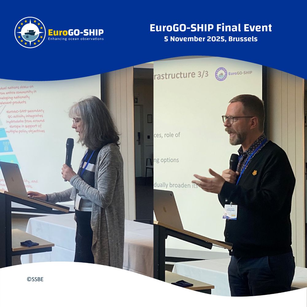
Ship-based #hydrography is the cornerstone of #OceanObservation delivering the most reliable #data. So, why isn’t there already a #European #Marine #ResearchInfrastructure for ship-based hydrography? One of the questions being unpacked at the EuroGO-SHIP Final Event🔎🤔
📸Picture by Christophe Licoppe
📸Picture by Christophe Licoppe

November 5, 2025 at 3:02 PM
Ship-based #hydrography is the cornerstone of #OceanObservation delivering the most reliable #data. So, why isn’t there already a #European #Marine #ResearchInfrastructure for ship-based hydrography? One of the questions being unpacked at the EuroGO-SHIP Final Event🔎🤔
📸Picture by Christophe Licoppe
📸Picture by Christophe Licoppe
🎤Pascale Lherminier sharing results of consultation with ship-based hydrography communities around Europe to understand their needs.
🎤Emmanuel Salmon presenting services that are not provided for at the moment. We hope that EuroGO-SHIP will deliver this in the future.
@horizoneu.bsky.social #REA
🎤Emmanuel Salmon presenting services that are not provided for at the moment. We hope that EuroGO-SHIP will deliver this in the future.
@horizoneu.bsky.social #REA
November 5, 2025 at 2:29 PM
🎤Pascale Lherminier sharing results of consultation with ship-based hydrography communities around Europe to understand their needs.
🎤Emmanuel Salmon presenting services that are not provided for at the moment. We hope that EuroGO-SHIP will deliver this in the future.
@horizoneu.bsky.social #REA
🎤Emmanuel Salmon presenting services that are not provided for at the moment. We hope that EuroGO-SHIP will deliver this in the future.
@horizoneu.bsky.social #REA
‘Multisensorial hydrography with Venetian depictions from 1880 to 1895’, by Daniel A. Finch-Race.
Read it here: doi.org/10.1016/j.jhg.2024.10.005
(Special issue: ‘Liquid Worlds’)
9/16
Read it here: doi.org/10.1016/j.jhg.2024.10.005
(Special issue: ‘Liquid Worlds’)
9/16

November 3, 2025 at 9:07 AM
‘Multisensorial hydrography with Venetian depictions from 1880 to 1895’, by Daniel A. Finch-Race.
Read it here: doi.org/10.1016/j.jhg.2024.10.005
(Special issue: ‘Liquid Worlds’)
9/16
Read it here: doi.org/10.1016/j.jhg.2024.10.005
(Special issue: ‘Liquid Worlds’)
9/16
Meet R/V Fay Slover, a fast and stable 55 ft U.S. research vessel operating in the Chesapeake Bay. Equipped for rapid coastal sampling and environmental monitoring, she supports projects spanning hydrography, water quality, and instrument deployment.
Learn more www.gmsoresearchvessels.com/fleet
Learn more www.gmsoresearchvessels.com/fleet

November 1, 2025 at 9:59 PM
Meet R/V Fay Slover, a fast and stable 55 ft U.S. research vessel operating in the Chesapeake Bay. Equipped for rapid coastal sampling and environmental monitoring, she supports projects spanning hydrography, water quality, and instrument deployment.
Learn more www.gmsoresearchvessels.com/fleet
Learn more www.gmsoresearchvessels.com/fleet
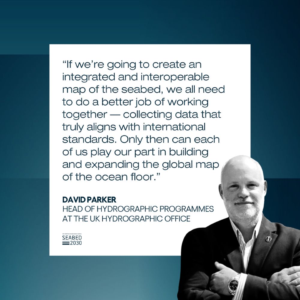
⛵ David Parker of #UKHO spent much of his early life at sea. A love of sailing sparked a lifelong interest in the ocean - and ultimately led him to a career in hydrography.
October 24, 2025 at 3:15 PM
⛵ David Parker of #UKHO spent much of his early life at sea. A love of sailing sparked a lifelong interest in the ocean - and ultimately led him to a career in hydrography.
Join us in this #webinar to hear about the successes of the EuroGO-SHIP project as it is making its way back to harbour after a three year journey.
👉 Register, save the date and stay tuned for more information: eurogo-ship.eu/eurogo-ship-...
#hydrography #marinescience #data #oceanobservation
👉 Register, save the date and stay tuned for more information: eurogo-ship.eu/eurogo-ship-...
#hydrography #marinescience #data #oceanobservation

October 24, 2025 at 8:27 AM
Join us in this #webinar to hear about the successes of the EuroGO-SHIP project as it is making its way back to harbour after a three year journey.
👉 Register, save the date and stay tuned for more information: eurogo-ship.eu/eurogo-ship-...
#hydrography #marinescience #data #oceanobservation
👉 Register, save the date and stay tuned for more information: eurogo-ship.eu/eurogo-ship-...
#hydrography #marinescience #data #oceanobservation
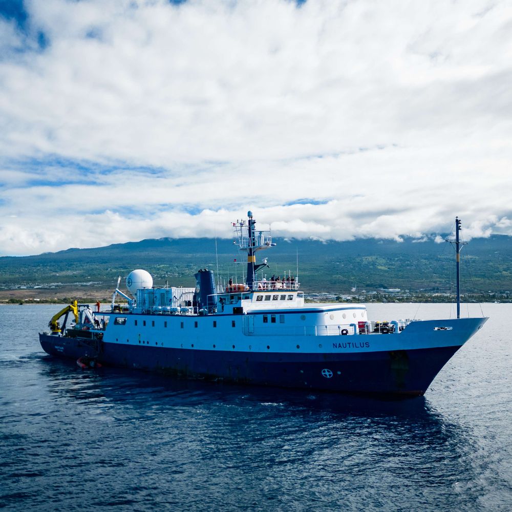
Sail onboard #EVNautilus in 2026 with a PAID internship! We're accepting applications in four categories: #OceanScience, #RemotelyOperatedVehicle #Engineering, #VideoSystemsEngineering, and #SeafloorMapping/Hydrography!
Learn more and apply by January 4, 2026: nautiluslive.org/join/interns...
Learn more and apply by January 4, 2026: nautiluslive.org/join/interns...

October 21, 2025 at 5:11 PM
Sail onboard #EVNautilus in 2026 with a PAID internship! We're accepting applications in four categories: #OceanScience, #RemotelyOperatedVehicle #Engineering, #VideoSystemsEngineering, and #SeafloorMapping/Hydrography!
Learn more and apply by January 4, 2026: nautiluslive.org/join/interns...
Learn more and apply by January 4, 2026: nautiluslive.org/join/interns...

by starlight
lines of position hold;
sextant sights fold,
cartography, hydrography;
chart to seek fix.
stars agree with the compass,
great-circle bellies mercator,
distance off read with ease.
landfall sighted from masthead,
soundings mark the depths:
serene
#poetry
lines of position hold;
sextant sights fold,
cartography, hydrography;
chart to seek fix.
stars agree with the compass,
great-circle bellies mercator,
distance off read with ease.
landfall sighted from masthead,
soundings mark the depths:
serene
#poetry
October 5, 2025 at 6:52 PM
by starlight
lines of position hold;
sextant sights fold,
cartography, hydrography;
chart to seek fix.
stars agree with the compass,
great-circle bellies mercator,
distance off read with ease.
landfall sighted from masthead,
soundings mark the depths:
serene
#poetry
lines of position hold;
sextant sights fold,
cartography, hydrography;
chart to seek fix.
stars agree with the compass,
great-circle bellies mercator,
distance off read with ease.
landfall sighted from masthead,
soundings mark the depths:
serene
#poetry


NOAA’s ship Rainier spent five days in August 2025 mapping the seafloor of Lituya Bay, Alaska. The team found parts of the bay up to 130 meters shallower than older maps showed, shaped by landslides and glacier movement. #NOAA #Hydrography #Alaska
🧪🏔️🌊⚒️
nauticalcharts.noaa.gov/updates/rain...
🧪🏔️🌊⚒️
nauticalcharts.noaa.gov/updates/rain...
The latest expedition in Lituya Bay: NOAA and National Park Service collaborate to update nautical charts – Office of Coast Survey
nauticalcharts.noaa.gov
October 2, 2025 at 4:12 PM
NOAA’s ship Rainier spent five days in August 2025 mapping the seafloor of Lituya Bay, Alaska. The team found parts of the bay up to 130 meters shallower than older maps showed, shaped by landslides and glacier movement. #NOAA #Hydrography #Alaska
🧪🏔️🌊⚒️
nauticalcharts.noaa.gov/updates/rain...
🧪🏔️🌊⚒️
nauticalcharts.noaa.gov/updates/rain...

Join the ranks of fabulous recent essays on the #Victorian Pacific + #Romantic lyric; on museums, collections, archives; on ecology, hydrography, atmosphere; on immunology, race and portraiture; and more!
compass.onlinelibrary.wiley.com/journal/1741...
compass.onlinelibrary.wiley.com/journal/1741...

Literature Compass
Click on the title to browse this journal
compass.onlinelibrary.wiley.com
September 30, 2025 at 2:19 PM
Join the ranks of fabulous recent essays on the #Victorian Pacific + #Romantic lyric; on museums, collections, archives; on ecology, hydrography, atmosphere; on immunology, race and portraiture; and more!
compass.onlinelibrary.wiley.com/journal/1741...
compass.onlinelibrary.wiley.com/journal/1741...

9年に亘って活躍した研究船「みらい」による、気象・環境・海洋といった学問分野での多彩な観測成果 ならびに 国際Hydrographyへの貢献を概観し、次代への抱負を語る。
--
海洋研究開発機構(JAMSTEC)
第22回「地球環境シリーズ」講演会
「地球環境変動の探求~「みらい」の功績と「みらいⅡ」の任務~」
--
海洋研究開発機構(JAMSTEC)
第22回「地球環境シリーズ」講演会
「地球環境変動の探求~「みらい」の功績と「みらいⅡ」の任務~」

第22回 海洋研究開発機構「地球環境シリーズ」講演会「地球環境変動の探求~「みらい」の功績と「みらいⅡ」の任務~」 | JAMSTEC | 海洋研究開発機構 | ジャムステック
令和7年度末、海洋地球研究船「みらい」が運航停止を迎えることとなりました。就航から28年目を迎える「みらい」は、この間、その機動性と装備を活かし、地球環境変動研究の推進に多大な貢献をしてきました。本講演会では、この「みらい」の活動に焦点を当て、航続距離22,000 ㎞にも及ぶ高精度海洋観測によって得られた科学的成果や日本の海洋観測技術発展への貢献、将来予測の高度化につながる道筋などを、これまでの2...
www.jamstec.go.jp
September 30, 2025 at 7:36 AM
9年に亘って活躍した研究船「みらい」による、気象・環境・海洋といった学問分野での多彩な観測成果 ならびに 国際Hydrographyへの貢献を概観し、次代への抱負を語る。
--
海洋研究開発機構(JAMSTEC)
第22回「地球環境シリーズ」講演会
「地球環境変動の探求~「みらい」の功績と「みらいⅡ」の任務~」
--
海洋研究開発機構(JAMSTEC)
第22回「地球環境シリーズ」講演会
「地球環境変動の探求~「みらい」の功績と「みらいⅡ」の任務~」
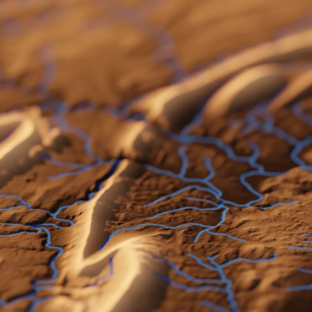
Check out TopoRivBlender, a new tool to create custom 3D images of topography and hydrography. Uses Blender and the OpenTopography API to produce 3D visualizations for data around the world.
More info:
waterdata.usgs.gov/blog/topo-ri...
github.com/DOI-USGS/top...
More info:
waterdata.usgs.gov/blog/topo-ri...
github.com/DOI-USGS/top...


September 29, 2025 at 5:54 PM
Check out TopoRivBlender, a new tool to create custom 3D images of topography and hydrography. Uses Blender and the OpenTopography API to produce 3D visualizations for data around the world.
More info:
waterdata.usgs.gov/blog/topo-ri...
github.com/DOI-USGS/top...
More info:
waterdata.usgs.gov/blog/topo-ri...
github.com/DOI-USGS/top...

#sciencecommunication #antiquemaps #antiquemap #denmark #nauticalchart #marinescience #marinelife #sealife #oceanlife #oceanscience #cartography #newsletter #article #fyp

September 18, 2025 at 3:39 PM

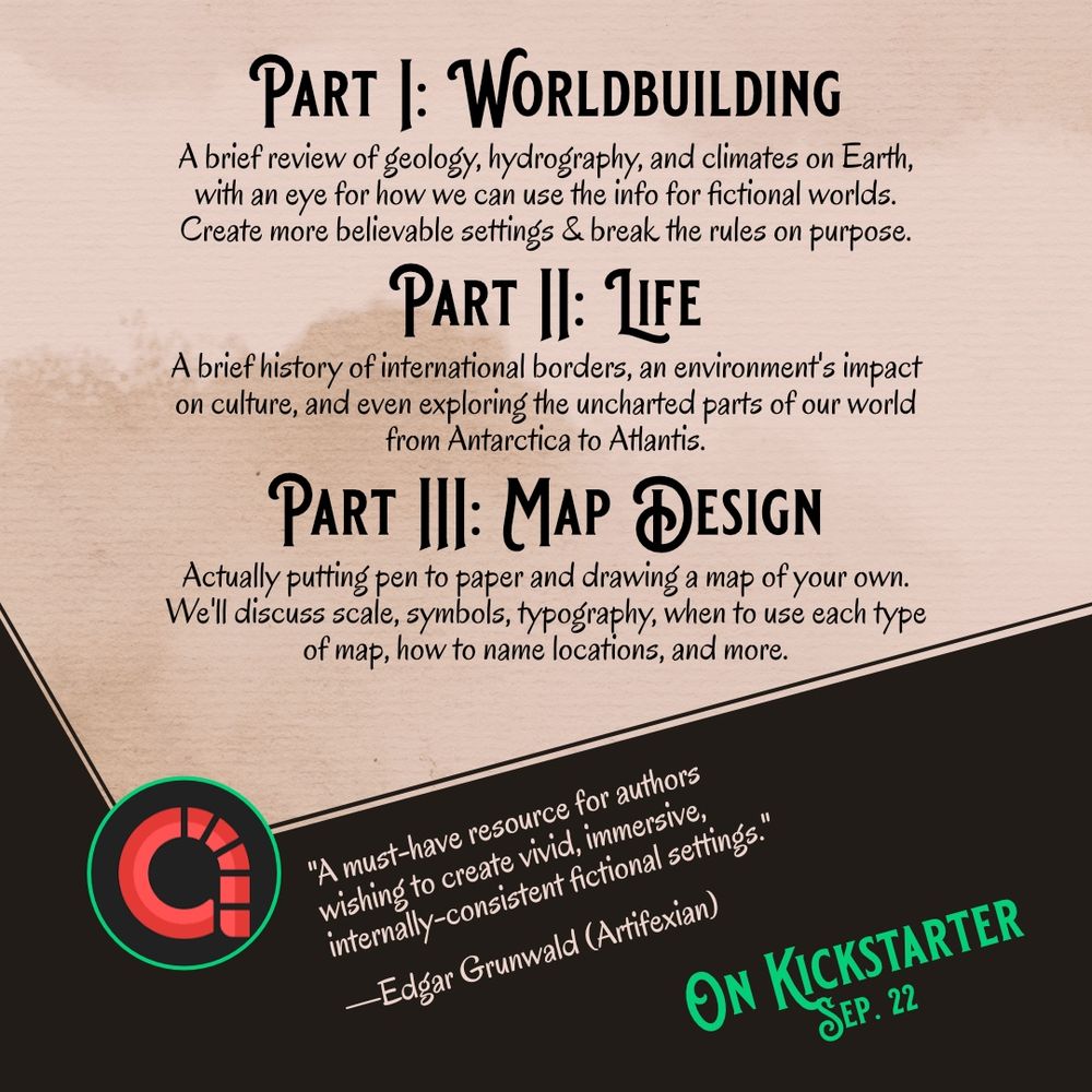
This one's for my fellow authors who love worldbuilding and making maps for your stories.
You can back AN AUTHOR'S GUIDE TO SETTING DESIGN on Kickstarter on September 22nd! Follow the project to make sure you don't miss it. 🪐📚💙
🔗 www.kickstarter.com/projects/ada...
You can back AN AUTHOR'S GUIDE TO SETTING DESIGN on Kickstarter on September 22nd! Follow the project to make sure you don't miss it. 🪐📚💙
🔗 www.kickstarter.com/projects/ada...

September 15, 2025 at 4:03 PM
This one's for my fellow authors who love worldbuilding and making maps for your stories.
You can back AN AUTHOR'S GUIDE TO SETTING DESIGN on Kickstarter on September 22nd! Follow the project to make sure you don't miss it. 🪐📚💙
🔗 www.kickstarter.com/projects/ada...
You can back AN AUTHOR'S GUIDE TO SETTING DESIGN on Kickstarter on September 22nd! Follow the project to make sure you don't miss it. 🪐📚💙
🔗 www.kickstarter.com/projects/ada...
The PLA’s project to clean up ‘Wet Wipe Island’ has now been completed.
Photo 1: Taken by the PLA's Hydrography department, Wet Wipe Island pre-works
Photo 2: Taken by the PLA's Hydrography department, Wet Wipe Island post-works
(1/3)
Photo 1: Taken by the PLA's Hydrography department, Wet Wipe Island pre-works
Photo 2: Taken by the PLA's Hydrography department, Wet Wipe Island post-works
(1/3)


September 11, 2025 at 9:22 AM
The PLA’s project to clean up ‘Wet Wipe Island’ has now been completed.
Photo 1: Taken by the PLA's Hydrography department, Wet Wipe Island pre-works
Photo 2: Taken by the PLA's Hydrography department, Wet Wipe Island post-works
(1/3)
Photo 1: Taken by the PLA's Hydrography department, Wet Wipe Island pre-works
Photo 2: Taken by the PLA's Hydrography department, Wet Wipe Island post-works
(1/3)
Highly recommend this miniseries , in part for the only time I’ve seen detailed hydrography on screen. About Wrocław.
en.m.wikipedia.org/wiki/High_Wa...
en.m.wikipedia.org/wiki/High_Wa...

High Water (TV series) - Wikipedia
en.m.wikipedia.org
September 8, 2025 at 1:26 AM
Highly recommend this miniseries , in part for the only time I’ve seen detailed hydrography on screen. About Wrocław.
en.m.wikipedia.org/wiki/High_Wa...
en.m.wikipedia.org/wiki/High_Wa...
Yeah, Eureka Valley was also apparently a bit Wild West with all the squatters and conflicting land claims. It might’ve also not gotten specific hydrography? I think one of those lines is the edge of one of the Land Grants.
August 21, 2025 at 6:56 PM
Yeah, Eureka Valley was also apparently a bit Wild West with all the squatters and conflicting land claims. It might’ve also not gotten specific hydrography? I think one of those lines is the edge of one of the Land Grants.
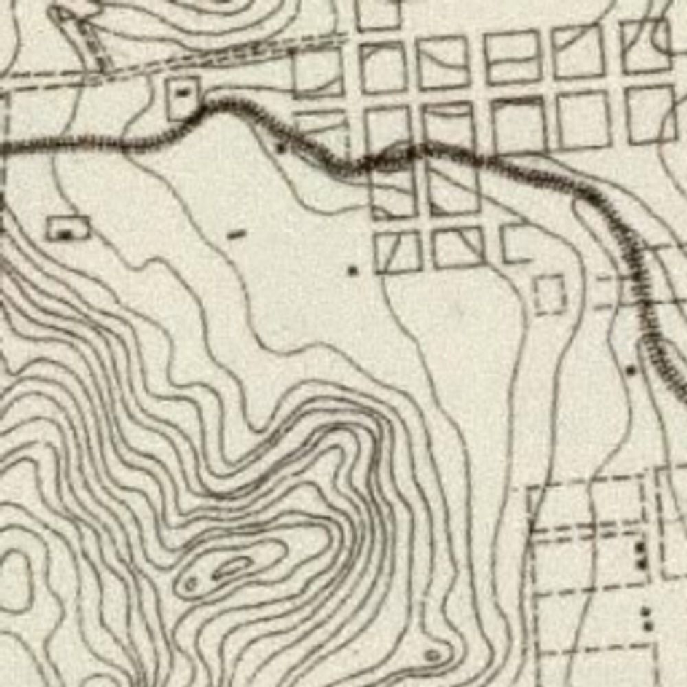
Thanks. Maybe the topography and hydrography were surveyed at different times, so one reflects regrading and the other doesn't?
August 21, 2025 at 4:44 PM
Thanks. Maybe the topography and hydrography were surveyed at different times, so one reflects regrading and the other doesn't?
Left: A map of the drainage network of Blockhouse Creek near Platteville, Wisconsin, hand-drawn by my Ph.D. advisor Jim Knox, I believe for his PhD research ca. 1967. Right, drainage network for the same basin, NHDPlus data. Pretty different definitions of "1st order" streams.


August 17, 2025 at 2:37 AM
Left: A map of the drainage network of Blockhouse Creek near Platteville, Wisconsin, hand-drawn by my Ph.D. advisor Jim Knox, I believe for his PhD research ca. 1967. Right, drainage network for the same basin, NHDPlus data. Pretty different definitions of "1st order" streams.