

Ensembleator
@ensembleator.bsky.social
Semi-retired meteorologist, living in lovely #YVR since 1994. I often write forecasts using abbreviations due to social media character limits. Dnt wry, U wll gt it.
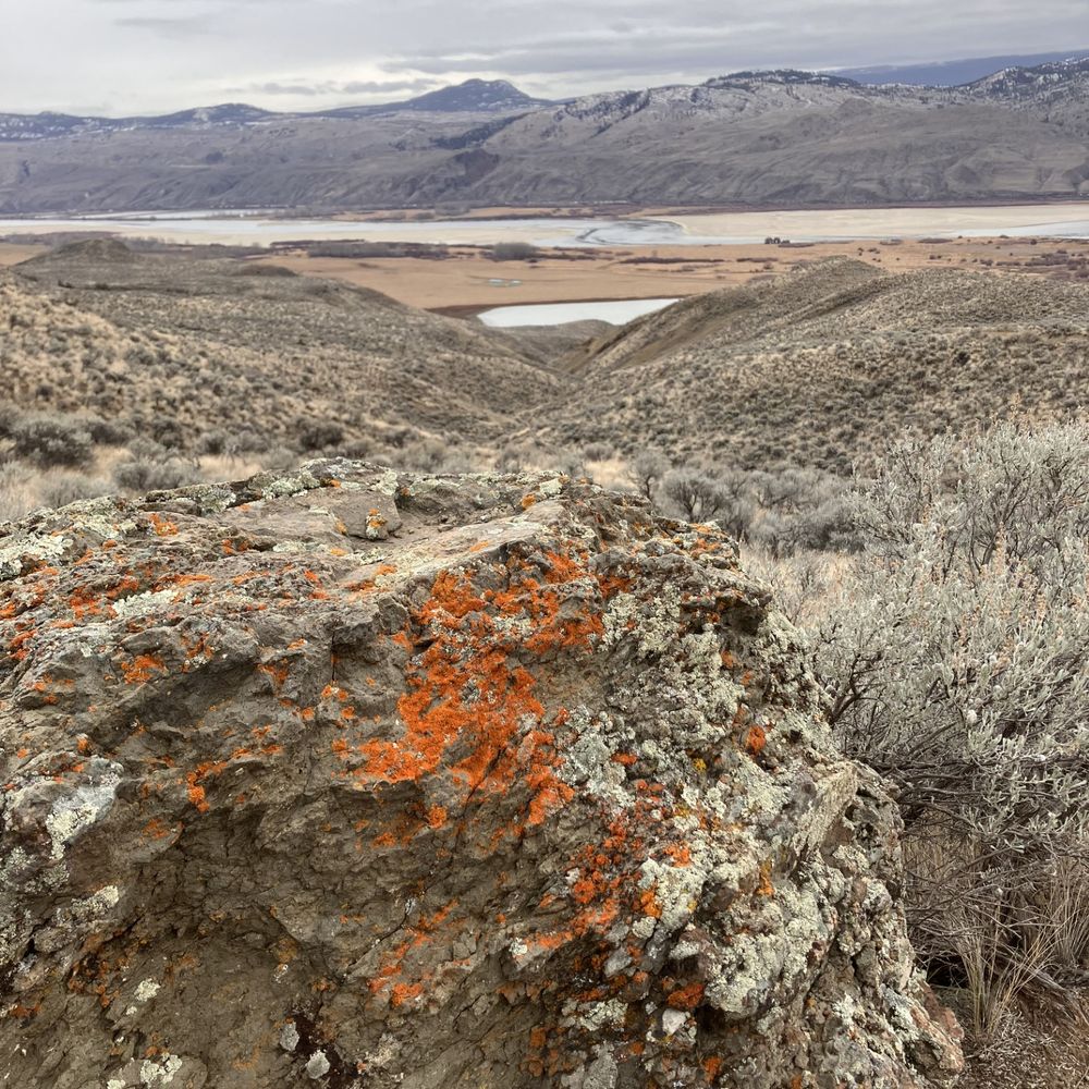
A damp hill walk in Ireland on a showery blustery day
November 7, 2025 at 9:39 PM
A damp hill walk in Ireland on a showery blustery day
Areas of fog dvlpg inland this AM #YVR. Owz a mainly sunny AM. Clds increase PM. Rain dvlps ovnite, tapers to shwrs that continue thru the day on Wed. Windy from the SE. Vrbl skies chc shwrs Thu AM w/rain, wind PM. Vrbl skies Fri chc shwr. Wknd looking nice: dry, vrbl skies, coolish. Back on Mon :)
November 4, 2025 at 1:33 PM
Areas of fog dvlpg inland this AM #YVR. Owz a mainly sunny AM. Clds increase PM. Rain dvlps ovnite, tapers to shwrs that continue thru the day on Wed. Windy from the SE. Vrbl skies chc shwrs Thu AM w/rain, wind PM. Vrbl skies Fri chc shwr. Wknd looking nice: dry, vrbl skies, coolish. Back on Mon :)
A gaggle of trofs and minor circulations offshore tracking E-NE but they all miss #YVR. Clds tdy w/partial clrg ltr AM. Dvlpg upr sys 47N 158W digs ESE and spawns a more significant trof/fnt for Wed. Areas fog Tue AM then vrbl skies. Rain/wind Wed. Breezy/shwrs Thu endg Fri AM then dry thru Sun PM.
November 3, 2025 at 2:54 PM
A gaggle of trofs and minor circulations offshore tracking E-NE but they all miss #YVR. Clds tdy w/partial clrg ltr AM. Dvlpg upr sys 47N 158W digs ESE and spawns a more significant trof/fnt for Wed. Areas fog Tue AM then vrbl skies. Rain/wind Wed. Breezy/shwrs Thu endg Fri AM then dry thru Sun PM.
Busy w/forestry tdy. Dirty ridge over SWBC this PM w/weak lows NW and the SW + a jetstream ovhd #YVR. Ridge splits the lows but chc shwr ovnite. Mainly cldy Mon AM w/vrbl skies PM. Mix sun/cld Tue (ptchy AM fog). Rain Wed all day w/a brisk E wind. More rain/breezy Thu. Shwrs Fri. Sat looks dry
November 3, 2025 at 12:55 AM
Busy w/forestry tdy. Dirty ridge over SWBC this PM w/weak lows NW and the SW + a jetstream ovhd #YVR. Ridge splits the lows but chc shwr ovnite. Mainly cldy Mon AM w/vrbl skies PM. Mix sun/cld Tue (ptchy AM fog). Rain Wed all day w/a brisk E wind. More rain/breezy Thu. Shwrs Fri. Sat looks dry
Deepng low to the W in the wake of ydy's short AR Xs SWBC this AM. It tracks inland just N of #YVR this AM: a windy pattern. Rain this AM. Brisk SE winds dvlp shortly (gust 50 beaches) and switch to WNW G60-70 beaches in the wake of the low. Winds diminish vrbl skies ltr PM. Mxd bag Sun w/chc shwr
November 1, 2025 at 1:57 PM
Deepng low to the W in the wake of ydy's short AR Xs SWBC this AM. It tracks inland just N of #YVR this AM: a windy pattern. Rain this AM. Brisk SE winds dvlp shortly (gust 50 beaches) and switch to WNW G60-70 beaches in the wake of the low. Winds diminish vrbl skies ltr PM. Mxd bag Sun w/chc shwr
Moisture rich fnt + trailing low (dvlpg now 41.5N 156W) Xs SWBC nxt 24h. Rain tdy, w/a brisk SE wnd, tapering to shwrs - w/a chc of a few dry hrs - this eve. Rain re-dvlps Sat AM, taprng to shwrs PM. Ttl #YVR rain 25-75 mm fm S-N. High rain rates will create lcl floods/road ponds this PM and Sat AM
October 31, 2025 at 1:58 PM
Moisture rich fnt + trailing low (dvlpg now 41.5N 156W) Xs SWBC nxt 24h. Rain tdy, w/a brisk SE wnd, tapering to shwrs - w/a chc of a few dry hrs - this eve. Rain re-dvlps Sat AM, taprng to shwrs PM. Ttl #YVR rain 25-75 mm fm S-N. High rain rates will create lcl floods/road ponds this PM and Sat AM
#YVR undr a moist SW flow w/a weak upr trof ofshr movng E. Vrbl skies tdy. Deep low 48.7N 155.5W lifts ENE, dragging a plume of subtrop air (an AR 1-2 inland) ovr SWBC Fri. AR ttl 25-50 mm, heaviest 2PM-6PM. Lcl flooding. Breezy. A pause ltr eve then more hvy rain w/the cold fnt Sat AM, tapers PM
October 30, 2025 at 1:42 PM
#YVR undr a moist SW flow w/a weak upr trof ofshr movng E. Vrbl skies tdy. Deep low 48.7N 155.5W lifts ENE, dragging a plume of subtrop air (an AR 1-2 inland) ovr SWBC Fri. AR ttl 25-50 mm, heaviest 2PM-6PM. Lcl flooding. Breezy. A pause ltr eve then more hvy rain w/the cold fnt Sat AM, tapers PM
Shwrs taper off this AM as a ridge blds onto the coast #YVR. Mainly cldy AM; some PM sun. Ptchy fog dvlps ovnite otwz a few clds Thu; dry. AR runs into SWBC Fri w/rain dvlpg AM tapering erly Sat AM. A sodden, breezy Halloween for the kids and kids at heart. Vrbl skies, dry Sat. Foggy/drizzly Sun AM
October 29, 2025 at 12:57 PM
Shwrs taper off this AM as a ridge blds onto the coast #YVR. Mainly cldy AM; some PM sun. Ptchy fog dvlps ovnite otwz a few clds Thu; dry. AR runs into SWBC Fri w/rain dvlpg AM tapering erly Sat AM. A sodden, breezy Halloween for the kids and kids at heart. Vrbl skies, dry Sat. Foggy/drizzly Sun AM
Slug of heavy rain will run thru #YVR over the next hour and a bit. Cold Front. Not a great time to walk the dog. Good thing I don't have one.
October 29, 2025 at 1:17 AM
Slug of heavy rain will run thru #YVR over the next hour and a bit. Cold Front. Not a great time to walk the dog. Good thing I don't have one.
Deep low nr 48N 139W tracking ENE, w/a warm fnt stretching to its E ovr SE WA, lifting N. Cold fnt trailing SSW. Rain/blustry SE wind dvlps this AM #YVR, tapering to shwrs Wed AM as the cold fnt sweeps inland. Some PM clrg. Vrbl skies/cool Thu. Rain/some wind Fri/Sat. Looks AR-ish. Dry/cool Sun.
October 28, 2025 at 1:17 PM
Deep low nr 48N 139W tracking ENE, w/a warm fnt stretching to its E ovr SE WA, lifting N. Cold fnt trailing SSW. Rain/blustry SE wind dvlps this AM #YVR, tapering to shwrs Wed AM as the cold fnt sweeps inland. Some PM clrg. Vrbl skies/cool Thu. Rain/some wind Fri/Sat. Looks AR-ish. Dry/cool Sun.
Devastating hurricane Melissa, eye filled with lightning and gravity waves propagating radially from the centre, about to wreak havoc on Jamaica today.
October 28, 2025 at 12:51 PM
Devastating hurricane Melissa, eye filled with lightning and gravity waves propagating radially from the centre, about to wreak havoc on Jamaica today.
#YVR undr a very cool Wly flow, unstbl at low lvls but stabilizing thru the day as a rdg bulds onshr. Mnly cldy, cool. Chc shwr this AM. Increasng cld ovnite as a warm fnt approaches fm the SW. Rain dvlpng Tue AM. Brisk E wind. Unsettled/shwrs Wed. AM fog, mainly sunny Thu w/outflow. Shwrs back Fri
October 27, 2025 at 1:51 PM
#YVR undr a very cool Wly flow, unstbl at low lvls but stabilizing thru the day as a rdg bulds onshr. Mnly cldy, cool. Chc shwr this AM. Increasng cld ovnite as a warm fnt approaches fm the SW. Rain dvlpng Tue AM. Brisk E wind. Unsettled/shwrs Wed. AM fog, mainly sunny Thu w/outflow. Shwrs back Fri
Diminishing winds, mainly cloudy, cool+ unsettled tdy #YVR w/some AM shwrs and mtn flurries/chc ⚡esp this PM. Vry cool aloft w/a building ridge at the sfc. Notice the jet stream now well to the S ovr Srn OR. Vrbl skies/chc sprinkles ovnite and Mon and quite cool. Cld, shwrs dvlpg Tue, rain/wind late
October 26, 2025 at 1:19 PM
Diminishing winds, mainly cloudy, cool+ unsettled tdy #YVR w/some AM shwrs and mtn flurries/chc ⚡esp this PM. Vry cool aloft w/a building ridge at the sfc. Notice the jet stream now well to the S ovr Srn OR. Vrbl skies/chc sprinkles ovnite and Mon and quite cool. Cld, shwrs dvlpg Tue, rain/wind late
Vertically stacked upr/sfc low near 48.7N 130W (clear centre) and a shallow/convective near-surface system tracking rapidly E near 44.5N 129W. It's the main system further N that's going to give us some wind (likely power) issues tonight #YVR / Fraser Valley
October 25, 2025 at 5:06 PM
Vertically stacked upr/sfc low near 48.7N 130W (clear centre) and a shallow/convective near-surface system tracking rapidly E near 44.5N 129W. It's the main system further N that's going to give us some wind (likely power) issues tonight #YVR / Fraser Valley
Convective upr/sfc low offshore moves ENE, Xing central VI this eve: a windy pattn. Shwrs + brisk E winds dvlp this AM #YVR, bcmg vry brisk SWlys ltr this eve (G 60's beach) as the low tracks inland to the N. Cool w/vrbl skes Sun. Mtn shwrs/flurries chc ⚡. Unsettled Mon, cool. Vry cool Tue AM, dry.
October 25, 2025 at 1:34 PM
Convective upr/sfc low offshore moves ENE, Xing central VI this eve: a windy pattn. Shwrs + brisk E winds dvlp this AM #YVR, bcmg vry brisk SWlys ltr this eve (G 60's beach) as the low tracks inland to the N. Cool w/vrbl skes Sun. Mtn shwrs/flurries chc ⚡. Unsettled Mon, cool. Vry cool Tue AM, dry.
A little vortmax spinning up offshore in jetstream-induced shear (blue-orange couplet) may bring some brief heavy showers this eve #YVR with a slight chc of ⚡
October 24, 2025 at 11:50 PM
A little vortmax spinning up offshore in jetstream-induced shear (blue-orange couplet) may bring some brief heavy showers this eve #YVR with a slight chc of ⚡