


shane loeffler
@shaneloeffler.com
climate / maps / dev
@carbonplan.org
opinions my own
@carbonplan.org
opinions my own
Reposted by shane loeffler

Verra recently announced that more than half of the credits from the Kariba REDD+ project don’t represent real climate benefits. Our new commentary explains why carbon market participants should treat Verra’s proposed solution to excess crediting with skepticism.

Verra doesn’t have a good solution for excess crediting – CarbonPlan
Verra recently acknowledged the existence of millions of excess credits issued to the Kariba REDD+ project. Rather than resolving the issue, Verra’s proposed solution exposes a fundamental structural ...
carbonplan.org
October 22, 2025 at 12:46 PM
Verra recently announced that more than half of the credits from the Kariba REDD+ project don’t represent real climate benefits. Our new commentary explains why carbon market participants should treat Verra’s proposed solution to excess crediting with skepticism.
This book is so good
Wrote a long book that comes out August. It covers from the origins of life at alkaline hydrothermal vents some 4 billion years ago through the Volcker Shock. I'm told pre-orders help, so if that sounds like your thing, buy one, won't you? www.harpercollins.com/products/the...
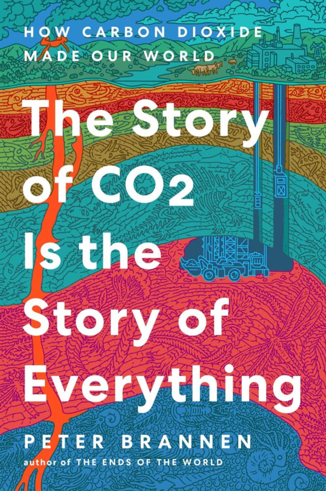
The Story of CO2 Is the Story of Everything
How carbon dioxide made planet Earth, shaped human history, and now holds our future in the balance.
Every year, we are dangerously warping the climate by ...
www.harpercollins.com
October 10, 2025 at 12:56 PM
This book is so good
Reposted by shane loeffler

I wrote about how Earth's wobble causes our view of the skies to shift over time. Here's a paywall-free gift link. With @fparis.bsky.social and @iamrumz.bsky.social

Your Zodiac Sign Is 2,000 Years Out of Date (Gift Article)
Over millennia, our view of the stars has shifted, because of Earth’s wobble. It may be time to rethink your sign.
www.nytimes.com
September 9, 2025 at 1:08 AM
I wrote about how Earth's wobble causes our view of the skies to shift over time. Here's a paywall-free gift link. With @fparis.bsky.social and @iamrumz.bsky.social
Reposted by shane loeffler

Nearly 6 billion people live in the 101 countries that a recent study has identified as confronting a net decline in water supply — signaling enormous challenges for food production and a heightening risk of conflict and instability.
By @abrahm.bsky.social, w/ graphics by @lucaswaldron.bsky.social
By @abrahm.bsky.social, w/ graphics by @lucaswaldron.bsky.social
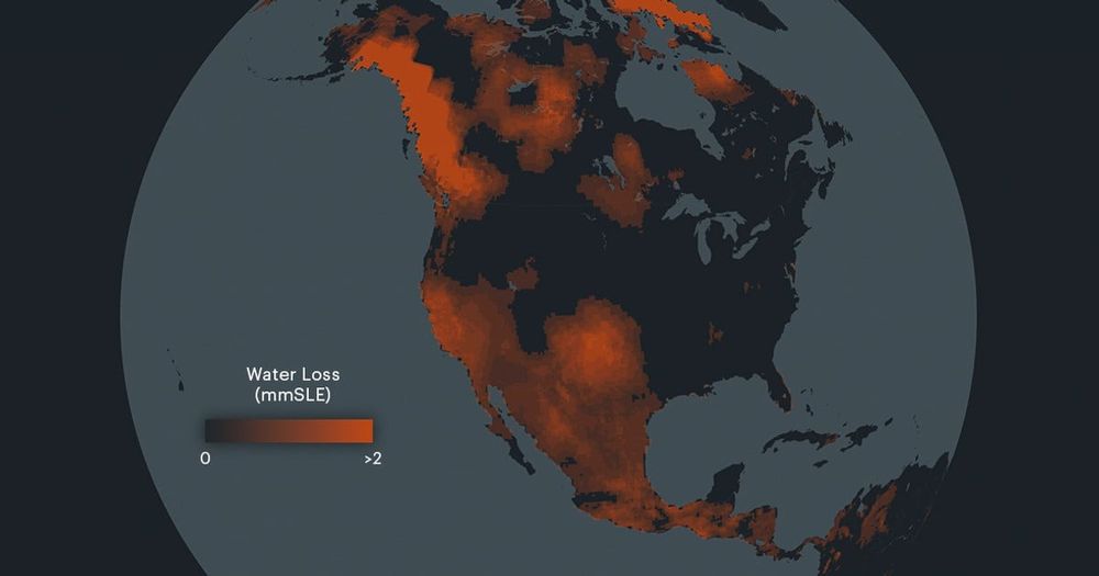
“Staggering” Water Loss Driven by Groundwater Mining Poses Global Threat
A new study finds that freshwater resources are rapidly disappearing, creating arid “mega” regions and causing sea levels to rise.
www.propublica.org
September 7, 2025 at 11:08 PM
Nearly 6 billion people live in the 101 countries that a recent study has identified as confronting a net decline in water supply — signaling enormous challenges for food production and a heightening risk of conflict and instability.
By @abrahm.bsky.social, w/ graphics by @lucaswaldron.bsky.social
By @abrahm.bsky.social, w/ graphics by @lucaswaldron.bsky.social
Reposted by shane loeffler
California’s offset program is not only deeply flawed, it also costs the state hundreds of millions of dollars in annual revenue. We dive into the details in a new commentary. carbonplan.org/research/off... (1/7)

Offsets are no free lunch – CarbonPlan
Offsets provide few climate benefits and cost California hundreds of millions of dollars each year. When lawmakers reauthorize the state’s cap and trade program this fall, they should eliminate the us...
carbonplan.org
August 21, 2025 at 10:34 PM
California’s offset program is not only deeply flawed, it also costs the state hundreds of millions of dollars in annual revenue. We dive into the details in a new commentary. carbonplan.org/research/off... (1/7)
Reposted by shane loeffler

An abandoned project from last year. I planned on a "Landforms of #Madison" map, but got stuck at the labeling stage because almost none of these features have names I could find. Maybe a 15–20 across the whole map. The state capitol sits on a big unnamed hill. This has downstream effects… (1/2)


June 12, 2025 at 9:06 PM
An abandoned project from last year. I planned on a "Landforms of #Madison" map, but got stuck at the labeling stage because almost none of these features have names I could find. Maybe a 15–20 across the whole map. The state capitol sits on a big unnamed hill. This has downstream effects… (1/2)
Reposted by shane loeffler

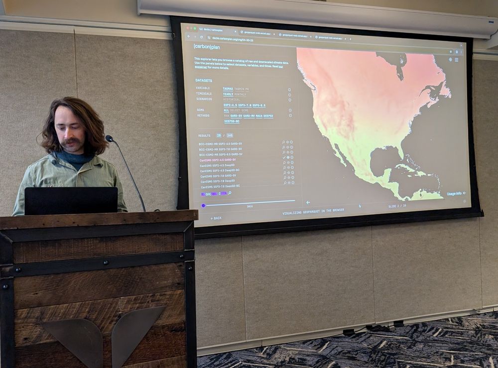
🆕 #CNG2025 session recording
Raphael Hagen & @shaneloeffler.com from @carbonplan.org share how they went about visualizing GeoParquet data directly in the web browser.
▶️ youtu.be/SsjNPFv5dgI
Raphael Hagen & @shaneloeffler.com from @carbonplan.org share how they went about visualizing GeoParquet data directly in the web browser.
▶️ youtu.be/SsjNPFv5dgI

[CNG 2025] Visualizing GeoParquet in the Browser – Raphael Hagen and Shane Loeffler
YouTube video by Cloud-Native Geospatial Forum
youtu.be
June 17, 2025 at 6:32 PM
🆕 #CNG2025 session recording
Raphael Hagen & @shaneloeffler.com from @carbonplan.org share how they went about visualizing GeoParquet data directly in the web browser.
▶️ youtu.be/SsjNPFv5dgI
Raphael Hagen & @shaneloeffler.com from @carbonplan.org share how they went about visualizing GeoParquet data directly in the web browser.
▶️ youtu.be/SsjNPFv5dgI
Reposted by shane loeffler

How did I not know about this???? It works amazingly well - select 'transactions' and then just whack in a company name. Massively under-used resource here
Want to know how fossil fuel companies use carbon offsets to claim they’re fighting climate change?
We've updated OffsetsDB — our offsets database — to allow you to search by carbon credit user. Search "Shell" and see what offsets they're using and when. (1/4) carbonplan.org/research/off...
We've updated OffsetsDB — our offsets database — to allow you to search by carbon credit user. Search "Shell" and see what offsets they're using and when. (1/4) carbonplan.org/research/off...
June 5, 2025 at 8:16 PM
How did I not know about this???? It works amazingly well - select 'transactions' and then just whack in a company name. Massively under-used resource here
Reposted by shane loeffler

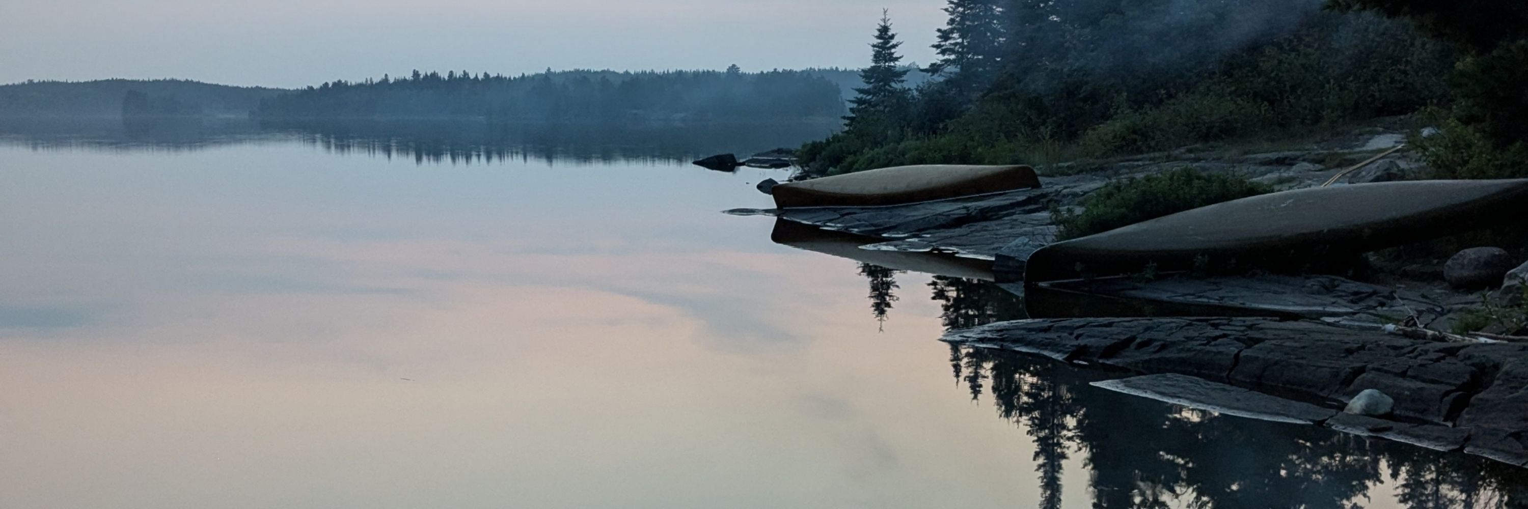
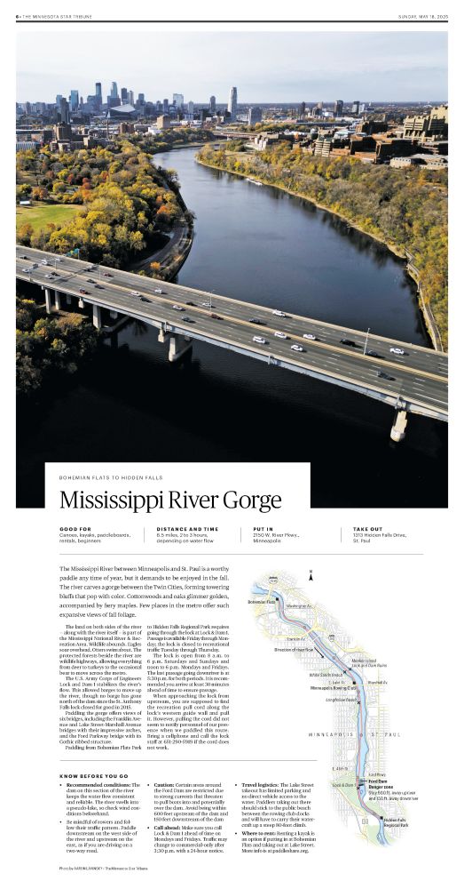
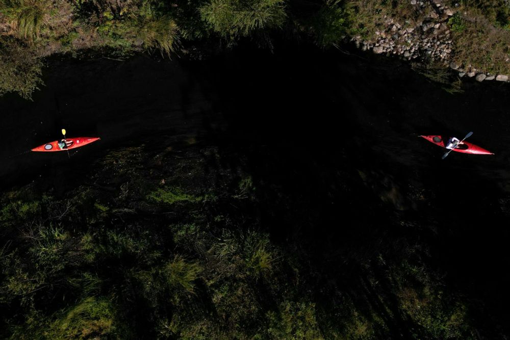
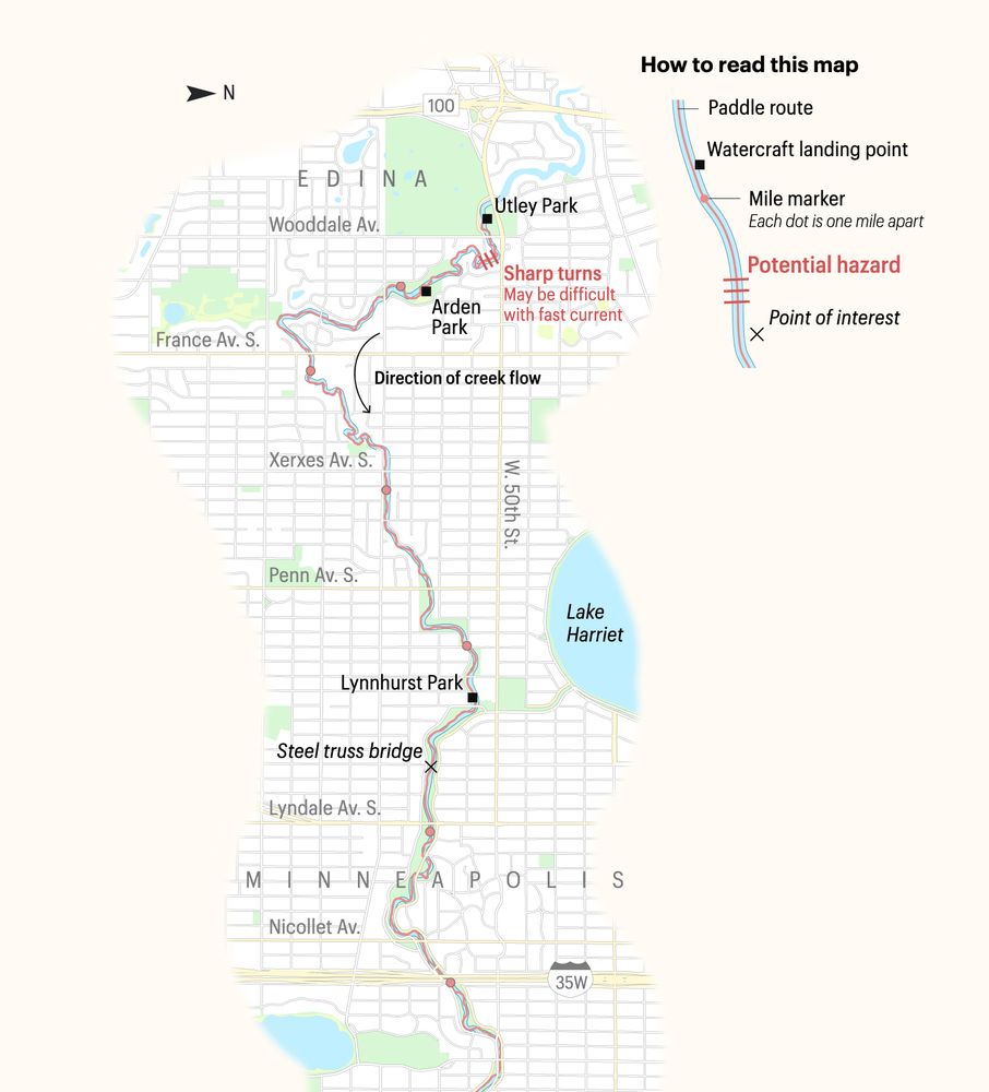
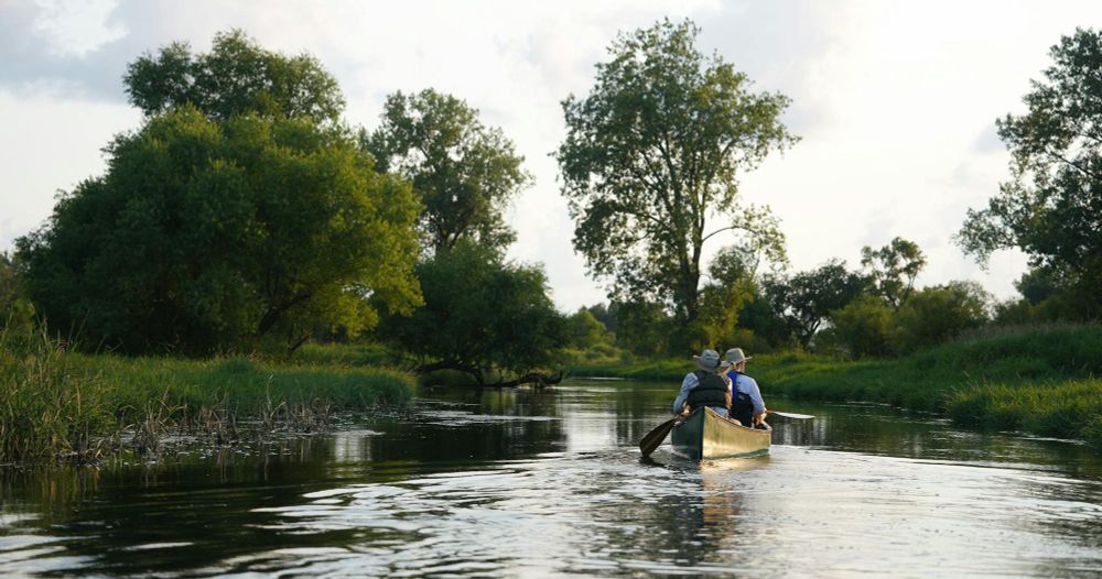
We spent an entire paddling season researching and paddling across the Twin Cities to create this guide. The Star Tribune has never put out a guide this comprehensive. Get out on the water, people. It's really the best thing you can do this summer.
www.startribune.com/canoe-kayak-...
www.startribune.com/canoe-kayak-...
May 19, 2025 at 3:17 PM
We spent an entire paddling season researching and paddling across the Twin Cities to create this guide. The Star Tribune has never put out a guide this comprehensive. Get out on the water, people. It's really the best thing you can do this summer.
www.startribune.com/canoe-kayak-...
www.startribune.com/canoe-kayak-...
Reposted by shane loeffler

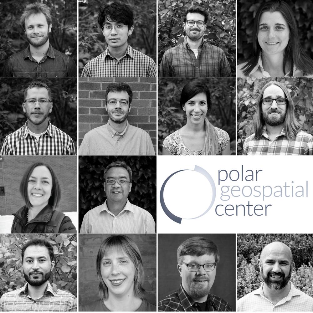
Effective immediately, the PGC is no longer accepting new NSF-supported requests due to a lack of renewal funding. Current work is wrapping up. Please contact your NSF program officer if impacted. We’re grateful to have supported your polar research. Read our full statement at www.pgc.umn.edu
May 5, 2025 at 9:33 PM
Effective immediately, the PGC is no longer accepting new NSF-supported requests due to a lack of renewal funding. Current work is wrapping up. Please contact your NSF program officer if impacted. We’re grateful to have supported your polar research. Read our full statement at www.pgc.umn.edu
Reposted by shane loeffler

Raphael and Shane @carbonplan.org on visualizing GeoParguet in the browser, along with some nerdy details like partitioning and spatial indexing @cloudnativegeo.org #cngconference

April 30, 2025 at 7:28 PM
Raphael and Shane @carbonplan.org on visualizing GeoParguet in the browser, along with some nerdy details like partitioning and spatial indexing @cloudnativegeo.org #cngconference
Reposted by shane loeffler

Last week I was playing around with a new "tree ring plot" to visualize daily global temperature anomalies from ERA5.
I thought it would be neat to make a version of the plot for daily global absolute temperatures (rather than anomalies):
I thought it would be neat to make a version of the plot for daily global absolute temperatures (rather than anomalies):

April 29, 2025 at 6:07 PM
Last week I was playing around with a new "tree ring plot" to visualize daily global temperature anomalies from ERA5.
I thought it would be neat to make a version of the plot for daily global absolute temperatures (rather than anomalies):
I thought it would be neat to make a version of the plot for daily global absolute temperatures (rather than anomalies):
Reposted by shane loeffler
Want to know how fossil fuel companies use carbon offsets to claim they’re fighting climate change?
We've updated OffsetsDB — our offsets database — to allow you to search by carbon credit user. Search "Shell" and see what offsets they're using and when. (1/4) carbonplan.org/research/off...
We've updated OffsetsDB — our offsets database — to allow you to search by carbon credit user. Search "Shell" and see what offsets they're using and when. (1/4) carbonplan.org/research/off...
April 23, 2025 at 6:18 PM
Want to know how fossil fuel companies use carbon offsets to claim they’re fighting climate change?
We've updated OffsetsDB — our offsets database — to allow you to search by carbon credit user. Search "Shell" and see what offsets they're using and when. (1/4) carbonplan.org/research/off...
We've updated OffsetsDB — our offsets database — to allow you to search by carbon credit user. Search "Shell" and see what offsets they're using and when. (1/4) carbonplan.org/research/off...
Reposted by shane loeffler
The Alliance of Freelance Cartographers needs your help! By taking our short annual survey, you strengthen your #cartography community. This survey is for anyone (globally) who did any amount of freelance mapping last year (even a little). forms.gle/VaZqPpxeB8Qu...
Please help spread this widely!
Please help spread this widely!

April 2, 2025 at 4:31 PM
The Alliance of Freelance Cartographers needs your help! By taking our short annual survey, you strengthen your #cartography community. This survey is for anyone (globally) who did any amount of freelance mapping last year (even a little). forms.gle/VaZqPpxeB8Qu...
Please help spread this widely!
Please help spread this widely!
Reposted by shane loeffler

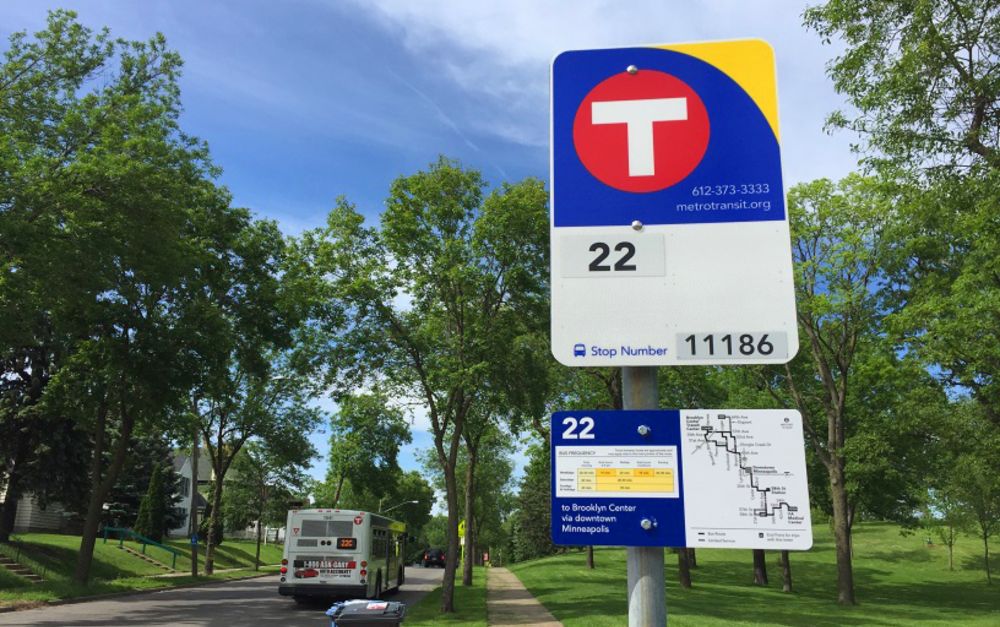
My latest is on the quiet good news of having free "Royale" access to the Transit App. www.minnpost.com/cityscape/20...
How Transit App is removing the mysteries of Twin Cities transit use
The Metro Transit “user experience” is improving, especially for those who keep up with technology like mobile apps.
www.minnpost.com
March 12, 2025 at 5:45 PM
My latest is on the quiet good news of having free "Royale" access to the Transit App. www.minnpost.com/cityscape/20...
Reposted by shane loeffler
When my house and community burned - where was the satellite information? A very raw blog post I am putting up so folks in the satellite, geospatial and tech fields can listen firsthand why I think we are failing the situations that need us the most.
www.linkedin.com/pulse/when-o...
www.linkedin.com/pulse/when-o...
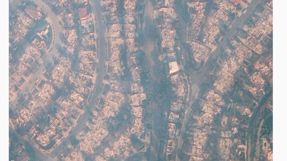
When our community burned where was the satellite information?
Video of our home burned down taken by a neighbor after the Palisades Fire. I am writing this as a follow-up to my brief post last week showing a video of our home destroyed by the Palisades fire.
www.linkedin.com
January 14, 2025 at 4:43 PM
When my house and community burned - where was the satellite information? A very raw blog post I am putting up so folks in the satellite, geospatial and tech fields can listen firsthand why I think we are failing the situations that need us the most.
www.linkedin.com/pulse/when-o...
www.linkedin.com/pulse/when-o...
Reposted by shane loeffler

🌍✨ What if your computing jobs could chase the sun and the wind, reducing your carbon footprint as they go?
1/8
1/8

January 13, 2025 at 3:03 PM
🌍✨ What if your computing jobs could chase the sun and the wind, reducing your carbon footprint as they go?
1/8
1/8
Reposted by shane loeffler
Last year, Bde Maka Ska was ice-free 26 days earlier than usual when I was a kid.
My latest:
www.startribune.com/how-does-202...
My latest:
www.startribune.com/how-does-202...

How does 2024’s weather compare with your childhood?
See if 2024 was anything like what you remember from growing up.
www.startribune.com
January 7, 2025 at 3:57 PM
Last year, Bde Maka Ska was ice-free 26 days earlier than usual when I was a kid.
My latest:
www.startribune.com/how-does-202...
My latest:
www.startribune.com/how-does-202...
Reposted by shane loeffler
There is a handy tool that @davidho.bsky.social helped build to see just that. TLDR is that it’s pretty fast in most places, but there are some bad spots one could do it: carbonplan.org/research/oae...

Mapping the efficiency of ocean alkalinity enhancement – CarbonPlan
This new dataset and tool make it easier to see how the efficiency of ocean alkalinity enhancement varies around the world. Developed in collaboration with [C]Worthy.
carbonplan.org
December 7, 2024 at 2:38 AM
There is a handy tool that @davidho.bsky.social helped build to see just that. TLDR is that it’s pretty fast in most places, but there are some bad spots one could do it: carbonplan.org/research/oae...
Reposted by shane loeffler

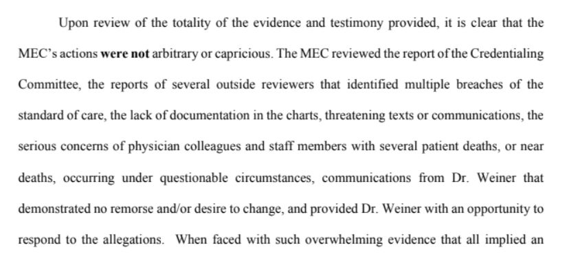
Let me tell you a story – one of the more haunting I’ve seen in 20 years of journalism. It’s about greed, death and denial. It took two years to unravel one doctor’s myth, a hospital’s complicity in creating it, and a documented trail of suspicious deaths…🧵
December 7, 2024 at 3:52 PM
Let me tell you a story – one of the more haunting I’ve seen in 20 years of journalism. It’s about greed, death and denial. It took two years to unravel one doctor’s myth, a hospital’s complicity in creating it, and a documented trail of suspicious deaths…🧵
Reposted by shane loeffler
NEW: “Eat What You Kill”
Hailed as a savior upon his arrival in Helena, Dr. Thomas C. Weiner became a favorite of patients and his hospital’s highest earner. As the myth surrounding the high-profile oncologist grew, so did the trail of patient harm and suspicious deaths. @davidmcswane.bsky.social
Hailed as a savior upon his arrival in Helena, Dr. Thomas C. Weiner became a favorite of patients and his hospital’s highest earner. As the myth surrounding the high-profile oncologist grew, so did the trail of patient harm and suspicious deaths. @davidmcswane.bsky.social

A Hospital Helped a Beloved Doctor’s Practice Flourish Even as It Suspected He Was Hurting Patients
Hailed as a savior upon his arrival in Helena, Dr. Thomas C. Weiner became a favorite of patients and his hospital’s highest earner. As the myth surrounding the high-profile oncologist grew, so did…
propub.li
December 7, 2024 at 3:00 PM
NEW: “Eat What You Kill”
Hailed as a savior upon his arrival in Helena, Dr. Thomas C. Weiner became a favorite of patients and his hospital’s highest earner. As the myth surrounding the high-profile oncologist grew, so did the trail of patient harm and suspicious deaths. @davidmcswane.bsky.social
Hailed as a savior upon his arrival in Helena, Dr. Thomas C. Weiner became a favorite of patients and his hospital’s highest earner. As the myth surrounding the high-profile oncologist grew, so did the trail of patient harm and suspicious deaths. @davidmcswane.bsky.social
Reposted by shane loeffler
I missed the #30DayMapChallenge, but wanted to share something I worked on during those 30 days for a story in my friend's zine about a backpacking trip I did several years back in the Rincon Mountains of southern Arizona.

December 6, 2024 at 8:42 PM
I missed the #30DayMapChallenge, but wanted to share something I worked on during those 30 days for a story in my friend's zine about a backpacking trip I did several years back in the Rincon Mountains of southern Arizona.
Reposted by shane loeffler
To make all of this even worse: ethanol CCS is being falsely sold as a carbon removal offset. This @carbonplan.org post is a fantastic, readable breakdown of why ethanol CCS simply avoids extra carbon being released - rather than sucking carbon from the air.
carbonplan.org/research/eth...
carbonplan.org/research/eth...


December 3, 2024 at 7:23 PM
To make all of this even worse: ethanol CCS is being falsely sold as a carbon removal offset. This @carbonplan.org post is a fantastic, readable breakdown of why ethanol CCS simply avoids extra carbon being released - rather than sucking carbon from the air.
carbonplan.org/research/eth...
carbonplan.org/research/eth...
Reposted by shane loeffler