


Nick Deshais
@nickdeshais.bsky.social
Seattle Times staff writer covering transportation.
Ferries, bikes, pedestrians, buses, trains and oh yeah cars too.
https://www.seattletimes.com/author/nicholas-deshais/
Ferries, bikes, pedestrians, buses, trains and oh yeah cars too.
https://www.seattletimes.com/author/nicholas-deshais/
We dig into this weekend's light rail extension and the ever important discussion of how to pronounce Des Moines and Deshais.
Give it a listen!
Give it a listen!
South King County is getting more light rail on Saturday
We dig into what's coming on Seattle Now
@nickdeshais.bsky.social @trishmurphy.bsky.social @jaughanvones.bsky.social
open.spotify.com/episode/1CHs...
We dig into what's coming on Seattle Now
@nickdeshais.bsky.social @trishmurphy.bsky.social @jaughanvones.bsky.social
open.spotify.com/episode/1CHs...

This is the 1 Line... with new stops in Kent, Des Moines, and Federal Way
open.spotify.com
December 3, 2025 at 7:55 PM
We dig into this weekend's light rail extension and the ever important discussion of how to pronounce Des Moines and Deshais.
Give it a listen!
Give it a listen!
Seattle motorists spent nearly three extra days behind the wheel this year, as the typical driver in the metro region lost 68 hours to traffic congestion.
www.seattletimes.com/seattle-news...
www.seattletimes.com/seattle-news...

Why Seattle-area drivers are waiting longer in traffic
If it seems you've been stuck in traffic for days, you have. And delays are worse this year than last.
www.seattletimes.com
December 3, 2025 at 5:25 PM
Seattle motorists spent nearly three extra days behind the wheel this year, as the typical driver in the metro region lost 68 hours to traffic congestion.
www.seattletimes.com/seattle-news...
www.seattletimes.com/seattle-news...
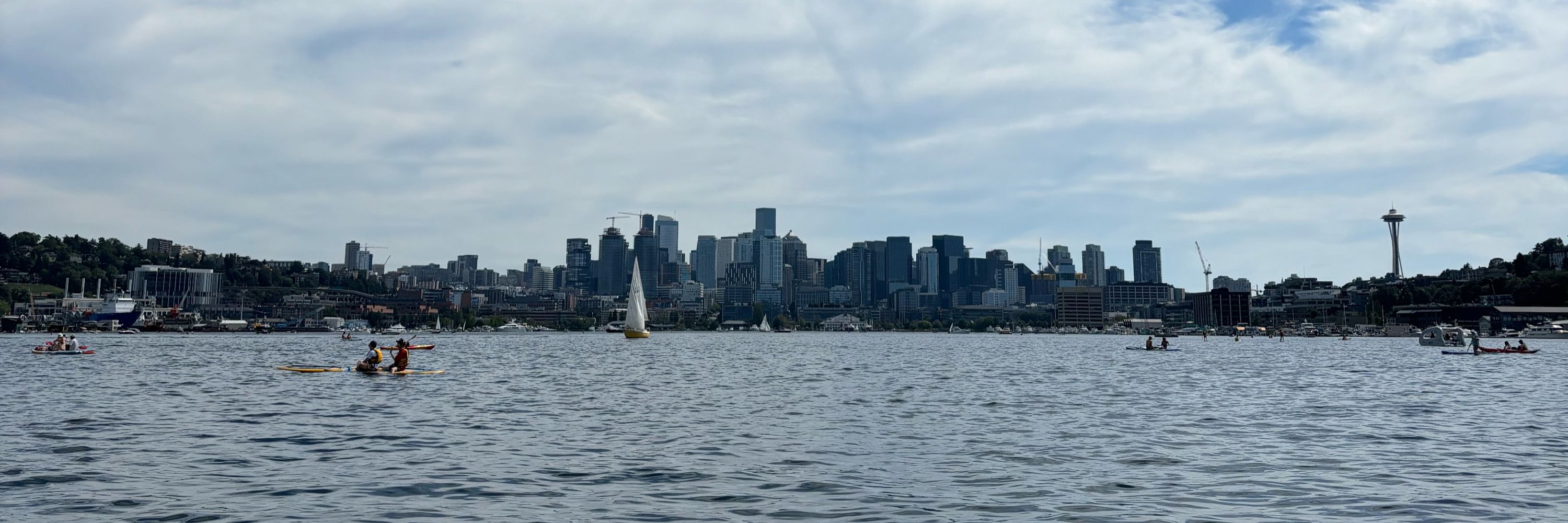
This Saturday, Seattle's light rail system will grow 8 miles, add 23,000 riders to the already 120,000, and open 3 stations in South King County. With this fourth expansion in the past two years, the spine of the system will stretch 40 miles.
Who will ride it?
www.seattletimes.com/seattle-news...
Who will ride it?
www.seattletimes.com/seattle-news...

Light rail is set to open 3 new stops. Who will benefit most?
The 8-mile, three-station light rail extension should be a boon for workers and college students as it eases connections to Sea-Tac Airport, Seattle and beyond.
www.seattletimes.com
December 1, 2025 at 9:17 PM
This Saturday, Seattle's light rail system will grow 8 miles, add 23,000 riders to the already 120,000, and open 3 stations in South King County. With this fourth expansion in the past two years, the spine of the system will stretch 40 miles.
Who will ride it?
www.seattletimes.com/seattle-news...
Who will ride it?
www.seattletimes.com/seattle-news...
Cyclists have long helped out their motoring cousins. After all, the nation’s earliest paved roads, including in Seattle, were done by and for bicyclists.
Now cars are giving back.
www.seattletimes.com/seattle-news...
Now cars are giving back.
www.seattletimes.com/seattle-news...

How Seattle’s new bike lanes are making the most of used car parts
Seattle is the first in the nation to test a new type of bike lane barrier made from recycled tires.
www.seattletimes.com
December 1, 2025 at 5:26 PM
Cyclists have long helped out their motoring cousins. After all, the nation’s earliest paved roads, including in Seattle, were done by and for bicyclists.
Now cars are giving back.
www.seattletimes.com/seattle-news...
Now cars are giving back.
www.seattletimes.com/seattle-news...
Parking in a paid lot will get more expensive next spring after the council adopted a 12% parking tax expected to raise $2 million in a normal year.
www.spokesman.com/stories/2025...
www.spokesman.com/stories/2025...

Spokane City Council approves parking and utility taxes to balance 2026 budget
With a last-minute compromise Monday, the Spokane City Council approved filling a $13 million budget deficit for 2026 through spending cuts, roughly 20 layoffs and two new taxes.
www.spokesman.com
November 25, 2025 at 6:13 PM
Parking in a paid lot will get more expensive next spring after the council adopted a 12% parking tax expected to raise $2 million in a normal year.
www.spokesman.com/stories/2025...
www.spokesman.com/stories/2025...
Reposted by Nick Deshais

Nice write up about the Great American Rail Trail 🚲 ⤵️
In print today, go buy your local newspaper (whether you live in Seattle or not)!
www.seattletimes.com/pacific-nw-m...
www.seattletimes.com/pacific-nw-m...

A rider’s experience on WA’s portion of the Great American Rail-Trail
The grand ambition: to complete a 3,700-mile rail trail that connects Washington to Washington, D.C. It's 55% done, but advocates say the hardest work remains ahead.
www.seattletimes.com
November 24, 2025 at 4:55 PM
Nice write up about the Great American Rail Trail 🚲 ⤵️
In print today, go buy your local newspaper (whether you live in Seattle or not)!
www.seattletimes.com/pacific-nw-m...
www.seattletimes.com/pacific-nw-m...
A rider’s experience on WA’s portion of the Great American Rail-Trail
The grand ambition: to complete a 3,700-mile rail trail that connects Washington to Washington, D.C. It's 55% done, but advocates say the hardest work remains ahead.
www.seattletimes.com
November 23, 2025 at 7:01 PM
In print today, go buy your local newspaper (whether you live in Seattle or not)!
www.seattletimes.com/pacific-nw-m...
www.seattletimes.com/pacific-nw-m...
"As I ride through the heart of the mountain, a tiny fear takes hold. I should’ve anticipated it, considering all the warnings I’d heard at the old Hyak train station moments before I entered the dark, 2.3-mile Snoqualmie Tunnel."
Print tomorrow, online now!
www.seattletimes.com/pacific-nw-m...
Print tomorrow, online now!
www.seattletimes.com/pacific-nw-m...
What it’s like to bike the WA section of the Great American Rail-Trail
The grand ambition: to complete a 3,700-mile rail trail that connects WA to Washington D.C. It's 55% done, but advocates say the hardest work remains ahead.
www.seattletimes.com
November 22, 2025 at 7:11 PM
"As I ride through the heart of the mountain, a tiny fear takes hold. I should’ve anticipated it, considering all the warnings I’d heard at the old Hyak train station moments before I entered the dark, 2.3-mile Snoqualmie Tunnel."
Print tomorrow, online now!
www.seattletimes.com/pacific-nw-m...
Print tomorrow, online now!
www.seattletimes.com/pacific-nw-m...
Reposted by Nick Deshais

Our Commercial E-Cargo Bike Program launches today. We want to work with businesses of all sizes to help our freight network become more cost-effective as delivery volumes continue to increase.
Learn what's next: https://sdotblog.seattle.gov/2025/11/20/seattle-commercial-e-cargo-bike-program/
Learn what's next: https://sdotblog.seattle.gov/2025/11/20/seattle-commercial-e-cargo-bike-program/


November 20, 2025 at 10:59 PM
Our Commercial E-Cargo Bike Program launches today. We want to work with businesses of all sizes to help our freight network become more cost-effective as delivery volumes continue to increase.
Learn what's next: https://sdotblog.seattle.gov/2025/11/20/seattle-commercial-e-cargo-bike-program/
Learn what's next: https://sdotblog.seattle.gov/2025/11/20/seattle-commercial-e-cargo-bike-program/
A power outage forced a shutdown of the Highway 99 tunnel through downtown Seattle on Thursday morning, but crews with Seattle City Light restored power just before 10 a.m. and the tunnel should be reopening to traffic once final checks are performed.
www.seattletimes.com/seattle-news...
www.seattletimes.com/seattle-news...

Highway 99 tunnel in Seattle to reopen; power outage resolved
There is no estimate for power restoration and the tunnel reopening, WSDOT said in a Thursday morning social media post.
www.seattletimes.com
November 20, 2025 at 6:29 PM
A power outage forced a shutdown of the Highway 99 tunnel through downtown Seattle on Thursday morning, but crews with Seattle City Light restored power just before 10 a.m. and the tunnel should be reopening to traffic once final checks are performed.
www.seattletimes.com/seattle-news...
www.seattletimes.com/seattle-news...
Trump’s DOT has been on a deregulation blitz, with 30 regulatory moves that could reduce safety and cost lives, according to experts.
www.propublica.org/article/trum...
www.propublica.org/article/trum...

How Trump’s Transportation Department Is Loosening Safety Rules Meant to Protect the Public
ProPublica has identified dozens of instances in which the Trump administration’s DOT has moved to cut, soften or delay safety regulations for cars, trucks, planes, trains and even oil pipelines. Expe...
www.propublica.org
November 20, 2025 at 5:25 PM
Trump’s DOT has been on a deregulation blitz, with 30 regulatory moves that could reduce safety and cost lives, according to experts.
www.propublica.org/article/trum...
www.propublica.org/article/trum...
Of the top 30 cities, three are in North America: Montreal (15), Quebec City (29) and Vancouver, B.C. (30).
If the lack of U.S. cities surprises you, go ride in Utrecht, Copenhagen, Ghent, Amsterdam or Paris and get unsurprised.
www.fastcompany.com/91442963/the...
If the lack of U.S. cities surprises you, go ride in Utrecht, Copenhagen, Ghent, Amsterdam or Paris and get unsurprised.
www.fastcompany.com/91442963/the...

The 30 most bike-friendly cities in the world
The 2025 Copenhagenize Index shows which cities have done the most—from redesigning streets to growing bike-share systems—to make it easy to get around on two wheels.
www.fastcompany.com
November 19, 2025 at 8:18 PM
Of the top 30 cities, three are in North America: Montreal (15), Quebec City (29) and Vancouver, B.C. (30).
If the lack of U.S. cities surprises you, go ride in Utrecht, Copenhagen, Ghent, Amsterdam or Paris and get unsurprised.
www.fastcompany.com/91442963/the...
If the lack of U.S. cities surprises you, go ride in Utrecht, Copenhagen, Ghent, Amsterdam or Paris and get unsurprised.
www.fastcompany.com/91442963/the...
Everyday is a stop on Taylor Swift's 2023 Eras Tour, according to Sound Transit.
www.seattletimes.com/seattle-news...
www.seattletimes.com/seattle-news...

Downtown Seattle light rail to close early for 3 nights. What to know.
During the late-night shutdown in the downtown area, shuttle buses will stop at each affected light rail station.
www.seattletimes.com
November 18, 2025 at 8:14 PM
Everyday is a stop on Taylor Swift's 2023 Eras Tour, according to Sound Transit.
www.seattletimes.com/seattle-news...
www.seattletimes.com/seattle-news...
Oh là là!

Ridership on Paris region transit systems is now generally at or higher than pre-pandemic levels. Bike use is much higher than pre-pandemic.
At the same time, car traffic in Paris and on its ring highway is substantially lower than it was pre-pandemic. www.institutparisregion.fr/mobilite-et-...
At the same time, car traffic in Paris and on its ring highway is substantially lower than it was pre-pandemic. www.institutparisregion.fr/mobilite-et-...


November 18, 2025 at 8:09 PM
Oh là là!
I recently asked SDOT why car parking can't be used for scooters, etc. They said:
"Repurposing car parking can be a more costly solution and there are a limited number of 24/7 spaces, especially downtown. We want to find efficient, balanced solutions that support all modes of travel."
"Repurposing car parking can be a more costly solution and there are a limited number of 24/7 spaces, especially downtown. We want to find efficient, balanced solutions that support all modes of travel."
@nondriver.bsky.social, Ilona Lohrey (GSBA), and I asked in the Seattle Times today for: "A parking corral system where, in busy areas around town, shared bikes and scooters must be parked in designated zones located on the street whenever physically possible." www.seattletimes.com/opinion/ok-c...

November 18, 2025 at 8:02 PM
I recently asked SDOT why car parking can't be used for scooters, etc. They said:
"Repurposing car parking can be a more costly solution and there are a limited number of 24/7 spaces, especially downtown. We want to find efficient, balanced solutions that support all modes of travel."
"Repurposing car parking can be a more costly solution and there are a limited number of 24/7 spaces, especially downtown. We want to find efficient, balanced solutions that support all modes of travel."
Reposted by Nick Deshais
This Saturday Ballard Fremont Greenways, Councilmember Strauss, and @seattledot.bsky.social are celebrating the new crosswalk on 15th Ave in Ballard.
When: This Saturday at 2 PM
Where: 15th Ave NW and NW 51st St in Ballard.
Learn more: sdotblog.seattle.gov/2025/11/05/1...
When: This Saturday at 2 PM
Where: 15th Ave NW and NW 51st St in Ballard.
Learn more: sdotblog.seattle.gov/2025/11/05/1...


November 14, 2025 at 8:07 PM
This Saturday Ballard Fremont Greenways, Councilmember Strauss, and @seattledot.bsky.social are celebrating the new crosswalk on 15th Ave in Ballard.
When: This Saturday at 2 PM
Where: 15th Ave NW and NW 51st St in Ballard.
Learn more: sdotblog.seattle.gov/2025/11/05/1...
When: This Saturday at 2 PM
Where: 15th Ave NW and NW 51st St in Ballard.
Learn more: sdotblog.seattle.gov/2025/11/05/1...
Happy 146th Birthday to the Bicycles of Washington State!
"The first bicycle arrived in Washington Territory on Nov. 14, 1879, and was prominently displayed in the window of a Seattle stationery and book shop at 617 Front Street owned by William H. Pumphrey."
www.historylink.org/File/20810
"The first bicycle arrived in Washington Territory on Nov. 14, 1879, and was prominently displayed in the window of a Seattle stationery and book shop at 617 Front Street owned by William H. Pumphrey."
www.historylink.org/File/20810

Cycling in Washington
The first bicycle arrived in Washington Territory in 1879 on a steamer from San Francisco and within a decade, Washington, along with the rest of the nation, went bike-crazy. Innovative developments
www.historylink.org
November 14, 2025 at 6:00 PM
Happy 146th Birthday to the Bicycles of Washington State!
"The first bicycle arrived in Washington Territory on Nov. 14, 1879, and was prominently displayed in the window of a Seattle stationery and book shop at 617 Front Street owned by William H. Pumphrey."
www.historylink.org/File/20810
"The first bicycle arrived in Washington Territory on Nov. 14, 1879, and was prominently displayed in the window of a Seattle stationery and book shop at 617 Front Street owned by William H. Pumphrey."
www.historylink.org/File/20810
Missouri Republican Rep. Sam Graves, chair of the House Transportation and Infrastructure Committee, said infrastructure for biking and walking to be an important federal priority.
usa.streetsblog.org/2025/11/12/g...
usa.streetsblog.org/2025/11/12/g...

House T&I Chair Vows ‘No Money for Bikes or Walking’ in Fed Transportation Bill — Streetsblog USA
The outlook for active transportation won't be good if advocates don't stand up.
usa.streetsblog.org
November 12, 2025 at 9:38 PM
Missouri Republican Rep. Sam Graves, chair of the House Transportation and Infrastructure Committee, said infrastructure for biking and walking to be an important federal priority.
usa.streetsblog.org/2025/11/12/g...
usa.streetsblog.org/2025/11/12/g...
Having seen these myself in action, I wonder why Seattle doesn't use this design on Healthy Streets in place of the easily movable signs.

Traffic calming on a street in Copenhagen. The two lane road narrows to one lane several times on this long block, with curbed barriers (either bollards or trees) to enforce. The wide bike lanes are uninterrupted.

November 12, 2025 at 8:25 PM
Having seen these myself in action, I wonder why Seattle doesn't use this design on Healthy Streets in place of the easily movable signs.

A Friendly Reminder for Scooter Riders in Downtown Seattle
YouTube video by Downtown Seattle Association
youtu.be
November 11, 2025 at 8:25 PM
Seattle-based Rad Power Bikes, former darling of the booming e-bike market, warned it could shut down amid slowing sales and the hangover of too-rapid growth during the pandemic.
www.seattletimes.com/business/loc...
www.seattletimes.com/business/loc...

Seattle e-bike company may close, cut jobs
Once the leader in e-bikes, Seattle-based Rad Power Bikes warned employees it could shut down if it can't solve a financial hangover from pandemic-era growth.
www.seattletimes.com
November 11, 2025 at 7:46 PM
Seattle-based Rad Power Bikes, former darling of the booming e-bike market, warned it could shut down amid slowing sales and the hangover of too-rapid growth during the pandemic.
www.seattletimes.com/business/loc...
www.seattletimes.com/business/loc...
The Seattle Department of Transportation has concluded it will likely need to return more than $4 million to the federal government after an internal review raised issues with how a 2017 grant from the Federal Highway Administration was executed.
www.seattletimes.com/seattle-news...
www.seattletimes.com/seattle-news...

Seattle transportation department likely to return $4M to feds
It’s not the first time a city project has been criticized by the federal government over its use of grants, or that the city has had to return grant funds.
www.seattletimes.com
November 4, 2025 at 10:17 PM
The Seattle Department of Transportation has concluded it will likely need to return more than $4 million to the federal government after an internal review raised issues with how a 2017 grant from the Federal Highway Administration was executed.
www.seattletimes.com/seattle-news...
www.seattletimes.com/seattle-news...
"Since 2023, however, something new has topped the list: traffic safety."
www.seattletimes.com/seattle-news...
www.seattletimes.com/seattle-news...

Seattle’s ‘surprising’ top public-safety concern, according to an annual survey
Seattle University's annual survey on public safety, initiated in 2015, shows how local perceptions of crime, safety and policing have shifted.
www.seattletimes.com
November 3, 2025 at 7:30 PM
"Since 2023, however, something new has topped the list: traffic safety."
www.seattletimes.com/seattle-news...
www.seattletimes.com/seattle-news...
How does a floating bridge handle a train going over it? One word: Spaghetti.
www.youtube.com/watch?v=-tIm...
www.youtube.com/watch?v=-tIm...

First in the world: How Sound Transit built light rail on a floating bridge
YouTube video by Sound Transit
www.youtube.com
November 3, 2025 at 7:29 PM
How does a floating bridge handle a train going over it? One word: Spaghetti.
www.youtube.com/watch?v=-tIm...
www.youtube.com/watch?v=-tIm...
In 2007, the "idea of free transit — it was visionary, it was lovely, it was beguiling.” And back then “it was completely impractical.”
What about now?
www.nytimes.com/interactive/...
What about now?
www.nytimes.com/interactive/...

Can Faster Buses Really Be Free?
An analysis of the possible promise and fundamental tension in one of Zohran Mamdani’s big plans for New York.
www.nytimes.com
October 27, 2025 at 10:59 PM
In 2007, the "idea of free transit — it was visionary, it was lovely, it was beguiling.” And back then “it was completely impractical.”
What about now?
www.nytimes.com/interactive/...
What about now?
www.nytimes.com/interactive/...