Michael Lowry
@michaelrlowry.bsky.social
6.4K followers 210 following 430 posts
Hurricane Specialist and Storm Surge Expert at Miami's WPLG-TV Local 10 News. Posts my own. http://linktr.ee/michaelrlowry
Posts Media Videos Starter Packs
Pinned
michaelrlowry.bsky.social
It's been death by a million papercuts to U.S. weather forecasts by the Trump administration, but yesterday's detailed 2026 budget feels like a deathblow. In today's @nytimes.com I ask: How far can we degrade our hurricane forecasting before people end up dead?
Opinion | How Far Can We Degrade Our Hurricane Forecasting Before People End Up Dead?
www.nytimes.com
Reposted by Michael Lowry
theeyewallwx.bsky.social
For South Jersey and Delaware, it appears this will be the most significant coastal storm in 10 to 15 years. Major impacts, particularly from gusty winds, beach erosion, and coastal flooding. We explain impacts and the latest on active Western weather below or at theeyewall.com.
Major coastal flooding and beach erosion coming for the Jersey Shore and Delmarva, while storminess continues out West
Biggest coastal storm impacts in 10 to 15 years for Delaware and South Jersey
open.substack.com
Reposted by Michael Lowry
wisc-satellite.bsky.social
7 years ago today, Category 5 Hurricane #Michael made landfall along Florida's Gulf Coast. More imagery and details on the CIMSS Satellite Blog: cimss.ssec.wisc.edu/satellite-bl... #FLwx
Reposted by Michael Lowry
bmcnoldy.bsky.social
The Accumulated Cyclone Energy (ACE) is at 92% of average for the date this Atlantic hurricane season. Rather than counting storms, this metric accounts for the combined duration and intensity of whatever storms there were.

Climatologically, 15% of the season's ACE is still ahead.
Reposted by Michael Lowry
jimmy-yunge.bsky.social
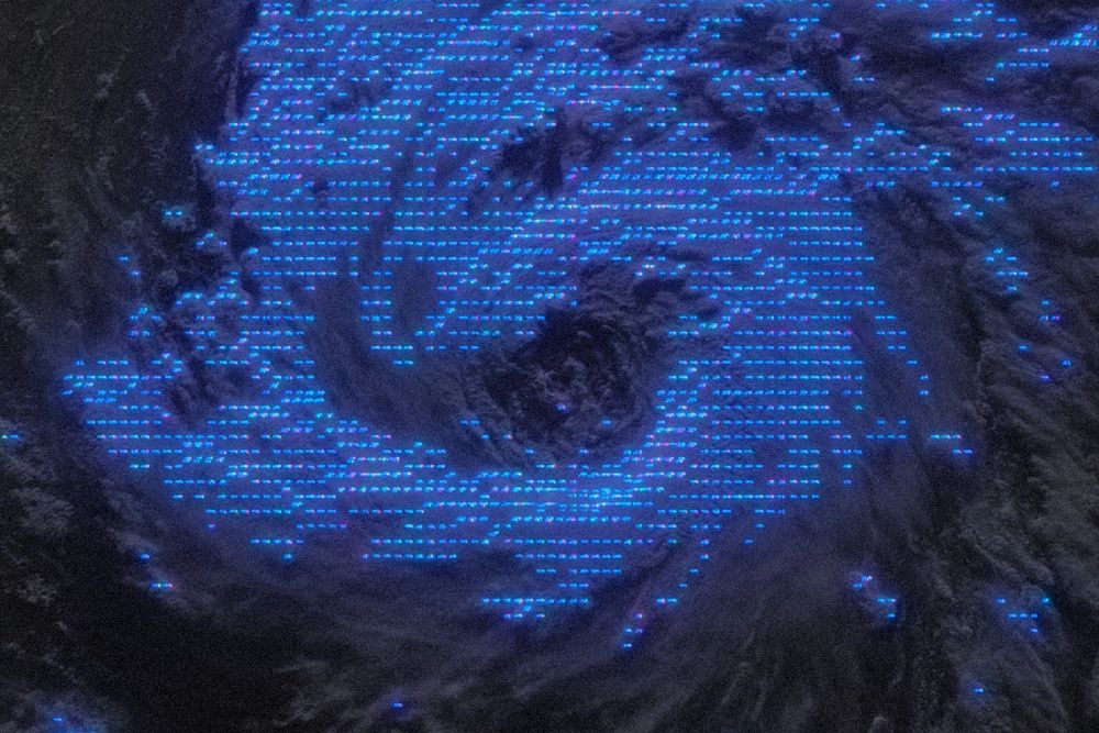
In the third SAR image you can also see trails of slower near-surface flow downwind of the volcanic islands.
Zoomed in image of the last SAR overpass in the original post using a color map with higher contrast. The small islands (black colors) leave behind small trails of lower wind speeds (cooler colors) as the mountainous terrain obstructs the near-surface wind, showing the extremely high resolution of these observations.
michaelrlowry.bsky.social
Jerry's not winning any beauty contests this morning, but it continues to drag heavy rains and blustery weather through the islands. Meanwhile, short-timer Karen formed about as far away as we've seen. Otherwise the tropics appear to be throttling down. ⬇️
Jerry Bringing Heavy Rains to the Leeward Islands as Karen Forms Far, Far Away
Jerry passing to the north of the Leeward Islands, Virgin Islands, and Puerto Rico but heavy rains and a flash flood threat continues into early Saturday
michaelrlowry.substack.com
michaelrlowry.bsky.social
Jerry's a bit disheveled at the moment but should pass near the northern Leeward Islands later today or early Friday near hurricane strength. Lots to talk about with the quasi-nor'easter shaping up this weekend. Plus, 96L waayyy out of bounds. My latest ⬇️
Disheveled Jerry to Pass Near the Northern Leeward Islands Today
Jerry’s strongest winds should pass north of the islands today, but a squally tail will bring the threat of blustery rains through tomorrow
michaelrlowry.substack.com
michaelrlowry.bsky.social
Jerry almost looking like a strong tropical wave than a bona fide tropical storm at the moment – very weak circulation to the southwest but impressive winds to the northeast. Its fast movement no doubt playing into this deformity. Should start slowing later tomorrow and Friday.
Reposted by Michael Lowry
bmcnoldy.bsky.social
A trio of cyclonic eddies in the Gulf of Mexico are creating record-high Ocean Heat Content values for the date. Absolutely something of importance during this part of hurricane season.
@miamirosenstiel.bsky.social
Reposted by Michael Lowry
nws.noaa.gov
A non-tropical low pressure system is forecast to develop late this week along the East Coast, bringing a renewed surge of onshore winds and moderate-to-major coastal flooding to the Carolinas and Mid-Atlantic shores.
michaelrlowry.bsky.social
Jerry's a top 1% in terms of its fast movement through the deep tropics. Its speed is knocking its circulation off kilter but it should organize as it slows and turns near the islands. Also, as Jerry would say, what's the deal with the weekend nor'easter?
Jerry Forms but Slow to Strengthen, Tropical Storm Watches Issued for the Northern Leeward Islands
Jerry forecast to pass near the northern Leeward Islands as a hurricane tomorrow and Friday but turn well east of the U.S.
michaelrlowry.substack.com
michaelrlowry.bsky.social
My 2 year old has learned that if he asks to "look at the radar" there's a good chance he'll get to see my phone :)
nathanwpyle.bsky.social
there’s always one person in the family who looks at the Doppler radar
5 emotionless people look at one person who is viewing a  laptop screen and saying hmmmm
Reposted by Michael Lowry
cira-csu.bsky.social
Tropical Storm Jerry forms over the central Atlantic and becomes the tenth named storm of the season.
michaelrlowry.bsky.social
I assume this is due to some convective parametrization issue? We've seen this for several years now but seems noticeably worse this season, especially at shorter lead times.
Reposted by Michael Lowry
nhc-atlc.nws-bot.us
Atlantic Tropical Storm Jerry Advisory Number 1 issued at Tue, 07 Oct 2025 14:35:01 +0000
...TROPICAL STORM JERRY FORMS OVER THE TROPICAL CENTRAL ATLANTIC... ...THE TENTH NAMED STORM OF THE SEASON...
Additional Details Here.

        000WTNT35 KNHC 071434TCPAT5 BULLETINTropical Storm Jerry Advisory Number   1NWS National Hurricane Center Miami FL       AL1020251100 AM AST Tue Oct 07 2025 ...TROPICAL STORM JERRY FORMS OVER THE TROPICAL CENTRAL ATLANTIC......THE TENTH NAMED STORM OF THE SEASON...  SUMMARY OF 1100 AM AST...1500 UTC...INFORMATION-----------------------------------------------LOCATION...11.5N 44.6WABOUT 1315 MI...2120 KM ESE OF THE NORTHERN LEEWARD ISLANDSMAXIMUM SUSTAINED WINDS...45 MPH...75 KM/HPRESENT MOVEMENT...W OR 280 DEGREES AT 24 MPH...39 KM/HMINIMUM CENTRAL PRESSURE...1006 MB...29.71 INCHES  WATCHES AND WARNINGS--------------------There are no coastal watches or warnings in effect.Interests in the northern Leeward Islands should monitor theprogress of Jerry as Tropical Storm Watches could be requiredlater today or tonight.  DISCUSSION AND OUTLOOK----------------------At 1100 AM AST (1500 UTC), the center of the newly formed Tropical Storm Jerry was located near latitude 11.5 North, longitude 44.6 West. Jerry is moving toward the west near 24 mph (39 km/h).  A decrease in forward speed and a turn to the west-northwest is expected during the next couple of days.  On the forecast track, the core of the system is expected to be near or to the north of the northern Leeward Islands late Thursday and Friday. Maximum sustained winds are near 45 mph (75 km/h) with higher gusts.Steady strengthening is forecast, and Jerry is expected to become a hurricane in a day or two. Tropical-storm-force winds extend outward up to 140 miles (220 km)from the center. The estimated minimum central pressure is 1006 mb (29.71 inches).  HAZARDS AFFECTING LAND----------------------Key messages for Tropical Storm Jerry can be found in the Tropical Cyclone Discussion under AWIPS header MIATCDAT5 and WMO header WTNT45 KNHC.SURF:  Swells generated by Jerry are expected to reach the Leeward Islands on Thursday.  These swells are likely to cause life-threatening surf and rip current conditions.  Please consultproducts from your local weather office. A depiction of rip current risk for the United States can be foundat: hurricanes.gov/graphics_at[X].shtml?ripCurrents  NEXT ADVISORY-------------Next complete advisory at 500 PM AST. $$Forecaster Cangialosi
michaelrlowry.bsky.social
By the looks of it, we'll have Jerry sooner rather than later. Soon-to-be Jerry is poised to be a hurricane as it passes precariously close to parts of the Leeward Islands by late week. Meanwhile I talk about the coastal storm closer to home for next week.
Tropical Depression Forming, Could Become a Hurricane as It Nears the Leeward Islands Thursday and Friday
Soon-to-be Jerry could move precariously close to the easternmost Caribbean islands as a hurricane by Thursday and Friday
michaelrlowry.substack.com
Reposted by Michael Lowry
nhcbot.bsky.social
NHC outlook 8pm EDT Oct 6th: 1) System in C Tropical Atlantic (#AL95) has high genesis chance (90%🔴). Northern Leeward Islands should monitor. 2) Trough crossing Yucatan has low genesis chance (10%🟡) in Bay of Campeche before moving into... https://x.com/NHC_Atlantic/status/1975355238052946275
Reposted by Michael Lowry
cira-csu.bsky.social
On September 27, 2025, Hurricane Humberto reached its peak intensity as a Category Five hurricane well northeast of Puerto Rico on its journey across the western Atlantic Ocean. The polar orbiting satellite Suomi-NPP captured a spectacular view of the clear eye of Humberto. (1/5)
This image of Hurricane Humberto contains the visible (band I1) product from the S-NPP weather satellite from 17:10 UTC on 2025-09-27.
Reposted by Michael Lowry
drwildcatwx.bsky.social
This is the PNS for the #EnderlinTornado upgrade to EF-5, the first since the #MooreTornado on May 20, 2013. #Tornado #EnhancedFujitaScale #EFScale
fgf.weather.im
#FGF issues Public Information Statement (PNS) at Oct 6, 9:30 AM CDT ...Enderlin Tornado #1 Upgraded to EF-5... Link
Reposted by Michael Lowry
mattlanza.bsky.social
12 years is a long time. A good stretch. But the EF-5 “drought” has ended.

Also, this is a lesson to the Monday morning quarterbacks that this took *3 months* to confirm. Good analysis takes time. So save your hot takes immediately after an event.
fgf.weather.im
#FGF issues Public Information Statement (PNS) at Oct 6, 9:30 AM CDT ...Enderlin Tornado #1 Upgraded to EF-5... Link
michaelrlowry.bsky.social
The only game in town this week is Invest 95L, which looks poised to become Jerry in the days ahead. It'll make a close pass to the islands, though trends favor a miss north. Something to watch. Also, I spy a cold front over South Florida... 👀
Tropical System Likely to Form, Could Strengthen as It Nears the Easternmost Caribbean Islands Later this Week
Invest 95L could become Jerry before the week is out, passing near or north of the Lesser Antilles
michaelrlowry.substack.com