


Brian Olson
@brianolson.bsky.social
California geologist, earthquake hazards scientist, Christian, and frustrated Angels/Ducks/Browns fan. Peace & Humpty-ness Forever!
“Older than some people, but younger than some buildings.”
“Older than some people, but younger than some buildings.”
Pinned
Brian Olson
@brianolson.bsky.social
· Dec 13


Hi, I’m Brian Olson—geologist, earthquake nerd, & SoCal resident. With 25+ years in engineering geology, I tackle hazards like liquefaction, landslides, & active faults. Expect posts on quakes, geology, travel, Disneyland, & how the Angels break my heart. 🌍🏰⚾
DAS Bump!
My summary of this morning’s session: “Forecasting Earthquakes with Continuous Data: From Lab to Field”. Sounds like a SCEC German punk band. #scecmeet
My summary of this morning’s session: “Forecasting Earthquakes with Continuous Data: From Lab to Field”. Sounds like a SCEC German punk band. #scecmeet
September 8, 2025 at 4:24 PM
DAS Bump!
My summary of this morning’s session: “Forecasting Earthquakes with Continuous Data: From Lab to Field”. Sounds like a SCEC German punk band. #scecmeet
My summary of this morning’s session: “Forecasting Earthquakes with Continuous Data: From Lab to Field”. Sounds like a SCEC German punk band. #scecmeet


Opening presentation of this year’s SCEC annual meeting in Palm Springs! It seems SCEC is a “large Enterprise” working to develop & share cutting-edge earthquake system science to enhance California’s resilience & to educate and inspire future scientists. #scecmeet #SCEC2025 🧪

September 8, 2025 at 12:48 AM
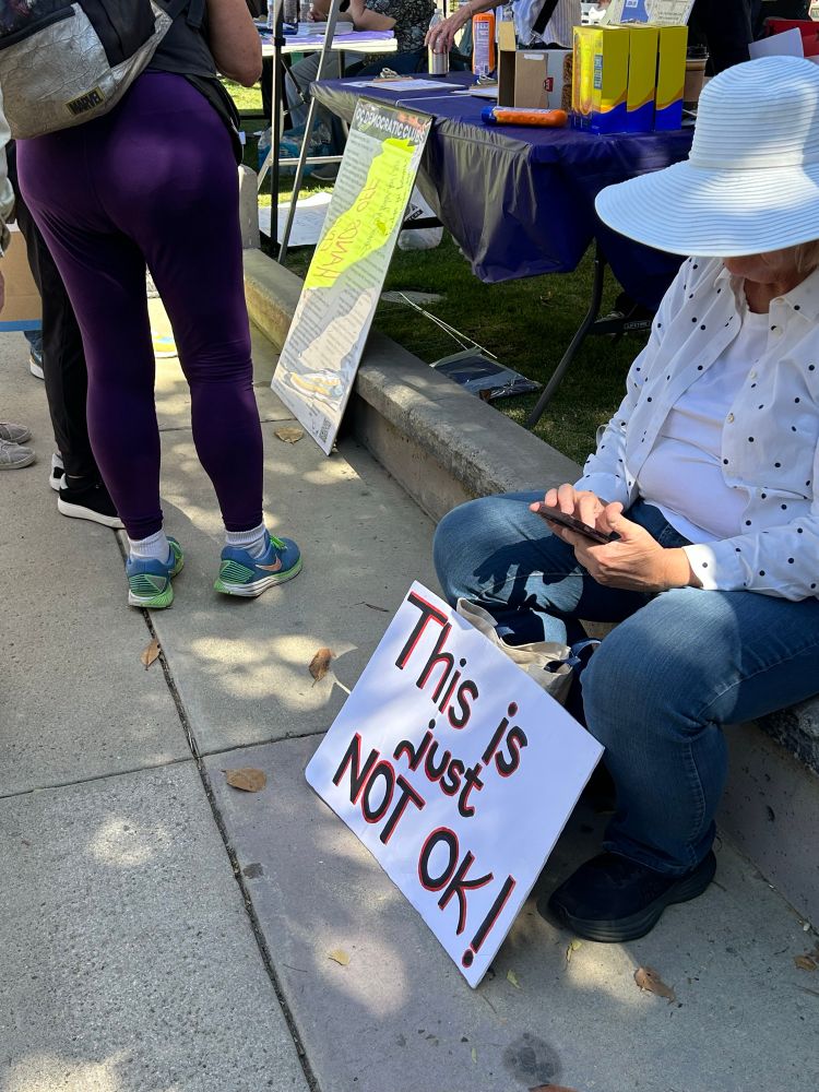
Well, given that he's not running for governor again becuase he reached his term limit....
Kristi Noem, standing next to the president in the White House, urges Californians to not elect Gavin Newsom again
June 10, 2025 at 4:45 PM
Well, given that he's not running for governor again becuase he reached his term limit....
Reposted by Brian Olson
“NSF watchers fear that a smaller, restructured agency could be more vulnerable to pressure from the White House to fund research that suits its ideological bent.” www.science.org/content/arti...
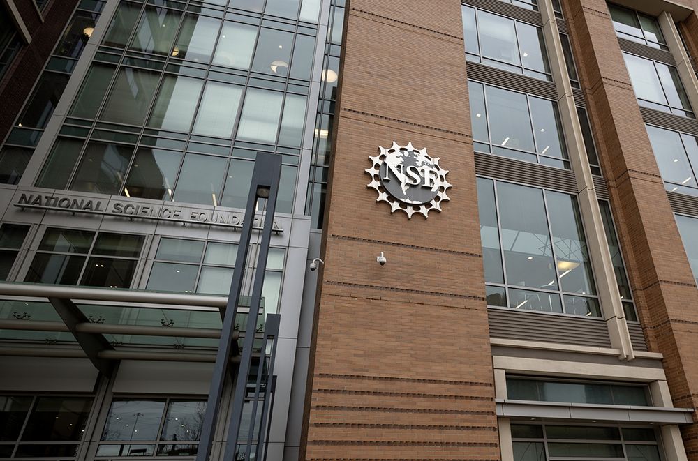
Exclusive: NSF faces radical shake-up as officials abolish its 37 divisions
Changes seen as a response to presidential directives on what research to fund
www.science.org
May 9, 2025 at 11:58 AM
“NSF watchers fear that a smaller, restructured agency could be more vulnerable to pressure from the White House to fund research that suits its ideological bent.” www.science.org/content/arti...
Reposted by Brian Olson
I'm guessing there was a real reason that the new pope served as the bishop of Chiclayo, but I'm going to pretend that whoever was doing the bishop assignments misheard it as Chicago and was like "great we can just promote one of our Chicago guys".
May 8, 2025 at 7:06 PM
I'm guessing there was a real reason that the new pope served as the bishop of Chiclayo, but I'm going to pretend that whoever was doing the bishop assignments misheard it as Chicago and was like "great we can just promote one of our Chicago guys".
It’s me! I’m “one scientist”! 🧪
April 17, 2025 at 12:56 AM
It’s me! I’m “one scientist”! 🧪
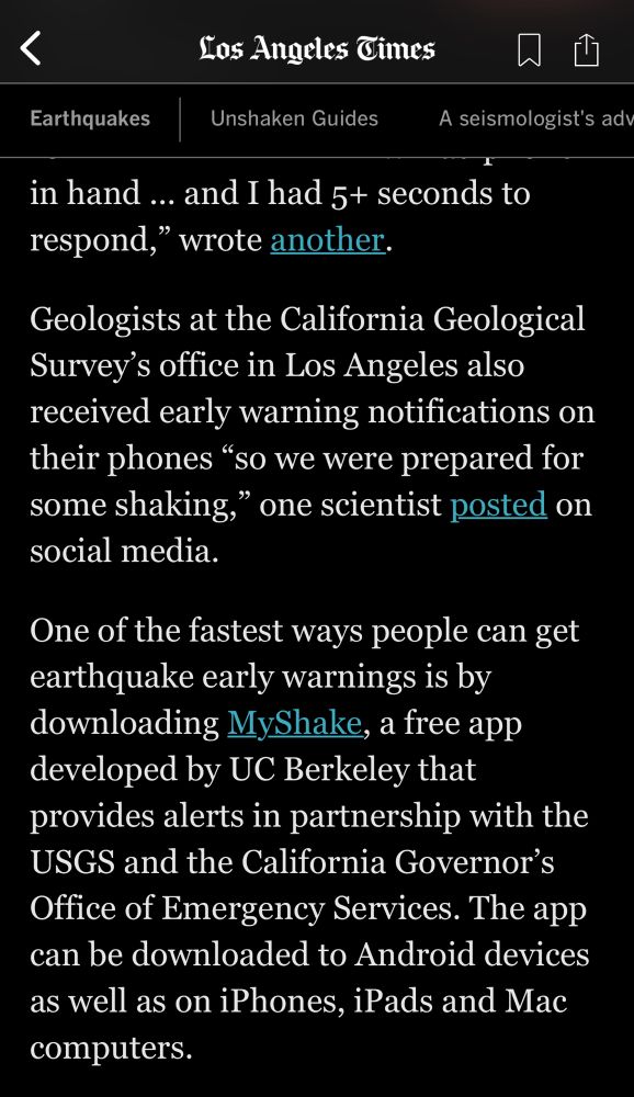
Us geologists here at the @cageosurvey.bsky.social LA office all got our early warning notifications on our phones so we were prepared for some shaking. Did you get one too?
Download @myshakeapp.bsky.social to be ready next time. #earthquake
Download @myshakeapp.bsky.social to be ready next time. #earthquake
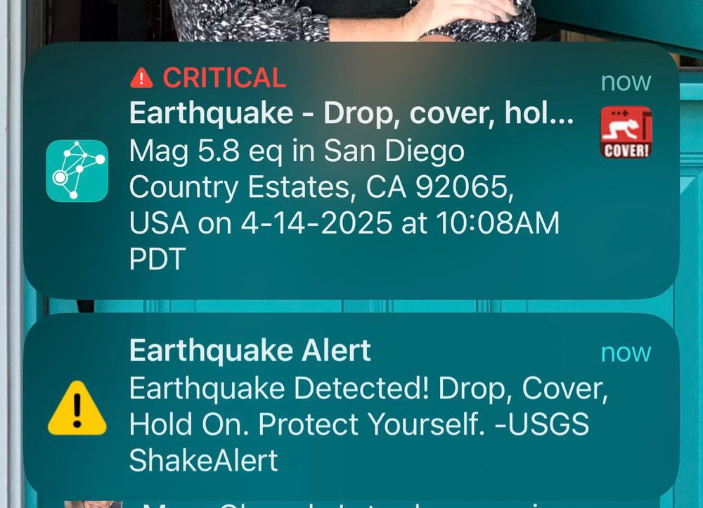
April 14, 2025 at 5:37 PM
Us geologists here at the @cageosurvey.bsky.social LA office all got our early warning notifications on our phones so we were prepared for some shaking. Did you get one too?
Download @myshakeapp.bsky.social to be ready next time. #earthquake
Download @myshakeapp.bsky.social to be ready next time. #earthquake
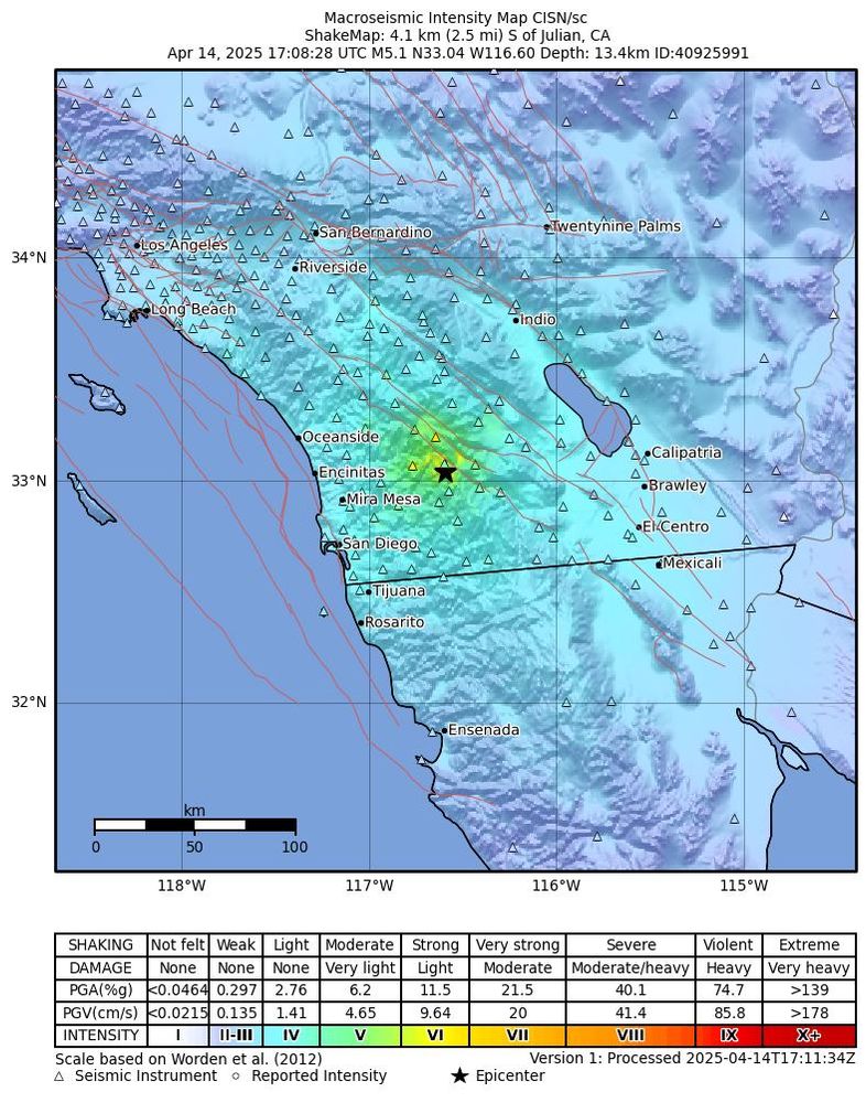
Felt the long-period shaking here in downtown LA from the M5.2 earthquake near Julian, CA (San Diego County). Epicenter is near the Elsinore Fault, which would be the primary suspect, but we'll see once more data comes in. #earthquake #Julian 🧪 @cageosurvey.bsky.social
April 14, 2025 at 5:26 PM
Felt the long-period shaking here in downtown LA from the M5.2 earthquake near Julian, CA (San Diego County). Epicenter is near the Elsinore Fault, which would be the primary suspect, but we'll see once more data comes in. #earthquake #Julian 🧪 @cageosurvey.bsky.social
You’ll forgive my concerns over a possible upcoming recession. I lost my job and almost lost my house in the last one.


April 7, 2025 at 6:11 PM
You’ll forgive my concerns over a possible upcoming recession. I lost my job and almost lost my house in the last one.
Reposted by Brian Olson
What do the Republicans and the oligarchs fear most? Solidarity between poor rural whites and Black urban folks.
They have always feared it. It’s time to come together, friends. Our futures are bound up together.
They have always feared it. It’s time to come together, friends. Our futures are bound up together.
April 5, 2025 at 10:48 PM
What do the Republicans and the oligarchs fear most? Solidarity between poor rural whites and Black urban folks.
They have always feared it. It’s time to come together, friends. Our futures are bound up together.
They have always feared it. It’s time to come together, friends. Our futures are bound up together.

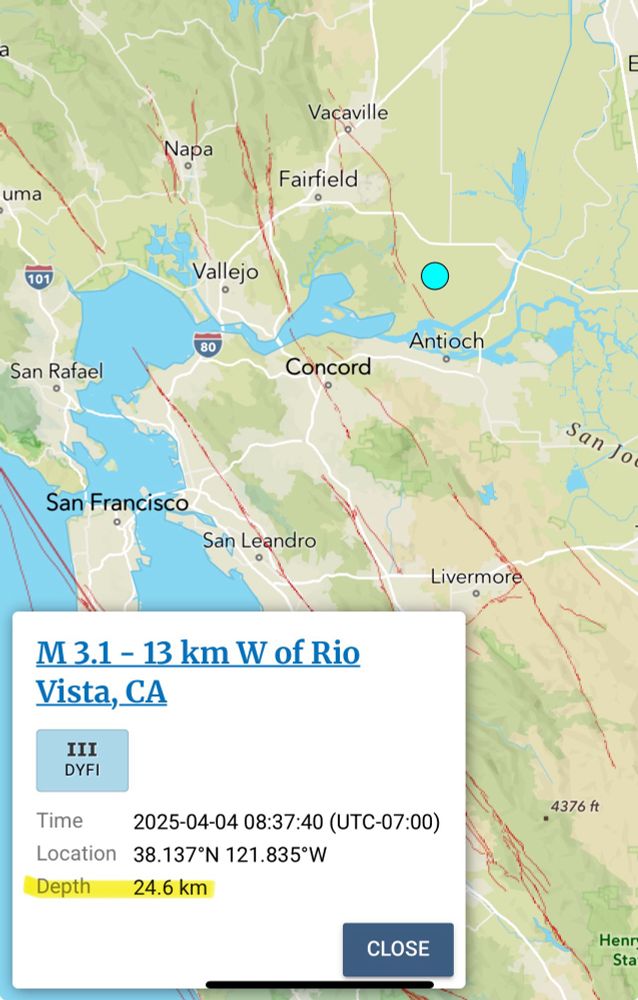
Anyone have any insight into why this M3.1 in the Sacramento delta is SO deep? 🧪
April 4, 2025 at 5:59 PM
Anyone have any insight into why this M3.1 in the Sacramento delta is SO deep? 🧪
Reposted by Brian Olson
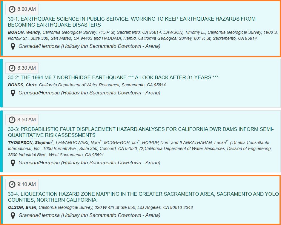
Folks attending the @geosociety.bsky.social Cordilleran conference - roll out of bed early, grab a ☕️ and head over to the Granada Room to catch my 8:00 am talk! Then stick around to learn about liquefaction hazards in Sacramento from @brianolson.bsky.social at 9:10. 😎
April 4, 2025 at 3:02 AM
Folks attending the @geosociety.bsky.social Cordilleran conference - roll out of bed early, grab a ☕️ and head over to the Granada Room to catch my 8:00 am talk! Then stick around to learn about liquefaction hazards in Sacramento from @brianolson.bsky.social at 9:10. 😎
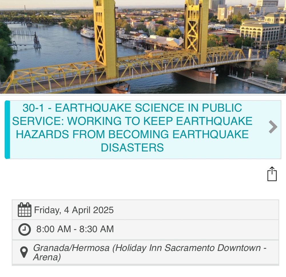
If you're at the GSA Cordilleran Section meeting in Sacramento tomorrow, stop by the "Earthquake Hazards in Applied Geology" session tomorrow morning and catch me and Wendy Bohon in action as we represent the California Geological Survey! 🧪 @drwendyrocks.bsky.social @cageosurvey.bsky.social
April 4, 2025 at 4:45 AM
If you're at the GSA Cordilleran Section meeting in Sacramento tomorrow, stop by the "Earthquake Hazards in Applied Geology" session tomorrow morning and catch me and Wendy Bohon in action as we represent the California Geological Survey! 🧪 @drwendyrocks.bsky.social @cageosurvey.bsky.social
Help me... I'm reviewing a technical document and need to know... is it "0.5 inch" or "0.5 inches"? 🧪
Can't find any style guides or clear rules.
Can't find any style guides or clear rules.
April 4, 2025 at 4:33 AM
Help me... I'm reviewing a technical document and need to know... is it "0.5 inch" or "0.5 inches"? 🧪
Can't find any style guides or clear rules.
Can't find any style guides or clear rules.
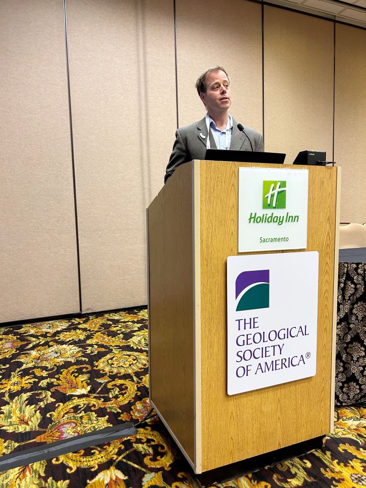
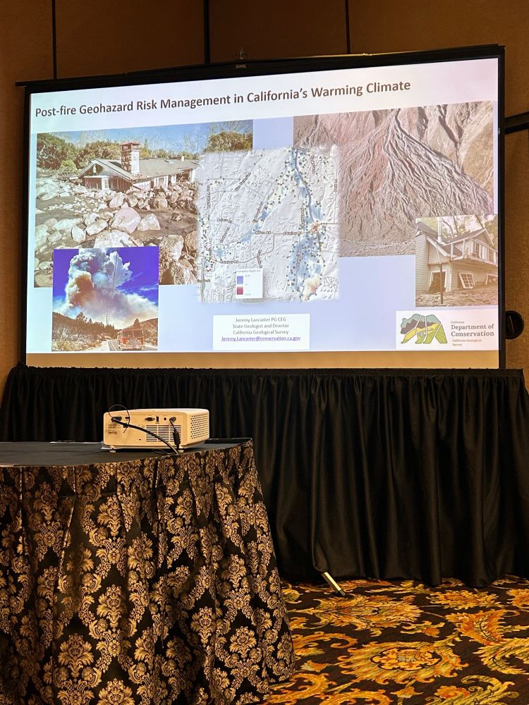
Jeremy Lancaster (California State Geologist) giving the lunchtime lecture at GSA on post-wildfire flooding & debris flow hazards. Highly developed alluvial fans are most prone. Studies find a minimum flow depth of 5 feet equaled total destruction of structures. @cageosurvey.bsky.social
April 2, 2025 at 6:35 PM
Jeremy Lancaster (California State Geologist) giving the lunchtime lecture at GSA on post-wildfire flooding & debris flow hazards. Highly developed alluvial fans are most prone. Studies find a minimum flow depth of 5 feet equaled total destruction of structures. @cageosurvey.bsky.social
Reposted by Brian Olson
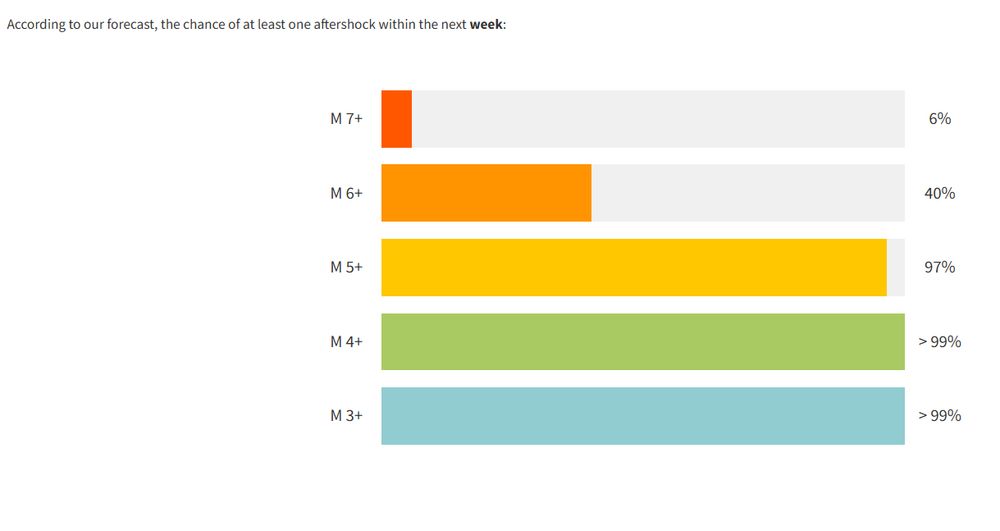
The USGS posted their aftershock forecast and they are saying there's a 40% chance of another M6+ earthquake in the next week. Certainly, there will be dozens to hundreds of smaller M4s and M5s. If you are in Bangkok, I doubt you'll feel quakes less than M6 though. Scary no matter what though.
March 29, 2025 at 12:05 AM
The USGS posted their aftershock forecast and they are saying there's a 40% chance of another M6+ earthquake in the next week. Certainly, there will be dozens to hundreds of smaller M4s and M5s. If you are in Bangkok, I doubt you'll feel quakes less than M6 though. Scary no matter what though.
That's one way to start your weekend! A M4.6 earthquake shook the Bombay Beach/Salton Sea area this morning, just before 10:30am local time. This part of California has been rumbling with small M1-2 quakes since March 1. This could be the main shock of that sequence. #earthquake 🧪

March 14, 2025 at 6:59 PM
That's one way to start your weekend! A M4.6 earthquake shook the Bombay Beach/Salton Sea area this morning, just before 10:30am local time. This part of California has been rumbling with small M1-2 quakes since March 1. This could be the main shock of that sequence. #earthquake 🧪
Reposted by Brian Olson

Would you like to learn about earthquakes and tsunamis in Northern California? 🧪⚒️
Register for an “Evening Discussion of Local Earthquake and Tsunami Hazards.” This hybrid event will be held on March 12 from 5:30-7 PM.
Visit now.humboldt.edu/news/lessons... for more information.
Register for an “Evening Discussion of Local Earthquake and Tsunami Hazards.” This hybrid event will be held on March 12 from 5:30-7 PM.
Visit now.humboldt.edu/news/lessons... for more information.

Lessons from December’s Earthquake and Tsunami Warning
On Dec. 5, 2024, a magnitude 7.0 earthquake struck off the coast of Humboldt County, shaking communities and triggering a tsunami warning along Northern and Central California’s coastline. Now local e...
now.humboldt.edu
March 4, 2025 at 7:37 PM
Would you like to learn about earthquakes and tsunamis in Northern California? 🧪⚒️
Register for an “Evening Discussion of Local Earthquake and Tsunami Hazards.” This hybrid event will be held on March 12 from 5:30-7 PM.
Visit now.humboldt.edu/news/lessons... for more information.
Register for an “Evening Discussion of Local Earthquake and Tsunami Hazards.” This hybrid event will be held on March 12 from 5:30-7 PM.
Visit now.humboldt.edu/news/lessons... for more information.
WE DON’T GAIN MORE SUNLIGHT WITH DAYLIGHT SAVING TIME! WE JUST SHIFT THE HOURS OF THE DAY WITH WHEN THE SUN IS UP!
March 9, 2025 at 7:13 AM
WE DON’T GAIN MORE SUNLIGHT WITH DAYLIGHT SAVING TIME! WE JUST SHIFT THE HOURS OF THE DAY WITH WHEN THE SUN IS UP!
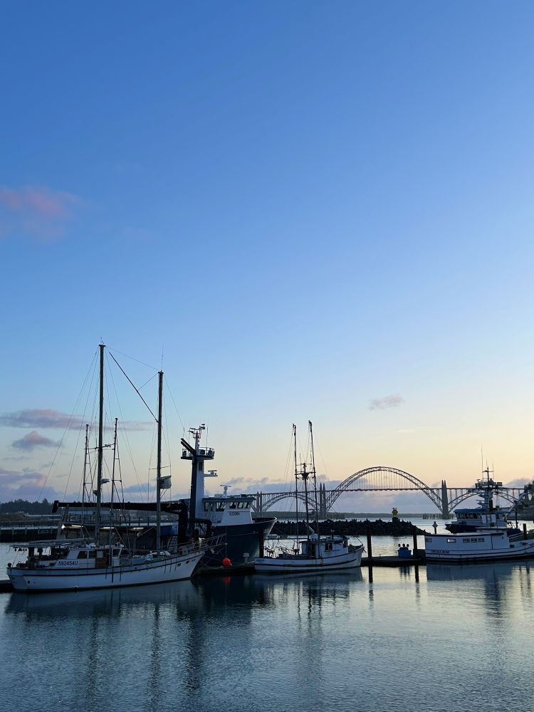
Excellent 1-day workshop in Newport, OR discussing ground failures from past Cascadia earthquakes and planning for future ones.


March 8, 2025 at 2:42 AM
Excellent 1-day workshop in Newport, OR discussing ground failures from past Cascadia earthquakes and planning for future ones.
Raising Cane!

March 5, 2025 at 4:01 AM
Raising Cane!
"[NOAA is] a colossal operation that has become one of the main drivers of the climate change alarm industry and, as such, is harmful to future U.S. prosperity." - Project 2025, Chapter 21
It's not about reducing bloat/waste... it's about eliminating an ideology...
It's not about reducing bloat/waste... it's about eliminating an ideology...

NOAA firings spark fears about long-term damage: The Trump administration has made drastic cuts to the National Oceanic and Atmospheric Administration (NOAA) that threaten to impact weather forecasting and other key services provided by the agency. In the wake of the wave of dismissals this week,…

NOAA firings spark fears about long-term damage
The Trump administration has made drastic cuts to the National Oceanic and Atmospheric Administration (NOAA) that threaten to impact weather forecasting and other key services provided by the agency. In the wake of the wave of dismissals this week,…
thehill.com
March 1, 2025 at 8:11 PM
"[NOAA is] a colossal operation that has become one of the main drivers of the climate change alarm industry and, as such, is harmful to future U.S. prosperity." - Project 2025, Chapter 21
It's not about reducing bloat/waste... it's about eliminating an ideology...
It's not about reducing bloat/waste... it's about eliminating an ideology...