Simon Brewer
banner
stormgasm.bsky.social
Simon Brewer
@stormgasm.bsky.social

Meteorologist, Storm Chaser, Journalist & Photographer: Hurricanes, Tornadoes, & Winter Storms
www.stormgasm.com

Environmental science 47%
Geology 23%

Reposted by Simon Brewer

Crazy scenes on I-90 and US-2 due to mudslides - both highways are CLOSED with no estimated reopenings at this time #wawx

Reposted by Simon Brewer

Mid-afternoon update at Snoqualmie Falls. Water levels are currently at 19.4 feet, nearly a foot and a half higher than yesterday!

Tomorrow morning it will make a run at the all-time record water level #wawx

Reposted by Simon Brewer

Reposted by Simon Brewer

On Wednesday, widespread heavy rain & very high snow levels (7,000-9,000 feet) will cause enormous runoff into already swollen rivers. Widespread moderate to major flood is likely, with some rivers expected to experience *record* flooding (esp. Skagit & Snohomish). #WAwx [2/3]

Reposted by Simon Brewer

Widespread significant river flooding has already developed across western Washington as a series of extremely warm & moist #AtmosphericRivers move slowly across the region. This flooding will further worsen tomorrow as strongest part of AR moves ashore. #WAwx [1/3]

Reposted by Simon Brewer

December 2, 2018:

An intense tornado struck the Naval Submarine Base Kings Bay in Georgia. The large EF3 threw vehicles and trailers, downed power poles, and blew over many trees on a nearby island. A boat anemometer measured a 144 mph gust. Four people were injured.

#weatherpicofday
OTD 7 years ago, December 1, 2018, I chased a small outbreak of #Twisters over Central Illinois. Captured a few cool photos as this cyclic supercell produced half a dozen twisters between Naples and Havana, IL on the 1st day of Meteorological Winter.
#ILwx

Ohio, Indiana, and Northern Kentucky might get 2 to 4 inches of snow tonight into tomorrow morning. Of course, some locations might get more of less accumulation depending on how the bands setup with only 1 inch or as much as 6 inches in spots.
December 1, 2025 #ohwx

Thankful for Thanksgiving leftovers!!!
Love turkey!
#Ohio #OHwx

#MegawedgeMonday
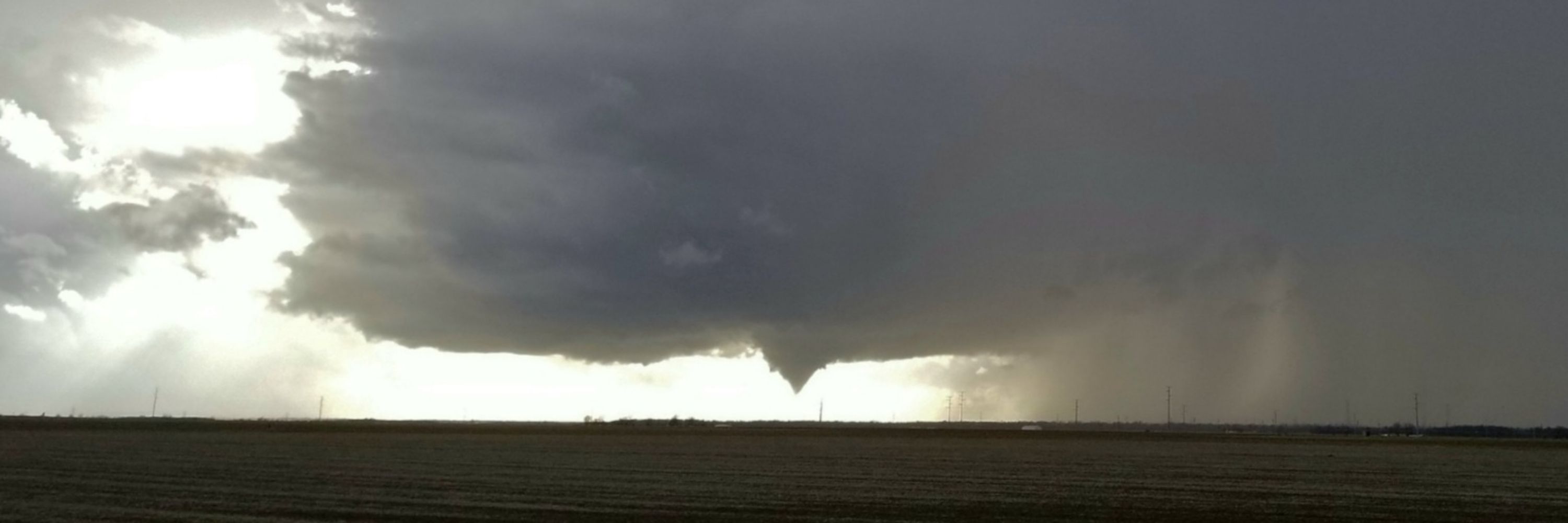
May 31, 2013 El Reno, Oklahoma

Megawedge (noun) - defined as a visually wedge-shaped tornado with respect to the observer from a wall cloud or updraft base to Earth's surface with a diameter equal to or greater than 1.5 miles in diameter.
#okwx

What a year 2025 has been so far!
Still 5+ weeks to go...
with @JustonStrmRider

Radar vs. View:
Intense convective snowband training off Lake Erie over Buffalo, NY creates what looks to be a WALL OF SNOW!
OTD 3 years ago, @ 3:36 AM EST 17 November 2022 from NW side of Buffalo looking south.
@NWSBUFFALO #NYwx

OTD 11 years ago on November 17-19 2014, and again 3 years ago on November 17-19 2022, I documented epic lake effect snow events over the Buffalo and Southtowns area.
#NYwx #LakeEffect #snow #thundersnow

Reposted by Simon Brewer

Cool study came out earlier this yr looking at the dynamical origins of the extreme 2023 Heatwave in the Desert SW

They concluded that the warm Tropical Atlantic was the primary culprit

The partial regression analysis (left) & AGCM forcing (right) are pretty telling
www.nature.com/articles/s41...

Reposted by Simon Brewer

November 17th, 1999:

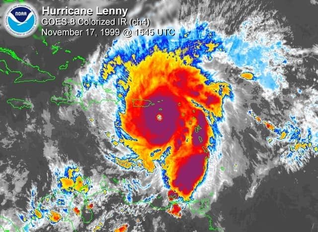
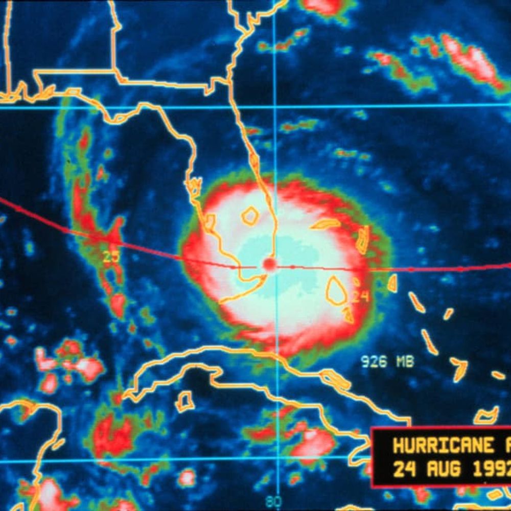
Hurricane Lenny became the first hurricane ever to strike the islands of the Lesser Antilles from the west. The menacing Category 4 storm was dubbed "backward or left-handed Lenny" because of its unusual motion.

Colors of November 2025

Aurora Borealis shining over... Dayton, Ohio tonight!!!
Beautiful colors!
What a powerful solar storm!
#ohwx

NEW VIDEO from a HUMAN!!!
Indiana Lake Effect Snow:
First decent lake effect snow event of the season over Northwest Indiana
#inwx
youtu.be/gUX5HbQpIvE?...

First snowflakes of the season mixing with some rain over the Eastside of Dayton, Ohio at 4:00 pm EST on November 9, 2025. #ohwx #snow

Just a reminder the National Debt crisis and resulting government shutdown was created by the unnecessary massive tax cuts for the Top 0.1%

Trickle Down Economics doesn't work

November might be the most interesting month for extreme weather in the USA. Potential for tornadoes, hurricanes, Nor'easters, and intense lake effect snow.
#November

Happy Halloween 2025!!!

Reposted by Simon Brewer

JD Vance is lying. He knows he’s lying. But he doesn’t care. Trump has taught Vance & all the others in my former political party that the truth doesn’t matter.

Certain the US Government could've sold every brick and window of the White House East Wing as historical momentos and cherished keepsakes to and for the US Citizens/Tax Payers, instead of just obliterating and trashing a historical structure... but what do I know! SMH
#stupid

Reposted by Simon Brewer

October 29-30th, 2011:
A nor'easter swept up the Appalachians into New England. Over a foot of snow fell from West Virginia to Maine, with more than two feet in Massachusetts and New Hampshire mountains. Winds over 50 mph were reported on Nantucket Island and Martha's Vineyard.

Something like this hasn't happened since 1935: a high-end, sub-900mb CAT 5 Tropical Cyclone made landfall at/near peak intensity in the Atlantic Basin. The October 28, 2025 Hurricane Melissa Jamaica landfall event is a rare meteorological moment in history.

Appears CAT 5 Hurricane Melissa made landfall near New Hope, Jamaica with an incredibly low estimated minimum central pressure of 892 mb and devastating maximum sustained winds of 185 mph with higher gusts possibly exceeding 200 mph. Also, tornado or tornado-like whirls possible!

Have to wonder if the Jamaican high terrain and/or trochoidal wobbles will have a significant impact on the potential landfall location of CAT 5 Hurricane Melissa. Localized enhanced steering currents can develop between the core of tropical cyclones and high terrain islands...

Incredible outflow channel ventilation for CAT 5 Hurricane Melissa over the Caribbean.
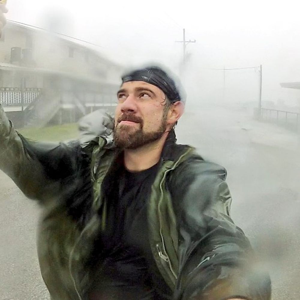
The most intense tropical cyclones typically have massive outflow channels like these.
October 27, 2025 #Jamaica

Reposted by Simon Brewer

Even with all of the structural, intensity, and SST/OHC changes underneath Hurricane #Melissa the last few days, the diurnal cycle still remains undefeated and inevitable