David Roth
@drmetwatch.bsky.social
2.3K followers 1.5K following 970 posts
Meteorologist. Into weather records. Soft spot for subtropical 🌀. 😻 and nature imagery, too.
Posts Media Videos Starter Packs
Pinned
drmetwatch.bsky.social
A convective, and per TAFB/NHC non-frontal, 1010 hPa low has formed over South FL. Per OPC, gale force winds already exist to its northeast.

The cyclone should move north along the coast on succeeding days. 🐻⌚️
drmetwatch.bsky.social
Since we’re sharing favorite published descriptions…this headline is more recent than 1904, sadly. ;)
Reposted by David Roth
msemilyedwards.bsky.social
i feel like i need to share this oldie but a goodie today
A tumblr post that reads "WHo would have believed that the perfect wikipedia photo caption could have been improved upon?" Two identical images are then side by side. The first caption is "Piper Kerr, a member of the Scottis National Antarctix Expedition, plays the bagpipes for an indifferent penguin, March 1904". The Caption for the image on the left reads, "Piper Kerr (right), a member of the Scottis National Antarctix Expedition, plays the bagpipes for an indifferent penguin, March 1904"
Reposted by David Roth
edwardsanthonyb.bsky.social
Not something you see every day in October. Cloud streets off the West Coast. Cold air (below 10th percentile for this time of year) spilling down from Canada is moving over warmer-than-normal Pacific water is a recipe for these "cloud streets." #ORwx #WAwx #CAwx
More: earthsky.org/earth/what-a...
Reposted by David Roth
cira-csu.bsky.social
A powerful nor'easter has been slamming into the East Coast since this weekend, bringing about heavy rainfall, gusty winds, and coastal flooding all along the eastern seaboard.
drmetwatch.bsky.social
Our dual-centered nor’easter. Gale-force winds continue near both centers.
drmetwatch.bsky.social
A closer look at Post-T.C. Jerry
drmetwatch.bsky.social
The 20th century reanalysis is tuned to HURDAT. At least there was some moisture surge into the Southwest. Most TCs lose their surface cyclone quickly as they enter the Southwest.
Reposted by David Roth
franklinjamesl.bsky.social
With about 80% of the precincts reporting I've seen enough. GDMI - Google DeepMind is going to win the seat for best track model in 2025. The race for best intensity model is still too close to call, but GDMI is right there with the consensus and OFCL. Quite a remarkable campaign.
drmetwatch.bsky.social
Once Harrison Tran backfilled TC rainfall graphics for older storms four years ago, including from the northeast Pacific, the tracks became necessary for CLIQR purposes. I’m hoping to update the database for newer seasons soon.
drmetwatch.bsky.social
Try the CLIQR database. NHC is aware that I placed older tracks in there, back to 1899. I helped one of their summer students find these a decade or so ago.

www.wpc.ncep.noaa.gov/research/rot...
www.wpc.ncep.noaa.gov
drmetwatch.bsky.social
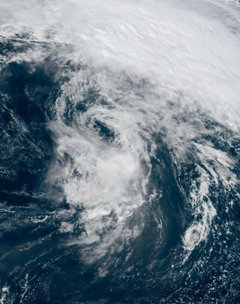
Post-T.C. Jerry and T.S. Lorenzo.

Lorenzo may become a threat to the Azores. 🐻⌚️
drmetwatch.bsky.social
aviationweather.gov does as well, so I’d seen that version of a station model before. :)
National Weather Service
weather.gov
drmetwatch.bsky.social
If it helps, Kotzebue got exceedingly close to its October low pressure record recently, which is 967.8 hPa, set October 3, 1960. Its all-time record is only a few hPa lower.
drmetwatch.bsky.social
There remains “low hanging fruit” in the October low pressure records across eastern NC, mentioned in prior years. 988 would be all you’d need to HSE/Hatteras; their period of record is ~150 years. 🐻⌚️
drmetwatch.bsky.social
The storm-force nor’easter is offshore Cape Fear NC. 992 hPa central pressure at 8 am Oct 12. Up here, periods and light rain/drizzle and breezy. 60f.
drmetwatch.bsky.social
Down to 1004 hPa at 8 am EDT Oct 11. Analyzed as a convective frontal wave. 40 kt winds reported a bit to its north but they could be higher considering the increased pressure gradient.
drmetwatch.bsky.social
There’s a 1007 hPa center in the FL Straits & a more broad 1008 hPa low northwest of Grand Bahama Island. A 40 kt wind report lies a bit offshore northeast FL.
Reposted by David Roth
damianshields.bsky.social
Autumn light over Loch Clair #Scotland #WesterRoss #Kinlochewe #Highlands www.damianshields.com
Reposted by David Roth
esa.int
🌎 Let's take a look back at when Cyclone Errol was heading towards the coast of Western Australia on 16 April.

In this @copernicusecmwf.bsky.social Sentinel-3 image, the typical pinhole eye – a small, well-defined eye often associated tropical cyclones – is clearly visible.
drmetwatch.bsky.social
A convective, and per TAFB/NHC non-frontal, 1010 hPa low has formed over South FL. Per OPC, gale force winds already exist to its northeast.

The cyclone should move north along the coast on succeeding days. 🐻⌚️
drmetwatch.bsky.social
Stories, or stores? ;)
drmetwatch.bsky.social
Clockwise from the top: Priscilla with fresh convection, Raymond near the Mexican coast, and Post-T.C. Octave, moving generally in Raymond’s direction.