


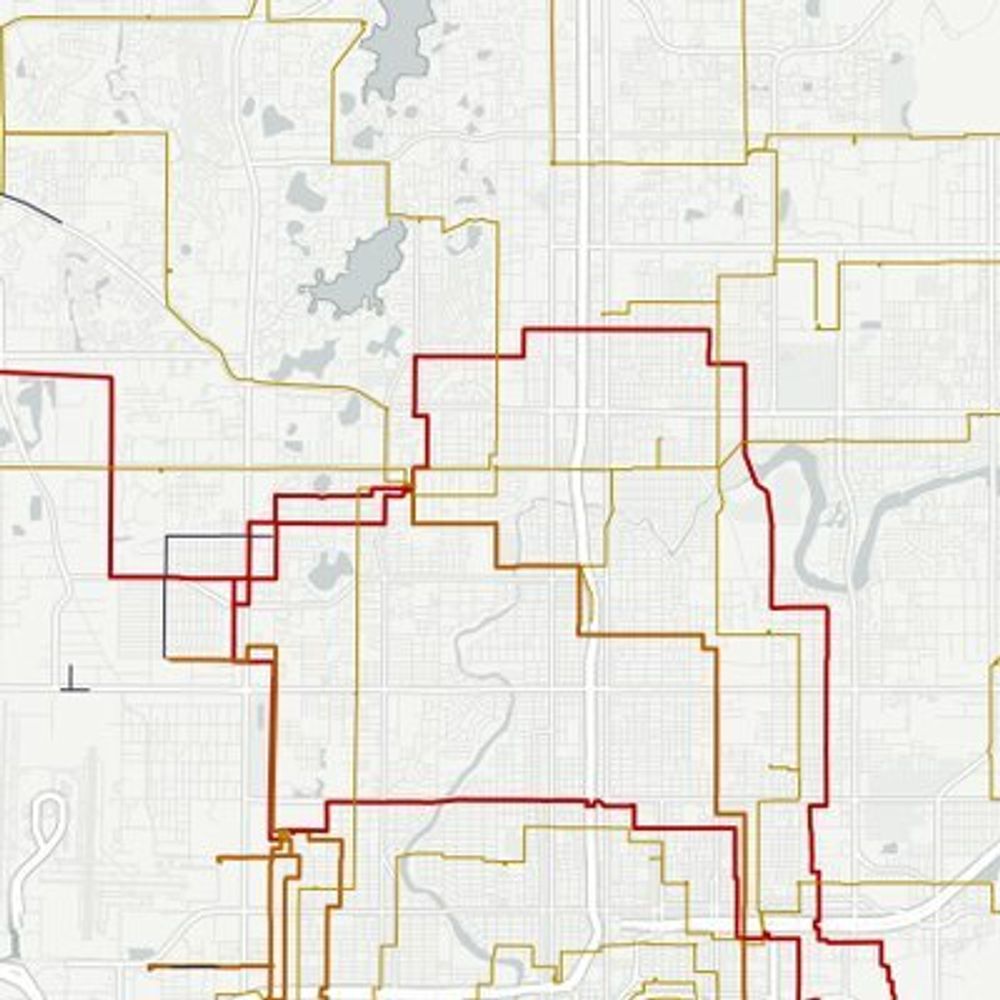
#30DayMapChallenge Day 14: OpenStreetMap
Choose from dozens of basemaps in #rstats mapgl based on OpenStreetMap. Use:
- `mapbox_style()` for @Mapbox styles;
- `maptiler_style()` for @MapTiler;
- `carto_style()` for @CARTO styles;
- `openfreemap_style()` for @OpenFreeMapOrg
Choose from dozens of basemaps in #rstats mapgl based on OpenStreetMap. Use:
- `mapbox_style()` for @Mapbox styles;
- `maptiler_style()` for @MapTiler;
- `carto_style()` for @CARTO styles;
- `openfreemap_style()` for @OpenFreeMapOrg


November 14, 2025 at 3:31 PM
#30DayMapChallenge Day 14: OpenStreetMap
Choose from dozens of basemaps in #rstats mapgl based on OpenStreetMap. Use:
- `mapbox_style()` for @Mapbox styles;
- `maptiler_style()` for @MapTiler;
- `carto_style()` for @CARTO styles;
- `openfreemap_style()` for @OpenFreeMapOrg
Choose from dozens of basemaps in #rstats mapgl based on OpenStreetMap. Use:
- `mapbox_style()` for @Mapbox styles;
- `maptiler_style()` for @MapTiler;
- `carto_style()` for @CARTO styles;
- `openfreemap_style()` for @OpenFreeMapOrg

🗺️ Climate Engine is looking sharper than ever with new basemaps!
You can now add high-res aerial imagery and topographic layers beneath your computed maps to explore fine-scale landscape detail.
Check out the demo and try it at app.climateengine.org
🌎
#EarthEngine #RemoteSensing #Geospatial
You can now add high-res aerial imagery and topographic layers beneath your computed maps to explore fine-scale landscape detail.
Check out the demo and try it at app.climateengine.org
🌎
#EarthEngine #RemoteSensing #Geospatial
November 7, 2025 at 5:39 PM
🗺️ Climate Engine is looking sharper than ever with new basemaps!
You can now add high-res aerial imagery and topographic layers beneath your computed maps to explore fine-scale landscape detail.
Check out the demo and try it at app.climateengine.org
🌎
#EarthEngine #RemoteSensing #Geospatial
You can now add high-res aerial imagery and topographic layers beneath your computed maps to explore fine-scale landscape detail.
Check out the demo and try it at app.climateengine.org
🌎
#EarthEngine #RemoteSensing #Geospatial

Was the Maghreb an ‘empty land’ before the Phoenicians arrived?
Often seen as marginal in relation to the civilisations of the Bronze Age Mediterranean, the identification of distinctive cultural practices and extensive connections in north-west Africa disproves this idea.
🆓 doi.org/10.15184/aqy...
Often seen as marginal in relation to the civilisations of the Bronze Age Mediterranean, the identification of distinctive cultural practices and extensive connections in north-west Africa disproves this idea.
🆓 doi.org/10.15184/aqy...

October 7, 2025 at 4:15 PM
Was the Maghreb an ‘empty land’ before the Phoenicians arrived?
Often seen as marginal in relation to the civilisations of the Bronze Age Mediterranean, the identification of distinctive cultural practices and extensive connections in north-west Africa disproves this idea.
🆓 doi.org/10.15184/aqy...
Often seen as marginal in relation to the civilisations of the Bronze Age Mediterranean, the identification of distinctive cultural practices and extensive connections in north-west Africa disproves this idea.
🆓 doi.org/10.15184/aqy...

Esri and Space42 Join to Launch "Map Africa Initiative"
Collaboration Seeks to Deliver High-Resolution Basemaps to Support Economic Growth and Innovation Across the African Continent
www.esri.com/about/newsro...
Collaboration Seeks to Deliver High-Resolution Basemaps to Support Economic Growth and Innovation Across the African Continent
www.esri.com/about/newsro...

September 15, 2025 at 4:35 PM
Esri and Space42 Join to Launch "Map Africa Initiative"
Collaboration Seeks to Deliver High-Resolution Basemaps to Support Economic Growth and Innovation Across the African Continent
www.esri.com/about/newsro...
Collaboration Seeks to Deliver High-Resolution Basemaps to Support Economic Growth and Innovation Across the African Continent
www.esri.com/about/newsro...
Last week @mappingmashups.bsky.social gave a talk about how we recently modernized our basemaps, except for one. Updating Watercolor to a new pipeline would be challenging... but Steve Gifford from Wet Dog Weather wrote some thoughts about how it might be done:
www.wetdogweather.com/2024/06/12/h...
www.wetdogweather.com/2024/06/12/h...

June 13, 2024 at 6:25 PM
Last week @mappingmashups.bsky.social gave a talk about how we recently modernized our basemaps, except for one. Updating Watercolor to a new pipeline would be challenging... but Steve Gifford from Wet Dog Weather wrote some thoughts about how it might be done:
www.wetdogweather.com/2024/06/12/h...
www.wetdogweather.com/2024/06/12/h...

I presume if they were just standard basemaps then you'd be using off-the-shelf tiles, so are they something aviation-specific? Or do they need to be stored on the device itself (so it can operate with no internet connection)?
June 14, 2025 at 4:13 PM
I presume if they were just standard basemaps then you'd be using off-the-shelf tiles, so are they something aviation-specific? Or do they need to be stored on the device itself (so it can operate with no internet connection)?
Changes to ArcGIS Desktop basemaps in ArcGIS Desktop 10 <a href="http://bit.ly/rLVGbB" class="hover:underline text-blue-600 dark:text-sky-400 no-card-link" target="_blank" rel="noopener" data-link="bsky">http://bit.ly/rLVGbB #gis #esri
Esri Newsroom | Publications, Press Coverage & Videos
Explore thought-provoking stories and articles about loca...
bit.ly
November 11, 2024 at 12:37 AM
Changes to ArcGIS Desktop basemaps in ArcGIS Desktop 10 <a href="http://bit.ly/rLVGbB" class="hover:underline text-blue-600 dark:text-sky-400 no-card-link" target="_blank" rel="noopener" data-link="bsky">http://bit.ly/rLVGbB #gis #esri

Are you using vector tile basemaps or raster?
February 19, 2025 at 11:07 PM
Are you using vector tile basemaps or raster?
The base map on https://openinframap.org has been updated and is now using the Protomaps basemap schema:
https://docs.protomaps.com/basemaps/downloads
The style has also been extensively tweaked, and it looks a bit more colourful at lower zooms - thoughts/feedback welcome!
https://docs.protomaps.com/basemaps/downloads
The style has also been extensively tweaked, and it looks a bit more colourful at lower zooms - thoughts/feedback welcome!
Open Infrastructure Map
Open map of the world's electricity, telecoms, oil, and gas infrastructure, using data from OpenStreetMap.
openinframap.org
March 23, 2025 at 6:16 PM
The base map on https://openinframap.org has been updated and is now using the Protomaps basemap schema:
https://docs.protomaps.com/basemaps/downloads
The style has also been extensively tweaked, and it looks a bit more colourful at lower zooms - thoughts/feedback welcome!
https://docs.protomaps.com/basemaps/downloads
The style has also been extensively tweaked, and it looks a bit more colourful at lower zooms - thoughts/feedback welcome!

One trick ive used for a while is taking Natural Earth colored land cover layers and colorizing them in QGIS to make interesting basemaps (with some hillshading ofc)

September 25, 2023 at 5:31 PM
One trick ive used for a while is taking Natural Earth colored land cover layers and colorizing them in QGIS to make interesting basemaps (with some hillshading ofc)

🎅 #12DaysOfMapComponents Day 6 🎅
How to use #ArcGIS API Keys for basemaps and subscriber content in #map components!
#geodev #webdev #esridev
www.youtube.com/shorts/vepEY...
How to use #ArcGIS API Keys for basemaps and subscriber content in #map components!
#geodev #webdev #esridev
www.youtube.com/shorts/vepEY...

12 Days of Map Components Day 6 #arcgis #esri #webdevelopment
YouTube video by Rene Rubalcava
www.youtube.com
December 19, 2024 at 1:53 PM
🎅 #12DaysOfMapComponents Day 6 🎅
How to use #ArcGIS API Keys for basemaps and subscriber content in #map components!
#geodev #webdev #esridev
www.youtube.com/shorts/vepEY...
How to use #ArcGIS API Keys for basemaps and subscriber content in #map components!
#geodev #webdev #esridev
www.youtube.com/shorts/vepEY...

Tinting basemaps to match your #ArcGIS dashboard theme

Tinting basemaps to match your dashboard theme
Learn how to tint basemaps to align with your dashboard theme
www.esri.com
March 19, 2025 at 3:03 PM
Tinting basemaps to match your #ArcGIS dashboard theme

ArcGIS Blog - A ‘Large Label’ Version of the Human Geography Basemaps by Andy Skinner
https://www.esri.com/arcgis-blog/products/arcgis-living-atlas/mapping/a-large-label-version-of-the-human-geography-basemaps
https://www.esri.com/arcgis-blog/products/arcgis-living-atlas/mapping/a-large-label-version-of-the-human-geography-basemaps
September 4, 2025 at 3:15 PM
ArcGIS Blog - A ‘Large Label’ Version of the Human Geography Basemaps by Andy Skinner
https://www.esri.com/arcgis-blog/products/arcgis-living-atlas/mapping/a-large-label-version-of-the-human-geography-basemaps
https://www.esri.com/arcgis-blog/products/arcgis-living-atlas/mapping/a-large-label-version-of-the-human-geography-basemaps

Right, but if you're using QGIS you can use a ton of different WMS basemaps. Shout-out to Klaus Karlsson. youtu.be/Mm-4skBhjdk?...

How to add web-based xyz layers to QGIS 3 using a python script
YouTube video by Thiago Sanna Freire Silva
youtu.be
February 19, 2025 at 7:46 PM
Right, but if you're using QGIS you can use a ton of different WMS basemaps. Shout-out to Klaus Karlsson. youtu.be/Mm-4skBhjdk?...

I have three presentations today at the 2025 Esri Developer and Technology Summit. First up, 'Essential Tools for ArcGIS Location Platform Developers' at 11:15am.
I would love to see you at one of them and chat about all things Location Platform, basemaps, and routing! 🗺️ 👩💻
#EsriDevTech25 #GIS
I would love to see you at one of them and chat about all things Location Platform, basemaps, and routing! 🗺️ 👩💻
#EsriDevTech25 #GIS


March 13, 2025 at 4:37 PM
I have three presentations today at the 2025 Esri Developer and Technology Summit. First up, 'Essential Tools for ArcGIS Location Platform Developers' at 11:15am.
I would love to see you at one of them and chat about all things Location Platform, basemaps, and routing! 🗺️ 👩💻
#EsriDevTech25 #GIS
I would love to see you at one of them and chat about all things Location Platform, basemaps, and routing! 🗺️ 👩💻
#EsriDevTech25 #GIS

🌍 Meta’s basemaps are now powered by Overture!
Meta has transitioned its global basemaps to #OvertureMaps’ open data, improving accuracy, validation, and industry collaboration.
Read the case study: overturemaps.org/case-study/2...
Meta has transitioned its global basemaps to #OvertureMaps’ open data, improving accuracy, validation, and industry collaboration.
Read the case study: overturemaps.org/case-study/2...

March 25, 2025 at 4:07 PM
🌍 Meta’s basemaps are now powered by Overture!
Meta has transitioned its global basemaps to #OvertureMaps’ open data, improving accuracy, validation, and industry collaboration.
Read the case study: overturemaps.org/case-study/2...
Meta has transitioned its global basemaps to #OvertureMaps’ open data, improving accuracy, validation, and industry collaboration.
Read the case study: overturemaps.org/case-study/2...

Basemapkit: web basemaps for the people
by @jonathanlurie.bsky.social
jonathanlurie.substack.com/p/basemapkit...
by @jonathanlurie.bsky.social
jonathanlurie.substack.com/p/basemapkit...

Basemapkit: web basemaps for the people
Painting maps from the shoulders of giants
jonathanlurie.substack.com
July 22, 2025 at 8:45 PM
Basemapkit: web basemaps for the people
by @jonathanlurie.bsky.social
jonathanlurie.substack.com/p/basemapkit...
by @jonathanlurie.bsky.social
jonathanlurie.substack.com/p/basemapkit...

Based on LIDAR data and @planetlabs.bsky.social basemaps, scientists discovered a tree with a crown diameter of more than 60 meters. They think it might be the biggest tree in the Amazon ctrees.org/news/largest...

December 10, 2024 at 8:34 AM
Based on LIDAR data and @planetlabs.bsky.social basemaps, scientists discovered a tree with a crown diameter of more than 60 meters. They think it might be the biggest tree in the Amazon ctrees.org/news/largest...

🚫No more switching apps for better maps!
🗺️WeatherFront delivers hi-res basemaps & street data—free.
⛈️Navigate storms with confidence
📍 Match radar to local roads
⚠️ Know exactly which outlook category you’re in
Upgrade your spatial awareness & download WF today!
🗺️WeatherFront delivers hi-res basemaps & street data—free.
⛈️Navigate storms with confidence
📍 Match radar to local roads
⚠️ Know exactly which outlook category you’re in
Upgrade your spatial awareness & download WF today!

July 14, 2025 at 3:34 AM
🚫No more switching apps for better maps!
🗺️WeatherFront delivers hi-res basemaps & street data—free.
⛈️Navigate storms with confidence
📍 Match radar to local roads
⚠️ Know exactly which outlook category you’re in
Upgrade your spatial awareness & download WF today!
🗺️WeatherFront delivers hi-res basemaps & street data—free.
⛈️Navigate storms with confidence
📍 Match radar to local roads
⚠️ Know exactly which outlook category you’re in
Upgrade your spatial awareness & download WF today!

🇺🇸 U.S. elections are just around the corner! Datawrapper has a full slate of new and updated basemaps to help you cover the polling and results:
🗳️ Electoral college (hexagon + standard)
🗳️ Congressional districts (hexagon + standard)
🗳️ State legislatures and state-level congressional maps
🗳️ Electoral college (hexagon + standard)
🗳️ Congressional districts (hexagon + standard)
🗳️ State legislatures and state-level congressional maps

October 31, 2024 at 3:07 PM
🇺🇸 U.S. elections are just around the corner! Datawrapper has a full slate of new and updated basemaps to help you cover the polling and results:
🗳️ Electoral college (hexagon + standard)
🗳️ Congressional districts (hexagon + standard)
🗳️ State legislatures and state-level congressional maps
🗳️ Electoral college (hexagon + standard)
🗳️ Congressional districts (hexagon + standard)
🗳️ State legislatures and state-level congressional maps

Planet Labs Basemaps 😀 - www.planet.com/products/bas.... The perks of working for a satellite imagery company don't compare to entertainment or sports, unless images of earth are your favorite thing. Unfortunately our basemaps are not cheap or that easy to buy, but they are an incredible product.

Planet Basemaps: Comprehensive, High-Frequency Mosaics for Analysis | Planet
Power your products and analytics with recent and visually precise Basemaps. With daily, global imaging, Planet creates current, complete, and analysis-ready Basemaps, customizable by area and time of...
www.planet.com
December 4, 2024 at 5:32 AM
Planet Labs Basemaps 😀 - www.planet.com/products/bas.... The perks of working for a satellite imagery company don't compare to entertainment or sports, unless images of earth are your favorite thing. Unfortunately our basemaps are not cheap or that easy to buy, but they are an incredible product.

Last month’s workshop series on modern web mapping with #rstats went great!
We covered 3D basemaps, custom map design, fast filtering in Shiny, story maps, and more.
The workshop recordings and tutorials are available - with a discount for all of you!
walkerdata.gumroad.c...
We covered 3D basemaps, custom map design, fast filtering in Shiny, story maps, and more.
The workshop recordings and tutorials are available - with a discount for all of you!
walkerdata.gumroad.c...


August 19, 2025 at 7:08 PM
Last month’s workshop series on modern web mapping with #rstats went great!
We covered 3D basemaps, custom map design, fast filtering in Shiny, story maps, and more.
The workshop recordings and tutorials are available - with a discount for all of you!
walkerdata.gumroad.c...
We covered 3D basemaps, custom map design, fast filtering in Shiny, story maps, and more.
The workshop recordings and tutorials are available - with a discount for all of you!
walkerdata.gumroad.c...