


Timothée Giraud
@rcarto.fosstodon.org.ap.brid.gy
I work at CNRS. I post about reproducible research and all things spatial.
Author of {mapsf}, {osrm} and other :rstats: spatial packages. Co-author of the […]
[bridged from https://fosstodon.org/@rcarto on the fediverse by https://fed.brid.gy/ ]
Author of {mapsf}, {osrm} and other :rstats: spatial packages. Co-author of the […]
[bridged from https://fosstodon.org/@rcarto on the fediverse by https://fed.brid.gy/ ]
Reposted by Timothée Giraud
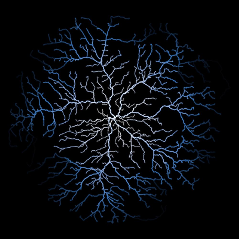
Day 03 of #30DayMapChallenge with a density choropleth and quantiles!
👏 Thanks to @Benjamin Novak's tutorial in @yan-holtz.bsky.social gallery r-graph-gallery.com/web-map-chor...
🌚 Used data from the Observatoire Statistique Tranfrontalier
#rstats #dataviz #map #ggplot2 #gis
👏 Thanks to @Benjamin Novak's tutorial in @yan-holtz.bsky.social gallery r-graph-gallery.com/web-map-chor...
🌚 Used data from the Observatoire Statistique Tranfrontalier
#rstats #dataviz #map #ggplot2 #gis

November 5, 2025 at 3:14 PM
Day 03 of #30DayMapChallenge with a density choropleth and quantiles!
👏 Thanks to @Benjamin Novak's tutorial in @yan-holtz.bsky.social gallery r-graph-gallery.com/web-map-chor...
🌚 Used data from the Observatoire Statistique Tranfrontalier
#rstats #dataviz #map #ggplot2 #gis
👏 Thanks to @Benjamin Novak's tutorial in @yan-holtz.bsky.social gallery r-graph-gallery.com/web-map-chor...
🌚 Used data from the Observatoire Statistique Tranfrontalier
#rstats #dataviz #map #ggplot2 #gis
Reposted by Timothée Giraud

📣 Save the date!!
Next Community Call: R-multiverse: a new way to publish R packages with @landau
📆 Monday, 29 September 2025 14:00 UTC
Information + find your local time + How to join: https://ropensci.org/commcalls/r-multiverse/
🙏 Please share this event with anyone who may be interested in […]
Next Community Call: R-multiverse: a new way to publish R packages with @landau
📆 Monday, 29 September 2025 14:00 UTC
Information + find your local time + How to join: https://ropensci.org/commcalls/r-multiverse/
🙏 Please share this event with anyone who may be interested in […]
Original post on hachyderm.io
hachyderm.io
September 1, 2025 at 3:32 PM
📣 Save the date!!
Next Community Call: R-multiverse: a new way to publish R packages with @landau
📆 Monday, 29 September 2025 14:00 UTC
Information + find your local time + How to join: https://ropensci.org/commcalls/r-multiverse/
🙏 Please share this event with anyone who may be interested in […]
Next Community Call: R-multiverse: a new way to publish R packages with @landau
📆 Monday, 29 September 2025 14:00 UTC
Information + find your local time + How to join: https://ropensci.org/commcalls/r-multiverse/
🙏 Please share this event with anyone who may be interested in […]
The first major version of {mapsf} has arrived on CRAN!
mapsf is a thematic mapping R package. Its goal is to be simple and lightweight while offering all the necessary features to create beautiful statistical maps.
This release includes a revamped theming […]
[Original post on fosstodon.org]
mapsf is a thematic mapping R package. Its goal is to be simple and lightweight while offering all the necessary features to create beautiful statistical maps.
This release includes a revamped theming […]
[Original post on fosstodon.org]


July 4, 2025 at 9:28 AM
The first major version of {mapsf} has arrived on CRAN!
mapsf is a thematic mapping R package. Its goal is to be simple and lightweight while offering all the necessary features to create beautiful statistical maps.
This release includes a revamped theming […]
[Original post on fosstodon.org]
mapsf is a thematic mapping R package. Its goal is to be simple and lightweight while offering all the necessary features to create beautiful statistical maps.
This release includes a revamped theming […]
[Original post on fosstodon.org]
New package on CRAN: {valh}, an interface between R and the Valhalla API
Valhalla is a routing service based on OpenStreetMap data.
https://valhalla.github.io/valhalla
Co-authored by @mthv
#gischat #rspatial #rstats #openstreetmap
Valhalla is a routing service based on OpenStreetMap data.
https://valhalla.github.io/valhalla
Co-authored by @mthv
#gischat #rspatial #rstats #openstreetmap

April 14, 2025 at 1:09 PM
New package on CRAN: {valh}, an interface between R and the Valhalla API
Valhalla is a routing service based on OpenStreetMap data.
https://valhalla.github.io/valhalla
Co-authored by @mthv
#gischat #rspatial #rstats #openstreetmap
Valhalla is a routing service based on OpenStreetMap data.
https://valhalla.github.io/valhalla
Co-authored by @mthv
#gischat #rspatial #rstats #openstreetmap
Introducing {maposm}, an R package that extracts, modifies and merges sets of layers from OpenStreetMap for cartographic purposes.
On github: https://github.com/riatelab/maposm
The package is not on CRAN, but it is on r-universe: https://riatelab.r-universe.dev/maposm
#rstats #rspatial #gischat
On github: https://github.com/riatelab/maposm
The package is not on CRAN, but it is on r-universe: https://riatelab.r-universe.dev/maposm
#rstats #rspatial #gischat


March 20, 2025 at 4:40 PM
Introducing {maposm}, an R package that extracts, modifies and merges sets of layers from OpenStreetMap for cartographic purposes.
On github: https://github.com/riatelab/maposm
The package is not on CRAN, but it is on r-universe: https://riatelab.r-universe.dev/maposm
#rstats #rspatial #gischat
On github: https://github.com/riatelab/maposm
The package is not on CRAN, but it is on r-universe: https://riatelab.r-universe.dev/maposm
#rstats #rspatial #gischat
A new version of {maptiles} has been released on CRAN. :rstats: 📦
You can now access the high-resolution (or retina) tiles distributed by some providers.
{maptiles} is a package for downloading and composing raster tiles with R.
https://github.com/riatelab/maptiles
#gischat #rstats #rspatial
You can now access the high-resolution (or retina) tiles distributed by some providers.
{maptiles} is a package for downloading and composing raster tiles with R.
https://github.com/riatelab/maptiles
#gischat #rstats #rspatial


February 7, 2025 at 9:56 AM
A new version of {maptiles} has been released on CRAN. :rstats: 📦
You can now access the high-resolution (or retina) tiles distributed by some providers.
{maptiles} is a package for downloading and composing raster tiles with R.
https://github.com/riatelab/maptiles
#gischat #rstats #rspatial
You can now access the high-resolution (or retina) tiles distributed by some providers.
{maptiles} is a package for downloading and composing raster tiles with R.
https://github.com/riatelab/maptiles
#gischat #rstats #rspatial

January 22, 2025 at 7:31 PM