


NeilT
@neil-d-t.bsky.social
maybe calculate which of the four segments of the "circle" it is on, then check the points in that segment.
November 6, 2025 at 6:23 PM
maybe calculate which of the four segments of the "circle" it is on, then check the points in that segment.
If I wanted to get fancy - assuming the egg is symmetrical and each line of longitude is a contiguous chunk of data, calculate from the rotation which "circle" (egg shape) of longitude is nearest to the plane perpendicular to the horizontal;
November 6, 2025 at 6:23 PM
If I wanted to get fancy - assuming the egg is symmetrical and each line of longitude is a contiguous chunk of data, calculate from the rotation which "circle" (egg shape) of longitude is nearest to the plane perpendicular to the horizontal;
It doesn't look like so many nodes, and computers are good at running straight through an array, so maybe it doesn't need it?
November 6, 2025 at 6:23 PM
It doesn't look like so many nodes, and computers are good at running straight through an array, so maybe it doesn't need it?
Blur? Layers of drifting particles/circling birds? Things of known size sitting around, like spoons and frying pans?
August 26, 2025 at 9:25 AM
Blur? Layers of drifting particles/circling birds? Things of known size sitting around, like spoons and frying pans?
What is the influence of decolonial thought? (Go ahead)
August 7, 2025 at 5:56 AM
What is the influence of decolonial thought? (Go ahead)
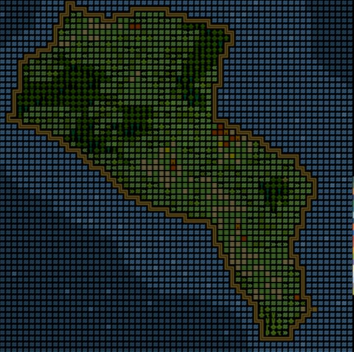
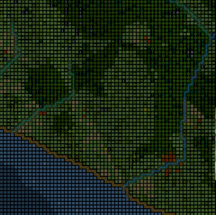
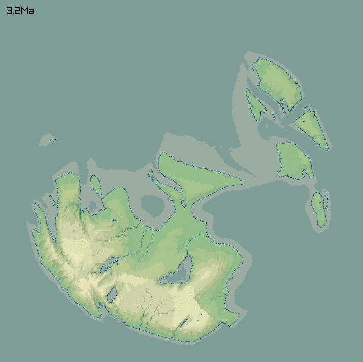
Final renderings of parts of the map.
July 30, 2025 at 10:22 PM
Final renderings of parts of the map.
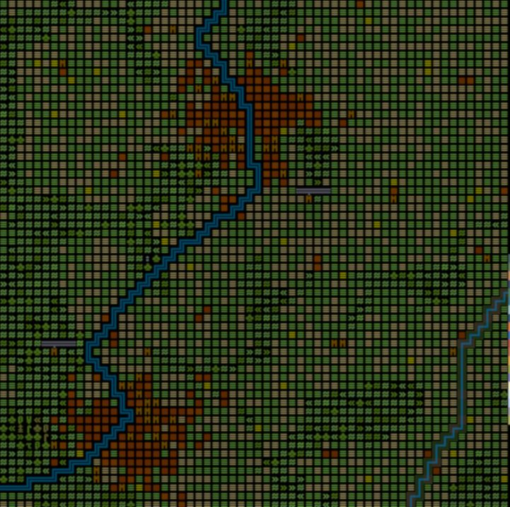
Cities being generated. Villages interact with each other, favouring large ones that are nearby, and some of them grow. TODO: develop a network of roads based on this, and let the communication advantages of roads and rivers influence city locations.
July 30, 2025 at 10:22 PM
Cities being generated. Villages interact with each other, favouring large ones that are nearby, and some of them grow. TODO: develop a network of roads based on this, and let the communication advantages of roads and rivers influence city locations.
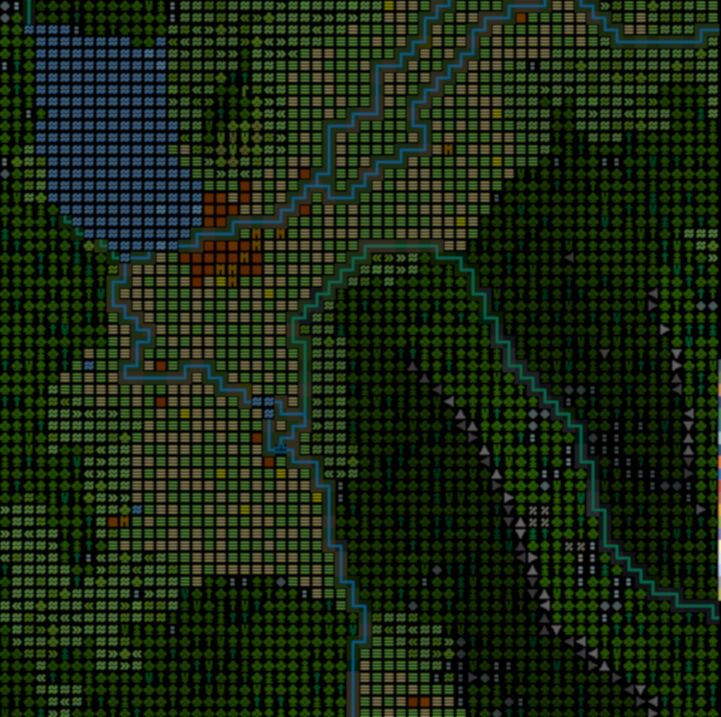
This map shows flat, slightly-sloping and steep ground. The treatment of civilization is fairly basic. Flat ground that can support a forest becomes fields; slightly-sloping pastures; the rest is left wild.

July 30, 2025 at 10:22 PM
This map shows flat, slightly-sloping and steep ground. The treatment of civilization is fairly basic. Flat ground that can support a forest becomes fields; slightly-sloping pastures; the rest is left wild.
TODO: compressional tectonics (i.e. high mountains), vulcanism, glaciation, decent treatment of deserts.
July 30, 2025 at 10:11 PM
TODO: compressional tectonics (i.e. high mountains), vulcanism, glaciation, decent treatment of deserts.
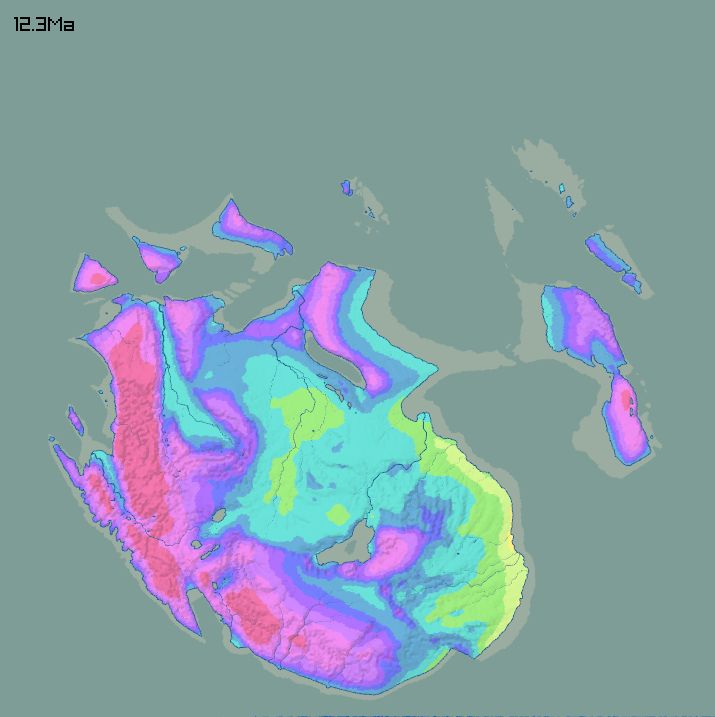
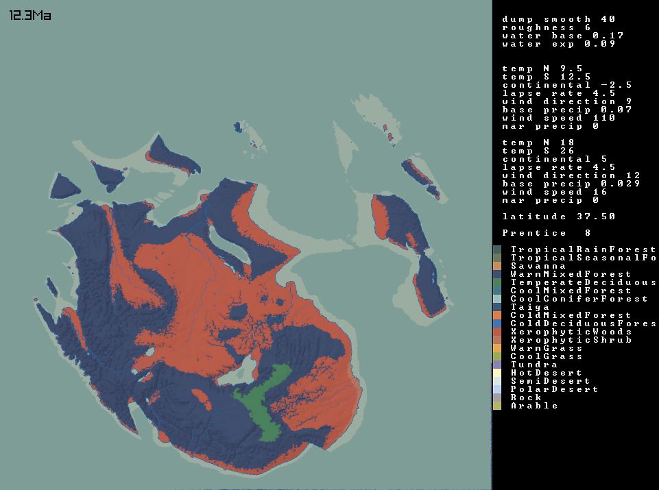
Choose a latitude, which gives basic climate parameters. Model temperature and rainfall in January and July. From estimates for evapotranspiration and available soil water each month at each point, get vegetation and biomes.
July 30, 2025 at 10:09 PM
Choose a latitude, which gives basic climate parameters. Model temperature and rainfall in January and July. From estimates for evapotranspiration and available soil water each month at each point, get vegetation and biomes.
Double the resolution of the underlying grid and run the model a little bit longer. Rainfall now is based on a climate model...

July 30, 2025 at 10:09 PM
Double the resolution of the underlying grid and run the model a little bit longer. Rainfall now is based on a climate model...
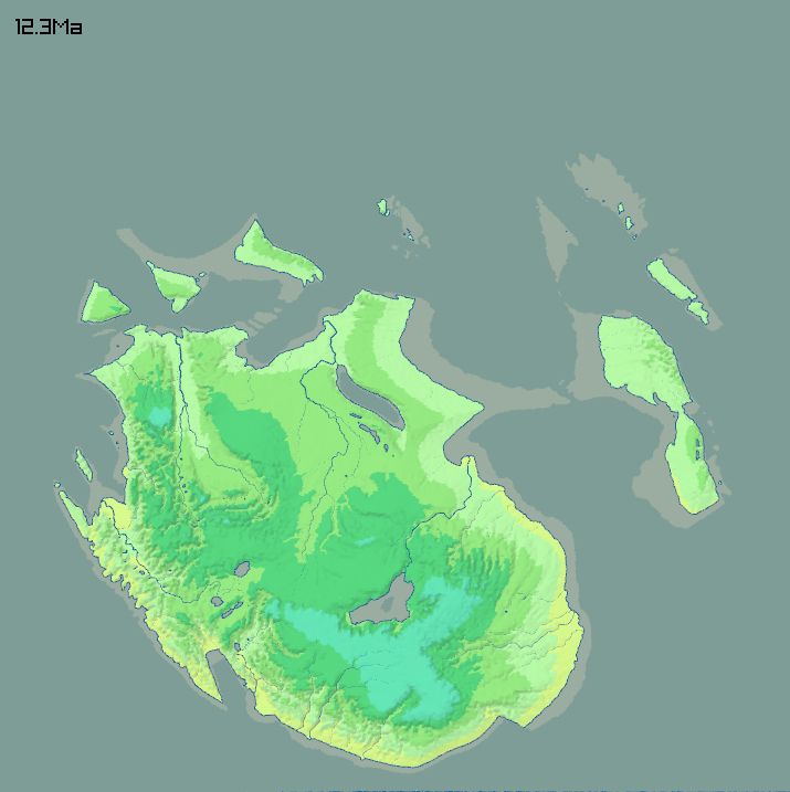
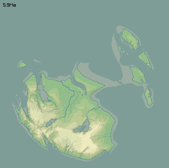
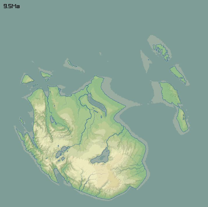
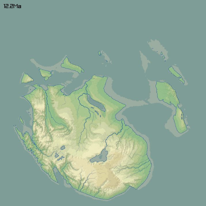
12 million years of erosion and deposition, using a stream power law. Apart from the rifting (and some isostatic stuff), parts of the land are pushed upward/downward over time with long wavelength noise.
July 30, 2025 at 10:09 PM
12 million years of erosion and deposition, using a stream power law. Apart from the rifting (and some isostatic stuff), parts of the land are pushed upward/downward over time with long wavelength noise.
The initial landscape, made from noise with some chunks cut out. Colours on the left are height above sea level. Yellow/blue on the right are soft/hard rock. Red is "rifting" - these areas will sink, simulating some effects of extensional tectonics.


July 30, 2025 at 10:09 PM
The initial landscape, made from noise with some chunks cut out. Colours on the left are height above sea level. Yellow/blue on the right are soft/hard rock. Red is "rifting" - these areas will sink, simulating some effects of extensional tectonics.
The first step is to make a 256x256 grid with random diagonals. See the pictures and alt texts. This gives something pleasantly irregular but as fast as a regular grid.


July 30, 2025 at 10:09 PM
The first step is to make a 256x256 grid with random diagonals. See the pictures and alt texts. This gives something pleasantly irregular but as fast as a regular grid.
Nice! The particular parametrization of waveguide shape, by two parameters for the tongue and a certain curve, is also part of the UI design, chosen for simplicity rather than how the vocal tract actually gets shaped.
July 26, 2025 at 8:53 PM
Nice! The particular parametrization of waveguide shape, by two parameters for the tongue and a certain curve, is also part of the UI design, chosen for simplicity rather than how the vocal tract actually gets shaped.
Apropos of that valley on the left, that looks like a marsh but is really a desert - I just realized I can handle water in a desert environment, without adding a proper evaporation model, by giving lakes zero outflow and rendering them as salt flats.
July 24, 2025 at 7:26 AM
Apropos of that valley on the left, that looks like a marsh but is really a desert - I just realized I can handle water in a desert environment, without adding a proper evaporation model, by giving lakes zero outflow and rendering them as salt flats.

I'm trying to implement the model in Bevan and Wilson 2013, "Models of settlement hierarchy based on partial evidence", where they try to reconstruct settlement patterns in bronze age Crete. They say it's a version of the Lotka-Volterra predator-prey equations, although I don't see it yet.
July 17, 2025 at 6:38 PM
I'm trying to implement the model in Bevan and Wilson 2013, "Models of settlement hierarchy based on partial evidence", where they try to reconstruct settlement patterns in bronze age Crete. They say it's a version of the Lotka-Volterra predator-prey equations, although I don't see it yet.
Oh dear, the image compression has not been kind to these. Image it less bone-coloured and with fewer moire effects.
May 20, 2025 at 10:16 PM
Oh dear, the image compression has not been kind to these. Image it less bone-coloured and with fewer moire effects.