


NeilT
@neil-d-t.bsky.social
Experimenting with particle-based fluid simulation. Here a viscous fluid (without any surface tension) breaks up into pieces in zero gravity.

November 8, 2025 at 7:55 PM
Experimenting with particle-based fluid simulation. Here a viscous fluid (without any surface tension) breaks up into pieces in zero gravity.
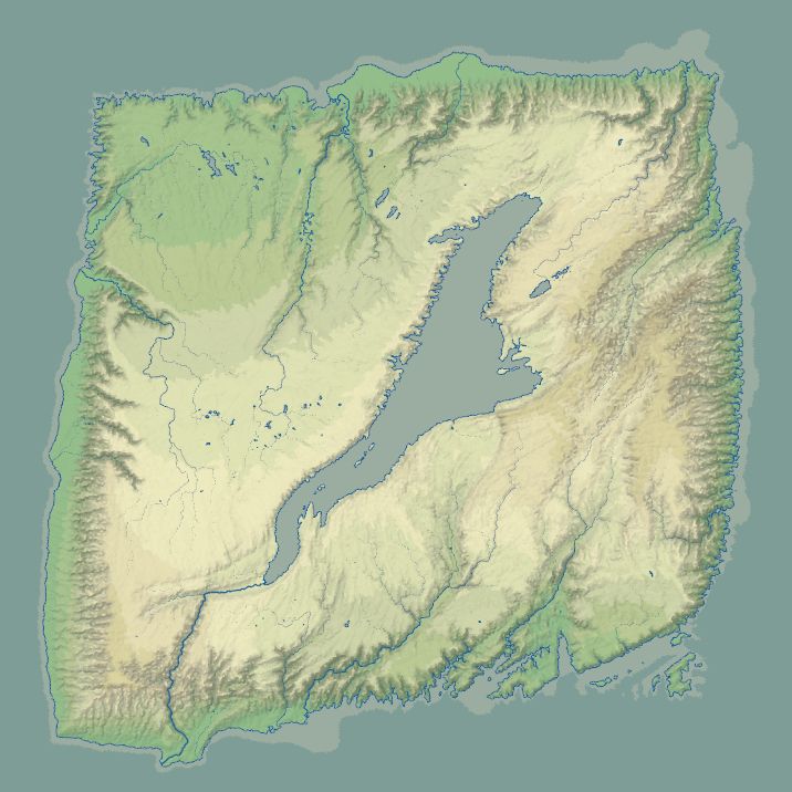
Final renderings of parts of the map.
July 30, 2025 at 10:22 PM
Final renderings of parts of the map.
Cities being generated. Villages interact with each other, favouring large ones that are nearby, and some of them grow. TODO: develop a network of roads based on this, and let the communication advantages of roads and rivers influence city locations.
July 30, 2025 at 10:22 PM
Cities being generated. Villages interact with each other, favouring large ones that are nearby, and some of them grow. TODO: develop a network of roads based on this, and let the communication advantages of roads and rivers influence city locations.
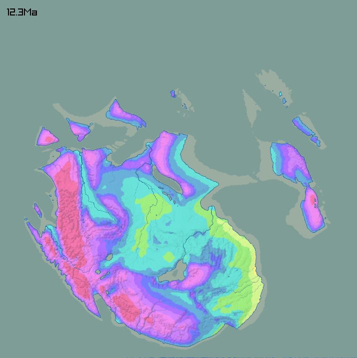
This map shows flat, slightly-sloping and steep ground. The treatment of civilization is fairly basic. Flat ground that can support a forest becomes fields; slightly-sloping pastures; the rest is left wild.

July 30, 2025 at 10:22 PM
This map shows flat, slightly-sloping and steep ground. The treatment of civilization is fairly basic. Flat ground that can support a forest becomes fields; slightly-sloping pastures; the rest is left wild.
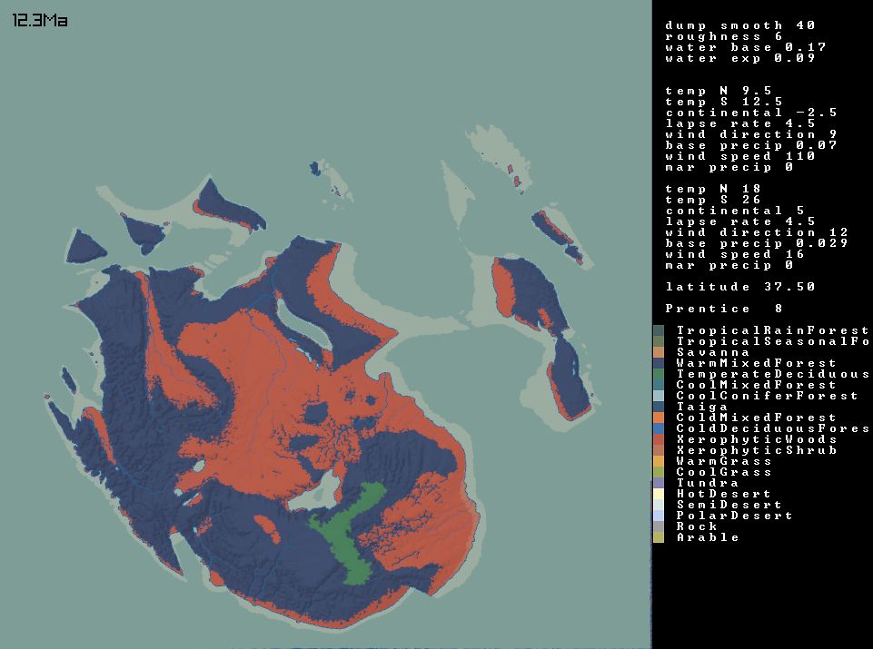
Choose a latitude, which gives basic climate parameters. Model temperature and rainfall in January and July. From estimates for evapotranspiration and available soil water each month at each point, get vegetation and biomes.
July 30, 2025 at 10:09 PM
Choose a latitude, which gives basic climate parameters. Model temperature and rainfall in January and July. From estimates for evapotranspiration and available soil water each month at each point, get vegetation and biomes.
Double the resolution of the underlying grid and run the model a little bit longer. Rainfall now is based on a climate model...

July 30, 2025 at 10:09 PM
Double the resolution of the underlying grid and run the model a little bit longer. Rainfall now is based on a climate model...
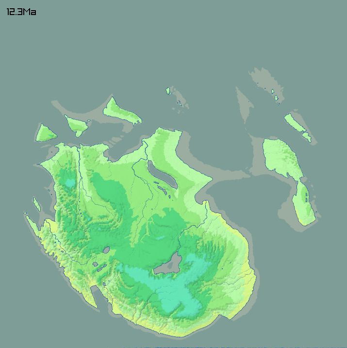
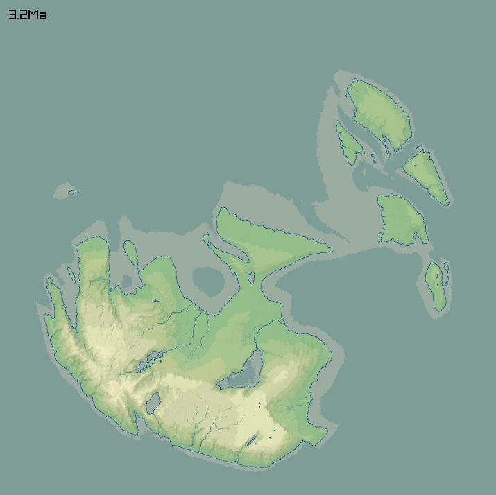
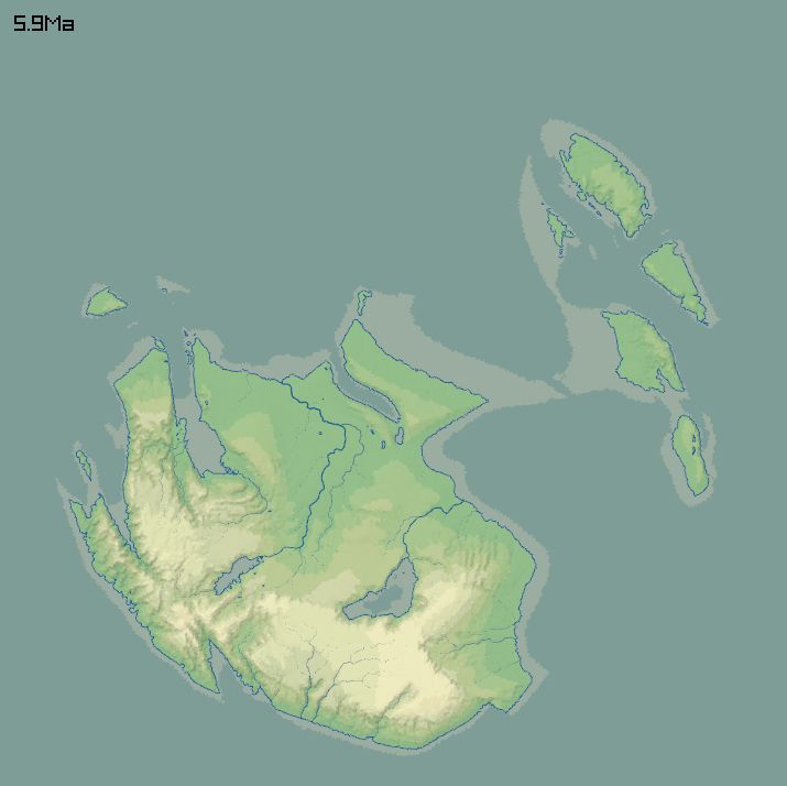
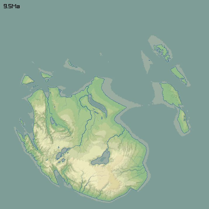
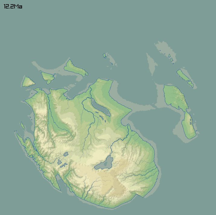
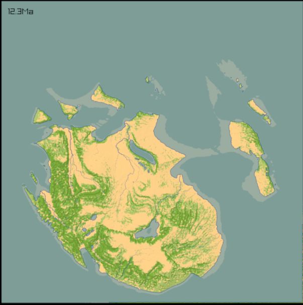
12 million years of erosion and deposition, using a stream power law. Apart from the rifting (and some isostatic stuff), parts of the land are pushed upward/downward over time with long wavelength noise.
July 30, 2025 at 10:09 PM
12 million years of erosion and deposition, using a stream power law. Apart from the rifting (and some isostatic stuff), parts of the land are pushed upward/downward over time with long wavelength noise.
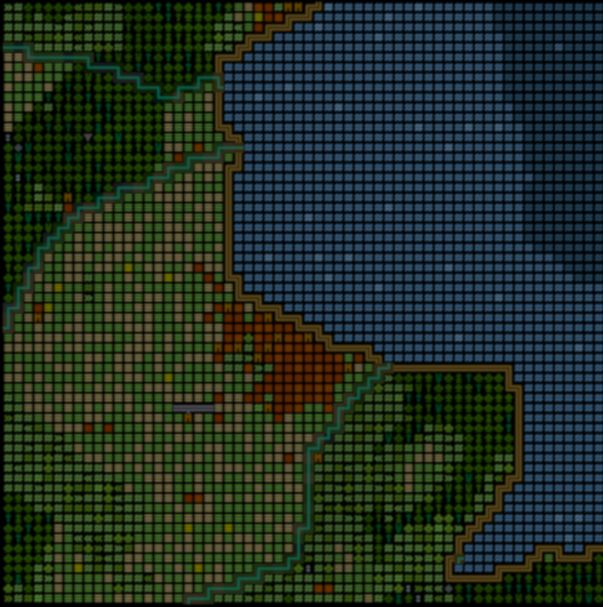
The initial landscape, made from noise with some chunks cut out. Colours on the left are height above sea level. Yellow/blue on the right are soft/hard rock. Red is "rifting" - these areas will sink, simulating some effects of extensional tectonics.


July 30, 2025 at 10:09 PM
The initial landscape, made from noise with some chunks cut out. Colours on the left are height above sea level. Yellow/blue on the right are soft/hard rock. Red is "rifting" - these areas will sink, simulating some effects of extensional tectonics.
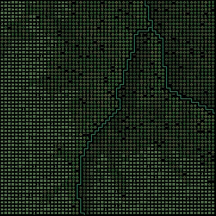
The first step is to make a 256x256 grid with random diagonals. See the pictures and alt texts. This gives something pleasantly irregular but as fast as a regular grid.


July 30, 2025 at 10:09 PM
The first step is to make a 256x256 grid with random diagonals. See the pictures and alt texts. This gives something pleasantly irregular but as fast as a regular grid.
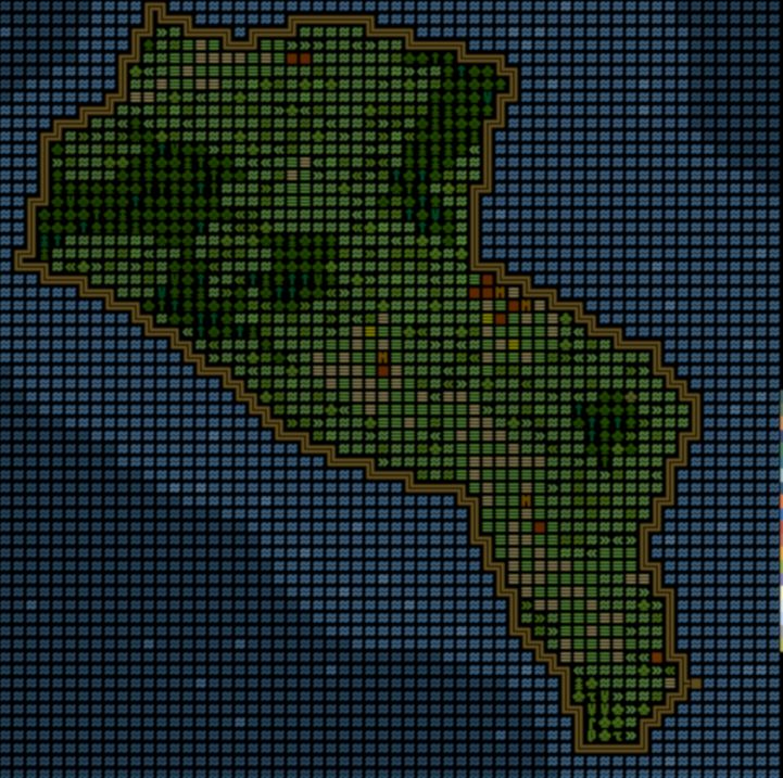
Another (small) continent with city sizes. This is a more appropriate number of cities, but there is no nice hierarchical structure there yet. #procgen

July 25, 2025 at 10:18 PM
Another (small) continent with city sizes. This is a more appropriate number of cities, but there is no nice hierarchical structure there yet. #procgen


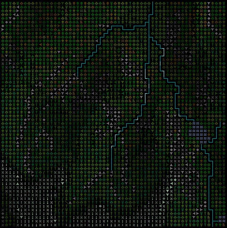
This is my go-to (see the alt texts). The points are still addressable as grid points, and are close to their original positions. Distance in the graph is not too far from euclidean distance.


April 16, 2025 at 7:20 PM
This is my go-to (see the alt texts). The points are still addressable as grid points, and are close to their original positions. Distance in the graph is not too far from euclidean distance.


Test to see what bluesky's video compression does to this
April 4, 2025 at 7:05 PM
Test to see what bluesky's video compression does to this

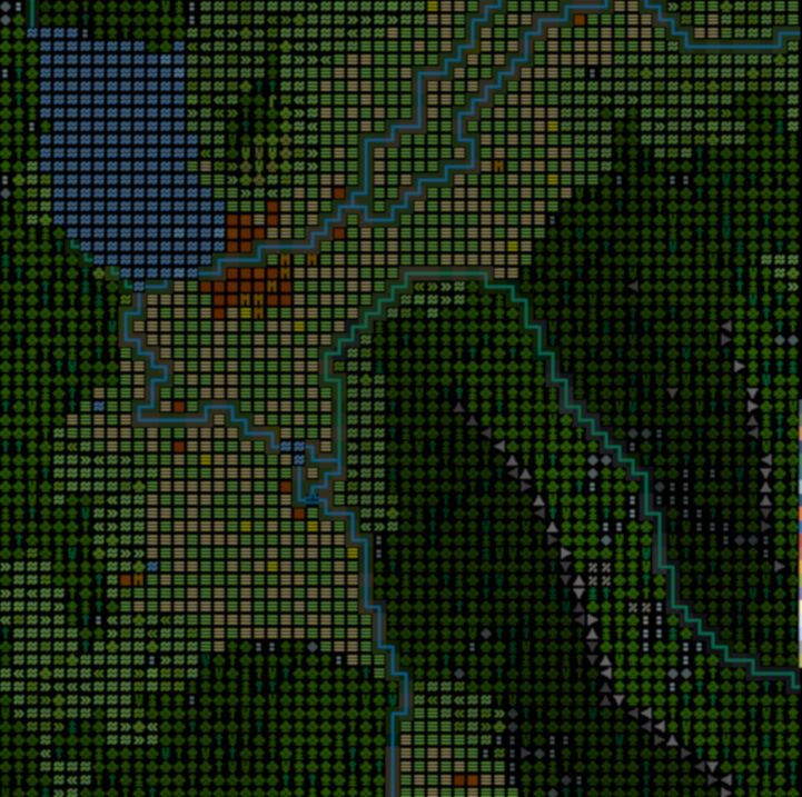
The vegetation of Squain, using the BIOME1 model.

March 22, 2025 at 10:35 PM
The vegetation of Squain, using the BIOME1 model.
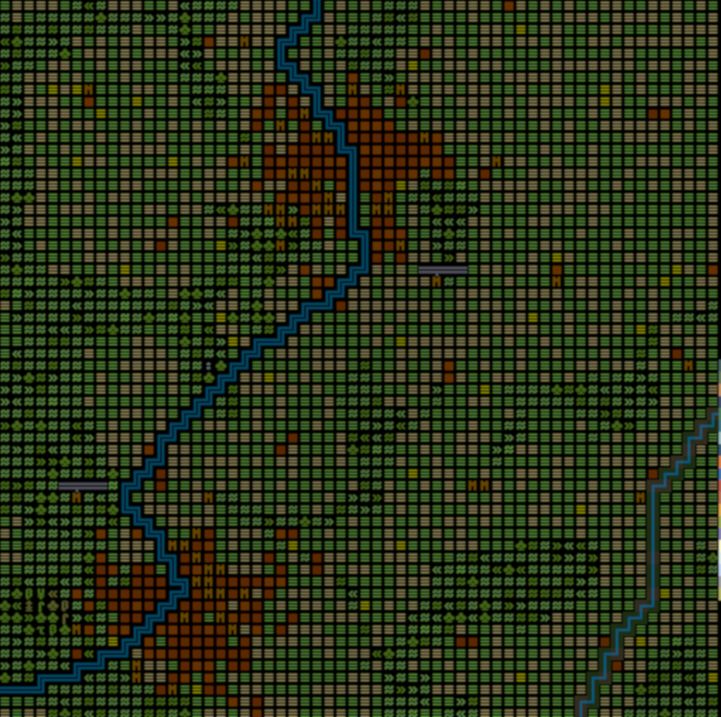
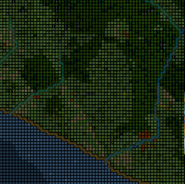
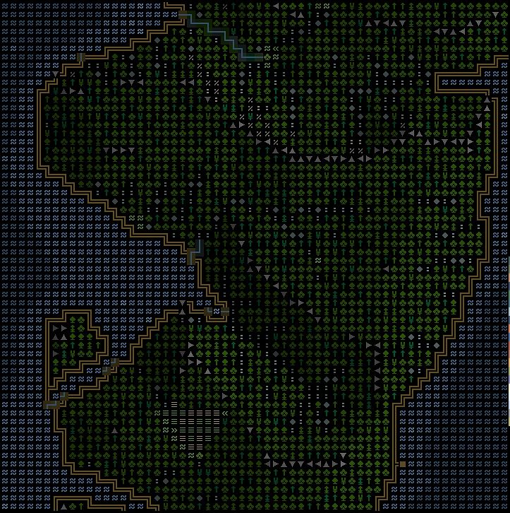
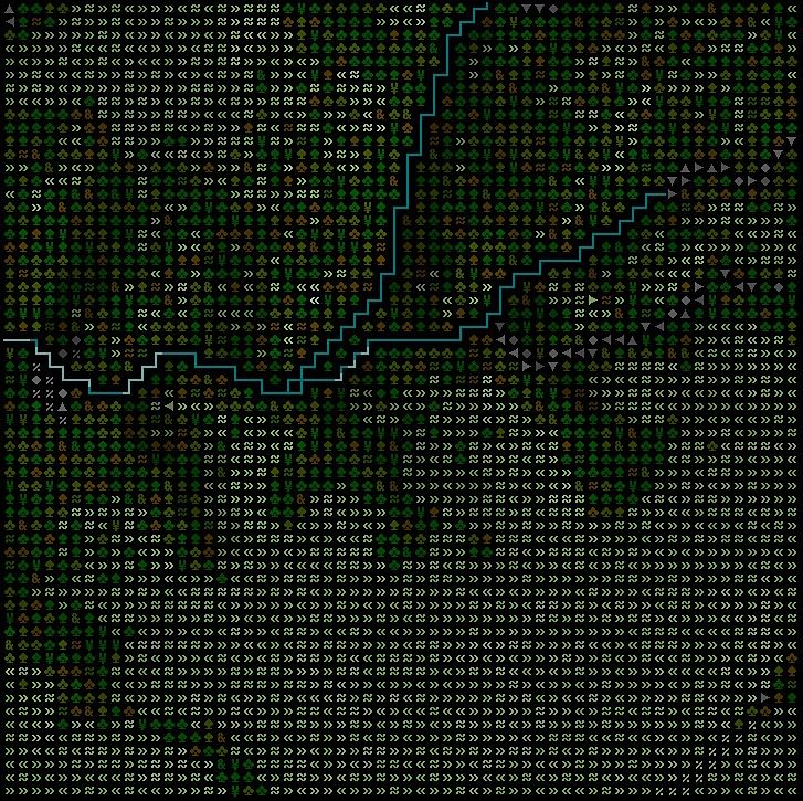
Textmode Spain. (The rivers are generated from the heightmap, which is why they look a bit odd.)

March 6, 2025 at 11:48 PM
Textmode Spain. (The rivers are generated from the heightmap, which is why they look a bit odd.)

Better rendering - colours for elevation & symbols for relief.


March 2, 2025 at 4:40 PM
Better rendering - colours for elevation & symbols for relief.