

Tom Mueller
@gisbatman.bsky.social
Deputy Director for MassGIS
Geospatial Technology 4 Life.
Geospatial Technology 4 Life.
Reposted by Tom Mueller

MA Governor Healey has declared November 19, 2025 Geographic Information Systems Day.

November 7, 2025 at 10:34 PM
MA Governor Healey has declared November 19, 2025 Geographic Information Systems Day.
MassGIS October GISette is now available mailchi.mp/15cc598debe7...
October 2025 MassGIS GISette Newsletter
mailchi.mp
November 3, 2025 at 7:45 PM
MassGIS October GISette is now available mailchi.mp/15cc598debe7...
Reposted by Tom Mueller

𝗔𝗽𝗽𝗹𝗶𝗰𝗮𝘁𝗶𝗼𝗻𝘀 𝗡𝗼𝘄 𝗢𝗽𝗲𝗻!
Join the 𝗛𝗢𝗧 𝗠𝗲𝗻𝘁𝗼𝗿𝘀𝗵𝗶𝗽 𝗣𝗿𝗼𝗴𝗿𝗮𝗺 and gain skills, mentorship, and opportunities to create local and global impact!
𝗔𝗽𝗽𝗹𝘆 𝗯𝘆: 𝗔𝘂𝗴𝘂𝘀𝘁 𝟮𝟰, 𝟮𝟬𝟮𝟱 – 𝟭𝟮:𝟬𝟬 𝗨𝗧𝗖
𝗔𝗽𝗽𝗹𝘆 𝗻𝗼𝘄 → Scan the QR code in the flyer or click here: bit.ly/3J8RWMJ
Join the 𝗛𝗢𝗧 𝗠𝗲𝗻𝘁𝗼𝗿𝘀𝗵𝗶𝗽 𝗣𝗿𝗼𝗴𝗿𝗮𝗺 and gain skills, mentorship, and opportunities to create local and global impact!
𝗔𝗽𝗽𝗹𝘆 𝗯𝘆: 𝗔𝘂𝗴𝘂𝘀𝘁 𝟮𝟰, 𝟮𝟬𝟮𝟱 – 𝟭𝟮:𝟬𝟬 𝗨𝗧𝗖
𝗔𝗽𝗽𝗹𝘆 𝗻𝗼𝘄 → Scan the QR code in the flyer or click here: bit.ly/3J8RWMJ

August 11, 2025 at 11:41 PM
𝗔𝗽𝗽𝗹𝗶𝗰𝗮𝘁𝗶𝗼𝗻𝘀 𝗡𝗼𝘄 𝗢𝗽𝗲𝗻!
Join the 𝗛𝗢𝗧 𝗠𝗲𝗻𝘁𝗼𝗿𝘀𝗵𝗶𝗽 𝗣𝗿𝗼𝗴𝗿𝗮𝗺 and gain skills, mentorship, and opportunities to create local and global impact!
𝗔𝗽𝗽𝗹𝘆 𝗯𝘆: 𝗔𝘂𝗴𝘂𝘀𝘁 𝟮𝟰, 𝟮𝟬𝟮𝟱 – 𝟭𝟮:𝟬𝟬 𝗨𝗧𝗖
𝗔𝗽𝗽𝗹𝘆 𝗻𝗼𝘄 → Scan the QR code in the flyer or click here: bit.ly/3J8RWMJ
Join the 𝗛𝗢𝗧 𝗠𝗲𝗻𝘁𝗼𝗿𝘀𝗵𝗶𝗽 𝗣𝗿𝗼𝗴𝗿𝗮𝗺 and gain skills, mentorship, and opportunities to create local and global impact!
𝗔𝗽𝗽𝗹𝘆 𝗯𝘆: 𝗔𝘂𝗴𝘂𝘀𝘁 𝟮𝟰, 𝟮𝟬𝟮𝟱 – 𝟭𝟮:𝟬𝟬 𝗨𝗧𝗖
𝗔𝗽𝗽𝗹𝘆 𝗻𝗼𝘄 → Scan the QR code in the flyer or click here: bit.ly/3J8RWMJ
Please check out the July MassGIS Newsletter, the GISette. We have been busy, including the first meeting of the Massachusetts Geospatial Information Coordinating Council (MaGICC) and updates to MassMapper.
mailchi.mp/8cb5a0f456d1...
mailchi.mp/8cb5a0f456d1...
July 2025 MassGIS GISette Newsletter
mailchi.mp
August 8, 2025 at 12:17 PM
Please check out the July MassGIS Newsletter, the GISette. We have been busy, including the first meeting of the Massachusetts Geospatial Information Coordinating Council (MaGICC) and updates to MassMapper.
mailchi.mp/8cb5a0f456d1...
mailchi.mp/8cb5a0f456d1...
Reposted by Tom Mueller

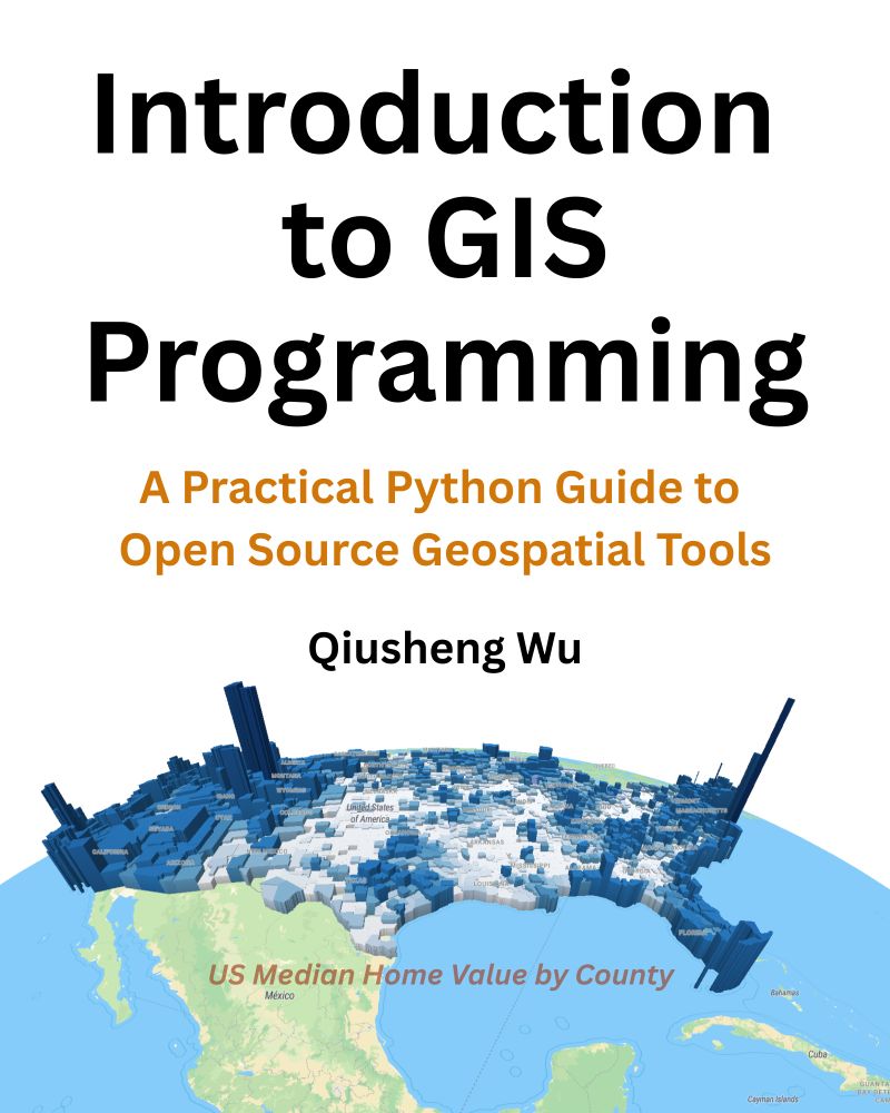
📣 Exciting News! The full-color print edition of my book “Introduction to GIS Programming: A Practical Python Guide to Open Source Geospatial Tools” is now available on Amazon!
📘 Grab your copy: amazon.com/dp/B0FFW34LL3
Prefer digital? The PDF version is available on Leanpub: leanpub.com/gispro
📘 Grab your copy: amazon.com/dp/B0FFW34LL3
Prefer digital? The PDF version is available on Leanpub: leanpub.com/gispro
June 28, 2025 at 12:20 AM
📣 Exciting News! The full-color print edition of my book “Introduction to GIS Programming: A Practical Python Guide to Open Source Geospatial Tools” is now available on Amazon!
📘 Grab your copy: amazon.com/dp/B0FFW34LL3
Prefer digital? The PDF version is available on Leanpub: leanpub.com/gispro
📘 Grab your copy: amazon.com/dp/B0FFW34LL3
Prefer digital? The PDF version is available on Leanpub: leanpub.com/gispro
Reposted by Tom Mueller
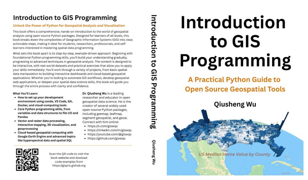
Introduction to GIS Programming: Book Release and Code Examples Walkthrough
YouTube Video: youtu.be/6GwMoV4LOiU
In this video, I provide a step-by-step guide on running the code examples from the book using Binder, Colab, and Docker.
#geospatial #opensource #python #mapping
YouTube Video: youtu.be/6GwMoV4LOiU
In this video, I provide a step-by-step guide on running the code examples from the book using Binder, Colab, and Docker.
#geospatial #opensource #python #mapping
June 29, 2025 at 2:43 PM
Introduction to GIS Programming: Book Release and Code Examples Walkthrough
YouTube Video: youtu.be/6GwMoV4LOiU
In this video, I provide a step-by-step guide on running the code examples from the book using Binder, Colab, and Docker.
#geospatial #opensource #python #mapping
YouTube Video: youtu.be/6GwMoV4LOiU
In this video, I provide a step-by-step guide on running the code examples from the book using Binder, Colab, and Docker.
#geospatial #opensource #python #mapping
Reposted by Tom Mueller

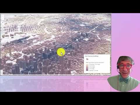
Teaching with the 3D scene Walking Time to Public Transport
YouTube video by Our Earth
youtu.be
June 6, 2025 at 4:36 PM
Reposted by Tom Mueller
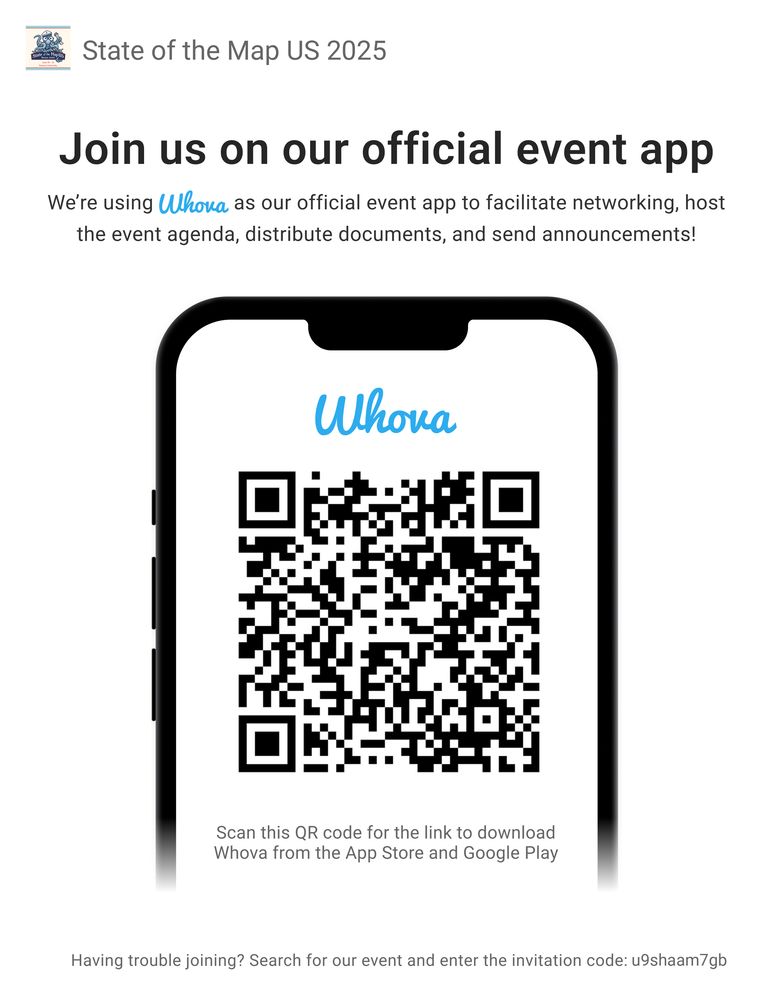
Are you going to State of the Map US? Have you downloaded the conference app yet?
We love the Whova app! It's a great way to check the schedule, learn more about speakers, and connect with fellow mappers at the event!
🔗 whova.com/portal/webap...
#MappyMonday #StateoftheMapUS #SOTMUS #Whova
We love the Whova app! It's a great way to check the schedule, learn more about speakers, and connect with fellow mappers at the event!
🔗 whova.com/portal/webap...
#MappyMonday #StateoftheMapUS #SOTMUS #Whova
June 2, 2025 at 6:00 PM
Are you going to State of the Map US? Have you downloaded the conference app yet?
We love the Whova app! It's a great way to check the schedule, learn more about speakers, and connect with fellow mappers at the event!
🔗 whova.com/portal/webap...
#MappyMonday #StateoftheMapUS #SOTMUS #Whova
We love the Whova app! It's a great way to check the schedule, learn more about speakers, and connect with fellow mappers at the event!
🔗 whova.com/portal/webap...
#MappyMonday #StateoftheMapUS #SOTMUS #Whova
Reposted by Tom Mueller

My personal essay: "A Different Kind Uncertainty" speaking out on the grave implications of the destruction of US science (including for GIS users). Yea verily, these are far from normal times ....
dusk.geo.orst.edu/uncertainty....
#GISchat #geogchat #geosky ⚒️ 🌊 🌍 🌎 🌏
dusk.geo.orst.edu/uncertainty....
#GISchat #geogchat #geosky ⚒️ 🌊 🌍 🌎 🌏

May 25, 2025 at 4:54 AM
My personal essay: "A Different Kind Uncertainty" speaking out on the grave implications of the destruction of US science (including for GIS users). Yea verily, these are far from normal times ....
dusk.geo.orst.edu/uncertainty....
#GISchat #geogchat #geosky ⚒️ 🌊 🌍 🌎 🌏
dusk.geo.orst.edu/uncertainty....
#GISchat #geogchat #geosky ⚒️ 🌊 🌍 🌎 🌏
Reposted by Tom Mueller

Come learn from the best - Michelle Williams, Survey123 Jedi - as she takes you on a journey to master Survey123 with confidence!
Complete details and registration options on our website at womeningis.org/survey123
#GISChat
Complete details and registration options on our website at womeningis.org/survey123
#GISChat

May 24, 2025 at 1:53 PM
Come learn from the best - Michelle Williams, Survey123 Jedi - as she takes you on a journey to master Survey123 with confidence!
Complete details and registration options on our website at womeningis.org/survey123
#GISChat
Complete details and registration options on our website at womeningis.org/survey123
#GISChat
Reposted by Tom Mueller

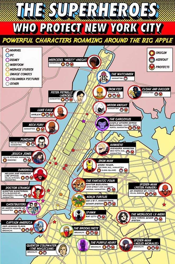
🦸 The superheroes who protect New York City.
May 21, 2025 at 6:06 PM
🦸 The superheroes who protect New York City.
The May MassGIS GISette is now available.
Please read about our exciting news, including the establishment of the Massachusetts Geospatial Information Coordinating Council (MaGICC).
mailchi.mp/b6c2b4287908...
Please read about our exciting news, including the establishment of the Massachusetts Geospatial Information Coordinating Council (MaGICC).
mailchi.mp/b6c2b4287908...
May 2025 MassGIS GISette Newsletter
mailchi.mp
May 20, 2025 at 11:04 PM
The May MassGIS GISette is now available.
Please read about our exciting news, including the establishment of the Massachusetts Geospatial Information Coordinating Council (MaGICC).
mailchi.mp/b6c2b4287908...
Please read about our exciting news, including the establishment of the Massachusetts Geospatial Information Coordinating Council (MaGICC).
mailchi.mp/b6c2b4287908...
Reposted by Tom Mueller
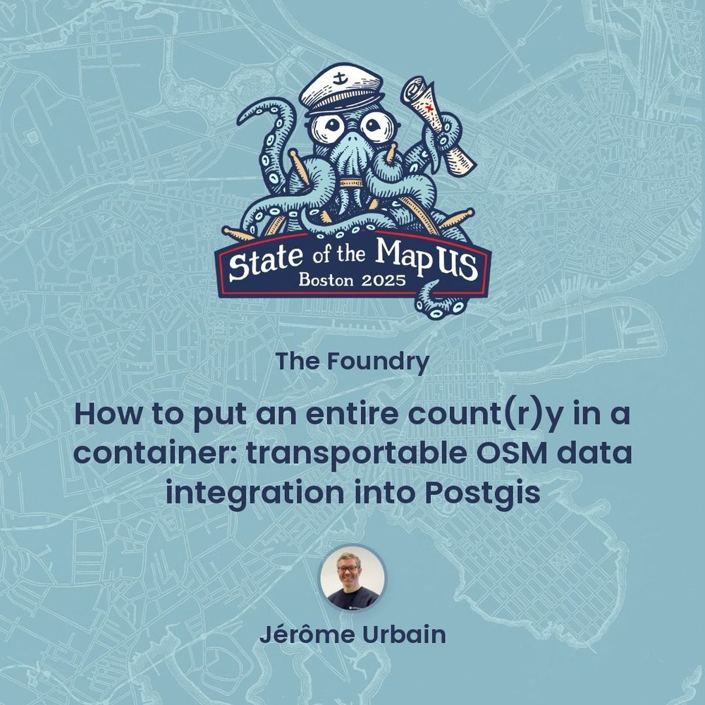
Jérôme Urbain will lead a hands-on tutorial on how to download OpenStreetMap data into a PostGIS database during this #SOTMUS workshop on Thursday afternoon. Access the full schedule here: bit.ly/SOTMUS2025_s...
🎟️ bit.ly/sotmus2025tix
#MappyMonday #StateoftheMapUS #OpenStreetMap #OSM #PostGIS
🎟️ bit.ly/sotmus2025tix
#MappyMonday #StateoftheMapUS #OpenStreetMap #OSM #PostGIS
May 19, 2025 at 9:00 PM
Jérôme Urbain will lead a hands-on tutorial on how to download OpenStreetMap data into a PostGIS database during this #SOTMUS workshop on Thursday afternoon. Access the full schedule here: bit.ly/SOTMUS2025_s...
🎟️ bit.ly/sotmus2025tix
#MappyMonday #StateoftheMapUS #OpenStreetMap #OSM #PostGIS
🎟️ bit.ly/sotmus2025tix
#MappyMonday #StateoftheMapUS #OpenStreetMap #OSM #PostGIS
Reposted by Tom Mueller
In case you missed my keynote and workshop at the New Mexico Geographic Information Council conference last week, here are all the resources: www.josephkerski.com/my-keynote-a...

My keynote and workshops at the NMGIC GIS conference and UNM Campus - Joseph Kerski, Ph.D. GISP
Thursday: Ethics in Mapping: Why and How: https://storymaps.arcgis.com/stories/034813a3e60640428d7ffed5261facd7 Connecting surveys, maps, analysis, dashboards, and story maps: Workshop: https://com...
www.josephkerski.com
May 9, 2025 at 3:37 PM
In case you missed my keynote and workshop at the New Mexico Geographic Information Council conference last week, here are all the resources: www.josephkerski.com/my-keynote-a...
Reposted by Tom Mueller

If you are a fan of GeoAI (and GenAI for Geo), or just want to learn more, I recommend you follow my colleague Rami on LinkedIn. Great videos. He'll run a workshop for us at AGILE2025 in Dresden. www.linkedin.com/in/rami-alou...
LinkedIn Login, Sign in | LinkedIn
Login to LinkedIn to keep in touch with people you know, share ideas, and build your career.
www.linkedin.com
May 9, 2025 at 8:31 AM
If you are a fan of GeoAI (and GenAI for Geo), or just want to learn more, I recommend you follow my colleague Rami on LinkedIn. Great videos. He'll run a workshop for us at AGILE2025 in Dresden. www.linkedin.com/in/rami-alou...
EXTRA! EXTRA! Check out the Special Edition of the MassGIS GISette - The Massachusetts Geospatial Strategy has been published! mailchi.mp/63b130b928ac...
Special Edition MassGIS GISette Newsletter
mailchi.mp
May 6, 2025 at 3:10 PM
EXTRA! EXTRA! Check out the Special Edition of the MassGIS GISette - The Massachusetts Geospatial Strategy has been published! mailchi.mp/63b130b928ac...
Reposted by Tom Mueller
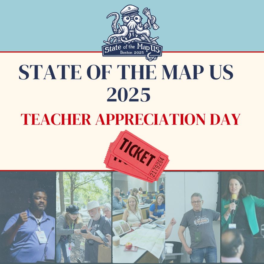
🍎 We have a special offer for educators interested in attending #StateoftheMapUS: Use code "TEACHERS-ROCK" on the Academic & Nonprofit Admission ticket option for a special rate🔗 bit.ly/sotmus2025tix
Valid on May 6 for the Academic and Nonprofit ticket. A .edu email address is required.
Valid on May 6 for the Academic and Nonprofit ticket. A .edu email address is required.
May 6, 2025 at 12:15 PM
🍎 We have a special offer for educators interested in attending #StateoftheMapUS: Use code "TEACHERS-ROCK" on the Academic & Nonprofit Admission ticket option for a special rate🔗 bit.ly/sotmus2025tix
Valid on May 6 for the Academic and Nonprofit ticket. A .edu email address is required.
Valid on May 6 for the Academic and Nonprofit ticket. A .edu email address is required.
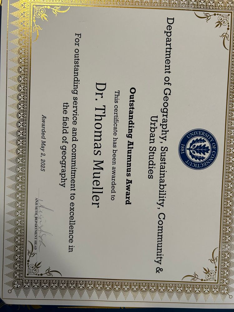
I was honored to receive the Outstanding Alumnus Award from the UCONN Department of Geography. I not only learned about Geog and GIS but also how to be a professional
May 6, 2025 at 11:24 AM
I was honored to receive the Outstanding Alumnus Award from the UCONN Department of Geography. I not only learned about Geog and GIS but also how to be a professional
Another great semester for GAMMA SIGMA THETA (ГΣθ), the National Honor Society for Geospatial Technology, hosted by The GeoTech Center. The final numbers for the Spring 2025 class are:
148 New Students
21 New Honorary Members
25 Academic Institutions
arcg.is/0Ga0jG
148 New Students
21 New Honorary Members
25 Academic Institutions
arcg.is/0Ga0jG

GAMMA SIGMA THETA (ГΣθ)
National Honor Society for Geospatial Technology
arcg.is
April 27, 2025 at 1:03 PM
Another great semester for GAMMA SIGMA THETA (ГΣθ), the National Honor Society for Geospatial Technology, hosted by The GeoTech Center. The final numbers for the Spring 2025 class are:
148 New Students
21 New Honorary Members
25 Academic Institutions
arcg.is/0Ga0jG
148 New Students
21 New Honorary Members
25 Academic Institutions
arcg.is/0Ga0jG
Reposted by Tom Mueller
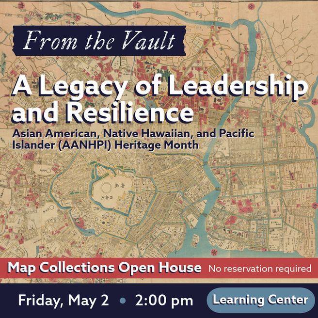
As Asian American, Native Hawaiian, and Pacific Islander (AANHPI) Heritage Month begins, this collections showing will be Friday, May 2 in the Leventhal Map & Education Center with a staff member available to answer questions.
Drop in any time between 2:00 pm - 4:00 pm.
No reservations required!
Drop in any time between 2:00 pm - 4:00 pm.
No reservations required!
April 26, 2025 at 10:34 AM
As Asian American, Native Hawaiian, and Pacific Islander (AANHPI) Heritage Month begins, this collections showing will be Friday, May 2 in the Leventhal Map & Education Center with a staff member available to answer questions.
Drop in any time between 2:00 pm - 4:00 pm.
No reservations required!
Drop in any time between 2:00 pm - 4:00 pm.
No reservations required!
Reposted by Tom Mueller
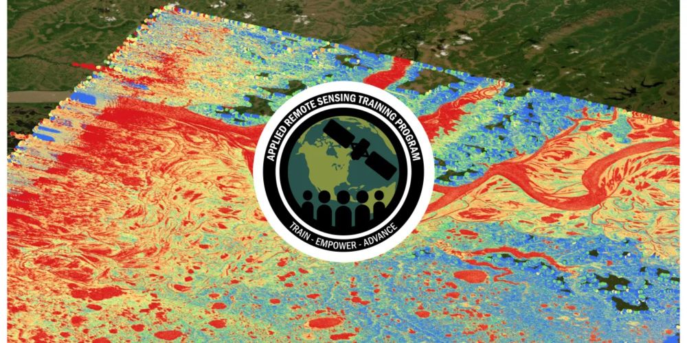
NASA's Surface Water and Ocean Topography (SWOT) mission enables us to map global surface freshwater components including rivers, lakes and wetlands with high-resolution measurements (~200 m).
Explore SWOT data and its potential applications in this training series: go.nasa.gov/4jcVk5J
Explore SWOT data and its potential applications in this training series: go.nasa.gov/4jcVk5J
ARSET - Monitoring Global Terrestrial Surface Water Height using Remote Sensing | NASA Applied Sciences
go.nasa.gov
April 23, 2025 at 9:29 PM
NASA's Surface Water and Ocean Topography (SWOT) mission enables us to map global surface freshwater components including rivers, lakes and wetlands with high-resolution measurements (~200 m).
Explore SWOT data and its potential applications in this training series: go.nasa.gov/4jcVk5J
Explore SWOT data and its potential applications in this training series: go.nasa.gov/4jcVk5J
Reposted by Tom Mueller
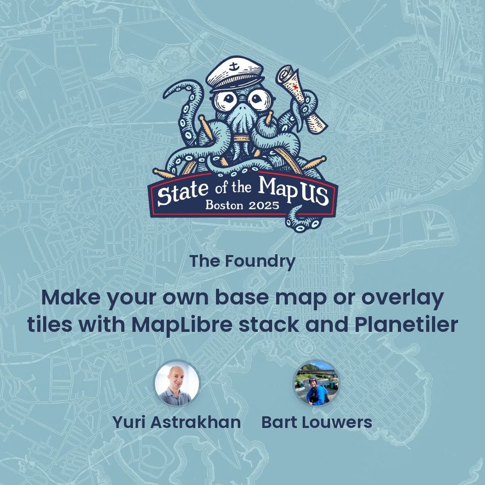
Make your own base map or overlay tiles with MapLibre stack and Planetile during this workshop at #SOTMUS with Yuri Astrakhan and Bart Louwers!
Snag your tickets and check out the entire schedule: openstreetmap.us/events/state...
Snag your tickets and check out the entire schedule: openstreetmap.us/events/state...
April 24, 2025 at 8:00 PM
Make your own base map or overlay tiles with MapLibre stack and Planetile during this workshop at #SOTMUS with Yuri Astrakhan and Bart Louwers!
Snag your tickets and check out the entire schedule: openstreetmap.us/events/state...
Snag your tickets and check out the entire schedule: openstreetmap.us/events/state...
Reposted by Tom Mueller
Reposted by Tom Mueller
The deadline for poster session submissions for #SOTMUS2025 has been extended! Send us your ideas by April 18th: bit.ly/SotMUS-poste...
#MappyMonday #OpenStreetMap #postersession #StateoftheMapUS
#MappyMonday #OpenStreetMap #postersession #StateoftheMapUS
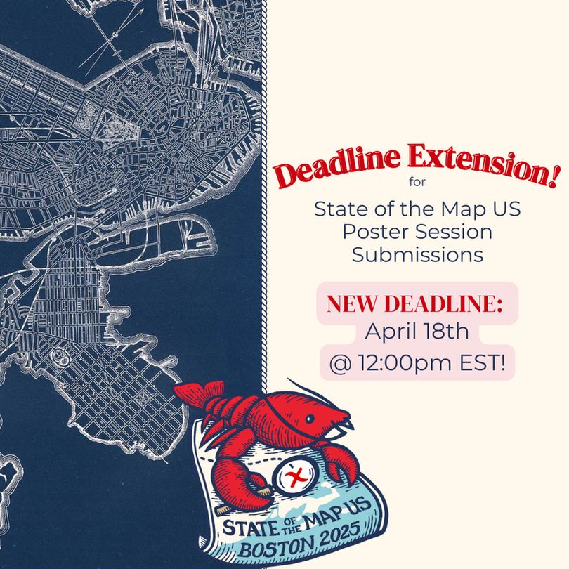
April 7, 2025 at 10:00 PM
The deadline for poster session submissions for #SOTMUS2025 has been extended! Send us your ideas by April 18th: bit.ly/SotMUS-poste...
#MappyMonday #OpenStreetMap #postersession #StateoftheMapUS
#MappyMonday #OpenStreetMap #postersession #StateoftheMapUS