


George Dyke
@georgedyke.bsky.social
Curious | 🚀 Space Enthusiast | 🌍 Earth Observer | 🛠️ Engineer | 💻 Software Wrangler | 🌊 Climate Advocate | 🎿 Snowboarder | 🚵 Mountain Biker | 🎺 Trumpeter | 🏒 Hockey Player | 👨👦 Parent
Reposted by George Dyke
I want to find a reggae band for a conference in Auckland in November. We don't have a lot of money, and we want to dance! Does anyone know anyone? #auckland #music #livemusic
August 21, 2025 at 11:21 PM
I want to find a reggae band for a conference in Auckland in November. We don't have a lot of money, and we want to dance! Does anyone know anyone? #auckland #music #livemusic
Reposted by George Dyke

Satellite-based damage assessments for the Earthquake in Myanmar are beginning to trickle out. Here’s a section of Mandalay from Planet & Microsoft AI for Good.
satelliteimagerydemostg.z5.web.core.windows.net/damage-asses...
satelliteimagerydemostg.z5.web.core.windows.net/damage-asses...

March 31, 2025 at 3:28 PM
Satellite-based damage assessments for the Earthquake in Myanmar are beginning to trickle out. Here’s a section of Mandalay from Planet & Microsoft AI for Good.
satelliteimagerydemostg.z5.web.core.windows.net/damage-asses...
satelliteimagerydemostg.z5.web.core.windows.net/damage-asses...
Reposted by George Dyke

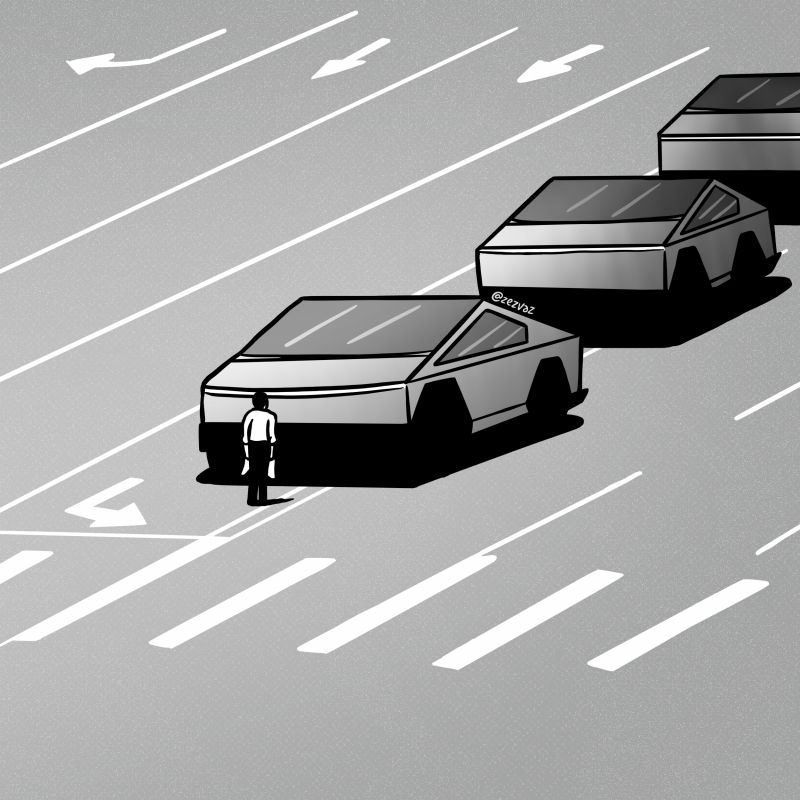
Portuguese editorial cartoonist Zez Vaz reaches back to Tiananmen Square to call on American defiance.
February 15, 2025 at 1:43 PM
Portuguese editorial cartoonist Zez Vaz reaches back to Tiananmen Square to call on American defiance.
Reposted by George Dyke
The main DEI page from @agu.org has been modified to take diversity out of the title. Glad to see it's not deleted entirely, but hey AGU, we're watching what you do and remembering the big game you once talked about supporting your diverse membership.
Today vs. January
Today vs. January


February 10, 2025 at 2:41 PM
The main DEI page from @agu.org has been modified to take diversity out of the title. Glad to see it's not deleted entirely, but hey AGU, we're watching what you do and remembering the big game you once talked about supporting your diverse membership.
Today vs. January
Today vs. January
Reposted by George Dyke

16TB archive of data.gov has been released on @source.coop, featuring over 311,000 datasets collected during 2024 & 2025, a complete archive of federal public datasets.
An initiative of Radiant Earth, Source is proud to support efforts that make open data more accessible and usable for all.
An initiative of Radiant Earth, Source is proud to support efforts that make open data more accessible and usable for all.
February 6, 2025 at 11:22 PM
16TB archive of data.gov has been released on @source.coop, featuring over 311,000 datasets collected during 2024 & 2025, a complete archive of federal public datasets.
An initiative of Radiant Earth, Source is proud to support efforts that make open data more accessible and usable for all.
An initiative of Radiant Earth, Source is proud to support efforts that make open data more accessible and usable for all.
Reposted by George Dyke

#OnThisDay in 1927, Virginia Norwood was born. A physicist and mathematician, she invented the first multispectral scanner to obtain images of the Earth from space. The Landsat 1 satellite and its successors have been scanning the planet thanks to the work of the "mother of Landsat."
#TalDíaComoHoy en 1927, nace Virginia Norwood. Física y matemática, inventó el 1º escáner multiespectral para obtener imágenes de la Tierra desde el espacio. El satélite Landsat 1 y sus sucesores han estado escaneando el planeta gracias al trabajo de la «madre del Landsat».


January 8, 2025 at 3:58 PM
#OnThisDay in 1927, Virginia Norwood was born. A physicist and mathematician, she invented the first multispectral scanner to obtain images of the Earth from space. The Landsat 1 satellite and its successors have been scanning the planet thanks to the work of the "mother of Landsat."
Reposted by George Dyke
The #PalisadeFire in California, USA, seen from ignition yesterday until sunrise today. Seen by NOAA's GOES-18 weather sat, a vital tool for monitoring these fires.
Really dreadful situation - and several other fires pop up as well. Firefighters have a hard task.
Really dreadful situation - and several other fires pop up as well. Firefighters have a hard task.
January 8, 2025 at 7:28 PM
The #PalisadeFire in California, USA, seen from ignition yesterday until sunrise today. Seen by NOAA's GOES-18 weather sat, a vital tool for monitoring these fires.
Really dreadful situation - and several other fires pop up as well. Firefighters have a hard task.
Really dreadful situation - and several other fires pop up as well. Firefighters have a hard task.
Digital Earth Africa's Coastlines new service dashboard - remarkable example of being able to leverage large open satellite data archives, open source software, + expertise to produce continental scale products - www.digitalearthafrica.org/platform-res... Bravo @satellitesci.bsky.social + team!

Coastlines
Our Coastlines monitoring service uses satellite data to map the typical location of the African coastline through time. It helps to understand the past changes in the coastline and identify areas of ...
www.digitalearthafrica.org
December 18, 2024 at 10:29 PM
Digital Earth Africa's Coastlines new service dashboard - remarkable example of being able to leverage large open satellite data archives, open source software, + expertise to produce continental scale products - www.digitalearthafrica.org/platform-res... Bravo @satellitesci.bsky.social + team!
Reposted by George Dyke

An exciting job opening in our Geoscience Australia #DigitalEarthAU program: a Director role developing and managing the high-performance ICT systems and data pipelines that power our continental-scale #EarthObservation and #geospatial data science! 🛰️🌏👩💻
www.apsjobs.gov.au/s/job-detail...
www.apsjobs.gov.au/s/job-detail...


December 16, 2024 at 3:40 AM
An exciting job opening in our Geoscience Australia #DigitalEarthAU program: a Director role developing and managing the high-performance ICT systems and data pipelines that power our continental-scale #EarthObservation and #geospatial data science! 🛰️🌏👩💻
www.apsjobs.gov.au/s/job-detail...
www.apsjobs.gov.au/s/job-detail...
Reposted by George Dyke
📢New publication by PhD student Cas Renette. Over 1 year we flew 5 campaigns of #UAV #Lidar to make #DTMs over #permafrost features (palsas) in N Sweden. We saw 15 cm heave on avg between Sept '22-April '23, as well as subsidence from April '23-Sept '23 #geospatial
tc.copernicus.org/articles/18/...
tc.copernicus.org/articles/18/...

Multitemporal UAV lidar detects seasonal heave and subsidence on palsas
Abstract. In the context of the accelerating impacts of climate change on permafrost landscapes, we use an uncrewed aerial vehicle (UAV) carrying a lidar scanner to investigate seasonal terrain change...
tc.copernicus.org
November 30, 2024 at 5:35 PM
📢New publication by PhD student Cas Renette. Over 1 year we flew 5 campaigns of #UAV #Lidar to make #DTMs over #permafrost features (palsas) in N Sweden. We saw 15 cm heave on avg between Sept '22-April '23, as well as subsidence from April '23-Sept '23 #geospatial
tc.copernicus.org/articles/18/...
tc.copernicus.org/articles/18/...
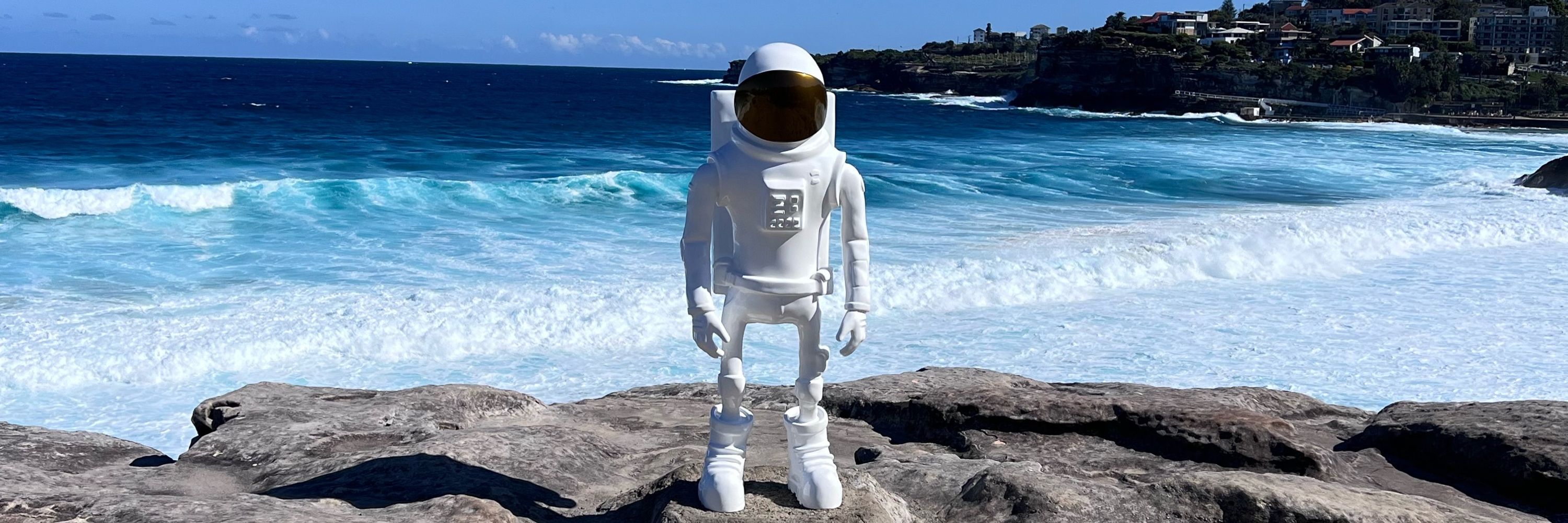
I have beefed up my profile on here adding a few pics from the always fun Sculpture by the Sea 2024 sculpturebythesea.com/bondi/ - here are a few more I liked!


December 16, 2024 at 1:21 AM
I have beefed up my profile on here adding a few pics from the always fun Sculpture by the Sea 2024 sculpturebythesea.com/bondi/ - here are a few more I liked!
An article I co-wrote in 2024 for #ESA Earth Online, lyrically "Frosty Frontiers and Salty Seas: Climate Data from ESA" 🚀🌍❄️🌊
earth.esa.int/eogateway/eo...
#satellites 🛰️ #space 🌌 #earth 🌍 #Altimeters #Climate 🌡️ #CryoSat #Cryosphere ❄️ #Glaciers 🗻 #Groundwater 💧 #Oceans 🌊 #SIRAL #SMOS #SoilMoisture 🌱
earth.esa.int/eogateway/eo...
#satellites 🛰️ #space 🌌 #earth 🌍 #Altimeters #Climate 🌡️ #CryoSat #Cryosphere ❄️ #Glaciers 🗻 #Groundwater 💧 #Oceans 🌊 #SIRAL #SMOS #SoilMoisture 🌱
Frosty Frontiers and Salty Seas: Climate Data from ESA - Earth Online
Oceans cover over 70% of Earth's surface, and their vastness means they play a crucial role in regulating the planet's climate.
earth.esa.int
December 16, 2024 at 1:11 AM
An article I co-wrote in 2024 for #ESA Earth Online, lyrically "Frosty Frontiers and Salty Seas: Climate Data from ESA" 🚀🌍❄️🌊
earth.esa.int/eogateway/eo...
#satellites 🛰️ #space 🌌 #earth 🌍 #Altimeters #Climate 🌡️ #CryoSat #Cryosphere ❄️ #Glaciers 🗻 #Groundwater 💧 #Oceans 🌊 #SIRAL #SMOS #SoilMoisture 🌱
earth.esa.int/eogateway/eo...
#satellites 🛰️ #space 🌌 #earth 🌍 #Altimeters #Climate 🌡️ #CryoSat #Cryosphere ❄️ #Glaciers 🗻 #Groundwater 💧 #Oceans 🌊 #SIRAL #SMOS #SoilMoisture 🌱
Sharing an article I co-wrote in 2024 for #ESA Earth Online on "Agriculture and Space: What Capabilities Can Satellites Bring?" earth.esa.int/eogateway/eo... #satellites #space #earth #agriculture #CryoSat #Envisat #ERS #PROBA-V #Sentinel-2 #Sentinel-3 #SMOS #SPOT #WorldView

Agriculture and Space: What Capabilities Can Satellites Bring? - Earth Online
Satellites enable the digital capture of vast and diverse agricultural data, which are essential for modern farming. By providing a comprehensive view of Earth's surface, satellites contribute invalua...
earth.esa.int
December 16, 2024 at 1:06 AM
Sharing an article I co-wrote in 2024 for #ESA Earth Online on "Agriculture and Space: What Capabilities Can Satellites Bring?" earth.esa.int/eogateway/eo... #satellites #space #earth #agriculture #CryoSat #Envisat #ERS #PROBA-V #Sentinel-2 #Sentinel-3 #SMOS #SPOT #WorldView
Reposted by George Dyke

A focused national purpose achieved a lot in the 1960s. Today's Artemis timeline shifts, April 2026 for Artemis II's crewed lunar flyby and mid-2027 for Artemis III's Moon landing.
Public understanding and support of lunar return has never been more vital.
#Artemis #SpaceRace
Public understanding and support of lunar return has never been more vital.
#Artemis #SpaceRace

NASA Shares Orion Heat Shield Findings, Updates Artemis Moon Missions - NASA
Lee esta historia en español aquí.
www.nasa.gov
December 6, 2024 at 5:33 AM
A focused national purpose achieved a lot in the 1960s. Today's Artemis timeline shifts, April 2026 for Artemis II's crewed lunar flyby and mid-2027 for Artemis III's Moon landing.
Public understanding and support of lunar return has never been more vital.
#Artemis #SpaceRace
Public understanding and support of lunar return has never been more vital.
#Artemis #SpaceRace
Reposted by George Dyke
We use satellite data to map Canada's forests. 🛰️🌲
National maps represent forest status and trends. Peer reviewed methods & accuracy statements.
#landcover #biomass #wildfire #Landsat #Sentinel2
Access open data here:
opendata.nfis.org/mapserver/nf...
Info/pubs: www.researchgate.net/publication/...
National maps represent forest status and trends. Peer reviewed methods & accuracy statements.
#landcover #biomass #wildfire #Landsat #Sentinel2
Access open data here:
opendata.nfis.org/mapserver/nf...
Info/pubs: www.researchgate.net/publication/...

November 20, 2024 at 8:25 PM
We use satellite data to map Canada's forests. 🛰️🌲
National maps represent forest status and trends. Peer reviewed methods & accuracy statements.
#landcover #biomass #wildfire #Landsat #Sentinel2
Access open data here:
opendata.nfis.org/mapserver/nf...
Info/pubs: www.researchgate.net/publication/...
National maps represent forest status and trends. Peer reviewed methods & accuracy statements.
#landcover #biomass #wildfire #Landsat #Sentinel2
Access open data here:
opendata.nfis.org/mapserver/nf...
Info/pubs: www.researchgate.net/publication/...
Reposted by George Dyke
Really exciting to see such so many familiar #ScienceTwitter faces appearing here! 🎉
Reintroduction time: I'm a coastal Earth Observation scientist from Canberra, Australia - my work involves mapping coastal change from space using petabytes of open satellite data! 🛰️🌊🧑🔬
Reintroduction time: I'm a coastal Earth Observation scientist from Canberra, Australia - my work involves mapping coastal change from space using petabytes of open satellite data! 🛰️🌊🧑🔬


November 10, 2024 at 3:46 AM
Really exciting to see such so many familiar #ScienceTwitter faces appearing here! 🎉
Reintroduction time: I'm a coastal Earth Observation scientist from Canberra, Australia - my work involves mapping coastal change from space using petabytes of open satellite data! 🛰️🌊🧑🔬
Reintroduction time: I'm a coastal Earth Observation scientist from Canberra, Australia - my work involves mapping coastal change from space using petabytes of open satellite data! 🛰️🌊🧑🔬