


ApexRMS Ecology
@apexrms.bsky.social
Ecological forecasting. Redefined.
A team of scientists and software developers focused on increasing the accessibility of ecological models to decision makers.
🧪 reproducibility | 🔥wildfire | 🌲carbon | 🐛 conservation
A team of scientists and software developers focused on increasing the accessibility of ecological models to decision makers.
🧪 reproducibility | 🔥wildfire | 🌲carbon | 🐛 conservation
🧪🌎 Last week, ApexRMS team members hosted a fantastic workshop at Trent U exploring a new SyncroSim package that brings the power of prioritizr into systematic conservation planning.

November 11, 2025 at 5:33 PM
🧪🌎 Last week, ApexRMS team members hosted a fantastic workshop at Trent U exploring a new SyncroSim package that brings the power of prioritizr into systematic conservation planning.
🧪🌎 SyncroSim modeling is coming to your browser.
The new Tables feature in #SyncroSim Cloud is coming soon! View & explore your model datasheets online, no software install needed.
The new Tables feature in #SyncroSim Cloud is coming soon! View & explore your model datasheets online, no software install needed.

November 7, 2025 at 6:57 PM
🧪🌎 SyncroSim modeling is coming to your browser.
The new Tables feature in #SyncroSim Cloud is coming soon! View & explore your model datasheets online, no software install needed.
The new Tables feature in #SyncroSim Cloud is coming soon! View & explore your model datasheets online, no software install needed.
Reposted by ApexRMS Ecology

How do windstorms affect forests in Europe?
In the latest addition to our Key Questions on Forests series, @drtomlocatelli.bsky.social from @forestresearchuk.bsky.social explores the complex impacts of windstorms on forests.
🔗 efi.int/forestquesti...
In the latest addition to our Key Questions on Forests series, @drtomlocatelli.bsky.social from @forestresearchuk.bsky.social explores the complex impacts of windstorms on forests.
🔗 efi.int/forestquesti...

October 30, 2025 at 7:53 AM
How do windstorms affect forests in Europe?
In the latest addition to our Key Questions on Forests series, @drtomlocatelli.bsky.social from @forestresearchuk.bsky.social explores the complex impacts of windstorms on forests.
🔗 efi.int/forestquesti...
In the latest addition to our Key Questions on Forests series, @drtomlocatelli.bsky.social from @forestresearchuk.bsky.social explores the complex impacts of windstorms on forests.
🔗 efi.int/forestquesti...
We’re hiring a Quantitative Ecologist (Internship)!
ApexRMS is looking for an early-career ecologist who’s passionate about using data, models, and code to understand how ecosystems change including wildfire risk, carbon dynamics, species conservation, and land use.
ApexRMS is looking for an early-career ecologist who’s passionate about using data, models, and code to understand how ecosystems change including wildfire risk, carbon dynamics, species conservation, and land use.
October 30, 2025 at 5:28 PM
We’re hiring a Quantitative Ecologist (Internship)!
ApexRMS is looking for an early-career ecologist who’s passionate about using data, models, and code to understand how ecosystems change including wildfire risk, carbon dynamics, species conservation, and land use.
ApexRMS is looking for an early-career ecologist who’s passionate about using data, models, and code to understand how ecosystems change including wildfire risk, carbon dynamics, species conservation, and land use.
🧪🌎 Want to boost your wildfire modeling skills?
We’ve got a few spots left for our BurnP3+ training course, happening Nov 12–14 at UBC Okanagan in Kelowna!
We’ve got a few spots left for our BurnP3+ training course, happening Nov 12–14 at UBC Okanagan in Kelowna!
October 17, 2025 at 2:51 PM
🧪🌎 Want to boost your wildfire modeling skills?
We’ve got a few spots left for our BurnP3+ training course, happening Nov 12–14 at UBC Okanagan in Kelowna!
We’ve got a few spots left for our BurnP3+ training course, happening Nov 12–14 at UBC Okanagan in Kelowna!
🧪🌎 This summer, we kicked off a new collab with @csiro.bsky.social’s Ecological Knowledge System team, supporting Australia’s emerging Nature Repair Market, a voluntary biodiversity credit system rooted in science.
October 3, 2025 at 3:08 PM
🧪🌎 This summer, we kicked off a new collab with @csiro.bsky.social’s Ecological Knowledge System team, supporting Australia’s emerging Nature Repair Market, a voluntary biodiversity credit system rooted in science.
Are you a biologist or environmental professional looking to turn imagery into insights?
Join us Nov 5th, 1–4 PM EST for the first-ever ecoClassify workshop, co-hosted by @westernu.ca and ApexRMS. Learn to classify satellite/UAV/DSLR imagery using transparent, reproducible workflows in #SyncroSim.
Join us Nov 5th, 1–4 PM EST for the first-ever ecoClassify workshop, co-hosted by @westernu.ca and ApexRMS. Learn to classify satellite/UAV/DSLR imagery using transparent, reproducible workflows in #SyncroSim.
September 26, 2025 at 5:34 PM
Are you a biologist or environmental professional looking to turn imagery into insights?
Join us Nov 5th, 1–4 PM EST for the first-ever ecoClassify workshop, co-hosted by @westernu.ca and ApexRMS. Learn to classify satellite/UAV/DSLR imagery using transparent, reproducible workflows in #SyncroSim.
Join us Nov 5th, 1–4 PM EST for the first-ever ecoClassify workshop, co-hosted by @westernu.ca and ApexRMS. Learn to classify satellite/UAV/DSLR imagery using transparent, reproducible workflows in #SyncroSim.
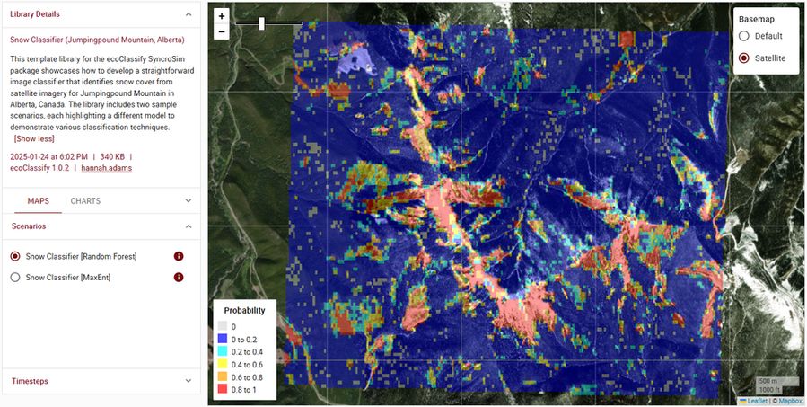
🧪🌎 Our latest #SyncroSim package is here!
EcoClassify helps you turn raw aerial imagery into classified maps using machine learning, no coding needed. It's all about making image classification for ecology and remote sensing easier and faster.
EcoClassify helps you turn raw aerial imagery into classified maps using machine learning, no coding needed. It's all about making image classification for ecology and remote sensing easier and faster.

September 19, 2025 at 6:32 PM
🧪🌎 Our latest #SyncroSim package is here!
EcoClassify helps you turn raw aerial imagery into classified maps using machine learning, no coding needed. It's all about making image classification for ecology and remote sensing easier and faster.
EcoClassify helps you turn raw aerial imagery into classified maps using machine learning, no coding needed. It's all about making image classification for ecology and remote sensing easier and faster.
🧪🌎 Natural resource management, powered by science-based modeling.
We’re kicking off a new series spotlighting the impactful projects we lead at ApexRMS — starting with our featured Landscape Change projects.
We’re kicking off a new series spotlighting the impactful projects we lead at ApexRMS — starting with our featured Landscape Change projects.
September 12, 2025 at 2:19 PM
🧪🌎 Natural resource management, powered by science-based modeling.
We’re kicking off a new series spotlighting the impactful projects we lead at ApexRMS — starting with our featured Landscape Change projects.
We’re kicking off a new series spotlighting the impactful projects we lead at ApexRMS — starting with our featured Landscape Change projects.
🌎🧪 Not every insight needs a new model—sometimes, you just need a new way to see the one you’ve already built.
With side-by-side map comparison in #SyncroSim Cloud, you can now view two model outputs next to each other and spot key differences across space, time, and scenarios.
With side-by-side map comparison in #SyncroSim Cloud, you can now view two model outputs next to each other and spot key differences across space, time, and scenarios.
September 5, 2025 at 2:57 PM
🌎🧪 Not every insight needs a new model—sometimes, you just need a new way to see the one you’ve already built.
With side-by-side map comparison in #SyncroSim Cloud, you can now view two model outputs next to each other and spot key differences across space, time, and scenarios.
With side-by-side map comparison in #SyncroSim Cloud, you can now view two model outputs next to each other and spot key differences across space, time, and scenarios.
🌎 Apex is making connections across the globe!
Our President & Systems Ecologist Colin Daniel just wrapped up a tour across Australia strengthening international collaborations involving fire, carbon, and landscape change modeling 🧪
Our President & Systems Ecologist Colin Daniel just wrapped up a tour across Australia strengthening international collaborations involving fire, carbon, and landscape change modeling 🧪

August 28, 2025 at 1:47 PM
🌎 Apex is making connections across the globe!
Our President & Systems Ecologist Colin Daniel just wrapped up a tour across Australia strengthening international collaborations involving fire, carbon, and landscape change modeling 🧪
Our President & Systems Ecologist Colin Daniel just wrapped up a tour across Australia strengthening international collaborations involving fire, carbon, and landscape change modeling 🧪
🌎 🧪 Earlier this summer, our team joined Swan River First Nation (SRFN) in Kinuso, AB, for a 2-day workshop on wildfire risk 🔥 Co-led with Todd Bailey (SRFN) & Trevor Wiens (Apropos Information Systems), we worked on plans for a decision-support tool to forecast wildfire risk across SRFN territory.

August 15, 2025 at 6:19 PM
🌎 🧪 Earlier this summer, our team joined Swan River First Nation (SRFN) in Kinuso, AB, for a 2-day workshop on wildfire risk 🔥 Co-led with Todd Bailey (SRFN) & Trevor Wiens (Apropos Information Systems), we worked on plans for a decision-support tool to forecast wildfire risk across SRFN territory.
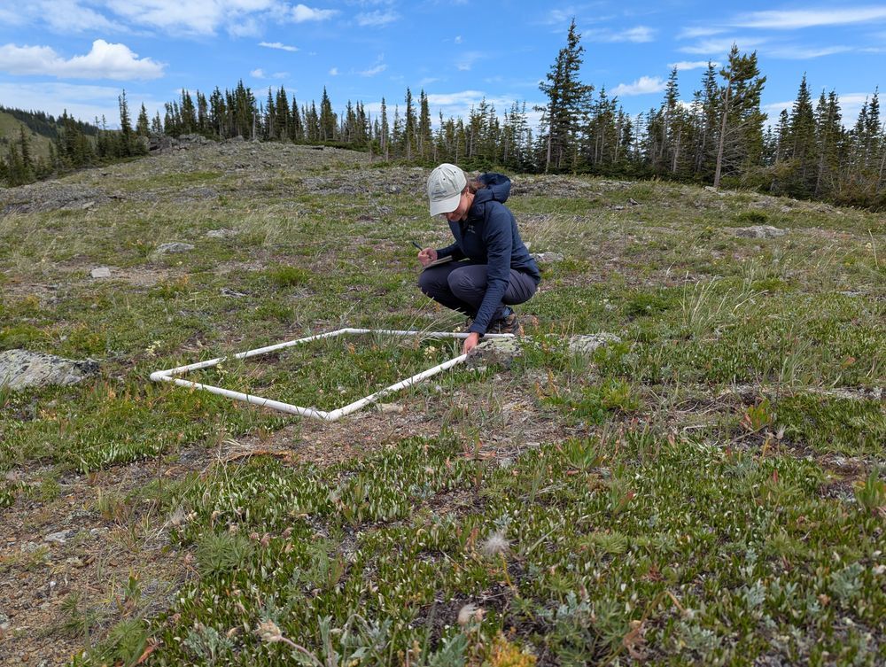
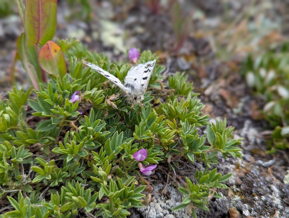
Celebrating 30 years of alpine science in the Rockies 🌎 🧪
This July, our teammates @afilazzola.bsky.social and Hannah Adams joined researchers in Alberta’s Kananaskis Country to help monitor an alpine butterfly and its host plant—a project that’s been running since 1995.
This July, our teammates @afilazzola.bsky.social and Hannah Adams joined researchers in Alberta’s Kananaskis Country to help monitor an alpine butterfly and its host plant—a project that’s been running since 1995.
August 8, 2025 at 3:28 PM
Celebrating 30 years of alpine science in the Rockies 🌎 🧪
This July, our teammates @afilazzola.bsky.social and Hannah Adams joined researchers in Alberta’s Kananaskis Country to help monitor an alpine butterfly and its host plant—a project that’s been running since 1995.
This July, our teammates @afilazzola.bsky.social and Hannah Adams joined researchers in Alberta’s Kananaskis Country to help monitor an alpine butterfly and its host plant—a project that’s been running since 1995.
The #SyncroSim Support page just got a major upgrade with the launch of our new Help Center.
Our new Help Center is your all-in-one destination for:
➡️ SyncroSim documentation
➡️ Forum access (browse or post questions)
➡️ Latest blog updates
➡️ Support requests
Our new Help Center is your all-in-one destination for:
➡️ SyncroSim documentation
➡️ Forum access (browse or post questions)
➡️ Latest blog updates
➡️ Support requests
July 31, 2025 at 2:54 PM
The #SyncroSim Support page just got a major upgrade with the launch of our new Help Center.
Our new Help Center is your all-in-one destination for:
➡️ SyncroSim documentation
➡️ Forum access (browse or post questions)
➡️ Latest blog updates
➡️ Support requests
Our new Help Center is your all-in-one destination for:
➡️ SyncroSim documentation
➡️ Forum access (browse or post questions)
➡️ Latest blog updates
➡️ Support requests
🌎🧪 Canada’s 2024 wildfire season is already on track to be one of the worst—and we’re only halfway through the year. With wildfire risk intensifying, Canada just launched the $11.7M Wildfire Resilience Consortium—a huge investment into wildfire research and mitigation efforts.
July 25, 2025 at 2:44 PM
🌎🧪 Canada’s 2024 wildfire season is already on track to be one of the worst—and we’re only halfway through the year. With wildfire risk intensifying, Canada just launched the $11.7M Wildfire Resilience Consortium—a huge investment into wildfire research and mitigation efforts.
🧪 New BurnP3+ training events announced for Fall 2025! 🌎
Following the success of our sold-out spring course, we're excited to offer two new opportunities to learn about wildfire risk modeling using BurnP3+, our #SyncroSim package for simulating burn probability.
Following the success of our sold-out spring course, we're excited to offer two new opportunities to learn about wildfire risk modeling using BurnP3+, our #SyncroSim package for simulating burn probability.
July 10, 2025 at 7:34 PM
🧪 New BurnP3+ training events announced for Fall 2025! 🌎
Following the success of our sold-out spring course, we're excited to offer two new opportunities to learn about wildfire risk modeling using BurnP3+, our #SyncroSim package for simulating burn probability.
Following the success of our sold-out spring course, we're excited to offer two new opportunities to learn about wildfire risk modeling using BurnP3+, our #SyncroSim package for simulating burn probability.
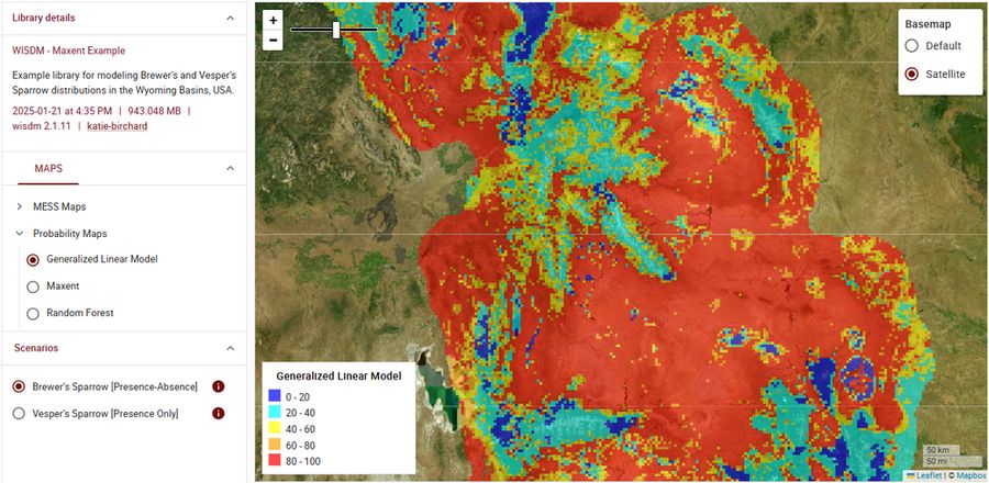
🧪 Our next #SyncroSim package highlight is WISDM—the Workbench for Integrated Species Distribution Modeling 🌎
WISDM is an open-source tool that brings modern species distribution modeling (SDM) workflows into the SyncroSim framework, turning raw data into informative maps faster than ever before.
WISDM is an open-source tool that brings modern species distribution modeling (SDM) workflows into the SyncroSim framework, turning raw data into informative maps faster than ever before.
July 4, 2025 at 6:21 PM
🧪 Our next #SyncroSim package highlight is WISDM—the Workbench for Integrated Species Distribution Modeling 🌎
WISDM is an open-source tool that brings modern species distribution modeling (SDM) workflows into the SyncroSim framework, turning raw data into informative maps faster than ever before.
WISDM is an open-source tool that brings modern species distribution modeling (SDM) workflows into the SyncroSim framework, turning raw data into informative maps faster than ever before.
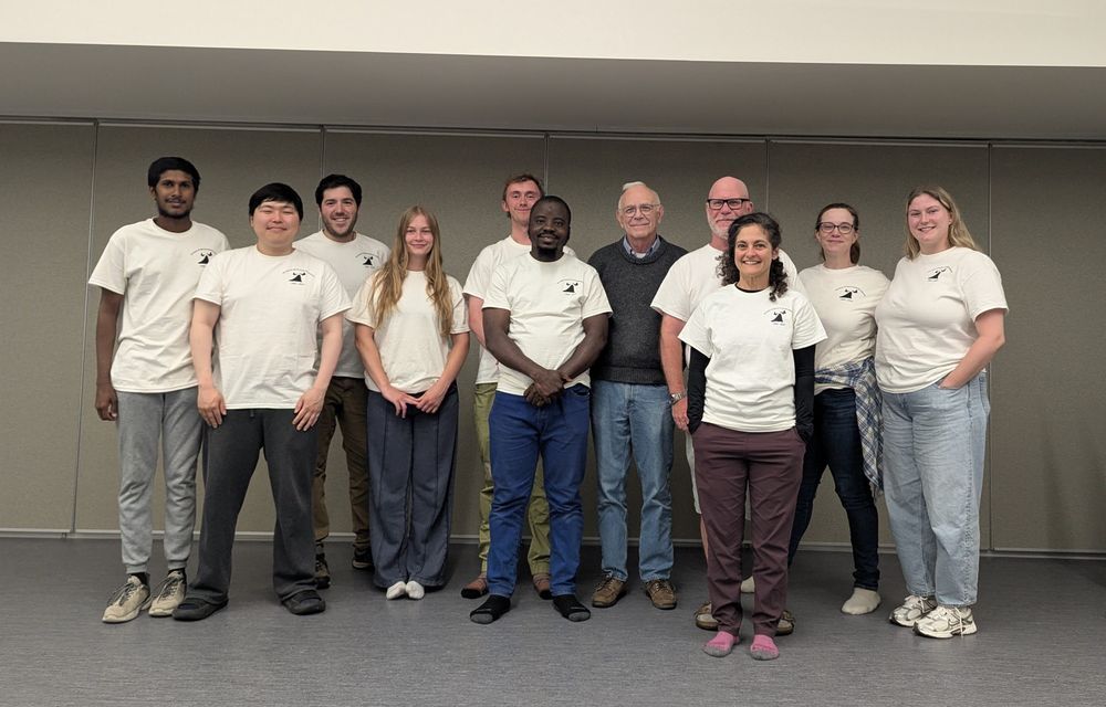
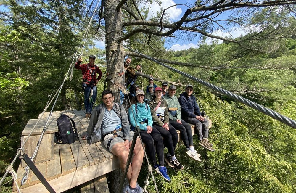
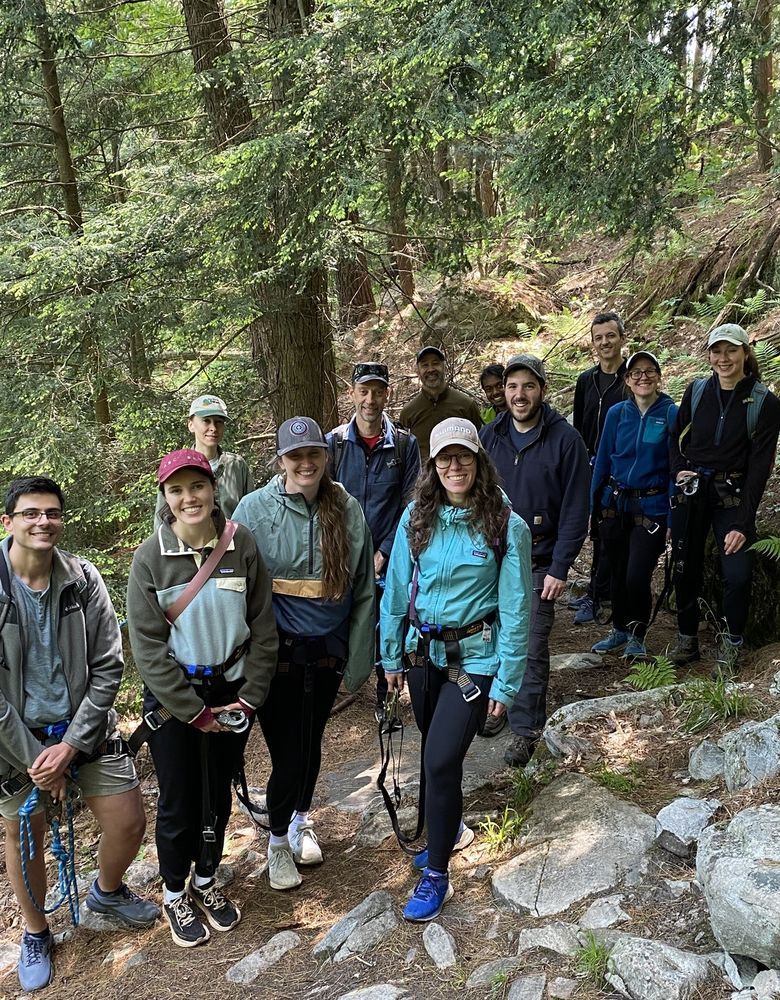
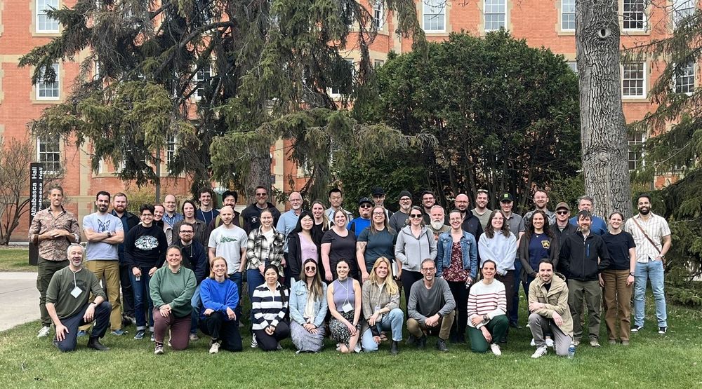
Last week our team unplugged from screens and stepped into the forest as we gathered in the Haliburton Highlands for our annual in-person staff retreat 🌎
June 20, 2025 at 1:07 PM
Last week our team unplugged from screens and stepped into the forest as we gathered in the Haliburton Highlands for our annual in-person staff retreat 🌎
🧪 AI is coming to SyncroSim!
We're working on ecoClassify — a new #SyncroSim package led by our team members, Hannah Adams and @afilazzola.bsky.social, that brings image classification into your workflows 🌎
We're working on ecoClassify — a new #SyncroSim package led by our team members, Hannah Adams and @afilazzola.bsky.social, that brings image classification into your workflows 🌎
May 16, 2025 at 2:22 PM
🧪 AI is coming to SyncroSim!
We're working on ecoClassify — a new #SyncroSim package led by our team members, Hannah Adams and @afilazzola.bsky.social, that brings image classification into your workflows 🌎
We're working on ecoClassify — a new #SyncroSim package led by our team members, Hannah Adams and @afilazzola.bsky.social, that brings image classification into your workflows 🌎
Another successful BurnP3+ workshop is in the books 🔥
Last week, we partnered with NRCan’s Canadian Forest Service to deliver an in-person training workshop at the @ualberta.bsky.social, guiding participants through wildfire hazard modeling using the BurnP3+ package for #SyncroSim 🧪 🌎
Last week, we partnered with NRCan’s Canadian Forest Service to deliver an in-person training workshop at the @ualberta.bsky.social, guiding participants through wildfire hazard modeling using the BurnP3+ package for #SyncroSim 🧪 🌎
May 7, 2025 at 1:52 PM
Another successful BurnP3+ workshop is in the books 🔥
Last week, we partnered with NRCan’s Canadian Forest Service to deliver an in-person training workshop at the @ualberta.bsky.social, guiding participants through wildfire hazard modeling using the BurnP3+ package for #SyncroSim 🧪 🌎
Last week, we partnered with NRCan’s Canadian Forest Service to deliver an in-person training workshop at the @ualberta.bsky.social, guiding participants through wildfire hazard modeling using the BurnP3+ package for #SyncroSim 🧪 🌎
🧪 We’re excited to unveil BurnP3+FireSTARR — the latest addition to our suite of wildfire 🔥 modeling tools for #SyncroSim 🌎

April 28, 2025 at 7:58 PM
🧪 We’re excited to unveil BurnP3+FireSTARR — the latest addition to our suite of wildfire 🔥 modeling tools for #SyncroSim 🌎
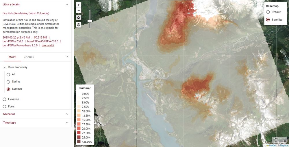
🌎 Next up in our package spotlight series is BurnP3+ 🔥, an open-source #SyncroSim package for simulating wildfire risk across landscapes 🧪

April 25, 2025 at 4:00 PM
🌎 Next up in our package spotlight series is BurnP3+ 🔥, an open-source #SyncroSim package for simulating wildfire risk across landscapes 🧪
We’re starting a new series to highlight the full range of #SyncroSim packages, starting with ST-Sim—the package for creating simulation models of landscape change 🌎 🧪

April 11, 2025 at 1:51 PM
We’re starting a new series to highlight the full range of #SyncroSim packages, starting with ST-Sim—the package for creating simulation models of landscape change 🌎 🧪
🌎 We’re excited to announce the launch of prioritizr SyncroSim, a new SyncroSim package that makes systematic conservation planning more accessible, flexible, and reproducible. 🧪
March 31, 2025 at 5:52 PM
🌎 We’re excited to announce the launch of prioritizr SyncroSim, a new SyncroSim package that makes systematic conservation planning more accessible, flexible, and reproducible. 🧪
🧪Earlier this month, team member Leonardo Frid visited the communities of Williams Lake and Clinton, BC to participate in landscape planning meetings with rightsholders from Williams Lake First Nation (WLFN) and other Indigenous communities, and land managers from the BC government and forest sector

March 21, 2025 at 1:13 PM
🧪Earlier this month, team member Leonardo Frid visited the communities of Williams Lake and Clinton, BC to participate in landscape planning meetings with rightsholders from Williams Lake First Nation (WLFN) and other Indigenous communities, and land managers from the BC government and forest sector