banner
youstorm.bsky.social
@youstorm.bsky.social
120 followers 83 following 300 posts
Weather⛈️and climate🌞🌍 community, all welcome at➡http://discord.gg/juGNGmWGjv , and videos➡ http://youtube.com/youstorm maintained by Chris Chambers and the YMS🐒👔.
Posts Media Videos Starter Packs
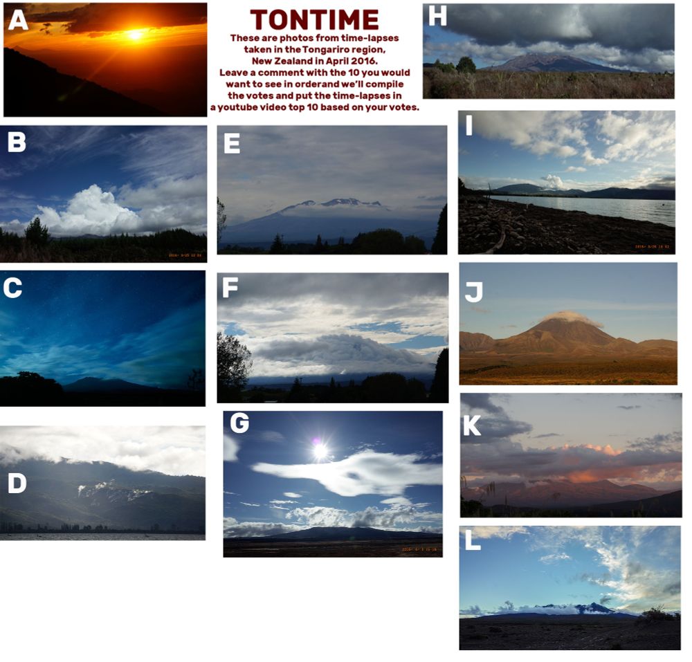
These are pictures from time-lapses as part of #TONTIME in Tongariro, New Zealand. Please leave a comment listing letters of ten ones you like in order of preference. The votes will be tallied into a top ten time-lapse countdown video in 4K on youtube later.
Many #bushfires continued to burn today over Cape Yorke Peninsula, northern #Queensland, Australia seen by Himawari-9. #bushfire #wildfires
In today's video we take a look at the September catastrophic outflow #flood from a #landslide-blocked lake in eastern #Taiwan during Typhoon #Ragasa. The combined effects from 3 tropical cyclones this year contributed to this disaster. #TyphoonRagasa youtu.be/wBeSwrnv1wQ
Typhoon Ragasa outflow flood from landslide blocked lake
YouTube video by YouStorm
youtu.be
Sustained hurricane force NNW winds 67 knots gusts to 81 knots at National Museum #Bermuda #HurricaneImelda
Gusting well over hurricane force at National Museum Bermuda, sustained winds getting close, #HurricaneImelda nearby live stream webcam at the Harbour is here portbermudawebcam.com
A surge of hurricane force N winds on W side of Hurricane #Imelda expected to pass over #Bermuda between midnight and 3 am. Brief period of calm in the centre of the storm may precede this, remain in shelter as extremely rapid wind increase expected after this. #HurricaneImelda
If anything, hurricane WRF's envisioning of the #Imelda 🌀sting jet near #Bermuda (outlined below centre in last frame) on Thu has gotten more violent with over 100 kt winds in the model. Yesterday's video took a look at this here➡️ youtu.be/YZHhtW7T93M #TropicalStormImelda
Today's video takes a quick look at Tropical Storm #Imelda forecast to turn towards Bermuda with a hurricane force sting jet in models youtu.be/YZHhtW7T93M
Tropical Storm Imelda to turn towards Bermuda, sting jet in models
YouTube video by YouStorm
youtu.be
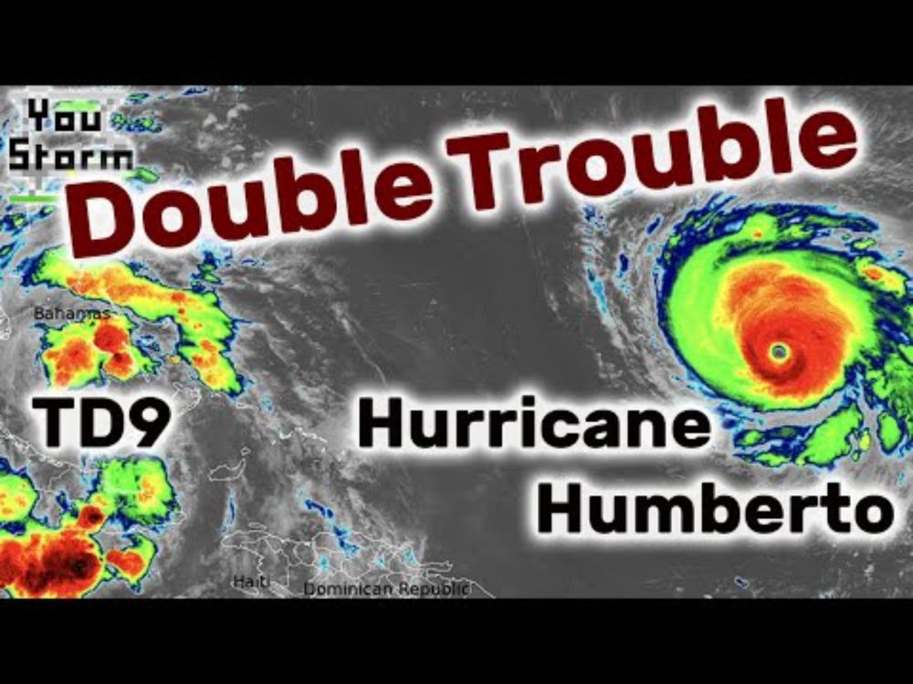
We take a look at Major Hurricane #Humberto and Tropical Depression 9 menacing The Bahamas and Cuba and posing a potential threat to the southeast USA and Bermuda through the week. #YouStormOutlook #HurricaneHumberto youtu.be/a4hvL7YxTTY
Hurricane Humberto and TD9 threaten Cuba, Bahamas, southeastern USA and Bermuda
YouTube video by YouStorm
youtu.be
Major category 4 Hurricane #Humberto at dawn this morning seen by #GOES19 #HurricaneHumberto
#Crepuscular rays earlier this evening as the change moved through seen from Mount Cooper Lookout, Bundoora, #Melbourne, #MelbourneWeather
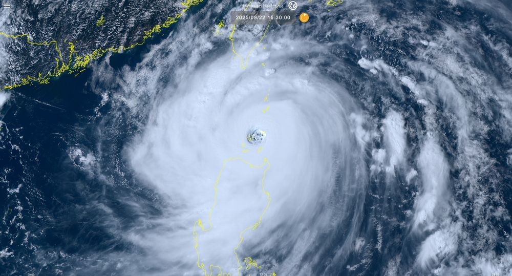
The eye of Super Typhoon #Ragasa (#NandoPH) is moving over Calayan Island, Babuyan Islands seen by #Himawari-9 #TyphoonRagasa #NandoPH
We take a quick look at spectacular twin Typhoons menacing the West Pacific right now Super Typhoon #Ragasa ( #NandoPH ) posing a major threat to the islands north of Luzon and Typhoon #Neoguri in today's #YouStormOutlook #TyphoonRagasa #SuperTyphoon youtu.be/Y_l3lMTlKEg
Twin typhoons Ragasa (Nando) and Neoguri menace the West Pacific
YouTube video by YouStorm
youtu.be
Come join us this evening 21 Sep at 9 pm Australian Eastern Time (1100 UTC 21 Sep) for the exciting premiere of the video: "Did an Atmospheric Tsunami strike Peru" youtu.be/2iOptDCYc7E
Did an Atmospheric Tsunami strike Peru?
YouTube video by YouStorm
youtu.be
#Tokyo flooding thunderstorm on 11 September seems to have involved an interesting interaction with sea breeze boundaries. Central Tokyo apparently got about 5 inches in an hour. Seen by Himawari-9
Infrared satellite imagery shows anchored thunderstorms over or near #Denpasar #Bali particularly from 1700 to 2100 UTC 9 Sep (early morning hours 10 Sep Bali time) responsible for the flash #flooding that has killed 6.
Reposted
Yesterday's view of Hurricane Kiko.

Image taken by Sentinel-3.
Hurricane #Kiko enters the Himawari satellite view, Big Island #Hawaii visible, yesterday's full video on this interesting pulsating annular major hurricane is here: youtu.be/EZlJoJf9GUw #HurricaneKiko
Major Hurricane #Kiko remains a powerful annular category 4 storm edging westward into the Central Pacific. We take a look at the forecast as it approaches #Hawaii in today's video. #HIwx #HurricaneKiko #YouStormOutlook youtu.be/EZlJoJf9GUw
Hurricane Kiko edges towards Hawaii
YouTube video by YouStorm
youtu.be
Hurricane #Kiko remains a powerful Cat 4 with 120 kt winds & annular structure seen by #GOES19 edging westward towards Central Pacific. Forecast to approach Hawaii longitudes Tue. #HIwx #HurricaneKiko
Hurricane #Kiko in the east Pacific is forecast to become a major hurricane today gradually edging westward towards distant Hawaii. Seen on 2 Sep #HurricaneKiko
The Emigrant Fire, Oregon seen by #GOES18 on 28 August, pyrocumulus and looks like pyrocumulonumbus development. #EmigrantFire #wildfires
The Garnet #wildfire California seen by #GOES18 with pyrocumulus and pyrocumulonimbus development on 27 August #GarnetFire
Storm #Erin (ex- #HurricaneErin) has become a monstrous extratropical cyclone seen today by #GOES16 #StormErin
Typhoon #Kajiki 3D tour using Suomi satellite imagery from 24 Aug 2025 while the storm was intensifying next to Hainan on route to Vietnam. #TyphoonKajiki