


Yes Data
@yesdata.bsky.social
Data-driven visuals and statistics focused on economics, health or human resources. Tools in posts, all visuals are original. 📊🗺️📸
Pinned
Yes Data
@yesdata.bsky.social
· Sep 28

☔️ Series: Rainfall (No. 6) - Japan
Japan's rainy season, tsuyu, brings heavy rainfall from June to mid-July.
🔧 Tools: Python (Rasterio, Rioxarray, Geopandas)
Japan's rainy season, tsuyu, brings heavy rainfall from June to mid-July.
🔧 Tools: Python (Rasterio, Rioxarray, Geopandas)
☔️ Series: Rainfall (No. 6) - Japan
Japan's rainy season, tsuyu, brings heavy rainfall from June to mid-July.
🔧 Tools: Python (Rasterio, Rioxarray, Geopandas)
Japan's rainy season, tsuyu, brings heavy rainfall from June to mid-July.
🔧 Tools: Python (Rasterio, Rioxarray, Geopandas)
September 28, 2025 at 5:19 PM
☔️ Series: Rainfall (No. 6) - Japan
Japan's rainy season, tsuyu, brings heavy rainfall from June to mid-July.
🔧 Tools: Python (Rasterio, Rioxarray, Geopandas)
Japan's rainy season, tsuyu, brings heavy rainfall from June to mid-July.
🔧 Tools: Python (Rasterio, Rioxarray, Geopandas)
🐔 Series: Chicken Density (No. 3) - Indonesia
Indonesia has a massive chicken population, supporting its huge poultry industry.
🔧 Tools: Python (Rasterio, Geopandas, Shapely)
Indonesia has a massive chicken population, supporting its huge poultry industry.
🔧 Tools: Python (Rasterio, Geopandas, Shapely)

September 21, 2025 at 12:59 PM
🐔 Series: Chicken Density (No. 3) - Indonesia
Indonesia has a massive chicken population, supporting its huge poultry industry.
🔧 Tools: Python (Rasterio, Geopandas, Shapely)
Indonesia has a massive chicken population, supporting its huge poultry industry.
🔧 Tools: Python (Rasterio, Geopandas, Shapely)
🚗 Series: Roads (No. 6) - India
India's 6.3 million km road network, the world's second largest, connects cities and villages, driving economic growth.
🔧 Tools: Python (Pandas, Geopandas, Matplotlib)
India's 6.3 million km road network, the world's second largest, connects cities and villages, driving economic growth.
🔧 Tools: Python (Pandas, Geopandas, Matplotlib)

September 14, 2025 at 1:10 PM
🚗 Series: Roads (No. 6) - India
India's 6.3 million km road network, the world's second largest, connects cities and villages, driving economic growth.
🔧 Tools: Python (Pandas, Geopandas, Matplotlib)
India's 6.3 million km road network, the world's second largest, connects cities and villages, driving economic growth.
🔧 Tools: Python (Pandas, Geopandas, Matplotlib)
🗺️ Series: Population Density (No. 12) - North America
North America's population density averages about 22 people per square kilometer, with significant regional variations.
🔧 Tools: Python (Rasterio, Geopandas, Shapely)
North America's population density averages about 22 people per square kilometer, with significant regional variations.
🔧 Tools: Python (Rasterio, Geopandas, Shapely)

September 7, 2025 at 4:26 PM
🗺️ Series: Population Density (No. 12) - North America
North America's population density averages about 22 people per square kilometer, with significant regional variations.
🔧 Tools: Python (Rasterio, Geopandas, Shapely)
North America's population density averages about 22 people per square kilometer, with significant regional variations.
🔧 Tools: Python (Rasterio, Geopandas, Shapely)
🚗 Series: Roads (No. 5) - Thailand
Thailand's road network connects Bangkok to regional centers with major highways, while rural roads vary in quality.
🔧 Tools: Python (Pandas, Geopandas, Matplotlib)
Thailand's road network connects Bangkok to regional centers with major highways, while rural roads vary in quality.
🔧 Tools: Python (Pandas, Geopandas, Matplotlib)

August 31, 2025 at 8:23 PM
🚗 Series: Roads (No. 5) - Thailand
Thailand's road network connects Bangkok to regional centers with major highways, while rural roads vary in quality.
🔧 Tools: Python (Pandas, Geopandas, Matplotlib)
Thailand's road network connects Bangkok to regional centers with major highways, while rural roads vary in quality.
🔧 Tools: Python (Pandas, Geopandas, Matplotlib)
🗺️ Series: Population Density (No. 11) - South America
South America's population density is starkly uneven, clustering in cities while thinning out in rural and wilderness areas.
🔧 Tools: Python (Rasterio, Geopandas, Shapely)
South America's population density is starkly uneven, clustering in cities while thinning out in rural and wilderness areas.
🔧 Tools: Python (Rasterio, Geopandas, Shapely)

August 24, 2025 at 9:57 PM
🗺️ Series: Population Density (No. 11) - South America
South America's population density is starkly uneven, clustering in cities while thinning out in rural and wilderness areas.
🔧 Tools: Python (Rasterio, Geopandas, Shapely)
South America's population density is starkly uneven, clustering in cities while thinning out in rural and wilderness areas.
🔧 Tools: Python (Rasterio, Geopandas, Shapely)
🐮 Series: Cattle Density (No. 5) - India
India has one of the highest cattle densities globally due to its large bovine population and limited agricultural land.
🔧 Tools: Python (Rasterio, Geopandas, Shapely)
India has one of the highest cattle densities globally due to its large bovine population and limited agricultural land.
🔧 Tools: Python (Rasterio, Geopandas, Shapely)

August 17, 2025 at 9:40 PM
🐮 Series: Cattle Density (No. 5) - India
India has one of the highest cattle densities globally due to its large bovine population and limited agricultural land.
🔧 Tools: Python (Rasterio, Geopandas, Shapely)
India has one of the highest cattle densities globally due to its large bovine population and limited agricultural land.
🔧 Tools: Python (Rasterio, Geopandas, Shapely)
🗺️ Series: UNESCO World Heritage Sites (No. 4) - North America
North America hosts UNESCO World Heritage Sites like Yellowstone and Chichen Itza, valued for their natural and cultural significance.
🔧 Tools: Python (Geopandas, Shapely, Contextily)
North America hosts UNESCO World Heritage Sites like Yellowstone and Chichen Itza, valued for their natural and cultural significance.
🔧 Tools: Python (Geopandas, Shapely, Contextily)

August 10, 2025 at 12:03 PM
🗺️ Series: UNESCO World Heritage Sites (No. 4) - North America
North America hosts UNESCO World Heritage Sites like Yellowstone and Chichen Itza, valued for their natural and cultural significance.
🔧 Tools: Python (Geopandas, Shapely, Contextily)
North America hosts UNESCO World Heritage Sites like Yellowstone and Chichen Itza, valued for their natural and cultural significance.
🔧 Tools: Python (Geopandas, Shapely, Contextily)
👨🌾 Series: HDI (No. 6) - North America
The Human Development Index assesses development via health, education, and living standards. The dataset contains anomalies. Values are estimates.
🔧 Tools: Python (Rasterio, Rioxarray, Shapely)
The Human Development Index assesses development via health, education, and living standards. The dataset contains anomalies. Values are estimates.
🔧 Tools: Python (Rasterio, Rioxarray, Shapely)

August 3, 2025 at 4:09 PM
👨🌾 Series: HDI (No. 6) - North America
The Human Development Index assesses development via health, education, and living standards. The dataset contains anomalies. Values are estimates.
🔧 Tools: Python (Rasterio, Rioxarray, Shapely)
The Human Development Index assesses development via health, education, and living standards. The dataset contains anomalies. Values are estimates.
🔧 Tools: Python (Rasterio, Rioxarray, Shapely)
🧯 Series: Fires (No. 4) - Japan
NASA uses its satellites to detect sources of heat on Earth.
This map shows 2023 signals. It only shows 'type 0' heat sources (presumed vegetation fire) with confidence 'h' (high).
🔧 Tools: Python (Geopandas, Shapely, Contextily)
NASA uses its satellites to detect sources of heat on Earth.
This map shows 2023 signals. It only shows 'type 0' heat sources (presumed vegetation fire) with confidence 'h' (high).
🔧 Tools: Python (Geopandas, Shapely, Contextily)

July 27, 2025 at 2:43 PM
🧯 Series: Fires (No. 4) - Japan
NASA uses its satellites to detect sources of heat on Earth.
This map shows 2023 signals. It only shows 'type 0' heat sources (presumed vegetation fire) with confidence 'h' (high).
🔧 Tools: Python (Geopandas, Shapely, Contextily)
NASA uses its satellites to detect sources of heat on Earth.
This map shows 2023 signals. It only shows 'type 0' heat sources (presumed vegetation fire) with confidence 'h' (high).
🔧 Tools: Python (Geopandas, Shapely, Contextily)
💧 Series: Rivers (No. 5) - Germany
Germany's river system, including major rivers like the Rhine, Danube, and Elbe, plays a vital role in transportation, trade, and supporting diverse ecosystems across the country.
🔧 Tools: Python (Pandas, Geopandas, Shapely)
Germany's river system, including major rivers like the Rhine, Danube, and Elbe, plays a vital role in transportation, trade, and supporting diverse ecosystems across the country.
🔧 Tools: Python (Pandas, Geopandas, Shapely)

July 20, 2025 at 11:41 AM
💧 Series: Rivers (No. 5) - Germany
Germany's river system, including major rivers like the Rhine, Danube, and Elbe, plays a vital role in transportation, trade, and supporting diverse ecosystems across the country.
🔧 Tools: Python (Pandas, Geopandas, Shapely)
Germany's river system, including major rivers like the Rhine, Danube, and Elbe, plays a vital role in transportation, trade, and supporting diverse ecosystems across the country.
🔧 Tools: Python (Pandas, Geopandas, Shapely)
☔️ Series: Rainfall (No. 5) - Africa
Africa's precipitation varies widely, with tropical regions like Central Africa receiving heavy rainfall, while vast deserts like the Sahara experience minimal precipitation.
🔧 Tools: Python (Rasterio, Rioxarray, Geopandas)
Africa's precipitation varies widely, with tropical regions like Central Africa receiving heavy rainfall, while vast deserts like the Sahara experience minimal precipitation.
🔧 Tools: Python (Rasterio, Rioxarray, Geopandas)

July 13, 2025 at 5:02 PM
☔️ Series: Rainfall (No. 5) - Africa
Africa's precipitation varies widely, with tropical regions like Central Africa receiving heavy rainfall, while vast deserts like the Sahara experience minimal precipitation.
🔧 Tools: Python (Rasterio, Rioxarray, Geopandas)
Africa's precipitation varies widely, with tropical regions like Central Africa receiving heavy rainfall, while vast deserts like the Sahara experience minimal precipitation.
🔧 Tools: Python (Rasterio, Rioxarray, Geopandas)
💧 Series: Rivers (No. 4) - Türkiye
Türkiye's river system includes major rivers like the Euphrates, Tigris, and Kızılırmak, which flow through diverse landscapes, supporting agriculture, hydropower, and ecosystems.
🔧 Tools: Python (Pandas, Geopandas, Shapely)
Türkiye's river system includes major rivers like the Euphrates, Tigris, and Kızılırmak, which flow through diverse landscapes, supporting agriculture, hydropower, and ecosystems.
🔧 Tools: Python (Pandas, Geopandas, Shapely)

July 6, 2025 at 12:09 PM
💧 Series: Rivers (No. 4) - Türkiye
Türkiye's river system includes major rivers like the Euphrates, Tigris, and Kızılırmak, which flow through diverse landscapes, supporting agriculture, hydropower, and ecosystems.
🔧 Tools: Python (Pandas, Geopandas, Shapely)
Türkiye's river system includes major rivers like the Euphrates, Tigris, and Kızılırmak, which flow through diverse landscapes, supporting agriculture, hydropower, and ecosystems.
🔧 Tools: Python (Pandas, Geopandas, Shapely)
🗺️ Series: UNESCO World Heritage Sites (No. 3) - D.R. Congo
The D.R. Congo is home to five UNESCO World Heritage Sites, including Virunga National Park, known for its diverse ecosystems and endangered mountain gorillas.
🔧 Tools: Python (Geopandas, Shapely, Contextily)
The D.R. Congo is home to five UNESCO World Heritage Sites, including Virunga National Park, known for its diverse ecosystems and endangered mountain gorillas.
🔧 Tools: Python (Geopandas, Shapely, Contextily)

June 29, 2025 at 11:04 AM
🗺️ Series: UNESCO World Heritage Sites (No. 3) - D.R. Congo
The D.R. Congo is home to five UNESCO World Heritage Sites, including Virunga National Park, known for its diverse ecosystems and endangered mountain gorillas.
🔧 Tools: Python (Geopandas, Shapely, Contextily)
The D.R. Congo is home to five UNESCO World Heritage Sites, including Virunga National Park, known for its diverse ecosystems and endangered mountain gorillas.
🔧 Tools: Python (Geopandas, Shapely, Contextily)
💧 Series: Rivers (No. 3) - Nigeria
Nigeria's Niger and Benue rivers form a vital confluence at Lokoja, driving ecosystems and culture.
🔧 Tools: Python (Pandas, Geopandas, Shapely)
Nigeria's Niger and Benue rivers form a vital confluence at Lokoja, driving ecosystems and culture.
🔧 Tools: Python (Pandas, Geopandas, Shapely)

June 22, 2025 at 4:44 PM
💧 Series: Rivers (No. 3) - Nigeria
Nigeria's Niger and Benue rivers form a vital confluence at Lokoja, driving ecosystems and culture.
🔧 Tools: Python (Pandas, Geopandas, Shapely)
Nigeria's Niger and Benue rivers form a vital confluence at Lokoja, driving ecosystems and culture.
🔧 Tools: Python (Pandas, Geopandas, Shapely)
👨🌾 Series: HDI (No. 5) - Brazil
The Human Development Index assesses development via health, education, and living standards. The dataset contains anomalies. Values are estimates.
🔧 Tools: Python (Rasterio, Rioxarray, Shapely)
The Human Development Index assesses development via health, education, and living standards. The dataset contains anomalies. Values are estimates.
🔧 Tools: Python (Rasterio, Rioxarray, Shapely)

June 15, 2025 at 10:56 AM
👨🌾 Series: HDI (No. 5) - Brazil
The Human Development Index assesses development via health, education, and living standards. The dataset contains anomalies. Values are estimates.
🔧 Tools: Python (Rasterio, Rioxarray, Shapely)
The Human Development Index assesses development via health, education, and living standards. The dataset contains anomalies. Values are estimates.
🔧 Tools: Python (Rasterio, Rioxarray, Shapely)
🚗 Series: Roads (No. 4) - Czechia
Czechia's road network is extensive and well-maintained, with a radial structure centered around Prague and ongoing modernization efforts.
🔧 Tools: Python (Pandas, Geopandas, Matplotlib)
Czechia's road network is extensive and well-maintained, with a radial structure centered around Prague and ongoing modernization efforts.
🔧 Tools: Python (Pandas, Geopandas, Matplotlib)

June 8, 2025 at 12:38 PM
🚗 Series: Roads (No. 4) - Czechia
Czechia's road network is extensive and well-maintained, with a radial structure centered around Prague and ongoing modernization efforts.
🔧 Tools: Python (Pandas, Geopandas, Matplotlib)
Czechia's road network is extensive and well-maintained, with a radial structure centered around Prague and ongoing modernization efforts.
🔧 Tools: Python (Pandas, Geopandas, Matplotlib)
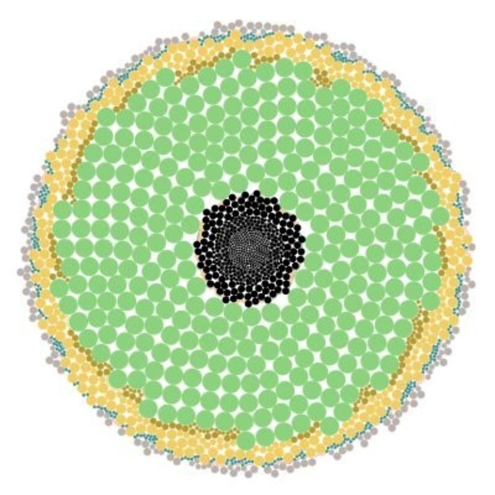
Reposted by Yes Data

Holy cow! South Asia’s cattle density really is highest in India. HT @yesdata_ (give them a follow)

June 3, 2025 at 1:07 PM
Holy cow! South Asia’s cattle density really is highest in India. HT @yesdata_ (give them a follow)
👨🌾 Series: HDI (No. 4) - Europe
The Human Development Index assesses development via health, education, and living standards. The dataset contains anomalies. Values are estimates.
🔧 Tools: Python (Rasterio, Rioxarray, Shapely)
The Human Development Index assesses development via health, education, and living standards. The dataset contains anomalies. Values are estimates.
🔧 Tools: Python (Rasterio, Rioxarray, Shapely)

June 1, 2025 at 11:23 AM
👨🌾 Series: HDI (No. 4) - Europe
The Human Development Index assesses development via health, education, and living standards. The dataset contains anomalies. Values are estimates.
🔧 Tools: Python (Rasterio, Rioxarray, Shapely)
The Human Development Index assesses development via health, education, and living standards. The dataset contains anomalies. Values are estimates.
🔧 Tools: Python (Rasterio, Rioxarray, Shapely)
🌡️ Heatmap: Consumer Price Index (April, 2025)
The consumer price index (CPI) measures inflation. It is used to estimate the average variation between two given periods in the prices of products consumed by households.
🔧 Tools: Python (Pandas, Plotly)
The consumer price index (CPI) measures inflation. It is used to estimate the average variation between two given periods in the prices of products consumed by households.
🔧 Tools: Python (Pandas, Plotly)

May 25, 2025 at 11:51 AM
🌡️ Heatmap: Consumer Price Index (April, 2025)
The consumer price index (CPI) measures inflation. It is used to estimate the average variation between two given periods in the prices of products consumed by households.
🔧 Tools: Python (Pandas, Plotly)
The consumer price index (CPI) measures inflation. It is used to estimate the average variation between two given periods in the prices of products consumed by households.
🔧 Tools: Python (Pandas, Plotly)
🍼 Streak: Monthly Birth Rate and Births by Year - France (March Edition)
For the past 33 months, France's birth rate has been lower than or equal to that of the same month last year. No males, no females, only stooges.
🔧 Tools: Python (Pandas, Plotly)
For the past 33 months, France's birth rate has been lower than or equal to that of the same month last year. No males, no females, only stooges.
🔧 Tools: Python (Pandas, Plotly)

May 18, 2025 at 3:12 PM
🍼 Streak: Monthly Birth Rate and Births by Year - France (March Edition)
For the past 33 months, France's birth rate has been lower than or equal to that of the same month last year. No males, no females, only stooges.
🔧 Tools: Python (Pandas, Plotly)
For the past 33 months, France's birth rate has been lower than or equal to that of the same month last year. No males, no females, only stooges.
🔧 Tools: Python (Pandas, Plotly)
🚗 Series: Roads (No. 3) - Middle East
The Middle East's road network varies widely, with modern highways contrasting with underdeveloped and conflict-damaged roads in countries like Yemen and Syria.
🔧 Tools: Python (Pandas, Geopandas, Matplotlib)
The Middle East's road network varies widely, with modern highways contrasting with underdeveloped and conflict-damaged roads in countries like Yemen and Syria.
🔧 Tools: Python (Pandas, Geopandas, Matplotlib)

May 11, 2025 at 11:39 AM
🚗 Series: Roads (No. 3) - Middle East
The Middle East's road network varies widely, with modern highways contrasting with underdeveloped and conflict-damaged roads in countries like Yemen and Syria.
🔧 Tools: Python (Pandas, Geopandas, Matplotlib)
The Middle East's road network varies widely, with modern highways contrasting with underdeveloped and conflict-damaged roads in countries like Yemen and Syria.
🔧 Tools: Python (Pandas, Geopandas, Matplotlib)
☔️ Series: Rainfall (No. 4) - Nigeria
Nigeria’s rainfall, 1,200 mm/year, ranges from 300 mm north to 3,000 mm south, sustaining ecosystems.
🔧 Tools: Python (Rasterio, Rioxarray, Geopandas)
Nigeria’s rainfall, 1,200 mm/year, ranges from 300 mm north to 3,000 mm south, sustaining ecosystems.
🔧 Tools: Python (Rasterio, Rioxarray, Geopandas)

May 4, 2025 at 12:27 PM
☔️ Series: Rainfall (No. 4) - Nigeria
Nigeria’s rainfall, 1,200 mm/year, ranges from 300 mm north to 3,000 mm south, sustaining ecosystems.
🔧 Tools: Python (Rasterio, Rioxarray, Geopandas)
Nigeria’s rainfall, 1,200 mm/year, ranges from 300 mm north to 3,000 mm south, sustaining ecosystems.
🔧 Tools: Python (Rasterio, Rioxarray, Geopandas)
🐮 Series: Cattle Density (No. 3) - South Asia
South Asia’s cattle density, highest in India, reflects sacred cow traditions, sustaining farming. Dense, vibrant populations foster resilient communities.
🔧 Tools: Python (Rasterio, Geopandas, Shapely)
South Asia’s cattle density, highest in India, reflects sacred cow traditions, sustaining farming. Dense, vibrant populations foster resilient communities.
🔧 Tools: Python (Rasterio, Geopandas, Shapely)

April 27, 2025 at 10:56 AM
🐮 Series: Cattle Density (No. 3) - South Asia
South Asia’s cattle density, highest in India, reflects sacred cow traditions, sustaining farming. Dense, vibrant populations foster resilient communities.
🔧 Tools: Python (Rasterio, Geopandas, Shapely)
South Asia’s cattle density, highest in India, reflects sacred cow traditions, sustaining farming. Dense, vibrant populations foster resilient communities.
🔧 Tools: Python (Rasterio, Geopandas, Shapely)
🧯 Series: Fires (No. 3) - Brazil
NASA uses its satellites to detect sources of heat on Earth.
This map shows 2023 signals. It only shows 'type 0' heat sources (presumed vegetation fire) with confidence 'h' (high).
🔧 Tools: Python (Geopandas, Shapely, Contextily)
NASA uses its satellites to detect sources of heat on Earth.
This map shows 2023 signals. It only shows 'type 0' heat sources (presumed vegetation fire) with confidence 'h' (high).
🔧 Tools: Python (Geopandas, Shapely, Contextily)

April 20, 2025 at 12:02 PM
🧯 Series: Fires (No. 3) - Brazil
NASA uses its satellites to detect sources of heat on Earth.
This map shows 2023 signals. It only shows 'type 0' heat sources (presumed vegetation fire) with confidence 'h' (high).
🔧 Tools: Python (Geopandas, Shapely, Contextily)
NASA uses its satellites to detect sources of heat on Earth.
This map shows 2023 signals. It only shows 'type 0' heat sources (presumed vegetation fire) with confidence 'h' (high).
🔧 Tools: Python (Geopandas, Shapely, Contextily)