


Texas Storm Chasers
@texasstormchasers.com
Get your local forecasts, weather articles, and video forecasts from the Texas Storm Chasers, along with interactive weather radar in TSC's Mobile App.
1050PM: Scattered showers/storms overnight through 4 AM Sunday in Texoma, North Texas, and Northeast Texas. Brief heavy rain, lightning, and small hail from stronger storms. Severe risk is DONE for Texas tonight. #TXwx
February 15, 2026 at 4:54 AM
1050PM: Scattered showers/storms overnight through 4 AM Sunday in Texoma, North Texas, and Northeast Texas. Brief heavy rain, lightning, and small hail from stronger storms. Severe risk is DONE for Texas tonight. #TXwx
⚠️ Western GALVESTON and JAMAICA BEACH are
under a TORNADO WARNING as strong rotation and winds in excess of 70 MPH move into the area. Get into shelter, away from windows in the lowest centermost room of your structure. We are live with coverage.
under a TORNADO WARNING as strong rotation and winds in excess of 70 MPH move into the area. Get into shelter, away from windows in the lowest centermost room of your structure. We are live with coverage.
February 15, 2026 at 1:21 AM
⚠️ Western GALVESTON and JAMAICA BEACH are
under a TORNADO WARNING as strong rotation and winds in excess of 70 MPH move into the area. Get into shelter, away from windows in the lowest centermost room of your structure. We are live with coverage.
under a TORNADO WARNING as strong rotation and winds in excess of 70 MPH move into the area. Get into shelter, away from windows in the lowest centermost room of your structure. We are live with coverage.
Tornado Watch in effect until 9 PM CST for much of East and Southeast Texas, including the Houston metro, the Piney Woods, and the Upper Texas Coast.
Storms will continue strengthening as they move east through the evening.
Storms will continue strengthening as they move east through the evening.

February 14, 2026 at 9:54 PM
Tornado Watch in effect until 9 PM CST for much of East and Southeast Texas, including the Houston metro, the Piney Woods, and the Upper Texas Coast.
Storms will continue strengthening as they move east through the evening.
Storms will continue strengthening as they move east through the evening.
344PM: A line of strong storms is moving east at about 40 mph from near Tyler and Gilmer toward Longview, Marshall, and Jefferson.
Wind gusts up to 60 mph are the main concern. Gusts near 60 mph were measured earlier at Tyler Pounds Field.
Wind gusts up to 60 mph are the main concern. Gusts near 60 mph were measured earlier at Tyler Pounds Field.

February 14, 2026 at 9:45 PM
344PM: A line of strong storms is moving east at about 40 mph from near Tyler and Gilmer toward Longview, Marshall, and Jefferson.
Wind gusts up to 60 mph are the main concern. Gusts near 60 mph were measured earlier at Tyler Pounds Field.
Wind gusts up to 60 mph are the main concern. Gusts near 60 mph were measured earlier at Tyler Pounds Field.
3PM Update: Storms pushing east across Texas.
Flash flooding in parts of North Texas. Severe risk increasing this evening across East & Southeast Texas with damaging winds, hail, and a low tornado threat.
Latest video:
🎥 youtu.be/IgLNkYWtuqI
Stay weather-aware.
Flash flooding in parts of North Texas. Severe risk increasing this evening across East & Southeast Texas with damaging winds, hail, and a low tornado threat.
Latest video:
🎥 youtu.be/IgLNkYWtuqI
Stay weather-aware.

Storms Intensifying Toward Houston & East Texas | 3PM Update
Storms continue moving east across Texas this afternoon.
Heavy rain has caused flash flooding in parts of North Texas, including areas near Sherman and DFW, where several inches of rain have…
youtu.be
February 14, 2026 at 9:09 PM
3PM Update: Storms pushing east across Texas.
Flash flooding in parts of North Texas. Severe risk increasing this evening across East & Southeast Texas with damaging winds, hail, and a low tornado threat.
Latest video:
🎥 youtu.be/IgLNkYWtuqI
Stay weather-aware.
Flash flooding in parts of North Texas. Severe risk increasing this evening across East & Southeast Texas with damaging winds, hail, and a low tornado threat.
Latest video:
🎥 youtu.be/IgLNkYWtuqI
Stay weather-aware.
238PM: A severe storm is moving east across central Zavala County around 40 mph, currently near La Pryor and heading toward Batesville on Highway 57.
Wind gusts up to 60 mph and hail up to quarter size are possible.
Wind gusts up to 60 mph and hail up to quarter size are possible.

February 14, 2026 at 8:38 PM
238PM: A severe storm is moving east across central Zavala County around 40 mph, currently near La Pryor and heading toward Batesville on Highway 57.
Wind gusts up to 60 mph and hail up to quarter size are possible.
Wind gusts up to 60 mph and hail up to quarter size are possible.
215PM: Line of storms pushing east across Texas this afternoon.
Flooding in parts of DFW. Stronger storms possible later in East & Southeast Texas with wind, hail, and a low tornado risk.
Latest update:
🎥 www.youtube.com/watch?v=NLQv...
Stay weather-aware.
Flooding in parts of DFW. Stronger storms possible later in East & Southeast Texas with wind, hail, and a low tornado risk.
Latest update:
🎥 www.youtube.com/watch?v=NLQv...
Stay weather-aware.

Storm Line Moving East Across Texas | 2PM Severe Update
Storms are pushing east across Texas this afternoon.
Heavy rain and flash flooding have impacted parts of DFW and North Texas, and the line continues moving into the Brazos Valley, East Texas, and…
www.youtube.com
February 14, 2026 at 8:16 PM
215PM: Line of storms pushing east across Texas this afternoon.
Flooding in parts of DFW. Stronger storms possible later in East & Southeast Texas with wind, hail, and a low tornado risk.
Latest update:
🎥 www.youtube.com/watch?v=NLQv...
Stay weather-aware.
Flooding in parts of DFW. Stronger storms possible later in East & Southeast Texas with wind, hail, and a low tornado risk.
Latest update:
🎥 www.youtube.com/watch?v=NLQv...
Stay weather-aware.
1234PM: A severe storm is moving east across southern Dallas County at about 35 mph.
Gusty winds up to 60 mph and small hail are possible as it moves from DeSoto toward Hutchins, Lancaster, Wilmer, Seagoville, and Balch Springs over the next 30 minutes.
Gusty winds up to 60 mph and small hail are possible as it moves from DeSoto toward Hutchins, Lancaster, Wilmer, Seagoville, and Balch Springs over the next 30 minutes.

February 14, 2026 at 6:34 PM
1234PM: A severe storm is moving east across southern Dallas County at about 35 mph.
Gusty winds up to 60 mph and small hail are possible as it moves from DeSoto toward Hutchins, Lancaster, Wilmer, Seagoville, and Balch Springs over the next 30 minutes.
Gusty winds up to 60 mph and small hail are possible as it moves from DeSoto toward Hutchins, Lancaster, Wilmer, Seagoville, and Balch Springs over the next 30 minutes.
Storms are moving east across Texas and will turn stronger this afternoon into the evening.
Damaging winds, hail, and a low tornado risk possible in East & Southeast Texas.
Latest update:
🎥 www.youtube.com/watch?v=yxkJ...
Stay weather-aware.
Damaging winds, hail, and a low tornado risk possible in East & Southeast Texas.
Latest update:
🎥 www.youtube.com/watch?v=yxkJ...
Stay weather-aware.
youtube.com
February 14, 2026 at 6:03 PM
Storms are moving east across Texas and will turn stronger this afternoon into the evening.
Damaging winds, hail, and a low tornado risk possible in East & Southeast Texas.
Latest update:
🎥 www.youtube.com/watch?v=yxkJ...
Stay weather-aware.
Damaging winds, hail, and a low tornado risk possible in East & Southeast Texas.
Latest update:
🎥 www.youtube.com/watch?v=yxkJ...
Stay weather-aware.
Late Saturday morning update:
Widespread rain and thunderstorms are moving northeast across North Texas, including the DFW Metroplex, and will continue through lunchtime.
Expect periods of heavy rain, lightning, small hail, and gusty winds. At this time, nothing severe is indicated.
Widespread rain and thunderstorms are moving northeast across North Texas, including the DFW Metroplex, and will continue through lunchtime.
Expect periods of heavy rain, lightning, small hail, and gusty winds. At this time, nothing severe is indicated.

February 14, 2026 at 5:07 PM
Late Saturday morning update:
Widespread rain and thunderstorms are moving northeast across North Texas, including the DFW Metroplex, and will continue through lunchtime.
Expect periods of heavy rain, lightning, small hail, and gusty winds. At this time, nothing severe is indicated.
Widespread rain and thunderstorms are moving northeast across North Texas, including the DFW Metroplex, and will continue through lunchtime.
Expect periods of heavy rain, lightning, small hail, and gusty winds. At this time, nothing severe is indicated.
Good morning, y’all. We expect storms to get rowdy later today across eastern Texas. Latest details outlining hazards and timing here in Baldy-in-Chief David Reimer’s latest Texas Weather Roundup: www.texasweatherroundup.video

Strong Storms Possible Across Eastern Texas Saturday Afternoon
Storms intensify across East and Southeast Texas Saturday afternoon, with damaging winds, hail, and a low tornado risk possible.
www.TexasWeatherRoundup.video
February 14, 2026 at 4:26 PM
Good morning, y’all. We expect storms to get rowdy later today across eastern Texas. Latest details outlining hazards and timing here in Baldy-in-Chief David Reimer’s latest Texas Weather Roundup: www.texasweatherroundup.video
845AM: Rain and storms this morning moving northeast across Big Country, Texoma, into North Texas. Heavy rain, lightning, and some small hail. DFW gets wet by lunchtime.
February 14, 2026 at 2:45 PM
845AM: Rain and storms this morning moving northeast across Big Country, Texoma, into North Texas. Heavy rain, lightning, and some small hail. DFW gets wet by lunchtime.
11PM: A loud and stormy night expected for the Concho Valley, Permian Basin, Big Country, Northwest Texas. Stronger storms with hail and gusty winds. Moving northeast into Saturday morning. #txwx
February 14, 2026 at 5:01 AM
11PM: A loud and stormy night expected for the Concho Valley, Permian Basin, Big Country, Northwest Texas. Stronger storms with hail and gusty winds. Moving northeast into Saturday morning. #txwx
1019PM: A line of strong storms is moving northeast around 50 mph from near Monahans and Gardendale toward Midland, Stanton, and Big Spring.
Some of these storms are producing wind gusts up to 60 mph and hail up to 1 inch in diameter.
Some of these storms are producing wind gusts up to 60 mph and hail up to 1 inch in diameter.

February 14, 2026 at 4:20 AM
1019PM: A line of strong storms is moving northeast around 50 mph from near Monahans and Gardendale toward Midland, Stanton, and Big Spring.
Some of these storms are producing wind gusts up to 60 mph and hail up to 1 inch in diameter.
Some of these storms are producing wind gusts up to 60 mph and hail up to 1 inch in diameter.
A Severe Thunderstorm Warning remains in effect until 8:45 PM CST for eastern Lubbock County and western Crosby County.
At 7:47 PM, a line of storms was moving east at 45 mph from near Petersburg through Slaton toward Crosbyton.
Hazards include wind gusts up to 60 mph and penny-size hail.
At 7:47 PM, a line of storms was moving east at 45 mph from near Petersburg through Slaton toward Crosbyton.
Hazards include wind gusts up to 60 mph and penny-size hail.

February 14, 2026 at 1:50 AM
A Severe Thunderstorm Warning remains in effect until 8:45 PM CST for eastern Lubbock County and western Crosby County.
At 7:47 PM, a line of storms was moving east at 45 mph from near Petersburg through Slaton toward Crosbyton.
Hazards include wind gusts up to 60 mph and penny-size hail.
At 7:47 PM, a line of storms was moving east at 45 mph from near Petersburg through Slaton toward Crosbyton.
Hazards include wind gusts up to 60 mph and penny-size hail.
Storm chances increase tonight in West Texas, and the severe threat shifts east on Saturday.
Parts of Southeast and East Texas are now under a Level 2 severe risk. The tornado threat remains low, but it is not zero.
texasstormchasers.com/weather/seve...
Parts of Southeast and East Texas are now under a Level 2 severe risk. The tornado threat remains low, but it is not zero.
texasstormchasers.com/weather/seve...

Severe Storm Risk Upgraded for Southeast and East Texas Saturday
Severe storms are possible Saturday across East and Southeast Texas, with damaging winds, hail, and a low tornado risk.
texasstormchasers.com
February 13, 2026 at 7:01 PM
Storm chances increase tonight in West Texas, and the severe threat shifts east on Saturday.
Parts of Southeast and East Texas are now under a Level 2 severe risk. The tornado threat remains low, but it is not zero.
texasstormchasers.com/weather/seve...
Parts of Southeast and East Texas are now under a Level 2 severe risk. The tornado threat remains low, but it is not zero.
texasstormchasers.com/weather/seve...
⚡️Heads up! Storms, some severe, will be making their way through Texas tomorrow evening and Saturday. Find out the latest specifics in today’s Texas Weather Roundup: www.texasweatherroundup.video

Your browser is up to date
You can use YouTube's latest features!
www.TexasWeatherRoundup.video
February 12, 2026 at 7:58 PM
⚡️Heads up! Storms, some severe, will be making their way through Texas tomorrow evening and Saturday. Find out the latest specifics in today’s Texas Weather Roundup: www.texasweatherroundup.video
Storm Chances Increase Across Texas Friday and Saturday texasstormchasers.com/forecast/tex... #TXwx

Storm Chances Increase Across Texas Friday and Saturday
Storm chances increase across Texas Friday and Saturday, with isolated severe weather possible and beneficial rainfall likely.
texasstormchasers.com
February 12, 2026 at 7:05 PM
Storm Chances Increase Across Texas Friday and Saturday texasstormchasers.com/forecast/tex... #TXwx
Texas Drought Monitor Update - Feb 10, 2026
73% of Texas is in official drought (D1+).
41% is in severe drought or worse.
17% is in extreme drought.
Worst conditions: South Texas, Hill Country, Big Bend.
What are conditions like in your area?
73% of Texas is in official drought (D1+).
41% is in severe drought or worse.
17% is in extreme drought.
Worst conditions: South Texas, Hill Country, Big Bend.
What are conditions like in your area?

February 12, 2026 at 3:32 PM
Texas Drought Monitor Update - Feb 10, 2026
73% of Texas is in official drought (D1+).
41% is in severe drought or worse.
17% is in extreme drought.
Worst conditions: South Texas, Hill Country, Big Bend.
What are conditions like in your area?
73% of Texas is in official drought (D1+).
41% is in severe drought or worse.
17% is in extreme drought.
Worst conditions: South Texas, Hill Country, Big Bend.
What are conditions like in your area?
Texas Storm Chasers is proud to serve as a Primary Sponsor of TESSA 2026.
TESSA is Texas’ annual severe weather conference, bringing together meteorologists, storm chasers, emergency managers, and weather enthusiasts for a full day of storm science, safety, and education.
TESSA is Texas’ annual severe weather conference, bringing together meteorologists, storm chasers, emergency managers, and weather enthusiasts for a full day of storm science, safety, and education.

February 12, 2026 at 12:32 AM
Texas Storm Chasers is proud to serve as a Primary Sponsor of TESSA 2026.
TESSA is Texas’ annual severe weather conference, bringing together meteorologists, storm chasers, emergency managers, and weather enthusiasts for a full day of storm science, safety, and education.
TESSA is Texas’ annual severe weather conference, bringing together meteorologists, storm chasers, emergency managers, and weather enthusiasts for a full day of storm science, safety, and education.
Just one month left of those early sunsets.
Daylight Saving Time this year will range from Sunday, March 8th to Sunday, November 1st.
Daylight Saving Time this year will range from Sunday, March 8th to Sunday, November 1st.

February 9, 2026 at 12:01 AM
Just one month left of those early sunsets.
Daylight Saving Time this year will range from Sunday, March 8th to Sunday, November 1st.
Daylight Saving Time this year will range from Sunday, March 8th to Sunday, November 1st.
It's Sunday which means it's time for a new Texas weather deep dive from Meteorologist Trey Greenwood! www.youtube.com/watch?v=4E2R...

Texas Weather This Week With Trey Greenwood | February 8-15, 2026
Meteorologist Trey Greenwood @ConvectiveChronicles breaks down what to expect in Texas weather for the week ahead.
Warm and mostly uneventful over the work week in Texas. Fire danger will be…
www.youtube.com
February 8, 2026 at 7:23 PM
It's Sunday which means it's time for a new Texas weather deep dive from Meteorologist Trey Greenwood! www.youtube.com/watch?v=4E2R...
Dense fog is ongoing across a large part of Southeast and South Texas this morning, including the Houston metro, College Station, Victoria, Corpus Christi, and down toward the Rio Grande Valley.
If you’re on the roads, slow down, use low beams, and give yourself extra space.
If you’re on the roads, slow down, use low beams, and give yourself extra space.

February 8, 2026 at 2:28 PM
Dense fog is ongoing across a large part of Southeast and South Texas this morning, including the Houston metro, College Station, Victoria, Corpus Christi, and down toward the Rio Grande Valley.
If you’re on the roads, slow down, use low beams, and give yourself extra space.
If you’re on the roads, slow down, use low beams, and give yourself extra space.
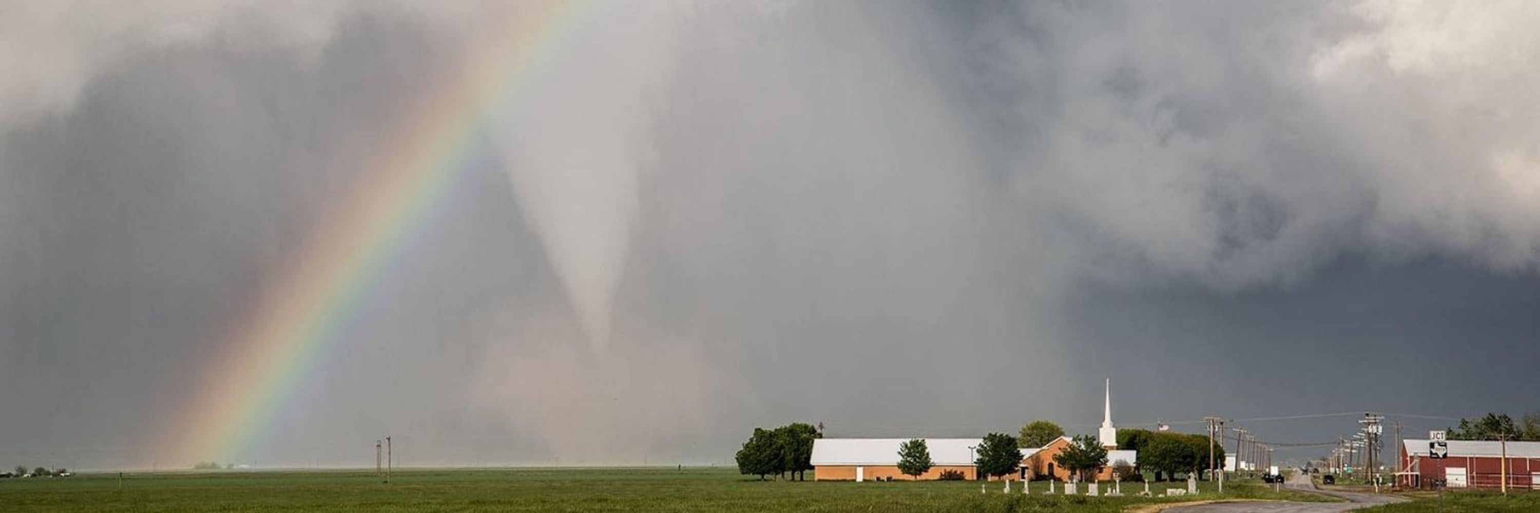
After yesterday's surprise tornado near Plum Grove in Southeast Texas, we are happy to share that this weekend's weather is looking AMAZING across Texas. Are you ready for sunshine and 70s!? youtu.be/8c2BYpspsTc?... #TXwx

Spring-Like Weekend Ahead After Today’s Cold Front
Texas is shaking off another weak cold front, and what follows is shaping up to be the best stretch of weather we’ve seen since December. Warm temperatures, dry air, and plenty of sunshine are on the…
youtu.be
February 4, 2026 at 6:40 PM
After yesterday's surprise tornado near Plum Grove in Southeast Texas, we are happy to share that this weekend's weather is looking AMAZING across Texas. Are you ready for sunshine and 70s!? youtu.be/8c2BYpspsTc?... #TXwx
