


Alka Tripathy-Lang
@dralkatrip.bsky.social
Science Communicator | Writer | Editor | Social Media Manager | Former dater of rocks | Ph.D. in Geology | Exerciser | Food lover | Parent | Partner | she/her
#AGU25 is coming up, and there's lots of neat research that'll be presented. I got to talk to some great scientists about work that pertains to sending people to the Moon and Mars for @eos.org! ⚒️🧪

Could processed astronaut poop help plants grow on the Moon and Mars? A new study presented at #AGU25 explores this and more, by @dralkatrip.bsky.social. eos.org/articles/fun...

Fungi, Fertilizer, and Feces Could Help Astronauts Grow Plants on the Moon - Eos
A new study offers tantalizing evidence that filamentous fungi extending from roots, along with treated astronaut waste, could provide sufficient scaffolding to help plants grow in planetary regolith.
eos.org
December 2, 2025 at 2:37 AM
Reposted by Alka Tripathy-Lang
As a long-time reader of @theopennotebook.bsky.social, I was happy to contribute to this article and be on the "other side" of the interview. Thank you @skylerdware.bsky.social for the opportunity. Lovely to hear how others are diversifying their work.

Many freelance journalists lean on writing-adjacent work, even outside journalism, to support their passion for reporting and writing, writes @bwfund.bsky.social early-career fellow @skylerdware.bsky.social in this story w/ @hannahseo.com, @kkdfv.bsky.social, @jtsangwrites.bsky.social, and others. 🧪

Diversifying Your Freelance Work for Stability and Joy - The Open Notebook
It’s difficult to make a living on freelance journalism alone. To support themselves and avoid burnout, some freelance science writers expand their portfolio to include work outside of written news re...
www.theopennotebook.com
November 13, 2025 at 6:24 PM
As a long-time reader of @theopennotebook.bsky.social, I was happy to contribute to this article and be on the "other side" of the interview. Thank you @skylerdware.bsky.social for the opportunity. Lovely to hear how others are diversifying their work.
😮
Full disclosure, I have not read the paper yet. I've only read the abstract and scanned the figures. ⚒️
Full disclosure, I have not read the paper yet. I've only read the abstract and scanned the figures. ⚒️
A giant Miocene landslide in the Wasatch Range, Utah - Geosphere paper. pubs.geoscienceworld.org/gsa/geospher...

October 31, 2025 at 10:59 PM
😮
Full disclosure, I have not read the paper yet. I've only read the abstract and scanned the figures. ⚒️
Full disclosure, I have not read the paper yet. I've only read the abstract and scanned the figures. ⚒️
Double, double, toil and trouble... oh wait no. Bubbles, spatter, lava and tremor, there we go! For @earthscope.org, I dove into a paper that used drone footage from Geldingadalir's lava lake + seismic data to explore the source of volcanic tremor. ⚒️🧪
www.earthscope.org/news/bubbles...
www.earthscope.org/news/bubbles...

Bubbles, spatter, lava, and tremor linked in Icelandic eruption of Geldingadalir | EarthScope Consortium
Comparing seismic data and drone imagery near a churning lava lake shows the signal of bursting bubbles.
www.earthscope.org
October 22, 2025 at 6:23 PM
Double, double, toil and trouble... oh wait no. Bubbles, spatter, lava and tremor, there we go! For @earthscope.org, I dove into a paper that used drone footage from Geldingadalir's lava lake + seismic data to explore the source of volcanic tremor. ⚒️🧪
www.earthscope.org/news/bubbles...
www.earthscope.org/news/bubbles...
Reposted by Alka Tripathy-Lang
Right on schedule! More than 10,000 tiny tremors (not felt) have rolled through #PugetSound and southern #VancouverIsland over the past 30 days. This is Episodic Tremor and Slip (ETS) and occurs here every 12-16 months:
www.earthquakescanada.nrcan.gc.ca/pprs-pprp/pu...
Also - it is #ShakeOut day!
⚒️🧪
www.earthquakescanada.nrcan.gc.ca/pprs-pprp/pu...
Also - it is #ShakeOut day!
⚒️🧪

October 16, 2025 at 2:25 PM
Right on schedule! More than 10,000 tiny tremors (not felt) have rolled through #PugetSound and southern #VancouverIsland over the past 30 days. This is Episodic Tremor and Slip (ETS) and occurs here every 12-16 months:
www.earthquakescanada.nrcan.gc.ca/pprs-pprp/pu...
Also - it is #ShakeOut day!
⚒️🧪
www.earthquakescanada.nrcan.gc.ca/pprs-pprp/pu...
Also - it is #ShakeOut day!
⚒️🧪
Reposted by Alka Tripathy-Lang
Oxidised (left) and unoxidised 3.2 billion year old banded iron formation. These samples are from drill core and were only a couple of meters apart. #geology #paleontology

October 15, 2025 at 7:34 PM
Oxidised (left) and unoxidised 3.2 billion year old banded iron formation. These samples are from drill core and were only a couple of meters apart. #geology #paleontology
Reposted by Alka Tripathy-Lang
"we propose this Potassium-40 deficit represents primitive proto-Earth mantle domains that largely escaped mantle mixing after the [moon-forming] giant impact and exist in the present-day deep mantle, contributing to some modern hotspot volcanism" ⚒️
www.nature.com/articles/s41...
www.nature.com/articles/s41...

Potassium-40 isotopic evidence for an extant pre-giant-impact component of Earth’s mantle - Nature Geoscience
Some mafic rocks have a ⁴⁰K/³⁹K ratio lower than all other terrestrial samples, according to isotopic composition analyses, suggesting parts of Earth’s mantle have retained their composition prior to ...
www.nature.com
October 14, 2025 at 10:48 PM
"we propose this Potassium-40 deficit represents primitive proto-Earth mantle domains that largely escaped mantle mixing after the [moon-forming] giant impact and exist in the present-day deep mantle, contributing to some modern hotspot volcanism" ⚒️
www.nature.com/articles/s41...
www.nature.com/articles/s41...
My latest for @earthscope.org combines Silurian reef systems with seismology! The highlighted research looks at how to parse noisy seismic data from a single station in the Chicago area. ⚒️🧪
www.earthscope.org/news/chicago...
www.earthscope.org/news/chicago...

Chicago’s seismicity captured by single seismic station | EarthScope Consortium
Model catalogs quarry blasts, heavy machinery noise, and other anthropogenic signals that can muddy seismic data.
www.earthscope.org
October 15, 2025 at 4:42 PM
My latest for @earthscope.org combines Silurian reef systems with seismology! The highlighted research looks at how to parse noisy seismic data from a single station in the Chicago area. ⚒️🧪
www.earthscope.org/news/chicago...
www.earthscope.org/news/chicago...
Reposted by Alka Tripathy-Lang

Tomorrow is ShakeOut!
On October 16 you can join geologists from the @cageosurvey.bsky.social at Tech Interactive in San Jose and in the California Natural Resources Agency Building as we talk about earthquake science and how to be earthquake ready.
On October 16 you can join geologists from the @cageosurvey.bsky.social at Tech Interactive in San Jose and in the California Natural Resources Agency Building as we talk about earthquake science and how to be earthquake ready.
October 15, 2025 at 3:52 PM
Tomorrow is ShakeOut!
On October 16 you can join geologists from the @cageosurvey.bsky.social at Tech Interactive in San Jose and in the California Natural Resources Agency Building as we talk about earthquake science and how to be earthquake ready.
On October 16 you can join geologists from the @cageosurvey.bsky.social at Tech Interactive in San Jose and in the California Natural Resources Agency Building as we talk about earthquake science and how to be earthquake ready.
Reposted by Alka Tripathy-Lang
I'm incredibly honored to be a part of this team and proud of this award!!! But I'm just a very small part of this program. Anita Marshall @bakingsodavolc.bsky.social deserves all the credit for the idea, the passion, the grunt work, and for its success!!! ⚒️🧪🔭

🎉🏆🥳UF Geology's GeoSPACE field program has been honored with the Award for Advancing Inclusive Excellence in STEM from @agu.org!!! Led by Prof. Anita Marshall @bakingsodavolc.bsky.social, it's the first designed to be accessible to students with disabilities and other complicating life factors ⚒️🧪🔭

GeoSPACE field program honored with national award for advancing inclusive STEM education
GeoSPACE is the first geoscience field camp designed specifically to be accessible and inclusive for students and faculty with disabilities.
news.clas.ufl.edu
October 10, 2025 at 12:26 PM
I'm incredibly honored to be a part of this team and proud of this award!!! But I'm just a very small part of this program. Anita Marshall @bakingsodavolc.bsky.social deserves all the credit for the idea, the passion, the grunt work, and for its success!!! ⚒️🧪🔭
My latest for @earthscope.org, a dive into mapping sediment thickness across the US with Transportable Array data! ⚒️
www.earthscope.org/news/a-new-m...
www.earthscope.org/news/a-new-m...

A new map charts sediment thickness across the continental US | EarthScope Consortium
No single map of sediment thickness across the conterminous U.S. existed that used a consistent method — until this new one based on Transportable Array seismic data.
www.earthscope.org
October 10, 2025 at 12:12 AM
My latest for @earthscope.org, a dive into mapping sediment thickness across the US with Transportable Array data! ⚒️
www.earthscope.org/news/a-new-m...
www.earthscope.org/news/a-new-m...
For @temblorinc.bsky.social, @beccapox.bsky.social writes about interesting new developments in tsunami early warning using prompt elastogravity waves, a small-amplitude, fast-moving seismic wave. ⚒️🧪

Tsunami early warning systems offer important information about impending waves. New systems, like one that uses prompt elastogravity signals (or PEGS) can increase the timeliness and accuracy of warnings. For more, check out Temblor's latest, by @beccapox.bsky.social
temblor.net/earthquake-i...
temblor.net/earthquake-i...

Upgrading Tsunami Warning Systems for Faster and More Accurate Alerts - Temblor.net
Tsunami early warning systems offer important information about impending waves. New systems can increase the timeliness and accuracy of warnings. By Rebecca Owen, Science Writer (@beccapox and @bec...
temblor.net
October 3, 2025 at 1:30 PM
For @temblorinc.bsky.social, @beccapox.bsky.social writes about interesting new developments in tsunami early warning using prompt elastogravity waves, a small-amplitude, fast-moving seismic wave. ⚒️🧪
Reposted by Alka Tripathy-Lang
This earthquake was originally reported as a magnitude 4.6 but was downgraded to a magnitude 4.3.
Remember, there is a trade off between speed and accuracy. As more data becomes available the initial reports are likely to be adjusted to reflect our improved understanding.
Feature not bug.
Remember, there is a trade off between speed and accuracy. As more data becomes available the initial reports are likely to be adjusted to reflect our improved understanding.
Feature not bug.

September 22, 2025 at 11:49 AM
This earthquake was originally reported as a magnitude 4.6 but was downgraded to a magnitude 4.3.
Remember, there is a trade off between speed and accuracy. As more data becomes available the initial reports are likely to be adjusted to reflect our improved understanding.
Feature not bug.
Remember, there is a trade off between speed and accuracy. As more data becomes available the initial reports are likely to be adjusted to reflect our improved understanding.
Feature not bug.
What went well, and what needs to be improved when it comes to major earthquakes that shake Istanbul? In @temblorinc.bsky.social 's latest, experts explore aspects of a recent M6.2 earthquake that shook the city and reportedly caused panic. 🧪⚒️
September 15, 2025 at 8:52 PM
What went well, and what needs to be improved when it comes to major earthquakes that shake Istanbul? In @temblorinc.bsky.social 's latest, experts explore aspects of a recent M6.2 earthquake that shook the city and reportedly caused panic. 🧪⚒️
How does insurance work when it comes to events like tsunamis? This short Temblor article describes one way path, built on NOAA's tsunami monitoring efforts. 10 days after the Kamchatka tsunami hit Samoa, the country received a payout from PCRIC. ⚒️🧪
Just 10 days after the Kamchatka tsunami hit the shores of Samoa, the island nation received a payout from the Pacific Catastrophe Risk Insurance Company. Temblor played a role in this process.
temblor.net/earthquake-i...
temblor.net/earthquake-i...

2025 Kamchatka tsunami triggered rapid insurance payout in the South Pacific - Temblor.net
Just 10 days after the Kamchatka tsunami hit its shores, the island nation of Samoa received a payout from the Pacific Catastrophe Risk Insurance Company (PCRIC), a regional development insurer. ...
temblor.net
September 13, 2025 at 4:38 PM
How does insurance work when it comes to events like tsunamis? This short Temblor article describes one way path, built on NOAA's tsunami monitoring efforts. 10 days after the Kamchatka tsunami hit Samoa, the country received a payout from PCRIC. ⚒️🧪
Long but interesting! Check out @temblorinc.bsky.social's latest on the July 2025 Kamchatka earthquake, in which Temblor scientists look at stress transfer associated with 2 foreshocks. They also compare the mainshock to a similar 1952 quake, explore some tsunamis, and consider an eruption. ⚒️🧪
Temblor's analysis of the July 2025 magnitude 8.8 Kamchatka quake explores some mysteries (a moderate tsunami, a curious eruption), and finds that the 10-day foreshock was exceptionally productive.
temblor.net/earthquake-i...
temblor.net/earthquake-i...

Huge July 2025 Kamchatka earthquake followed unusually productive foreshock sequence - Temblor.net
A large foreshock that struck 10 days before the magnitude 8.8 Kamchatka earthquake brought the epicentral megathrust patch closer to failure and produced an exceptionally abundant burst of aftershock...
temblor.net
September 10, 2025 at 2:48 AM
Long but interesting! Check out @temblorinc.bsky.social's latest on the July 2025 Kamchatka earthquake, in which Temblor scientists look at stress transfer associated with 2 foreshocks. They also compare the mainshock to a similar 1952 quake, explore some tsunamis, and consider an eruption. ⚒️🧪
Reposted by Alka Tripathy-Lang

📣 SSA is seeking nominations for the Editor-in-Chief of the Bulletin of the Seismological Society of America #BSSA. Nominations are open through October 2025.
⭐ Full Job Description: www.seismosoc.org/news/ssa-see...
⭐ Nomination Link: www.seismosoc.org/publications...
⭐ Full Job Description: www.seismosoc.org/news/ssa-see...
⭐ Nomination Link: www.seismosoc.org/publications...

SSA Seeks New BSSA Editor-in-Chief | Seismological Society of America
15 August 2025—The Seismological Society of America announces its search for the next Editor-in-Chief (EIC) of the Bulletin of the Seismological Society of America (BSSA), its flagship, peer-reviewed…
www.seismosoc.org
September 9, 2025 at 11:01 PM
📣 SSA is seeking nominations for the Editor-in-Chief of the Bulletin of the Seismological Society of America #BSSA. Nominations are open through October 2025.
⭐ Full Job Description: www.seismosoc.org/news/ssa-see...
⭐ Nomination Link: www.seismosoc.org/publications...
⭐ Full Job Description: www.seismosoc.org/news/ssa-see...
⭐ Nomination Link: www.seismosoc.org/publications...
Reposted by Alka Tripathy-Lang

JMARS VIRTUAL TRAINING: New User Introduction
Tuesday, September 16, 2025, 9am-1pm MST.
This is intended for New Users interested in learning the basics of JMARS software. Please sign up to participate at:
tinyurl.com/mum73suk
DEADLINE for registration is September 9th!
Tuesday, September 16, 2025, 9am-1pm MST.
This is intended for New Users interested in learning the basics of JMARS software. Please sign up to participate at:
tinyurl.com/mum73suk
DEADLINE for registration is September 9th!

September 3, 2025 at 5:20 PM
JMARS VIRTUAL TRAINING: New User Introduction
Tuesday, September 16, 2025, 9am-1pm MST.
This is intended for New Users interested in learning the basics of JMARS software. Please sign up to participate at:
tinyurl.com/mum73suk
DEADLINE for registration is September 9th!
Tuesday, September 16, 2025, 9am-1pm MST.
This is intended for New Users interested in learning the basics of JMARS software. Please sign up to participate at:
tinyurl.com/mum73suk
DEADLINE for registration is September 9th!
Yes, yes I do want to see this new geologic map!

You want to see this new geologic map of the contiguous US that the USGS just released.

Cooperative National Geologic Map | NGMDB
Explore the Cooperative National Geologic Map, a unified view of our Nation's geology, with interactive layers and geologic data.
ngmdb.usgs.gov
August 28, 2025 at 8:20 PM
Yes, yes I do want to see this new geologic map!
Reposted by Alka Tripathy-Lang
🔥PRESS RELEASE🔥Revisiting an Enigma on California’s North Coast: The Mw 6.5 Fickle Hill Earthquake of 21 December 1954 #BSSA
What lies beneath Fickle Hill? The answer may help solve an earthquake mystery that has puzzled seismologists for decades.
PAPER: pubs.geoscienceworld.org/ssa/bssa/art...
What lies beneath Fickle Hill? The answer may help solve an earthquake mystery that has puzzled seismologists for decades.
PAPER: pubs.geoscienceworld.org/ssa/bssa/art...

August 20, 2025 at 1:01 PM
🔥PRESS RELEASE🔥Revisiting an Enigma on California’s North Coast: The Mw 6.5 Fickle Hill Earthquake of 21 December 1954 #BSSA
What lies beneath Fickle Hill? The answer may help solve an earthquake mystery that has puzzled seismologists for decades.
PAPER: pubs.geoscienceworld.org/ssa/bssa/art...
What lies beneath Fickle Hill? The answer may help solve an earthquake mystery that has puzzled seismologists for decades.
PAPER: pubs.geoscienceworld.org/ssa/bssa/art...
Reposted by Alka Tripathy-Lang
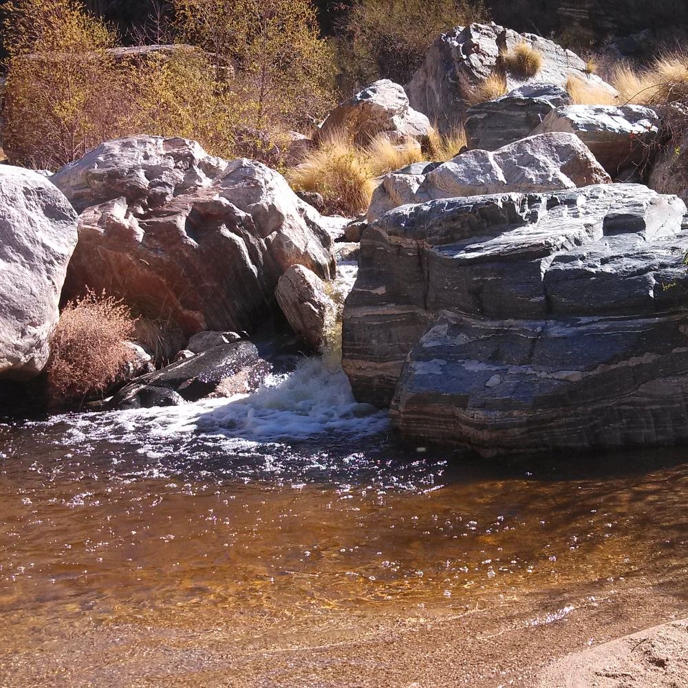
Finally got a chance to process some of my backpacking photos from Late July. I hope to share some pretty photos and general geoscience descriptions of the area in the coming weeks. For now, here’s a sunset reflection on a small pond next to Lower Golden Trout Lake in the John Muir Wilderness.

August 6, 2025 at 9:48 PM
Finally got a chance to process some of my backpacking photos from Late July. I hope to share some pretty photos and general geoscience descriptions of the area in the coming weeks. For now, here’s a sunset reflection on a small pond next to Lower Golden Trout Lake in the John Muir Wilderness.
Reposted by Alka Tripathy-Lang
During a tsunami warning we always caution that a tsunami arrives as a series of waves and the first arrival is not always the largest. Larger tsunami arrivals can occur hours later. We can see this from the recent M 8.8 Kamchatka earthquake.🧪
August 4, 2025 at 11:06 PM
During a tsunami warning we always caution that a tsunami arrives as a series of waves and the first arrival is not always the largest. Larger tsunami arrivals can occur hours later. We can see this from the recent M 8.8 Kamchatka earthquake.🧪
Reposted by Alka Tripathy-Lang

I'll be on sabbatical starting January 1, 2026, and if anyone is looking for a guest speaker for department seminars, I'm happy to discuss possible dates. Reskeet widely! 🧪⚒️
August 1, 2025 at 7:22 PM
I'll be on sabbatical starting January 1, 2026, and if anyone is looking for a guest speaker for department seminars, I'm happy to discuss possible dates. Reskeet widely! 🧪⚒️
Reposted by Alka Tripathy-Lang
🚨 JOB ALERT 🚨 Please share with your networks!
Branch Chief of Watershed and Climate Resiliency for the California Geological Survey
calcareers.ca.gov/CalHrPublic/...
Branch Chief of Watershed and Climate Resiliency for the California Geological Survey
calcareers.ca.gov/CalHrPublic/...
Branch Chief - Watershed and Climate Resiliency
Looking to make a difference? Join our strong and mighty workforce. We offer benefits and growth opportunities and impact the lives of millions of Californians.
calcareers.ca.gov
July 31, 2025 at 12:52 PM
🚨 JOB ALERT 🚨 Please share with your networks!
Branch Chief of Watershed and Climate Resiliency for the California Geological Survey
calcareers.ca.gov/CalHrPublic/...
Branch Chief of Watershed and Climate Resiliency for the California Geological Survey
calcareers.ca.gov/CalHrPublic/...
Reposted by Alka Tripathy-Lang
Since people are still doing it and I'm going to have time to kill until I figure out what to for the rest of a chaotic week that promises to have lots of little pockets of down time:
1 like = 1 opinion about subducting slabs.
1 like = 1 opinion about subducting slabs.
July 30, 2025 at 10:14 PM
Since people are still doing it and I'm going to have time to kill until I figure out what to for the rest of a chaotic week that promises to have lots of little pockets of down time:
1 like = 1 opinion about subducting slabs.
1 like = 1 opinion about subducting slabs.