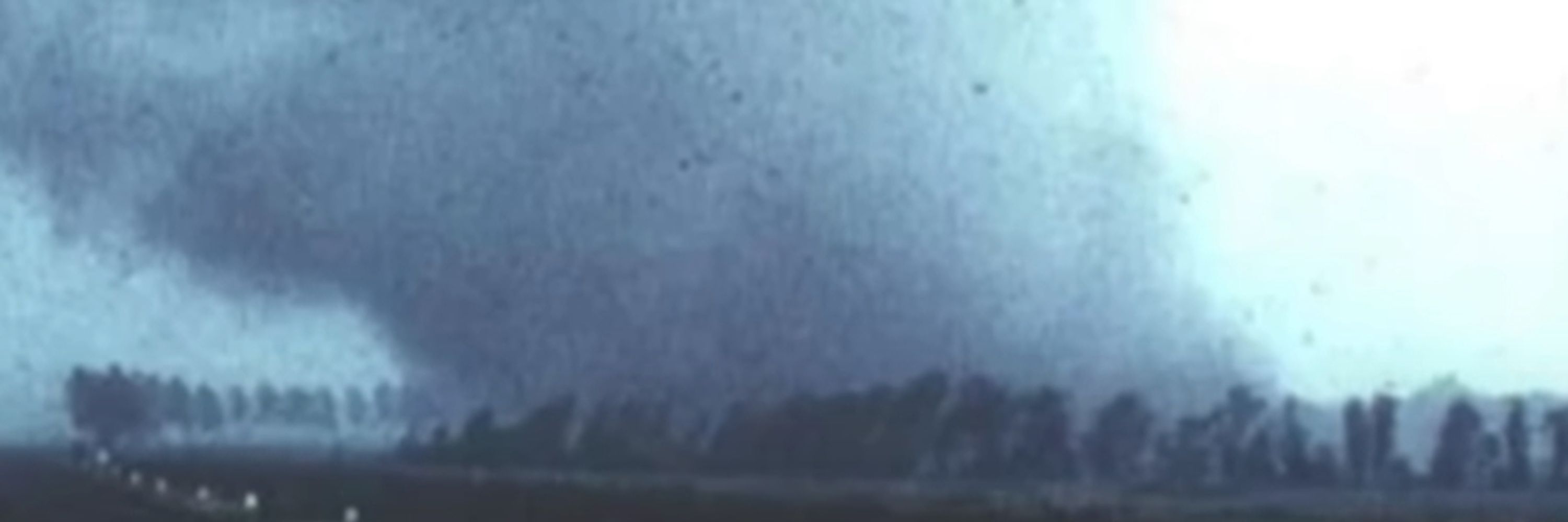
AzumangWX 🌪🌀
@azumangawx.bsky.social
130 followers 120 following 1.9K posts
(He/She/They) 
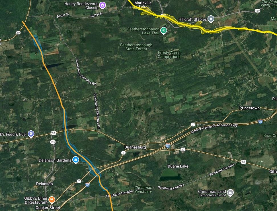
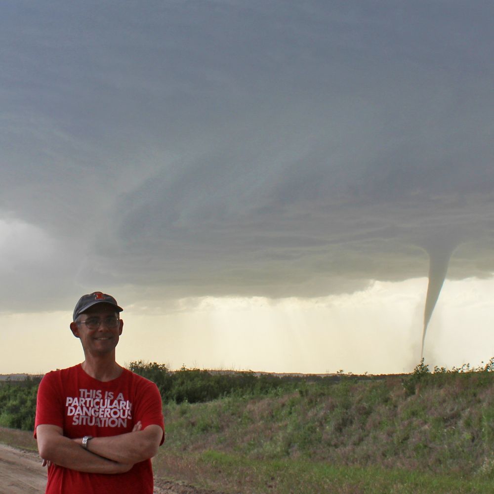
Severe WX nerd from NY #wxsky 90s/00s anime enjoyer #NODICTATORS Ally ⚢ 🏳️‍🌈🏳️‍⚧️<3 (unless you're Chiyo Mihama) WARNING: LOTS OF POLITICAL POSTS!
Posts Media Videos Starter Packs
Pinned
azumangawx.bsky.social
"my dreams aren't that weird guys"

bro's dreams 🥀 :
Reposted by AzumangWX 🌪🌀
fumovstvo.bsky.social
Marisa and ice cream with chocolate topping

#kirisamemarisa #marisakirisame #fumo #fumofumo #touhou #touhouplush #霧雨魔理沙 #ふもふも #ふも #фумо
azumangawx.bsky.social
Coming along nicely...

#WxSky #weather
Reposted by AzumangWX 🌪🌀
azumangawx.bsky.social
#WxSky Been working on this project for a while now- a precise data set of every #tornado in the Northeast.
Featuring undocumented tornadoes from the 1700s to now, detailed paths, photos and videos, adjustments to ratings, comments and descriptions about each tornado.
(Yes Worcester is an F5) {1}
azumangawx.bsky.social
"my dreams aren't that weird guys"

bro's dreams 🥀 :
azumangawx.bsky.social
doing normal 11:45 pm activities right now
#WxSky
This is a tornado survey I'm currently doing. Which tornado? Don't spoil it.
Reposted by AzumangWX 🌪🌀
nadocast.possumden.net
NADOCast Tornado Forecast
Run: 20251014_t12z
Image: nadocast_2022_models_conus_tornado_20251014_t12z_f02-23.png
Source: http://data.nadocast.com/
NADOCast tornado probability forecast for run 20251014_t12z. Image: nadocast_2022_models_conus_tornado_20251014_t12z_f02-23.png.
Reposted by AzumangWX 🌪🌀
vortexjeff.bsky.social
Rare severe thunderstorm watch issued for parts of southern California overnight
spc-storms.nws-bot.us
SPC Severe Thunderstorm Watch 622
⛈️
Isolated damaging wind gusts to 70 mph possible
A tornado or two possible

SUMMARY🌪️
Additional Details Here.


URGENT - IMMEDIATE BROADCAST REQUESTED
Severe Thunderstorm Watch Number 622
NWS Storm Prediction Center Norman OK
1115 PM PDT Mon Oct 13 2025

The NWS Storm Prediction Center has issued a

* Severe Thunderstorm Watch for portions of 
  Southern California
  Coastal Waters

* Effective this Monday night and Tuesday morning from 1115 PM
  until 600 AM PDT.

* Primary threats include...
  Isolated damaging wind gusts to 70 mph possible
  A tornado or two possible

SUMMARY...A line of low-topped convection will move
east-southeastward through the early morning hours while posing a
threat for mainly occasional strong to damaging winds. A brief
tornado or two may also occur.

The severe thunderstorm watch area is approximately along and 35
statute miles east and west of a line from 15 miles west northwest
of Paso Robles CA to 20 miles southwest of Los Angeles CA. For a
complete depiction of the watch see the associated watch outline
update (WOUS64 KWNS WOU2).

PRECAUTIONARY/PREPAREDNESS ACTIONS...

REMEMBER...A Severe Thunderstorm Watch means conditions are
favorable for severe thunderstorms in and close to the watch area.
Persons in these areas should be on the lookout for threatening
weather conditions and listen for later statements and possible
warnings. Severe thunderstorms can and occasionally do produce
tornadoes.

&&

AVIATION...A few severe thunderstorms with hail surface and aloft to
0 inches. Extreme turbulence and surface wind gusts to 60 knots. A
few cumulonimbi with maximum tops to 250. Mean storm motion vector
29030.

...Gleason

WW 0622 Image
azumangawx.bsky.social
Rare overnight risk of #tornadoes tonight in Southern California. A rare instance of heightened wind shear combined with presice location of convection in relation to the parent low has created an environment where a couple spin ups are possible. Mostly a linear storm mode,though .
#WxSky #weather
Reposted by AzumangWX 🌪🌀
pamkeithdc.bsky.social
A typhoon hit the west coast of Alaska and several homes and communities have been washed out. Most of the communities are indigenous, so…no press coverage.

They also can’t count on FEMA.

Sad and ridiculous.
Reposted by AzumangWX 🌪🌀
spc.weather.im
#SPC issues MCD 2145 concerning SEVERE POTENTIAL...WATCH UNLIKELY [watch prob: 5%] [Most Prob: Tornado: UP TO 95 MPH, Gust: UP TO 60 MPH]: PORTIONS OF SOUTH-CENTRAL COASTAL CALIFORNIA. Link
azumangawx.bsky.social
While I do condemn Trump's actions Against Letitia James as an act of political aggression, I also have no sympathy for her, as she allowed Andrew Cuomo to get away with sexually assaulting women without prosecution or even being charged with anything.
Reposted by AzumangWX 🌪🌀
mskohut.bsky.social
Did you know a typhoon hit Alaska and people are stranded and have died?? NOPE. And that FEMA & the National Guard are NOWHERE HELPFUL.
Reposted by AzumangWX 🌪🌀
emergency.weather.im
PSR issues Flash Flood Emergency [flash flood: observed, flash flood damage threat: catastrophic] for Pinal [AZ] till Oct 12, 1:45 PM MST Link
IEMBot Image TBD
Reposted by AzumangWX 🌪🌀
azumangawx.bsky.social
Violent supercells are erupting in Brazil right now.

Baseball or larger sized hail and strong #tornadoes are possible given the environment [if the ceiling can be reached.]
#WxSky #weather
azumangawx.bsky.social
For those curious, the four main tornadoes featured above are the 2024 Rome tornado, 2006 Pocantico Hills Tornado, the 2013 Mariaville tornado and 2014 Delanson tornado (all of which are in NY since it's my home state and I am biased.)
Reposted by AzumangWX 🌪🌀
azumangawx.bsky.social
⚠️BREAKING NEWS: THE EF5 DROUGHT HAS ENDED⚠️

ENDERLIN #TORNADO FROM JUNE UPGRADED TO EF5 FOLLOWING REVIEW OF CONTEXTUAL DAMAGE BY TIM MARSHALL ET AL.

To emphasize how unreal this is, I legit had to do a double take to make sure I was sober and/or not hallucinating.

#WxSky #weather
azumangawx.bsky.social
of course there's a random supercell with lime size hail and a TBSS in Utah right now, because why wouldn't there be???
azumangawx.bsky.social
[2] Still very much a work in progress as many tornadoes (especially ones that are listed as a single point in official databases) are not included yet. Primary methods of analysis include Google earth imagery, newspaper articles, NWS sources, and retroactive damage location assessments.
azumangawx.bsky.social
#WxSky Been working on this project for a while now- a precise data set of every #tornado in the Northeast.
Featuring undocumented tornadoes from the 1700s to now, detailed paths, photos and videos, adjustments to ratings, comments and descriptions about each tornado.
(Yes Worcester is an F5) {1}
Reposted by AzumangWX 🌪🌀
azumangawx.bsky.social
Past week-
Texas "invades" blue states
Trump threatens to arrest dem lawmakers and politicians
Supreme Court about to legalize torture against LGBT people
DOJ wants to make a registry of gun owners
SCOTUS threatens to erase blue districts on election maps

The move to a one party regime is here.