


November 13, 2025 at 1:22 AM

Fall and winter will clash over southern Ontario during the next few days, bringing folks a few stormy days of weather whiplash. Be prepared for rain, thunder and snow, depending on where you are. #ONstorm #ONwx
https://ow.ly/6aok50Xs4AX
https://ow.ly/6aok50Xs4AX

Ontario faces multi-hazards with rain, thunder and snow squalls - The Weather Network
Fall and winter will clash over southern Ontario during the next few days, bringing folks a few stormy days of weather whiplash. Be prepared for rain, thunder and snow, depending on where you are
ow.ly
November 15, 2025 at 2:03 PM
Fall and winter will clash over southern Ontario during the next few days, bringing folks a few stormy days of weather whiplash. Be prepared for rain, thunder and snow, depending on where you are. #ONstorm #ONwx
https://ow.ly/6aok50Xs4AX
https://ow.ly/6aok50Xs4AX


About 9 cm of snow fell at the London airport overnight, but further south, some people were reporting 60 cm of snow. #ONwx https://ow.ly/sWQl50XpWnL

First snow: Here's what you need to know to get your day going - The Weather Network
Buses have been cancelled for Middlesex, Elgin counties and the Red Zone
ow.ly
November 11, 2025 at 2:30 PM
About 9 cm of snow fell at the London airport overnight, but further south, some people were reporting 60 cm of snow. #ONwx https://ow.ly/sWQl50XpWnL


Did a quick profile check with the latest HRRR, here's a good example of the vertical temp profile needed to generate freezing rain/IP (it's a bit ruff, but I think it demonstrates it OK ). Profile is for Kirkland Lake ON. Added 4casted Radar for the same run. #onwx #onstorm


November 15, 2025 at 3:05 AM


The CAN GEPS ens.-mean Sig.Wx. Guidance just confirming what other models (WPC, Euro, etc.) are saying re: Freezing Rain/IP-no surprise here, they r on the same page. Current ECCC Alert as of post. Heed all ECCC alerts/guidance #onwx #onstorm Red/pink lines=Highest risk-Stay Safe!


November 14, 2025 at 10:45 PM
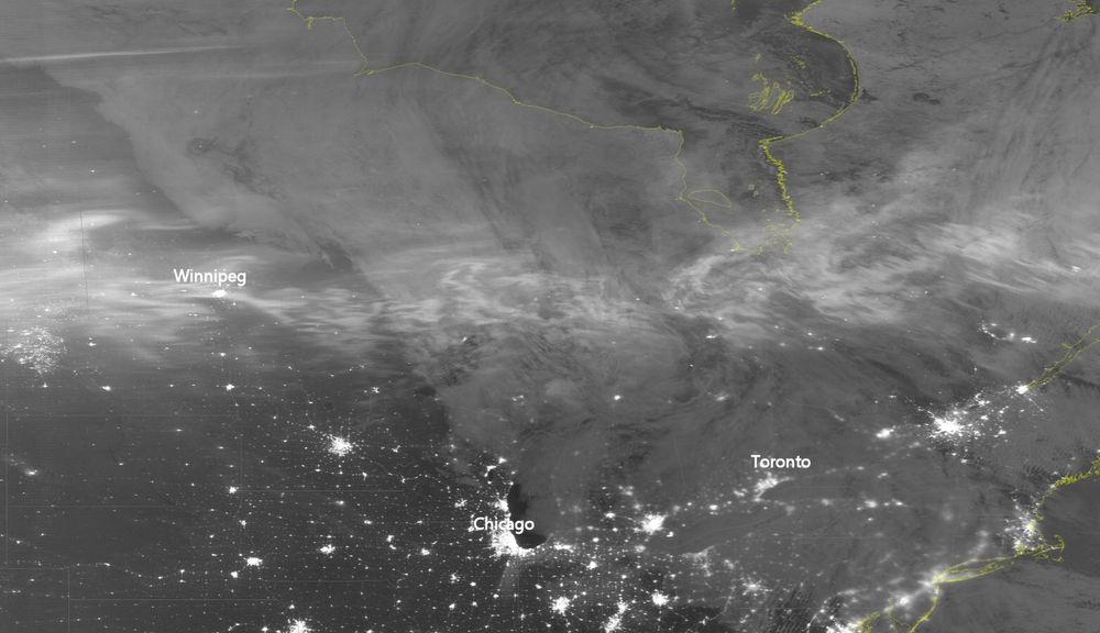
Current IR/Radar loop/trend to 7:20 PM EST, deep SWONT, most favored area, with a few holes in SCONT. But last night parts of EONT around the Kingston area-had 44-55% cloud cover & they had a good Aurora display. 🎲🎲 You never truly know how this plays out. #onwx #onstorm
November 13, 2025 at 12:31 AM


First thoughts...like the placement of Snow/FRZN Rain/IP from WPC-Similar to CAN GEPS Sig. Wx , but the Can is a bit further east -in all cases the Ottawa Valley remain the concern. As higher res. models get a hold of this,-will help identify the most affect areas #onwx #onstorm


November 14, 2025 at 2:00 AM
A good portion of southern Ontario is seeing its first snowfall of the season on Sunday, enough to cause difficult travel as roads become slippery and coated with accumulations in many areas. #ONstorm #ONwx
https://ow.ly/FzWE50Xp0Z0
https://ow.ly/FzWE50Xp0Z0

Earliest accumulation of 5+ cm of snow in Toronto in 56 years - The Weather Network
A good portion of southern Ontario is seeing its first snowfall of the season on Sunday, enough to cause difficult travel as roads become slippery and coated with accumulations in many areas. Toronto has seen its earliest occurrence of 5+ cm of snowfall since Oct. 22, 1969
ow.ly
November 9, 2025 at 7:30 PM
A good portion of southern Ontario is seeing its first snowfall of the season on Sunday, enough to cause difficult travel as roads become slippery and coated with accumulations in many areas. #ONstorm #ONwx
https://ow.ly/FzWE50Xp0Z0
https://ow.ly/FzWE50Xp0Z0

Buffet of fall and winter-like weather conditions this weekend in southern Ontario. Expect a mix of everything, from thunderstorms and warm temperatures to a dramatic cold front bringing significant wind and snow squalls. #ONstorm #ONwx www.theweathernetwork.com/en/news/weat...


November 15, 2025 at 2:50 PM
Buffet of fall and winter-like weather conditions this weekend in southern Ontario. Expect a mix of everything, from thunderstorms and warm temperatures to a dramatic cold front bringing significant wind and snow squalls. #ONstorm #ONwx www.theweathernetwork.com/en/news/weat...


