


Yohan
@yohan.so
Sharing insights from the intersection of geospatial data science and economics | PhD in Economic Geography from LSE | Data Scientist at ADB. Views are my own.
Newsletter: http://spatialedge.co
Newsletter: http://spatialedge.co
If you're using nightlights you need to know about two things:
1. What 𝙩𝙮𝙥𝙚 of economic activity it captures, and
2. 𝙎𝙥𝙖𝙩𝙞𝙖𝙡 𝙢𝙞𝙨𝙢𝙖𝙩𝙘𝙝𝙚𝙨
Here's the breakdown (in simple terms):
1. What 𝙩𝙮𝙥𝙚 of economic activity it captures, and
2. 𝙎𝙥𝙖𝙩𝙞𝙖𝙡 𝙢𝙞𝙨𝙢𝙖𝙩𝙘𝙝𝙚𝙨
Here's the breakdown (in simple terms):
April 29, 2025 at 11:13 AM
If you're using nightlights you need to know about two things:
1. What 𝙩𝙮𝙥𝙚 of economic activity it captures, and
2. 𝙎𝙥𝙖𝙩𝙞𝙖𝙡 𝙢𝙞𝙨𝙢𝙖𝙩𝙘𝙝𝙚𝙨
Here's the breakdown (in simple terms):
1. What 𝙩𝙮𝙥𝙚 of economic activity it captures, and
2. 𝙎𝙥𝙖𝙩𝙞𝙖𝙡 𝙢𝙞𝙨𝙢𝙖𝙩𝙘𝙝𝙚𝙨
Here's the breakdown (in simple terms):

By far, the data I'm asked most about is related to traffic and mobility.
It's for good reason.
This data is insanely hard to come by.
So I've compiled a comprehensive list of datasets.
These cover both paid and free options:
It's for good reason.
This data is insanely hard to come by.
So I've compiled a comprehensive list of datasets.
These cover both paid and free options:

April 25, 2025 at 11:24 AM
By far, the data I'm asked most about is related to traffic and mobility.
It's for good reason.
This data is insanely hard to come by.
So I've compiled a comprehensive list of datasets.
These cover both paid and free options:
It's for good reason.
This data is insanely hard to come by.
So I've compiled a comprehensive list of datasets.
These cover both paid and free options:
One of the best use cases for geospatial data is examining environmental factors.
Here's a list of my favourite geospatial environmental datasets:
Here's a list of my favourite geospatial environmental datasets:

April 24, 2025 at 11:17 AM
One of the best use cases for geospatial data is examining environmental factors.
Here's a list of my favourite geospatial environmental datasets:
Here's a list of my favourite geospatial environmental datasets:
Climate datasets are the most commonly used geospatial data out there.
But how accurate are they?
A new study examines this (and the results are surprising):
But how accurate are they?
A new study examines this (and the results are surprising):

April 22, 2025 at 11:13 AM
Climate datasets are the most commonly used geospatial data out there.
But how accurate are they?
A new study examines this (and the results are surprising):
But how accurate are they?
A new study examines this (and the results are surprising):
You can get €50k (equity-free) to launch a geospatial business.
I’ve done it twice.
Here are the exact steps I took to obtain funding from @esa.int 's Business Incubation Centre:
I’ve done it twice.
Here are the exact steps I took to obtain funding from @esa.int 's Business Incubation Centre:

April 21, 2025 at 11:29 AM
You can get €50k (equity-free) to launch a geospatial business.
I’ve done it twice.
Here are the exact steps I took to obtain funding from @esa.int 's Business Incubation Centre:
I’ve done it twice.
Here are the exact steps I took to obtain funding from @esa.int 's Business Incubation Centre:
Reposted by Yohan
Starter thread 🤖🧪 (AI for science) popularizing earth observation foundation models.

April 15, 2025 at 2:01 PM
Starter thread 🤖🧪 (AI for science) popularizing earth observation foundation models.
How to get a job as a data scientist at the World Bank?
This is something I was asked about a lot.
But my experience was (very) unorthodox.
It involved burnout, CrossFit and Kyiv:
This is something I was asked about a lot.
But my experience was (very) unorthodox.
It involved burnout, CrossFit and Kyiv:

April 18, 2025 at 11:24 AM
How to get a job as a data scientist at the World Bank?
This is something I was asked about a lot.
But my experience was (very) unorthodox.
It involved burnout, CrossFit and Kyiv:
This is something I was asked about a lot.
But my experience was (very) unorthodox.
It involved burnout, CrossFit and Kyiv:

Granular and real-time estimates of carbon emissions are insanely tough to obtain.
However, a new paper claims to have cracked it.
Here's the breakdown:
However, a new paper claims to have cracked it.
Here's the breakdown:

April 11, 2025 at 11:24 AM
Granular and real-time estimates of carbon emissions are insanely tough to obtain.
However, a new paper claims to have cracked it.
Here's the breakdown:
However, a new paper claims to have cracked it.
Here's the breakdown:
Bill Gates loves estimating household wealth from satellites.
So he'll love this new paper, which produces time-series wealth estimates at a granular level.
So he'll love this new paper, which produces time-series wealth estimates at a granular level.

April 10, 2025 at 11:17 AM
Bill Gates loves estimating household wealth from satellites.
So he'll love this new paper, which produces time-series wealth estimates at a granular level.
So he'll love this new paper, which produces time-series wealth estimates at a granular level.
Official sub-national GDP is a nightmare to find.
Most countries don't even publish it.
However, some geospatial datasets provide these insights for every country in the world.
Here's a list of geospatial GDP datasets, I wish I knew about 5 years ago:
Most countries don't even publish it.
However, some geospatial datasets provide these insights for every country in the world.
Here's a list of geospatial GDP datasets, I wish I knew about 5 years ago:

April 7, 2025 at 11:29 AM
Official sub-national GDP is a nightmare to find.
Most countries don't even publish it.
However, some geospatial datasets provide these insights for every country in the world.
Here's a list of geospatial GDP datasets, I wish I knew about 5 years ago:
Most countries don't even publish it.
However, some geospatial datasets provide these insights for every country in the world.
Here's a list of geospatial GDP datasets, I wish I knew about 5 years ago:
Official estimates of methane emissions are inaccurate.
How do we know?
An analysis of satellite imagery conducted by NASA and Harvard.
Here's the breakdown:
How do we know?
An analysis of satellite imagery conducted by NASA and Harvard.
Here's the breakdown:

April 4, 2025 at 11:24 AM
Official estimates of methane emissions are inaccurate.
How do we know?
An analysis of satellite imagery conducted by NASA and Harvard.
Here's the breakdown:
How do we know?
An analysis of satellite imagery conducted by NASA and Harvard.
Here's the breakdown:
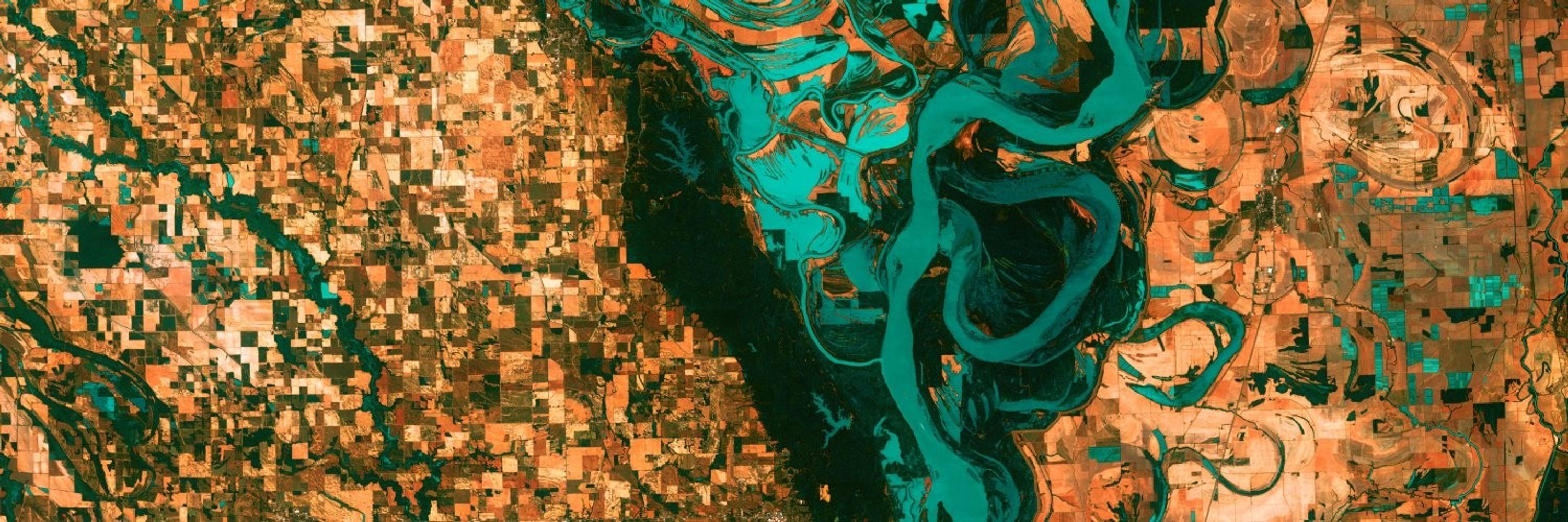
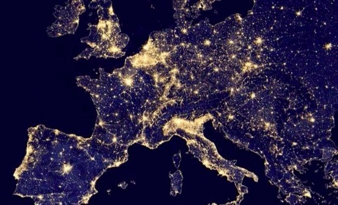
Some new surprising facts about nightlights have just been uncovered.
These will impact how we use nightlights to measure economic growth.
Here's the breakdown:
These will impact how we use nightlights to measure economic growth.
Here's the breakdown:

April 3, 2025 at 11:17 AM
Some new surprising facts about nightlights have just been uncovered.
These will impact how we use nightlights to measure economic growth.
Here's the breakdown:
These will impact how we use nightlights to measure economic growth.
Here's the breakdown:
Much of the world runs on informal transport networks.
However, it's difficult to assess how efficient these are.
A new study examines 7,000 bus routes in 36 cities across 22 countries in order to find out.
The results are pretty surprising:
However, it's difficult to assess how efficient these are.
A new study examines 7,000 bus routes in 36 cities across 22 countries in order to find out.
The results are pretty surprising:

April 1, 2025 at 11:13 AM
Much of the world runs on informal transport networks.
However, it's difficult to assess how efficient these are.
A new study examines 7,000 bus routes in 36 cities across 22 countries in order to find out.
The results are pretty surprising:
However, it's difficult to assess how efficient these are.
A new study examines 7,000 bus routes in 36 cities across 22 countries in order to find out.
The results are pretty surprising:


Meta is using Facebook and mobile phone data to produce super-granular household wealth estimates.
Here’s what you need to know about the Relative Wealth Index:
Here’s what you need to know about the Relative Wealth Index:

March 24, 2025 at 12:29 PM
Meta is using Facebook and mobile phone data to produce super-granular household wealth estimates.
Here’s what you need to know about the Relative Wealth Index:
Here’s what you need to know about the Relative Wealth Index:
In 1969 a husband and wife launched a geospatial company with $1,100.
Today that bootstrapped company makes annual revenue over $1.5 billion.
Here’s the story of ESRI:
Today that bootstrapped company makes annual revenue over $1.5 billion.
Here’s the story of ESRI:

March 21, 2025 at 12:24 PM
In 1969 a husband and wife launched a geospatial company with $1,100.
Today that bootstrapped company makes annual revenue over $1.5 billion.
Here’s the story of ESRI:
Today that bootstrapped company makes annual revenue over $1.5 billion.
Here’s the story of ESRI:
Internet access unlocks economic and educational opportunities.
Using (free) geospatial data, we can now identify which areas lack internet access at super granular levels.
Here's the breakdown:
Using (free) geospatial data, we can now identify which areas lack internet access at super granular levels.
Here's the breakdown:

March 20, 2025 at 12:17 PM
Internet access unlocks economic and educational opportunities.
Using (free) geospatial data, we can now identify which areas lack internet access at super granular levels.
Here's the breakdown:
Using (free) geospatial data, we can now identify which areas lack internet access at super granular levels.
Here's the breakdown:
Inequality isn't just about income and wealth.
It's also related to environmental factors.
Here's how poorer people are more impacted by heat-related deaths:
It's also related to environmental factors.
Here's how poorer people are more impacted by heat-related deaths:

March 18, 2025 at 12:13 PM
Inequality isn't just about income and wealth.
It's also related to environmental factors.
Here's how poorer people are more impacted by heat-related deaths:
It's also related to environmental factors.
Here's how poorer people are more impacted by heat-related deaths:
There are many geospatial land-use maps available.
However, they all tell us different things.
So which one is the most accurate?
Let's find out:
However, they all tell us different things.
So which one is the most accurate?
Let's find out:

March 17, 2025 at 12:29 PM
There are many geospatial land-use maps available.
However, they all tell us different things.
So which one is the most accurate?
Let's find out:
However, they all tell us different things.
So which one is the most accurate?
Let's find out:
It's incredibly tough to come up with granular estimates of 𝙝𝙪𝙢𝙖𝙣-𝙢𝙖𝙙𝙚 CO2 emissions.
However, a new approach attempts to do this in real-time using free data.
Here's the breakdown:
However, a new approach attempts to do this in real-time using free data.
Here's the breakdown:

March 14, 2025 at 12:24 PM
It's incredibly tough to come up with granular estimates of 𝙝𝙪𝙢𝙖𝙣-𝙢𝙖𝙙𝙚 CO2 emissions.
However, a new approach attempts to do this in real-time using free data.
Here's the breakdown:
However, a new approach attempts to do this in real-time using free data.
Here's the breakdown:
Measuring agricultural GDP at a pixel level is notoriously challenging.
It requires precise information on crop type and crop yield.
@esa.int has launched a (free) dataset that provides this information.
Here's what you need to know about it:
It requires precise information on crop type and crop yield.
@esa.int has launched a (free) dataset that provides this information.
Here's what you need to know about it:

March 13, 2025 at 1:29 PM
Measuring agricultural GDP at a pixel level is notoriously challenging.
It requires precise information on crop type and crop yield.
@esa.int has launched a (free) dataset that provides this information.
Here's what you need to know about it:
It requires precise information on crop type and crop yield.
@esa.int has launched a (free) dataset that provides this information.
Here's what you need to know about it: