
Impressive lenticular photos at sunrise from the summit, then a surreal view from the valley.
Valley pic credit: Colby Morris/MWO


Impressive lenticular photos at sunrise from the summit, then a surreal view from the valley.
Valley pic credit: Colby Morris/MWO
Not record-threatening cold for this time of year, but yeesh...🥶

Not record-threatening cold for this time of year, but yeesh...🥶
Can the NFL move the Bills-Steelers game to Orchard Park...and to Thanksgiving?

Can the NFL move the Bills-Steelers game to Orchard Park...and to Thanksgiving?
Should be ok getting out of town today as long as you're not driving to ND or N. MN.
Tomorrow AM: slick driving, flight delays possible.


Should be ok getting out of town today as long as you're not driving to ND or N. MN.
Tomorrow AM: slick driving, flight delays possible.
Here are the 2 "operational" ECMWF, GFS 0z Monday model run 7-day forecasts for this Sunday. Could they possibly be more different? 😆


Here are the 2 "operational" ECMWF, GFS 0z Monday model run 7-day forecasts for this Sunday. Could they possibly be more different? 😆
Per NOAA's database, looks to be strongest to hit that part of NE WA in over 20 years, since Ingrid in March 2005.


Per NOAA's database, looks to be strongest to hit that part of NE WA in over 20 years, since Ingrid in March 2005.
In theory, at least. We'll see if that actually holds in future model runs.


In theory, at least. We'll see if that actually holds in future model runs.
Another inch or so today.
Some mountain locations in SBA County picked up over 10 inches of rain the past 72 hours.


Another inch or so today.
Some mountain locations in SBA County picked up over 10 inches of rain the past 72 hours.
🛰️: CIRA_CSU

🛰️: CIRA_CSU
Stay tuned. ⚡️🌬️

Stay tuned. ⚡️🌬️
But that was this morning's low in Key West, Florida, tying their "record coldest so early in fall" with four other dates in 1966, 1955, 1913.

But that was this morning's low in Key West, Florida, tying their "record coldest so early in fall" with four other dates in 1966, 1955, 1913.
- #9 Oregon @ #20 Iowa: Weather only a "duck" could love.
- NY Giants @ Chicago Bears: A passing, kicking challenge with cold wind howling from end zone to end zone. Flurry or snow shower, too?


- #9 Oregon @ #20 Iowa: Weather only a "duck" could love.
- NY Giants @ Chicago Bears: A passing, kicking challenge with cold wind howling from end zone to end zone. Flurry or snow shower, too?
About 2 dozen daily record lows in jeopardy on Veterans Day.
More deets: weather.com/forecast/reg...

About 2 dozen daily record lows in jeopardy on Veterans Day.
More deets: weather.com/forecast/reg...
The Tacoma Narrows Bridge collapse happened 85 years ago today.
weather.com/science/weat...

The Tacoma Narrows Bridge collapse happened 85 years ago today.
weather.com/science/weat...
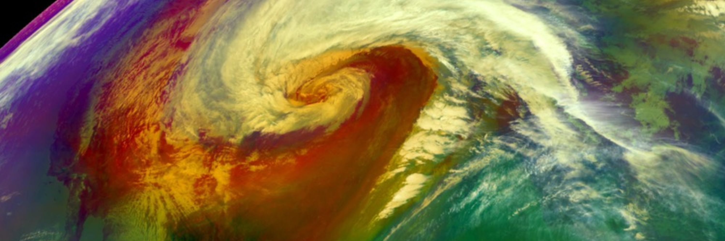
Now: Pacific storm moving ashore right now with high winds.
Late today-early Thu: Locally damaging winds possible in the Northeast.
#November 🌬️🍃


Now: Pacific storm moving ashore right now with high winds.
Late today-early Thu: Locally damaging winds possible in the Northeast.
#November 🌬️🍃
How about daytime highs struggling to reach the low 50s along the coast of the Carolinas Tuesday?
Fortunately, this cold won't last long.


How about daytime highs struggling to reach the low 50s along the coast of the Carolinas Tuesday?
Fortunately, this cold won't last long.

I believe a post from @drmetwatch.bsky.social Tuesday would imply that today is day 8 of at least locally heavy rain in Hispaniola.
E flank outer bands of TCs are frequently signif. flash flood generators.

I believe a post from @drmetwatch.bsky.social Tuesday would imply that today is day 8 of at least locally heavy rain in Hispaniola.
E flank outer bands of TCs are frequently signif. flash flood generators.
Record tying intense Atlantic Basin hurricane landfall.

Record tying intense Atlantic Basin hurricane landfall.
SLOSH, wind wave model combination suggests over 6 feet of above ground inundation or higher possible in areas shaded in orange and red.

SLOSH, wind wave model combination suggests over 6 feet of above ground inundation or higher possible in areas shaded in orange and red.
...but these peak sustained winds in Melissa are in the EF4 range. Some gusts could be EF5 in the hills/mountains, etc.

...but these peak sustained winds in Melissa are in the EF4 range. Some gusts could be EF5 in the hills/mountains, etc.
Likely rainfall rates of several inches per hour into an extremely flash flood, mudslide prone area.

Likely rainfall rates of several inches per hour into an extremely flash flood, mudslide prone area.

Quite an elite list of Cat. 5 Atlantic landfalls. Melissa will be among them by both pressure and winds.

Quite an elite list of Cat. 5 Atlantic landfalls. Melissa will be among them by both pressure and winds.

