


Department of Geographical Sciences at University of Maryland
@umdgeography.bsky.social
Cutting-edge research on global environmental changes from University of Maryland’s Department of Geographical Sciences. #remotesensing #gis #geospatialscience
Join us Thursday, Nov. 20 at 3:30 p.m. for a seminar with @uwmadison.bsky.social's Song Gao on how GeoAI + satellite imagery can reveal human-mobility patterns in cities.
He’ll share a new deep-learning framework and recent work from the GeoDS Lab (Zoom & in person)
🔗 go.umd.edu/seminar-gao-...
He’ll share a new deep-learning framework and recent work from the GeoDS Lab (Zoom & in person)
🔗 go.umd.edu/seminar-gao-...

November 18, 2025 at 4:31 PM
Join us Thursday, Nov. 20 at 3:30 p.m. for a seminar with @uwmadison.bsky.social's Song Gao on how GeoAI + satellite imagery can reveal human-mobility patterns in cities.
He’ll share a new deep-learning framework and recent work from the GeoDS Lab (Zoom & in person)
🔗 go.umd.edu/seminar-gao-...
He’ll share a new deep-learning framework and recent work from the GeoDS Lab (Zoom & in person)
🔗 go.umd.edu/seminar-gao-...
🗓️ Join us at 3:30 p.m. on Thursday, Nov. 13 for this seminar on #firescience with Tess McCabe & Shane Coffield from the UMD Earth System Science Interdisciplinary Center (ESSIC)/NASA Goddard Space Flight Center. Via Zoom or in person: go.umd.edu/geog-seminar...

November 11, 2025 at 5:03 PM
🗓️ Join us at 3:30 p.m. on Thursday, Nov. 13 for this seminar on #firescience with Tess McCabe & Shane Coffield from the UMD Earth System Science Interdisciplinary Center (ESSIC)/NASA Goddard Space Flight Center. Via Zoom or in person: go.umd.edu/geog-seminar...
🗓️ GEOG Seminar: Join us Thursday, Nov. 6, at 3:30 p.m. for "Turning Scientists’ Dreams into Reality: Your Wish Is an Instrument Scientist’s Command" with Philip W. Dabney from NASA Goddard Space Flight Center: go.umd.edu/geog-seminar...

November 3, 2025 at 7:37 PM
🗓️ GEOG Seminar: Join us Thursday, Nov. 6, at 3:30 p.m. for "Turning Scientists’ Dreams into Reality: Your Wish Is an Instrument Scientist’s Command" with Philip W. Dabney from NASA Goddard Space Flight Center: go.umd.edu/geog-seminar...
Help us spread the word! 🌍🛰️
Join our final grad info session for:
* MS in GIS
* Grad Certificate in GIS
* Grad Certificate in Remote Sensing
Learn the latest in geospatial tech, theory + applications to advance your career.
👉 Register lnkd.in/erNR2EqQ
Join our final grad info session for:
* MS in GIS
* Grad Certificate in GIS
* Grad Certificate in Remote Sensing
Learn the latest in geospatial tech, theory + applications to advance your career.
👉 Register lnkd.in/erNR2EqQ

October 22, 2025 at 8:57 PM
Help us spread the word! 🌍🛰️
Join our final grad info session for:
* MS in GIS
* Grad Certificate in GIS
* Grad Certificate in Remote Sensing
Learn the latest in geospatial tech, theory + applications to advance your career.
👉 Register lnkd.in/erNR2EqQ
Join our final grad info session for:
* MS in GIS
* Grad Certificate in GIS
* Grad Certificate in Remote Sensing
Learn the latest in geospatial tech, theory + applications to advance your career.
👉 Register lnkd.in/erNR2EqQ
🗓️ This Thursday: Join us in LeFrak Hall 1158 or on Zoom 💻 for the seminar "The Effects of Climate Change on Vulnerable Children with Dispersed Family Networks"with Keehoon Jung, doctoral student in @umdarec.bsky.social ⤵️
go.umd.edu/geog-seminar...
go.umd.edu/geog-seminar...

October 14, 2025 at 1:54 PM
🗓️ This Thursday: Join us in LeFrak Hall 1158 or on Zoom 💻 for the seminar "The Effects of Climate Change on Vulnerable Children with Dispersed Family Networks"with Keehoon Jung, doctoral student in @umdarec.bsky.social ⤵️
go.umd.edu/geog-seminar...
go.umd.edu/geog-seminar...
🚨 Grad program info sessions in #GeospatialSciences are coming up!
Advance your career or gain new skills in GIS, Remote Sensing & GEOINT.
📅 Oct 2 | 12 PM EDT – MS GIS & Certs
Register ▶️ lnkd.in/ehbhNKNn
📅 Oct 6 | 5 PM EDT – MS GEOINT & Cert
Register ▶️ lnkd.in/eC5X-xY5
Advance your career or gain new skills in GIS, Remote Sensing & GEOINT.
📅 Oct 2 | 12 PM EDT – MS GIS & Certs
Register ▶️ lnkd.in/ehbhNKNn
📅 Oct 6 | 5 PM EDT – MS GEOINT & Cert
Register ▶️ lnkd.in/eC5X-xY5

September 26, 2025 at 8:28 PM
🚨 Grad program info sessions in #GeospatialSciences are coming up!
Advance your career or gain new skills in GIS, Remote Sensing & GEOINT.
📅 Oct 2 | 12 PM EDT – MS GIS & Certs
Register ▶️ lnkd.in/ehbhNKNn
📅 Oct 6 | 5 PM EDT – MS GEOINT & Cert
Register ▶️ lnkd.in/eC5X-xY5
Advance your career or gain new skills in GIS, Remote Sensing & GEOINT.
📅 Oct 2 | 12 PM EDT – MS GIS & Certs
Register ▶️ lnkd.in/ehbhNKNn
📅 Oct 6 | 5 PM EDT – MS GEOINT & Cert
Register ▶️ lnkd.in/eC5X-xY5
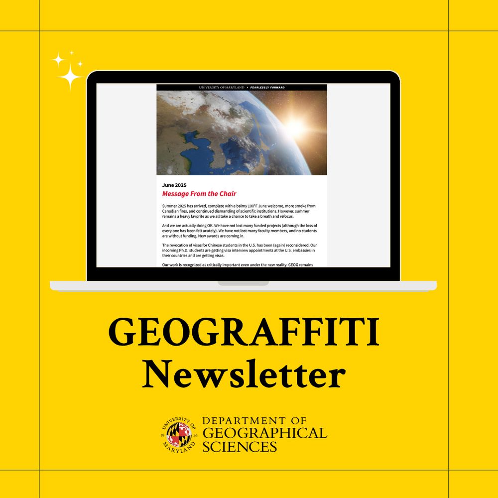
📬 Our newsletter is out: Brave the heat with GEOG research highlights, news, cool maps and more 🔥 mailchi.mp/30f252c59336...
June 26, 2025 at 6:14 PM
📬 Our newsletter is out: Brave the heat with GEOG research highlights, news, cool maps and more 🔥 mailchi.mp/30f252c59336...
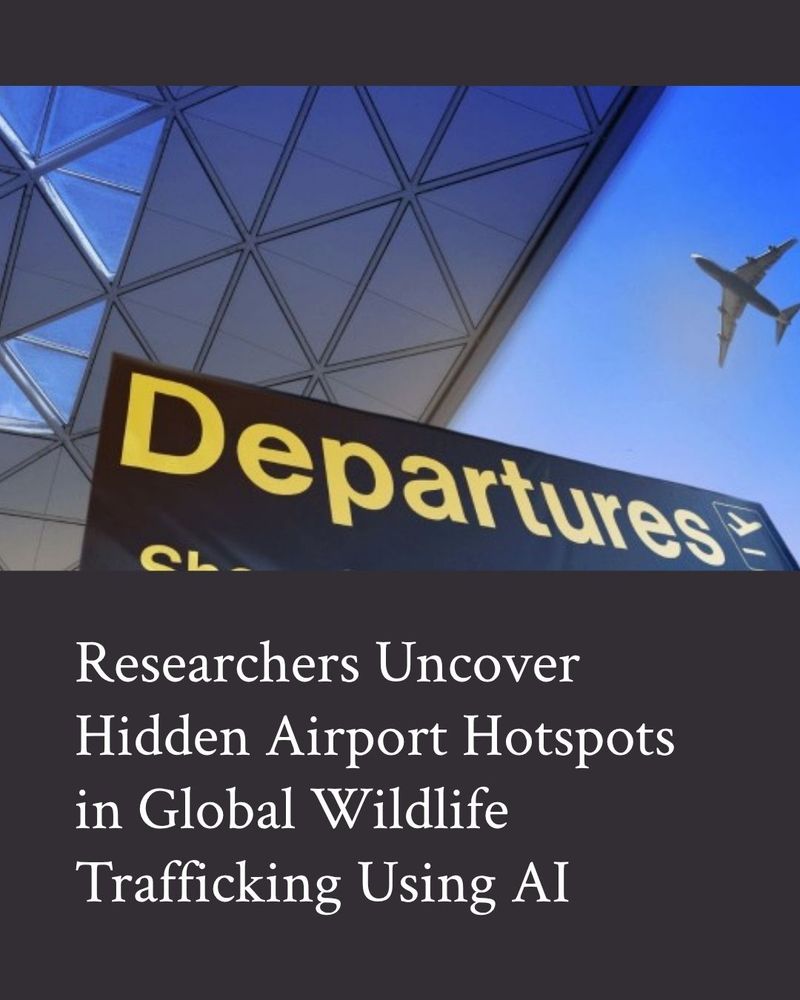
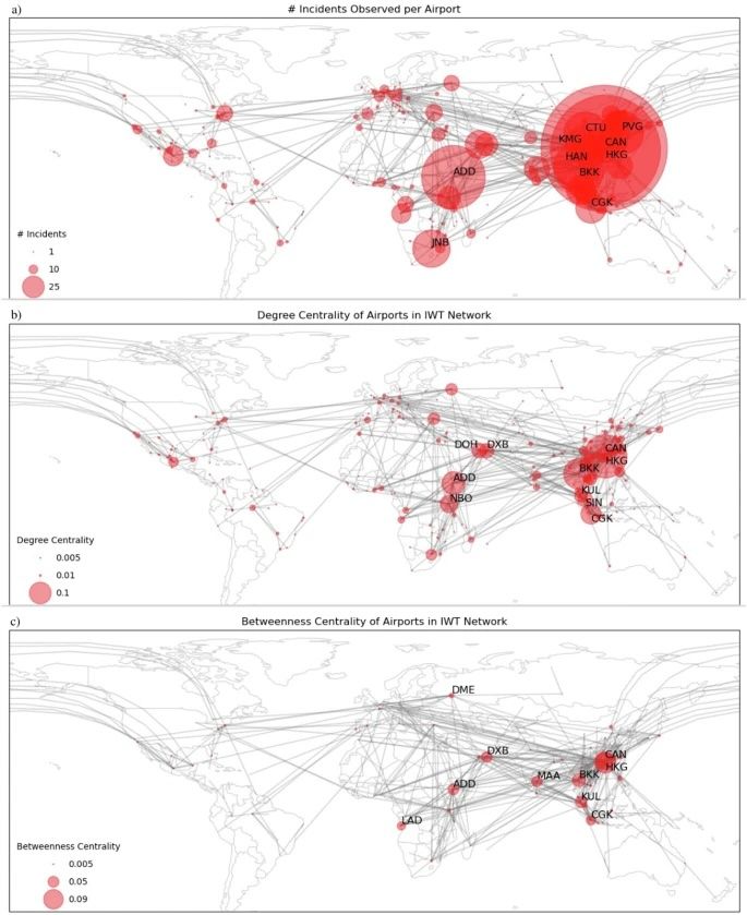
✈️ 🦏 Which airports are quietly fueling the illegal wildlife trade? How can AI help stop them?
A study by @usc.edu student Hannah Murray w/ GEOG Prof Meredith Gore + USC Assoc Prof Bistra Dilkina reveals trafficking hotspots using AI, network science ⤵️ tinyurl.com/mr2ncj9d
#worldenvironmentday
A study by @usc.edu student Hannah Murray w/ GEOG Prof Meredith Gore + USC Assoc Prof Bistra Dilkina reveals trafficking hotspots using AI, network science ⤵️ tinyurl.com/mr2ncj9d
#worldenvironmentday
June 5, 2025 at 7:03 PM
✈️ 🦏 Which airports are quietly fueling the illegal wildlife trade? How can AI help stop them?
A study by @usc.edu student Hannah Murray w/ GEOG Prof Meredith Gore + USC Assoc Prof Bistra Dilkina reveals trafficking hotspots using AI, network science ⤵️ tinyurl.com/mr2ncj9d
#worldenvironmentday
A study by @usc.edu student Hannah Murray w/ GEOG Prof Meredith Gore + USC Assoc Prof Bistra Dilkina reveals trafficking hotspots using AI, network science ⤵️ tinyurl.com/mr2ncj9d
#worldenvironmentday
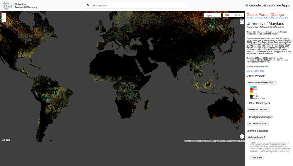
From: UMD-GLAD:🌳 The 2024 global tree cover loss data by
UMD-GLAD are now live!
📊 View & download GeoTIFFs via the Earth Engine App:
t.co/4b6cqGc70V
🗂️ Also in the EE Data Catalog: t.co/7O3uRQ3gbO
#ForestChange #TreeCoverLoss #EarthEngine
UMD-GLAD are now live!
📊 View & download GeoTIFFs via the Earth Engine App:
t.co/4b6cqGc70V
🗂️ Also in the EE Data Catalog: t.co/7O3uRQ3gbO
#ForestChange #TreeCoverLoss #EarthEngine
June 4, 2025 at 1:37 PM
From: UMD-GLAD:🌳 The 2024 global tree cover loss data by
UMD-GLAD are now live!
📊 View & download GeoTIFFs via the Earth Engine App:
t.co/4b6cqGc70V
🗂️ Also in the EE Data Catalog: t.co/7O3uRQ3gbO
#ForestChange #TreeCoverLoss #EarthEngine
UMD-GLAD are now live!
📊 View & download GeoTIFFs via the Earth Engine App:
t.co/4b6cqGc70V
🗂️ Also in the EE Data Catalog: t.co/7O3uRQ3gbO
#ForestChange #TreeCoverLoss #EarthEngine
🗓️ Don’t miss this hybrid seminar on Thursday, May 8 at 3:30 pm! Gokul Iyer, team lead at JGCRI, will dive into how LNG trade and critical materials shape the energy transition—using insights from the Global Change Analysis Model: go.umd.edu/seminar-goku...

May 2, 2025 at 8:31 PM
🗓️ Don’t miss this hybrid seminar on Thursday, May 8 at 3:30 pm! Gokul Iyer, team lead at JGCRI, will dive into how LNG trade and critical materials shape the energy transition—using insights from the Global Change Analysis Model: go.umd.edu/seminar-goku...
🌳🗺️ After 13 years of refining methods for forest loss maps,
UMD-GLAD's Sasha Tyukavina and colleagues have published a unified set of methods for validating land cover— published in Remote Sensing of Environment.
Read more: t.co/HOW3m7dOPm
UMD-GLAD's Sasha Tyukavina and colleagues have published a unified set of methods for validating land cover— published in Remote Sensing of Environment.
Read more: t.co/HOW3m7dOPm

May 1, 2025 at 5:06 PM
🌳🗺️ After 13 years of refining methods for forest loss maps,
UMD-GLAD's Sasha Tyukavina and colleagues have published a unified set of methods for validating land cover— published in Remote Sensing of Environment.
Read more: t.co/HOW3m7dOPm
UMD-GLAD's Sasha Tyukavina and colleagues have published a unified set of methods for validating land cover— published in Remote Sensing of Environment.
Read more: t.co/HOW3m7dOPm
From NASA-UMD's Global Ecosystem Dynamics Investigation:
GEDI L4A post-storage datasets are available on NASA Earth Data via the Oak Ridge Lab.
Now all #GEDI footprint level datasets from Level 1 to 4 are public up until mission week 311 except L4C WSCI: search.earthdata.nasa.gov/search/granu...
GEDI L4A post-storage datasets are available on NASA Earth Data via the Oak Ridge Lab.
Now all #GEDI footprint level datasets from Level 1 to 4 are public up until mission week 311 except L4C WSCI: search.earthdata.nasa.gov/search/granu...

April 24, 2025 at 5:00 PM
From NASA-UMD's Global Ecosystem Dynamics Investigation:
GEDI L4A post-storage datasets are available on NASA Earth Data via the Oak Ridge Lab.
Now all #GEDI footprint level datasets from Level 1 to 4 are public up until mission week 311 except L4C WSCI: search.earthdata.nasa.gov/search/granu...
GEDI L4A post-storage datasets are available on NASA Earth Data via the Oak Ridge Lab.
Now all #GEDI footprint level datasets from Level 1 to 4 are public up until mission week 311 except L4C WSCI: search.earthdata.nasa.gov/search/granu...
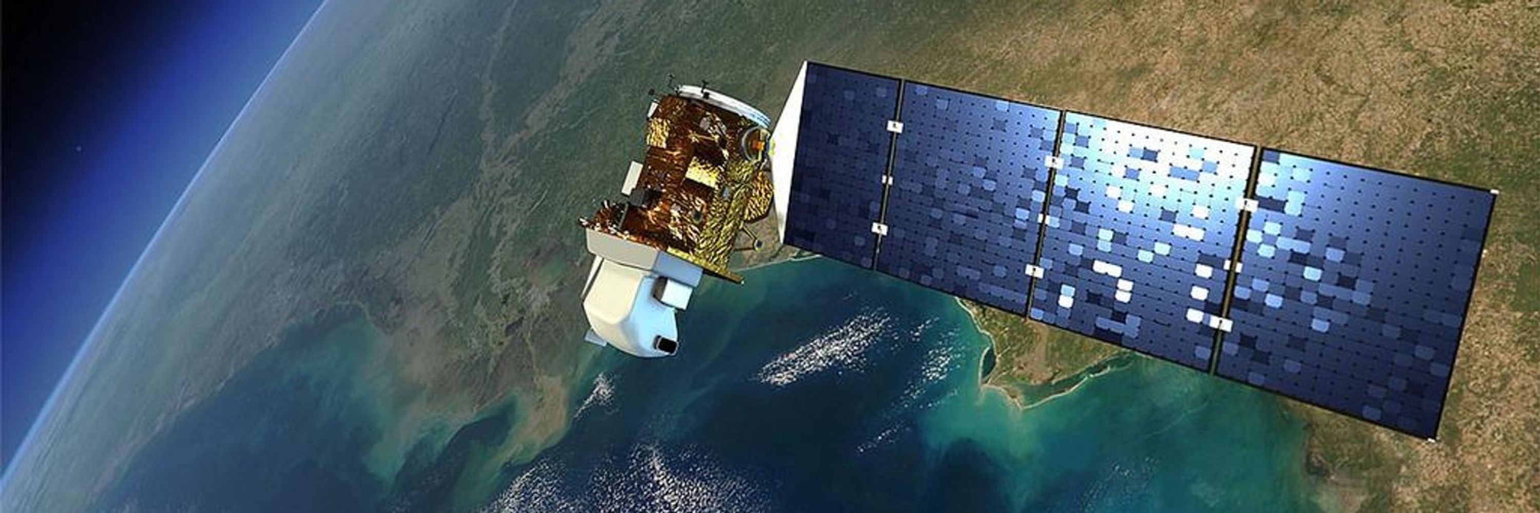
🛰️ 🌎 Position yourself for success! Don't miss our virtual info sessions about our master of science programs, ranked #2 in the US: geog.umd.edu/events
➡️ Geospatial Intelligence (GEOINT) at 5 p.m. EDT on Mon, April 21
➡️ GIS or Remote Sensing at noon EDT on Tues, April 22
#geospatial
➡️ Geospatial Intelligence (GEOINT) at 5 p.m. EDT on Mon, April 21
➡️ GIS or Remote Sensing at noon EDT on Tues, April 22
#geospatial

April 10, 2025 at 7:15 PM
🛰️ 🌎 Position yourself for success! Don't miss our virtual info sessions about our master of science programs, ranked #2 in the US: geog.umd.edu/events
➡️ Geospatial Intelligence (GEOINT) at 5 p.m. EDT on Mon, April 21
➡️ GIS or Remote Sensing at noon EDT on Tues, April 22
#geospatial
➡️ Geospatial Intelligence (GEOINT) at 5 p.m. EDT on Mon, April 21
➡️ GIS or Remote Sensing at noon EDT on Tues, April 22
#geospatial