


Antonio Vecoli (@tonyveco on X)
@tonyveco.bsky.social
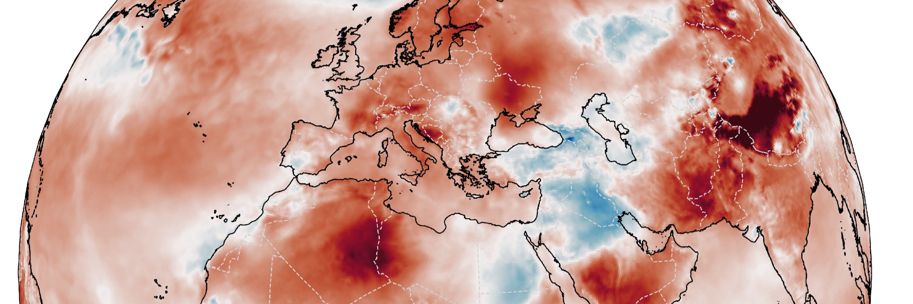
#remotesensing @ https://bsky.app/profile/adamplatform.bsky.social
#Climate & #Copernicus Atmospheric Composition training for @eumetsat
@Esa ESAC 2014/15
Former #Copernicus 🇪🇺 Support Office /EMS/DEFIS
#Sentinerd S3B & S6A #Aeolus, #SolarOrbiter #MTGS1
#Climate & #Copernicus Atmospheric Composition training for @eumetsat
@Esa ESAC 2014/15
Former #Copernicus 🇪🇺 Support Office /EMS/DEFIS
#Sentinerd S3B & S6A #Aeolus, #SolarOrbiter #MTGS1
🔴⚠️🌋🇪🇹After more than 10000 years,the 1st historical #eruption of #HayliGubbi #volcano has occurred in E. #Ethiopia, producing an eruptive column that reached more than 18km of height on Nov.23.⬇️Meteosat12 animation of RGB Ash product of the huge gas & ash plume moving eastward.
November 24, 2025 at 7:50 PM
🔴⚠️🌋🇪🇹After more than 10000 years,the 1st historical #eruption of #HayliGubbi #volcano has occurred in E. #Ethiopia, producing an eruptive column that reached more than 18km of height on Nov.23.⬇️Meteosat12 animation of RGB Ash product of the huge gas & ash plume moving eastward.
🔴 ⚠️ ⛈️ 🛰️ In less than 12 hours a series of extreme #weather events have affected N.#Italy,with #landslides and #floods from #Tuscany to #FriuliVeneziaGiulia with 2 deaths in the area of Gorizia. ⬇️ 12hours on Nov.17 of FCI IR from Meteosat12 #EUMETview #climateemergency
November 18, 2025 at 11:24 AM
🔴 ⚠️ ⛈️ 🛰️ In less than 12 hours a series of extreme #weather events have affected N.#Italy,with #landslides and #floods from #Tuscany to #FriuliVeneziaGiulia with 2 deaths in the area of Gorizia. ⬇️ 12hours on Nov.17 of FCI IR from Meteosat12 #EUMETview #climateemergency
🔴⚠️🌀🇵🇭Ongoing scary landfall of #Fungwong on northern Aurora in Luzon,as a cat.4 Typhoon with gusts over 230km/h.More than 100000 evacuated and 400mm of rain so far,few days after #Kalmaegi.⬇️ Latest 6 hours by Himawari9 #ClimateEmergency #COP30 #Philippines
November 9, 2025 at 1:35 PM
🔴⚠️🌀🇵🇭Ongoing scary landfall of #Fungwong on northern Aurora in Luzon,as a cat.4 Typhoon with gusts over 230km/h.More than 100000 evacuated and 400mm of rain so far,few days after #Kalmaegi.⬇️ Latest 6 hours by Himawari9 #ClimateEmergency #COP30 #Philippines
🔴⚠️🌀🇵🇭After the devastating Kalmaegi,now #Fungwong is beating #Philippines again with winds at 200km/h.The cat.3 #Typhoon is reaching Luzon and yet affecting catanduanes.The Himawari9 animation of last 12hrs shows also mesovortices in the eye.#ClimateEmergency #UwanPH COP30
November 9, 2025 at 3:31 AM
🔴⚠️🌀🇵🇭After the devastating Kalmaegi,now #Fungwong is beating #Philippines again with winds at 200km/h.The cat.3 #Typhoon is reaching Luzon and yet affecting catanduanes.The Himawari9 animation of last 12hrs shows also mesovortices in the eye.#ClimateEmergency #UwanPH COP30
🔴⚠️🌀🇯🇲In the aftermath of hurricane #Melissa, the tropical vegetation of southwestern Jamaica has been devastated by the landfall at almost 300km/h.The first #Sentinel2 images after the event show the extreme consequences on BlackRiver and the wider area. #ClimateEmergency
November 5, 2025 at 2:53 AM
🔴⚠️🌀🇯🇲In the aftermath of hurricane #Melissa, the tropical vegetation of southwestern Jamaica has been devastated by the landfall at almost 300km/h.The first #Sentinel2 images after the event show the extreme consequences on BlackRiver and the wider area. #ClimateEmergency
🔴⚠️🌀🇯🇲The third Cat.5 hurricane of the season,and yet one of 4 strongest ever in the Atlantic,#melissa keeps slowly moving westward with max winds at 280km/h according
@NHC_Atlantic
⬇️#GOES19 latest 12hrs with smaller eye after intensifying for hours. #ClimateEmergency
@NHC_Atlantic
⬇️#GOES19 latest 12hrs with smaller eye after intensifying for hours. #ClimateEmergency
October 28, 2025 at 1:17 AM
🔴⚠️🌀🇯🇲The third Cat.5 hurricane of the season,and yet one of 4 strongest ever in the Atlantic,#melissa keeps slowly moving westward with max winds at 280km/h according
@NHC_Atlantic
⬇️#GOES19 latest 12hrs with smaller eye after intensifying for hours. #ClimateEmergency
@NHC_Atlantic
⬇️#GOES19 latest 12hrs with smaller eye after intensifying for hours. #ClimateEmergency
🔴⚠️🌀🇯🇲In less than 6 hours, #Melissa has intensified as #Hurricane of Cat.4 with winds at 225km/h, yet threatening Jamaica with heavy rains even before the full impact on Monday.⬇️Latest 12hrs via @zoom_earth with cat4 monster at sunrise in the Caribbean. #ClimateEmergency pic.x.com/IV02PhMAkk
October 26, 2025 at 1:10 PM
🔴⚠️🌀🇯🇲In less than 6 hours, #Melissa has intensified as #Hurricane of Cat.4 with winds at 225km/h, yet threatening Jamaica with heavy rains even before the full impact on Monday.⬇️Latest 12hrs via @zoom_earth with cat4 monster at sunrise in the Caribbean. #ClimateEmergency pic.x.com/IV02PhMAkk
🔴⚠️🌀🏴🇮🇪UPDATE:Hundreds thousands of people with power outages in Ireland and N Ireland, winds at 180km/h in Scotland and 100km/h in N France.It's the stunning summary of #StormAmy in the last 24hrs⬇️From sunrise to sunset #Amy seen today by Meteosat12. #climateemergency
October 4, 2025 at 7:56 PM
🔴⚠️🌀🏴🇮🇪UPDATE:Hundreds thousands of people with power outages in Ireland and N Ireland, winds at 180km/h in Scotland and 100km/h in N France.It's the stunning summary of #StormAmy in the last 24hrs⬇️From sunrise to sunset #Amy seen today by Meteosat12. #climateemergency
🔴⚠️🌀🛰🏴🇮🇪The first atlantic #storm of the season has reached Europe on Oct.3.#StormAmy has hit #Ireland and #Scotland with gusts at 180km/h on the coasts now moving eastward affecting first #France with waves of 5m and then N. countries⬇️12hrs of #meteosat12 between 3-4 Oct.
October 4, 2025 at 8:39 AM
🔴⚠️🌀🛰🏴🇮🇪The first atlantic #storm of the season has reached Europe on Oct.3.#StormAmy has hit #Ireland and #Scotland with gusts at 180km/h on the coasts now moving eastward affecting first #France with waves of 5m and then N. countries⬇️12hrs of #meteosat12 between 3-4 Oct.
🔴 ⚠️ 🌀 ⛈️ 🛰️ The remnants of Hurricane #Gabrielle is an extra tropical cyclone that crossed the Atlantic reaching first Portugal, then hitting Spain where a red alert is ongoing for the Comunitat Valenciana. ⬇️ 36hrs for 27/28 Sept. by meteosat 12 #ClimateEmergency
September 28, 2025 at 11:08 PM
🔴 ⚠️ 🌀 ⛈️ 🛰️ The remnants of Hurricane #Gabrielle is an extra tropical cyclone that crossed the Atlantic reaching first Portugal, then hitting Spain where a red alert is ongoing for the Comunitat Valenciana. ⬇️ 36hrs for 27/28 Sept. by meteosat 12 #ClimateEmergency
🔴⚠️🌀🛰The second Cat.5 #Hurricane of the season after Erin in the Atlantic. #Humberto intensified in few hours reaching gusts at 310km/h with an 30km wide eye.The last back to back seasons with 2 Cat 5 Hurricanes was in the 1930s.⬇️Latest 10hrs by GOES19 IR. #climateemergency
September 28, 2025 at 1:29 AM
🔴⚠️🌀🛰The second Cat.5 #Hurricane of the season after Erin in the Atlantic. #Humberto intensified in few hours reaching gusts at 310km/h with an 30km wide eye.The last back to back seasons with 2 Cat 5 Hurricanes was in the 1930s.⬇️Latest 10hrs by GOES19 IR. #climateemergency
🔴⚠️🌀🇵🇭Super Typhoon #Ragasa is the strongest storm 2025,a cat.5 cyclone with gusts at 260km/h towards Babuyan islands where it could bring total distruction
.Its eye is 80km wide but increasing while getting stronger⬇️Himawary9 last 6hrs #climateemergency
.Its eye is 80km wide but increasing while getting stronger⬇️Himawary9 last 6hrs #climateemergency
September 22, 2025 at 12:16 AM
🔴⚠️🌀🇵🇭Super Typhoon #Ragasa is the strongest storm 2025,a cat.5 cyclone with gusts at 260km/h towards Babuyan islands where it could bring total distruction
.Its eye is 80km wide but increasing while getting stronger⬇️Himawary9 last 6hrs #climateemergency
.Its eye is 80km wide but increasing while getting stronger⬇️Himawary9 last 6hrs #climateemergency
🔴 ⚠️ ⛈️ ⚡ Severe storms with flash floods have affected N #Italy down to #Tuscany with widespread emergencies across all the provinces. More than 100K lightnings counted over the region during the storms. ⬇️meteosat-12 of 24hrs during the storms: GeoColor RGB + LI Accumulated Flash Area via #eumetview.
August 21, 2025 at 6:08 PM
🔴 ⚠️ ⛈️ ⚡ Severe storms with flash floods have affected N #Italy down to #Tuscany with widespread emergencies across all the provinces. More than 100K lightnings counted over the region during the storms. ⬇️meteosat-12 of 24hrs during the storms: GeoColor RGB + LI Accumulated Flash Area via #eumetview.
🔴⚠️🔥🇪🇸🇵🇹♨️An unprecedented massive smoke has reached W.#France from several burning #wildfires in #Spain and #Portugal. Dry weather & strong winds created a catastrophic scenario in the iberic peninsula.⬇️12hrs in daylight on Aug.15 by meteosat-12. #climateemergency
August 16, 2025 at 9:38 AM
🔴⚠️🔥🇪🇸🇵🇹♨️An unprecedented massive smoke has reached W.#France from several burning #wildfires in #Spain and #Portugal. Dry weather & strong winds created a catastrophic scenario in the iberic peninsula.⬇️12hrs in daylight on Aug.15 by meteosat-12. #climateemergency