


Jason Ross
@s2sweatherwatcher.bsky.social
ECCC 🇨🇦 Professional weather watcher keeping an eye on #BCStorm 📍Sea to Sky📍Coast Mountains of British Columbia.
A weak ridge of high-pressure system will build over southern BC today, initiating a dry start to the work week. A strong Pacific frontal system is forecast to impact the coast Tues evening into Weds, marking a return to an active pattern with moderate to heavy precipitation & high freezing levels.
November 3, 2025 at 1:07 PM
A weak ridge of high-pressure system will build over southern BC today, initiating a dry start to the work week. A strong Pacific frontal system is forecast to impact the coast Tues evening into Weds, marking a return to an active pattern with moderate to heavy precipitation & high freezing levels.
A weak ridge of high pressure will bring a mix of sun and cloud today, with a slight chance of showers. A strong system will impact the area on Sat into early Sun, bringing rain & wind along the coast, heavy snow in the alpine regions with the freezing level near 1500m, rising to near 1800m Sat PM.
October 17, 2025 at 12:11 PM
A weak ridge of high pressure will bring a mix of sun and cloud today, with a slight chance of showers. A strong system will impact the area on Sat into early Sun, bringing rain & wind along the coast, heavy snow in the alpine regions with the freezing level near 1500m, rising to near 1800m Sat PM.
A ridge of high pressure situated over the BC interior, combined with a low-pressure system to the south over Washington state, will produce strong outflow winds over Howe Sound this morning. The high-pressure will keep conditions cool and dry across the South Coast to start this week.
October 13, 2025 at 1:31 PM
A ridge of high pressure situated over the BC interior, combined with a low-pressure system to the south over Washington state, will produce strong outflow winds over Howe Sound this morning. The high-pressure will keep conditions cool and dry across the South Coast to start this week.
A weak upper-level disturbance is expected to move across the south coast this evening into early Saturday morning, potentially bringing showers or flurries to high alpine regions. A ridge of high pressure will build over the coastal area later on Saturday, persisting into early next week. #BCStorm
October 3, 2025 at 12:05 PM
A weak upper-level disturbance is expected to move across the south coast this evening into early Saturday morning, potentially bringing showers or flurries to high alpine regions. A ridge of high pressure will build over the coastal area later on Saturday, persisting into early next week. #BCStorm
(1)A frontal system will cross the south coast this morning, bringing periods of rain heavy at times. As the front crosses the area, the rain is expected to transition to showers by afternoon. A temporary reprieve from precipitation is forecast for this evening through Tuesday morning.
September 29, 2025 at 2:51 PM
(1)A frontal system will cross the south coast this morning, bringing periods of rain heavy at times. As the front crosses the area, the rain is expected to transition to showers by afternoon. A temporary reprieve from precipitation is forecast for this evening through Tuesday morning.
A zonal flow over the BC coast will direct a series of frontal systems towards the area, with the first system expected to arrive this evening into Sat. A secondary system will arrive from the Pacific, reaching the BC south coast late Sun to Mon, potentially producing significant rainfall. #BCStorm
September 26, 2025 at 12:03 PM
A zonal flow over the BC coast will direct a series of frontal systems towards the area, with the first system expected to arrive this evening into Sat. A secondary system will arrive from the Pacific, reaching the BC south coast late Sun to Mon, potentially producing significant rainfall. #BCStorm
A ridge of high pressure will build along the south coast early this week, resulting in drier and warmer conditions. This pattern is anticipated to persist into next weekend before transitioning to a fall-like pattern with a chance of precipitation. #BCStorm
September 22, 2025 at 12:07 PM
A ridge of high pressure will build along the south coast early this week, resulting in drier and warmer conditions. This pattern is anticipated to persist into next weekend before transitioning to a fall-like pattern with a chance of precipitation. #BCStorm
A weak ridge of high pressure will bring dry and mild conditions to the south coast today. A frontal system is anticipated to arrive Saturday evening, accompanied by periods of rain. Post-frontal showers are possible Sunday morning before high pressure begins to build in Sunday afternoon. #BCStorm
September 19, 2025 at 12:09 PM
A weak ridge of high pressure will bring dry and mild conditions to the south coast today. A frontal system is anticipated to arrive Saturday evening, accompanied by periods of rain. Post-frontal showers are possible Sunday morning before high pressure begins to build in Sunday afternoon. #BCStorm
A ridge of high pressure will build over the south coast today and Tuesday, resulting in warmer and drier conditions. A weak system will graze the area mid-week, accompanied by increased cloud cover and a small chance of showers. #BCStorm
September 15, 2025 at 12:06 PM
A ridge of high pressure will build over the south coast today and Tuesday, resulting in warmer and drier conditions. A weak system will graze the area mid-week, accompanied by increased cloud cover and a small chance of showers. #BCStorm
A weak ridge of high pressure will maintain dry conditions through Saturday. A cold front will sweep across the south coast on Sunday, bringing cooler temperatures and showers. A ridge of high pressure will strengthen over the area early next week, leading to warmer and drier conditions.
September 12, 2025 at 12:03 PM
A weak ridge of high pressure will maintain dry conditions through Saturday. A cold front will sweep across the south coast on Sunday, bringing cooler temperatures and showers. A ridge of high pressure will strengthen over the area early next week, leading to warmer and drier conditions.
Still some disagreement! Dry and seasonably warm follows the treads over the past several weeks.


September 10, 2025 at 12:02 PM
Still some disagreement! Dry and seasonably warm follows the treads over the past several weeks.
A broad upper trough situated just offshore will maintain cool, cloudy, and unsettled conditions across the south coast to start the week, with a chance of showers and a risk of thunderstorms. High pressure will build toward mid-week, with drier conditions and warmer temperatures. #BCStorm
September 8, 2025 at 11:57 AM
A broad upper trough situated just offshore will maintain cool, cloudy, and unsettled conditions across the south coast to start the week, with a chance of showers and a risk of thunderstorms. High pressure will build toward mid-week, with drier conditions and warmer temperatures. #BCStorm
A strong upper ridge of high pressure that has been over the BC coast with hot, smoky conditions will slowly start to break down this weekend. A weak shortwave will move across the area with a chance of showers & a risk of thunderstorms. This will help push the smoke out of the south coast. #BCStorm
September 5, 2025 at 1:52 PM
A strong upper ridge of high pressure that has been over the BC coast with hot, smoky conditions will slowly start to break down this weekend. A weak shortwave will move across the area with a chance of showers & a risk of thunderstorms. This will help push the smoke out of the south coast. #BCStorm
Goes West Fire Temperature RGB imagery detecting fire hotspot locations across BC. Note the hotspot northwest of Squamish that is causing air quality problems.


September 3, 2025 at 2:07 PM
Goes West Fire Temperature RGB imagery detecting fire hotspot locations across BC. Note the hotspot northwest of Squamish that is causing air quality problems.
Layers of smoke or FU from the Elaho fires are visible over the Squamish area this evening.


September 3, 2025 at 3:15 AM
Layers of smoke or FU from the Elaho fires are visible over the Squamish area this evening.
A ridge of high pressure will rebuild over southern BC this week, bringing dry conditions with hot daytime temps that will push well above normal. Temperatures will reach the low 30s to mid 30s over the south coast. Temps will start to cool down towards the weekend as an onshore flow increases.


September 1, 2025 at 1:24 PM
A ridge of high pressure will rebuild over southern BC this week, bringing dry conditions with hot daytime temps that will push well above normal. Temperatures will reach the low 30s to mid 30s over the south coast. Temps will start to cool down towards the weekend as an onshore flow increases.
Outflow winds are pushing wildlife smoke towards the Squamish area this morning. This smoke is from a new out of control wildfire started by lightning on Aug 30, northwest of Squamish in the Elaho Valley. #BCwildfire #BCStorm

August 31, 2025 at 6:14 PM
Outflow winds are pushing wildlife smoke towards the Squamish area this morning. This smoke is from a new out of control wildfire started by lightning on Aug 30, northwest of Squamish in the Elaho Valley. #BCwildfire #BCStorm
A thunderstorm has developed in the past 30 minutes in the Squamish area. When thunder roars, go indoors!"Once inside, stay away from electrical appliances, plumbing, windows, and doors. Wait at least 30 minutes after the last rumble of thunder before going back outside.

August 29, 2025 at 11:38 PM
A thunderstorm has developed in the past 30 minutes in the Squamish area. When thunder roars, go indoors!"Once inside, stay away from electrical appliances, plumbing, windows, and doors. Wait at least 30 minutes after the last rumble of thunder before going back outside.
A weak disturbance will bring a chance of showers across the Sea to Sky today, with a risk of afternoon and evening thunderstorms. An upper low will approach the outer coast this weekend, bringing cooler temperatures and a small chance of showers. #BCStorm
August 29, 2025 at 12:55 PM
A weak disturbance will bring a chance of showers across the Sea to Sky today, with a risk of afternoon and evening thunderstorms. An upper low will approach the outer coast this weekend, bringing cooler temperatures and a small chance of showers. #BCStorm
Summer is not over! A high-pressure system will build over the province, potentially driving temperatures to +30 °C with elevated humidex values over southern BC on Sunday.


August 20, 2025 at 2:13 PM
Summer is not over! A high-pressure system will build over the province, potentially driving temperatures to +30 °C with elevated humidex values over southern BC on Sunday.
An unusually strong system will reach the region late this evening through Saturday morning. This system is being fueled by a strong upper-level low/shortwave trough, as well as remnant moisture from ex-typhoons and tropical storms, which will produce rain at times heavy over the south coast.

August 14, 2025 at 1:26 PM
An unusually strong system will reach the region late this evening through Saturday morning. This system is being fueled by a strong upper-level low/shortwave trough, as well as remnant moisture from ex-typhoons and tropical storms, which will produce rain at times heavy over the south coast.
A ridge of high-pressure system spanning from the eastern Pacific into southwestern BC will persist, leading to hot and dry conditions with above-normal temperatures through Tuesday. The ridge will begin to weaken on Tuesday evening into Wednesday, with an onshore flow introducing cooler temps.

August 11, 2025 at 11:54 AM
A ridge of high-pressure system spanning from the eastern Pacific into southwestern BC will persist, leading to hot and dry conditions with above-normal temperatures through Tuesday. The ridge will begin to weaken on Tuesday evening into Wednesday, with an onshore flow introducing cooler temps.
Decent chance of thunderstorms with heavy downpours later this afternoon and evening across the South Coast.

August 6, 2025 at 4:42 PM
Decent chance of thunderstorms with heavy downpours later this afternoon and evening across the South Coast.
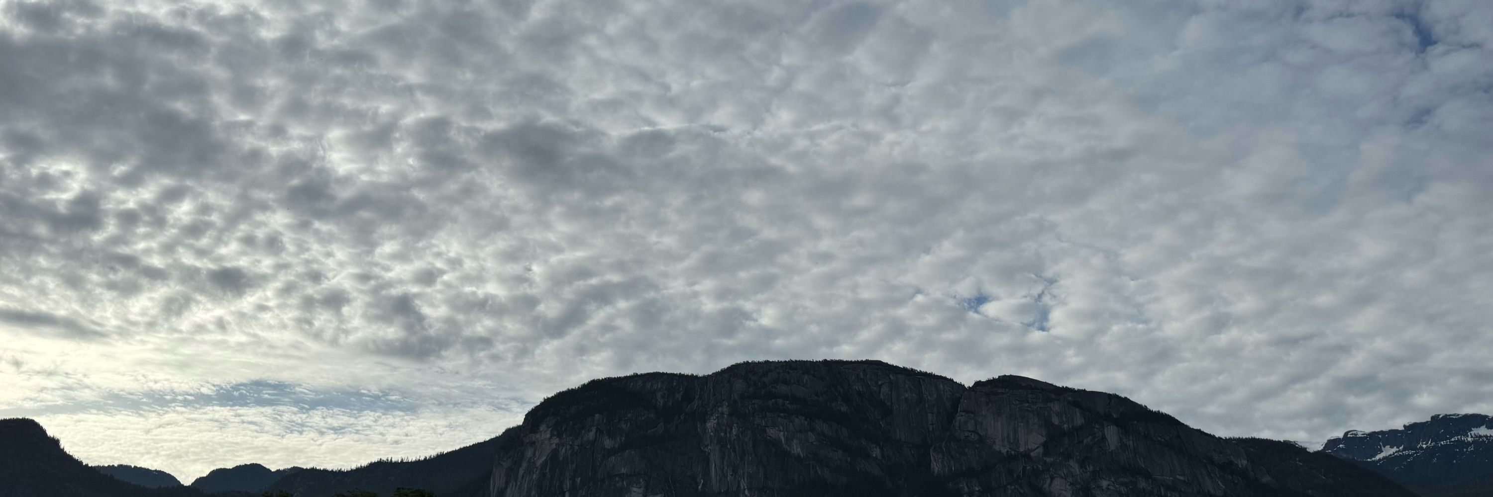
An upper trough over the Pacific will drive a frontal system towards the south coast this evening through Wednesday, bringing much-needed precipitation and a risk of thunderstorms to the area. High pressure will start to build over southwestern BC on Thursday into next weekend. #BCStorm
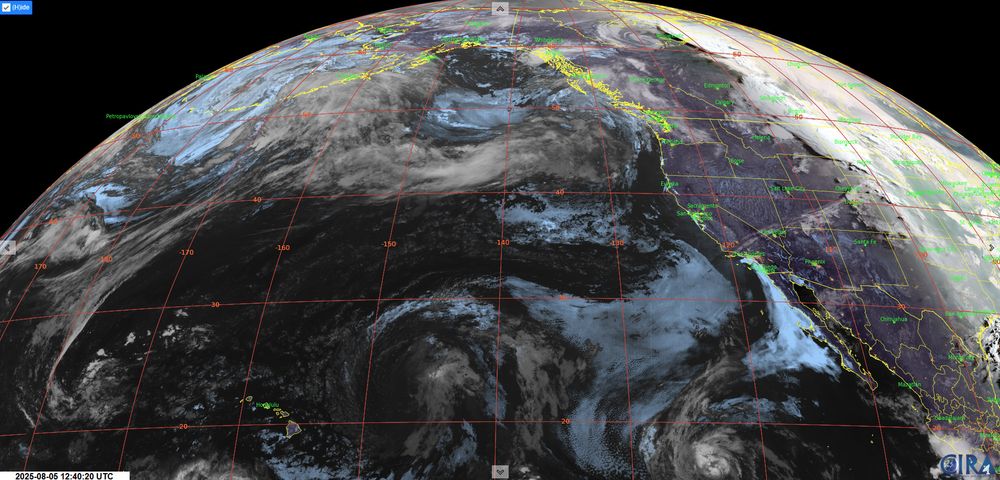
August 5, 2025 at 1:10 PM
An upper trough over the Pacific will drive a frontal system towards the south coast this evening through Wednesday, bringing much-needed precipitation and a risk of thunderstorms to the area. High pressure will start to build over southwestern BC on Thursday into next weekend. #BCStorm
I apologize for the typo this morning. It was tough to get rolling earlier today after my epic trail run yesterday into Garibaldi Provincial Park Panorama Ridge.
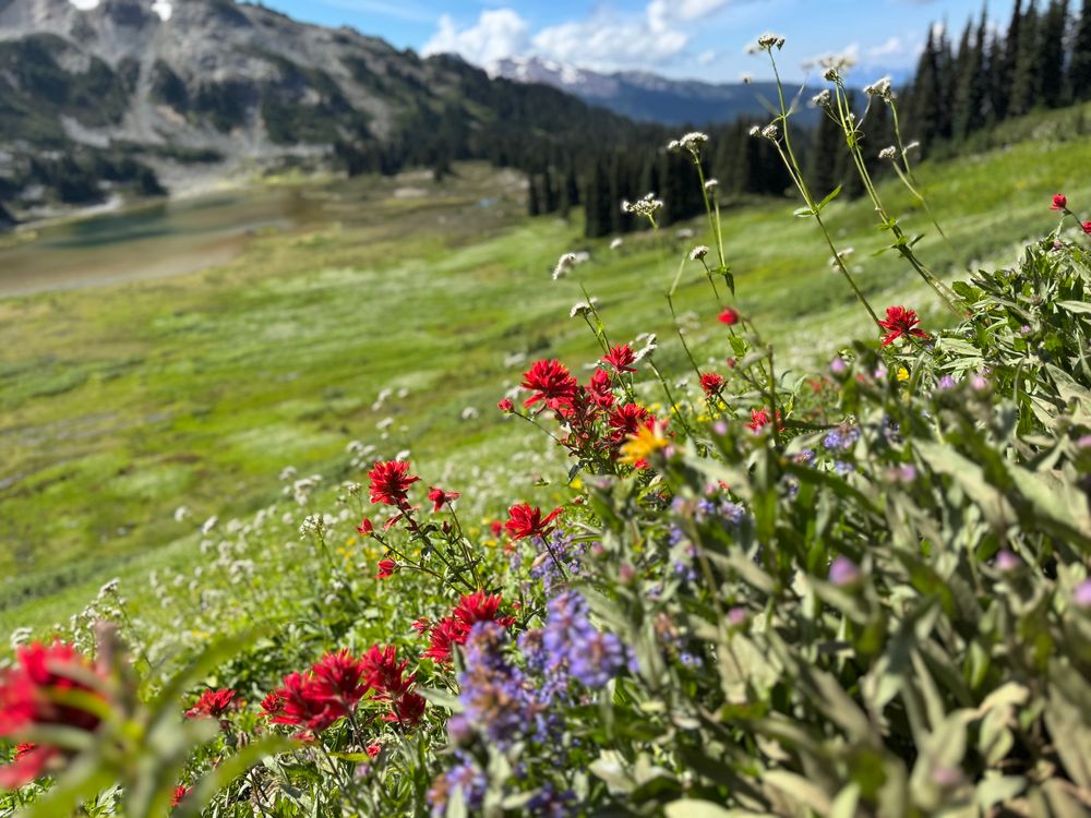
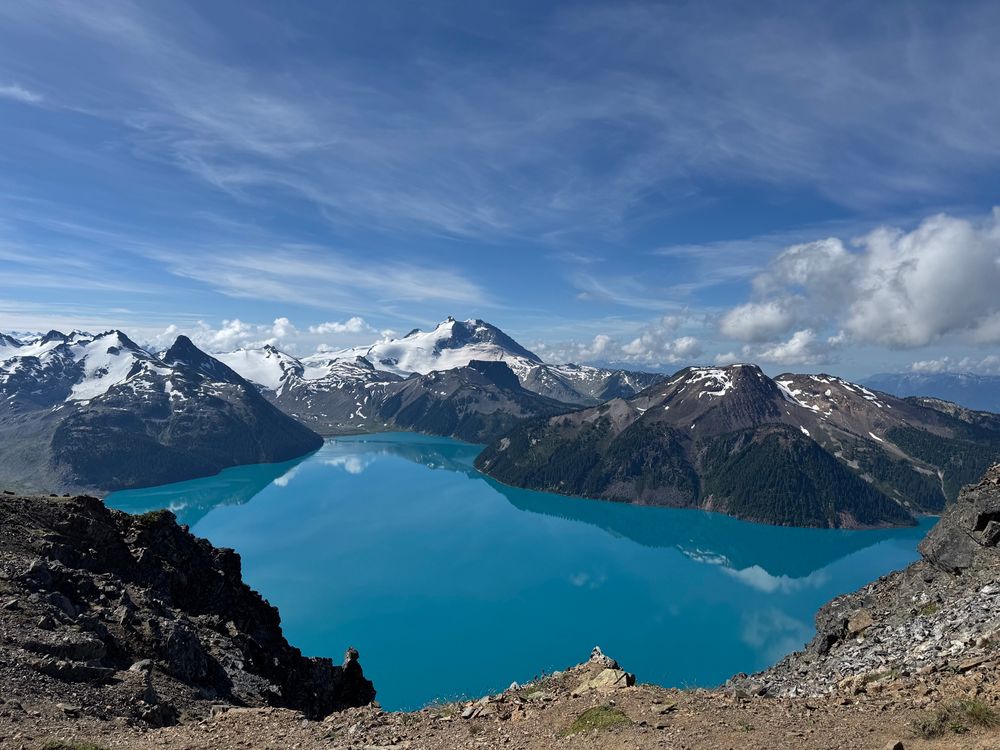
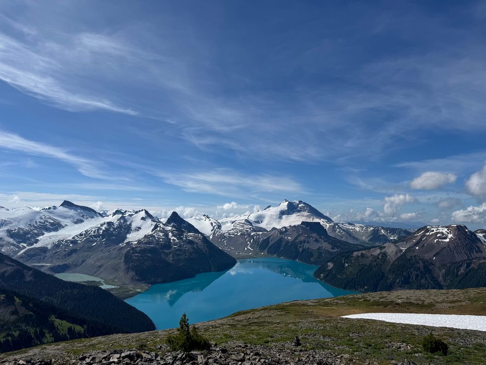
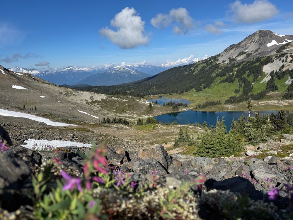
July 29, 2025 at 1:39 AM
I apologize for the typo this morning. It was tough to get rolling earlier today after my epic trail run yesterday into Garibaldi Provincial Park Panorama Ridge.