


pycoaj
@pycoaj.bsky.social
Python for Climate/Ocean/Atmosphere science.
気候・海洋・大気分野でのpython情報。
気候・海洋・大気分野でのpython情報。
Reposted by pycoaj

📝New eLearning: Supervised Machine Learning Readiness 📝
Get started with ML in the Earth systems sciences with this self-paced no- and low-code learning series. Enroll for free today on NSF Unidata eLearning!
elearning.unidata.ucar.edu/course/view....
Get started with ML in the Earth systems sciences with this self-paced no- and low-code learning series. Enroll for free today on NSF Unidata eLearning!
elearning.unidata.ucar.edu/course/view....

May 8, 2025 at 6:00 PM
📝New eLearning: Supervised Machine Learning Readiness 📝
Get started with ML in the Earth systems sciences with this self-paced no- and low-code learning series. Enroll for free today on NSF Unidata eLearning!
elearning.unidata.ucar.edu/course/view....
Get started with ML in the Earth systems sciences with this self-paced no- and low-code learning series. Enroll for free today on NSF Unidata eLearning!
elearning.unidata.ucar.edu/course/view....
Reposted by pycoaj
Due to the current gap in funding from the U.S. National Science Foundation (NSF), the NSF Unidata Program is pausing most operations effective 12 May 2025. Nearly all staff will be furloughed until funds from our existing NSF grant become available. For more information, see buff.ly/d2TC1Oy

NSF Unidata Pause in Most Operations
NSF Unidata Pause in Most Operations
www.unidata.ucar.edu
May 9, 2025 at 4:00 PM
Due to the current gap in funding from the U.S. National Science Foundation (NSF), the NSF Unidata Program is pausing most operations effective 12 May 2025. Nearly all staff will be furloughed until funds from our existing NSF grant become available. For more information, see buff.ly/d2TC1Oy
Reposted by pycoaj

MetPy 1.7.0 is out! Highlights include saturation vapor pressure (including over ice) and LCL calculations, automated high/low identification, and clients for accessing S3 archives of NEXRAD L2/L3, GOES, and ML weather prediction output (from NOAA/CIRA), and more! github.com/Unidata/MetP...
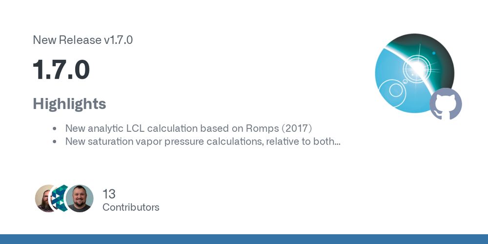
Release 1.7.0 · Unidata/MetPy
Highlights
New analytic LCL calculation based on Romps (2017)
New saturation vapor pressure calculations, relative to both ice and liquid, using Ambaum (2020)
Moisture/temperature dependent gas co...
github.com
May 1, 2025 at 8:10 PM
MetPy 1.7.0 is out! Highlights include saturation vapor pressure (including over ice) and LCL calculations, automated high/low identification, and clients for accessing S3 archives of NEXRAD L2/L3, GOES, and ML weather prediction output (from NOAA/CIRA), and more! github.com/Unidata/MetP...
Reposted by pycoaj
Want a clean way to combine a Skew-T and time series in Python?
This week’s #MetPyMonday shows how to wrangle GridSpec for a tight layout with MetPy + Siphon. youtu.be/fzEJvnaXYJw?...
This week’s #MetPyMonday shows how to wrangle GridSpec for a tight layout with MetPy + Siphon. youtu.be/fzEJvnaXYJw?...
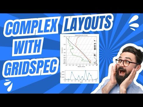
MetPy Mondays #327 – Complicated Layouts with GridSpec
YouTube video by NSF Unidata
youtu.be
April 23, 2025 at 5:24 PM
Want a clean way to combine a Skew-T and time series in Python?
This week’s #MetPyMonday shows how to wrangle GridSpec for a tight layout with MetPy + Siphon. youtu.be/fzEJvnaXYJw?...
This week’s #MetPyMonday shows how to wrangle GridSpec for a tight layout with MetPy + Siphon. youtu.be/fzEJvnaXYJw?...
Reposted by pycoaj

If you've been looking for a quick way to make some GOES composites (e.g. geocolor, airmass), here's a notebook showing how to do it using SatPy and AWS S3 data (optionally a little bit of the next @metpy.bsky.social release). gist.github.com/dopplershift...
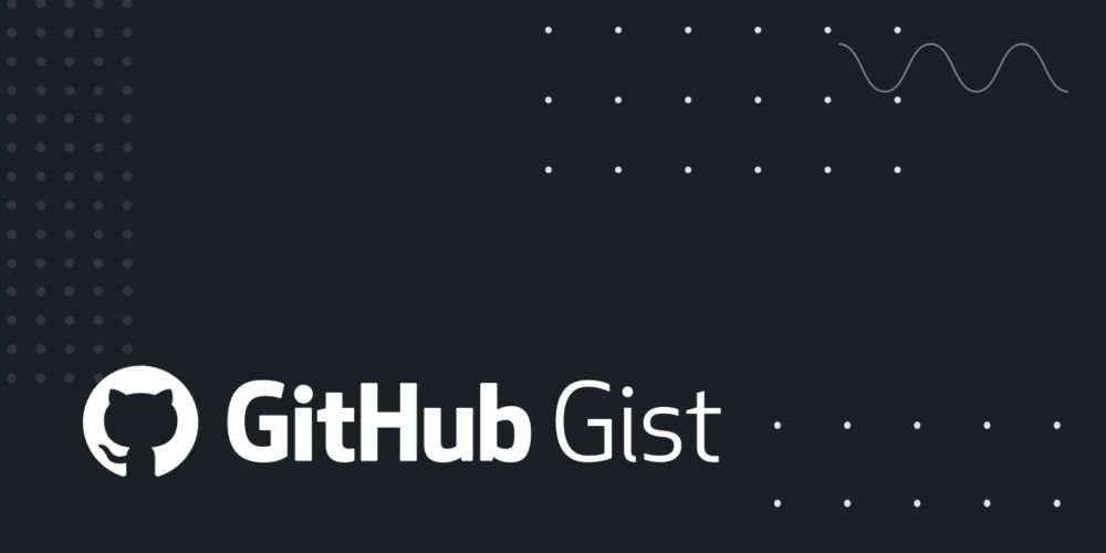
Create GOES composite imagery products in Python using SatPy and data from public AWS S3 buckets.
Create GOES composite imagery products in Python using SatPy and data from public AWS S3 buckets. - GOES Composites with SatPy.ipynb
gist.github.com
April 12, 2025 at 6:12 PM
If you've been looking for a quick way to make some GOES composites (e.g. geocolor, airmass), here's a notebook showing how to do it using SatPy and AWS S3 data (optionally a little bit of the next @metpy.bsky.social release). gist.github.com/dopplershift...
Reposted by pycoaj

Join us tomorrow, Wednesday April 16 at 12 PM ET for Pangeo lightning talks! The amazing set of topics includes climate data visualization, Parquet usage in oceanography, organizing model data with Zarr and STAC, speeding up Zarr, scaling geospatial zonal statistics, and rechunking 🤩

Spring showcase close-out: Lightning talks! (April 16, 2025 at 12 PM ET)
Title: “Spring showcase close-out: Lightning talks!!!” When: Wednesday, April 16, 2025 at 12 PM EST Where: Launch Meeting - Zoom Add to your calendar: Community calendar Details: ⚡ Join us next ...
discourse.pangeo.io
April 15, 2025 at 6:56 PM
Join us tomorrow, Wednesday April 16 at 12 PM ET for Pangeo lightning talks! The amazing set of topics includes climate data visualization, Parquet usage in oceanography, organizing model data with Zarr and STAC, speeding up Zarr, scaling geospatial zonal statistics, and rechunking 🤩
Reposted by pycoaj

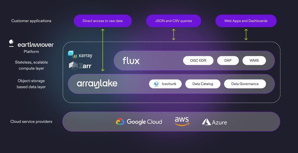
Imagine if all you had to do to serve geopspatial data over OGC APIs was to ingest @zarr.dev datasets into cloud object storage...and the platform handled the rest. Scaling, logging, metrics, auth, etc. That's Flux! Join our webinar if you want to learn more.

1/ Today we are launching Flux, a powerful new addition to the Earthmover platform. Flux is a high-performance gateway for exploring, querying, and visualizing geospatial data via standards-compliant APIs (EDR, WMS, and OPeNDAP).
April 16, 2025 at 3:15 PM
Imagine if all you had to do to serve geopspatial data over OGC APIs was to ingest @zarr.dev datasets into cloud object storage...and the platform handled the rest. Scaling, logging, metrics, auth, etc. That's Flux! Join our webinar if you want to learn more.
Reposted by pycoaj
I have to admit that I too was confused about how S3 prefixes and scalability work before reading this post by @functionth.bsky.social.
📣 Blog post alert! 𝐄𝐱𝐩𝐥𝐨𝐫𝐢𝐧𝐠 𝐈𝐜𝐞𝐜𝐡𝐮𝐧𝐤 𝐬𝐜𝐚𝐥𝐚𝐛𝐢𝐥𝐢𝐭𝐲: 𝐮𝐧𝐭𝐚𝐧𝐠𝐥𝐢𝐧𝐠 𝐒𝟑'𝐬 𝐩𝐫𝐞𝐟𝐢𝐱 𝐬𝐭𝐨𝐫𝐲. This technical post by @functionth.bsky.social dives deep into the internals of how S3 shards data, showing that distributed Icechunk can easily perform 230,000 object reads/sec and beyond. earthmover.io/blog/explori...
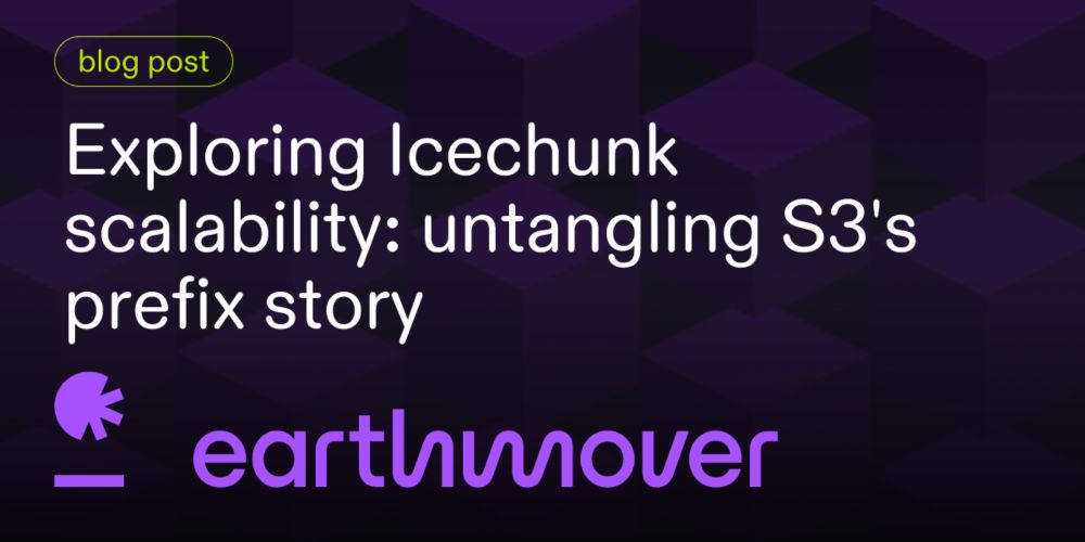
Exploring Icechunk scalability: untangling S3's prefix story | Earthmover
We show Icechunk can scale to extremely high concurrency levels, and explain how it achieves this in modern object stores.
earthmover.io
April 9, 2025 at 3:42 PM
I have to admit that I too was confused about how S3 prefixes and scalability work before reading this post by @functionth.bsky.social.
Reposted by pycoaj

🌍✨ Check out this demo of visualizing Earth Engine data on a 3D globe! It shows how to visualize nighttime light and land cover data, and you can easily adapt the code to visualize any #EarthEngine dataset.
Notebook: geemap.org/workshops/GE...
GitHub: github.com/gee-communit...
#geospatial
Notebook: geemap.org/workshops/GE...
GitHub: github.com/gee-communit...
#geospatial
April 11, 2025 at 2:22 PM
🌍✨ Check out this demo of visualizing Earth Engine data on a 3D globe! It shows how to visualize nighttime light and land cover data, and you can easily adapt the code to visualize any #EarthEngine dataset.
Notebook: geemap.org/workshops/GE...
GitHub: github.com/gee-communit...
#geospatial
Notebook: geemap.org/workshops/GE...
GitHub: github.com/gee-communit...
#geospatial
Reposted by pycoaj
📣 Tomorrow's Pangeo showcase presentation will be at an earlier than usual time! Join us on April 9 at 12 PM ET to learn about scaling Dask Array up for terabyte-level performance! Hope to see y'all there 🚀 discourse.pangeo.io/t/pangeo-sho...
Pangeo Showcase: "Dask Array: Scaling Up for Terabyte-Level Performance" (April 9, 2025 at 12 PM ET)
‼ Please note that this is happening at 12 PM ET even though it’s typically a “late” meeting week Title: “Dask Array: Scaling Up for Terabyte-Level Performance” Invited Speaker: Hendrik Makait When...
discourse.pangeo.io
April 9, 2025 at 1:18 AM
📣 Tomorrow's Pangeo showcase presentation will be at an earlier than usual time! Join us on April 9 at 12 PM ET to learn about scaling Dask Array up for terabyte-level performance! Hope to see y'all there 🚀 discourse.pangeo.io/t/pangeo-sho...
Reposted by pycoaj
🚀 Leafmap now supports visualizing geospatial data on a stunning 3D globe with MapLibre 🌍
🎥 Check out the full tutorial: youtu.be/D2bdwLkU1KQ
📓 Dive into the notebook: leafmap.org/maplibre/globe_control
🌐 Try the demo: maps.gishub.org/maplibre/globe_control_4.html
#Geospatial #3DMapping #Python
🎥 Check out the full tutorial: youtu.be/D2bdwLkU1KQ
📓 Dive into the notebook: leafmap.org/maplibre/globe_control
🌐 Try the demo: maps.gishub.org/maplibre/globe_control_4.html
#Geospatial #3DMapping #Python
April 9, 2025 at 12:34 PM
🚀 Leafmap now supports visualizing geospatial data on a stunning 3D globe with MapLibre 🌍
🎥 Check out the full tutorial: youtu.be/D2bdwLkU1KQ
📓 Dive into the notebook: leafmap.org/maplibre/globe_control
🌐 Try the demo: maps.gishub.org/maplibre/globe_control_4.html
#Geospatial #3DMapping #Python
🎥 Check out the full tutorial: youtu.be/D2bdwLkU1KQ
📓 Dive into the notebook: leafmap.org/maplibre/globe_control
🌐 Try the demo: maps.gishub.org/maplibre/globe_control_4.html
#Geospatial #3DMapping #Python
Reposted by pycoaj

The 28 March NITheCS Micro-School titled ‘Unlocking Earth Observation Data – Access and Analysis with Xarray Ecosystem Tools’ by Marco Wolsza (Friedrich Schiller University Jena, Germany) is now available to view online at buff.ly/1UJDQEC


April 5, 2025 at 2:59 PM
The 28 March NITheCS Micro-School titled ‘Unlocking Earth Observation Data – Access and Analysis with Xarray Ecosystem Tools’ by Marco Wolsza (Friedrich Schiller University Jena, Germany) is now available to view online at buff.ly/1UJDQEC
Reposted by pycoaj
🚀 GeoAI Tutorial 17: Create a Labeled Dataset for Deep Learning 🌍
Learn how to create a labeled dataset interactively in a Jupyter environment—no desktop GIS required.
🎥 Watch the full tutorial here: youtu.be/QqjhLFN8Hdc
📓 Explore the notebook: geoai.gishub.org/examples/cre...
Learn how to create a labeled dataset interactively in a Jupyter environment—no desktop GIS required.
🎥 Watch the full tutorial here: youtu.be/QqjhLFN8Hdc
📓 Explore the notebook: geoai.gishub.org/examples/cre...
April 5, 2025 at 1:39 PM
🚀 GeoAI Tutorial 17: Create a Labeled Dataset for Deep Learning 🌍
Learn how to create a labeled dataset interactively in a Jupyter environment—no desktop GIS required.
🎥 Watch the full tutorial here: youtu.be/QqjhLFN8Hdc
📓 Explore the notebook: geoai.gishub.org/examples/cre...
Learn how to create a labeled dataset interactively in a Jupyter environment—no desktop GIS required.
🎥 Watch the full tutorial here: youtu.be/QqjhLFN8Hdc
📓 Explore the notebook: geoai.gishub.org/examples/cre...
Reposted by pycoaj
No showcase this week, but join us on April 9 at 12 PM ET to learn about scaling Dask Array up for terabyte-level performance! We're also looking for folks to give lightning talks at our last showcase of the Spring on April 16 - sign up here - forms.gle/NA5zXdgmHHZs...

Pangeo lightning talks - Spring 2025
Sign up to give a lightning talk at the Pangeo showcase on April 16 at 12 PM ET
You can give a demo, slides, rant, whatever you want to share - but keep it to 5 minutes or less please! We'll be stric...
forms.gle
April 2, 2025 at 2:05 PM
No showcase this week, but join us on April 9 at 12 PM ET to learn about scaling Dask Array up for terabyte-level performance! We're also looking for folks to give lightning talks at our last showcase of the Spring on April 16 - sign up here - forms.gle/NA5zXdgmHHZs...
Reposted by pycoaj
This one was a lot of fun to work on! Why @xarray.bsky.social and @zarr.dev are faster than DuckDB and Parquet for gridded data...from first principles.
⭐ We just released the first post in our Fundamentals series. This one is called 𝐓𝐞𝐧𝐬𝐨𝐫𝐬 𝐯𝐬. 𝐓𝐚𝐛𝐥𝐞𝐬 - 𝐖𝐡𝐲 𝐭𝐚𝐛𝐮𝐥𝐚𝐫 𝐭𝐨𝐨𝐥𝐬 𝐭𝐫𝐢𝐩 𝐨𝐯𝐞𝐫 𝐠𝐫𝐢𝐝𝐝𝐞𝐝 𝐝𝐚𝐭𝐚. earthmover.io/blog/tensors...

Fundamentals: Tensors vs. Tables | Earthmover
Why tabular tools trip over gridded data.
earthmover.io
April 3, 2025 at 6:05 PM
This one was a lot of fun to work on! Why @xarray.bsky.social and @zarr.dev are faster than DuckDB and Parquet for gridded data...from first principles.
Reposted by pycoaj

aerobulk-python 0.4.2 (Pre-Alpha)
General Circulation Model Postprocessing with xarray
Author: aerobulk-python Developers
🏠Homepage
General Circulation Model Postprocessing with xarray
Author: aerobulk-python Developers
🏠Homepage
April 2, 2025 at 3:00 AM
aerobulk-python 0.4.2 (Pre-Alpha)
General Circulation Model Postprocessing with xarray
Author: aerobulk-python Developers
🏠Homepage
General Circulation Model Postprocessing with xarray
Author: aerobulk-python Developers
🏠Homepage
Reposted by pycoaj
Need to know which METAR station is closest to your point of interest? Checkout this week's #metpymonday
We show you how to:
✅ Build a clean station list from MetPy
✅ Find the nearest station using KDTree
✅ Find distance with GeoPandas
#Python
youtu.be/nMTFb-8e1Nk?...
We show you how to:
✅ Build a clean station list from MetPy
✅ Find the nearest station using KDTree
✅ Find distance with GeoPandas
#Python
youtu.be/nMTFb-8e1Nk?...
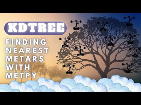
MetPy Mondays #326 - Use KDTree and MetPy to Find the Nearest METAR
YouTube video by NSF Unidata
youtu.be
April 1, 2025 at 4:20 PM
Need to know which METAR station is closest to your point of interest? Checkout this week's #metpymonday
We show you how to:
✅ Build a clean station list from MetPy
✅ Find the nearest station using KDTree
✅ Find distance with GeoPandas
#Python
youtu.be/nMTFb-8e1Nk?...
We show you how to:
✅ Build a clean station list from MetPy
✅ Find the nearest station using KDTree
✅ Find distance with GeoPandas
#Python
youtu.be/nMTFb-8e1Nk?...
Reposted by pycoaj
🚀 GeoAI Tutorial 14: Search and Download Data From Microsoft Planetary Computer 🌍
Learn how to search, visualize, and download geospatial data from Microsoft Planetary Computer.
🎥 Watch the full tutorial here: youtu.be/bnY5isQApW0
📓 Explore the notebook: geoai.gishub.org/examples/pla...
Learn how to search, visualize, and download geospatial data from Microsoft Planetary Computer.
🎥 Watch the full tutorial here: youtu.be/bnY5isQApW0
📓 Explore the notebook: geoai.gishub.org/examples/pla...

March 22, 2025 at 1:14 AM
🚀 GeoAI Tutorial 14: Search and Download Data From Microsoft Planetary Computer 🌍
Learn how to search, visualize, and download geospatial data from Microsoft Planetary Computer.
🎥 Watch the full tutorial here: youtu.be/bnY5isQApW0
📓 Explore the notebook: geoai.gishub.org/examples/pla...
Learn how to search, visualize, and download geospatial data from Microsoft Planetary Computer.
🎥 Watch the full tutorial here: youtu.be/bnY5isQApW0
📓 Explore the notebook: geoai.gishub.org/examples/pla...
Reposted by pycoaj
The 14 March NITheCS Micro-School titled ‘Introduction to Xarray: Empowering Multidimensional Data Analysis’ by Marco Wolsza (Friedrich Schiller University Jena, Germany) may now be viewed online at buff.ly/jLJ4KKI.


March 19, 2025 at 9:30 AM
The 14 March NITheCS Micro-School titled ‘Introduction to Xarray: Empowering Multidimensional Data Analysis’ by Marco Wolsza (Friedrich Schiller University Jena, Germany) may now be viewed online at buff.ly/jLJ4KKI.
Reposted by pycoaj

🌐 Scaling geoscience workloads with Dask and Xarray is crucial for analyzing massive datasets. Hendrik Makait explores the challenges and improvements in Dask, making it easier to scale from prototyping to petabyte-scale analyses. 📊
Watch the talk:
Watch the talk:

Hendrik Makait - Geoscience at Massive Scale | PyData Paris 2024
When scaling geoscience workloads to large datasets, many scientists and developers reach for Dask, a library for distributed computing that plugs seamlessly...
buff.ly
March 13, 2025 at 8:05 AM
🌐 Scaling geoscience workloads with Dask and Xarray is crucial for analyzing massive datasets. Hendrik Makait explores the challenges and improvements in Dask, making it easier to scale from prototyping to petabyte-scale analyses. 📊
Watch the talk:
Watch the talk:
Reposted by pycoaj
🚀 GeoAI Tutorial 12: Wetland Mapping with Deep Learning and GeoAI! 🌍
🎥 Watch the full tutorial here: youtu.be/ed79i3DTWT0
📓 Explore the notebook: geoai.gishub.org/examples/wet...
#GeoAI #geospatial #AI #Python #DeepLearning
🎥 Watch the full tutorial here: youtu.be/ed79i3DTWT0
📓 Explore the notebook: geoai.gishub.org/examples/wet...
#GeoAI #geospatial #AI #Python #DeepLearning
March 15, 2025 at 12:44 PM
🚀 GeoAI Tutorial 12: Wetland Mapping with Deep Learning and GeoAI! 🌍
🎥 Watch the full tutorial here: youtu.be/ed79i3DTWT0
📓 Explore the notebook: geoai.gishub.org/examples/wet...
#GeoAI #geospatial #AI #Python #DeepLearning
🎥 Watch the full tutorial here: youtu.be/ed79i3DTWT0
📓 Explore the notebook: geoai.gishub.org/examples/wet...
#GeoAI #geospatial #AI #Python #DeepLearning
Reposted by pycoaj
🌟 Leafmap Tutorial 105: Visualizing Vector Data with Time Attributes! This demo showcases the evolution of median home values in California from 2000 to 2025. 📈🏡
🔗 Watch on YouTube: youtu.be/FiP3sKkoyKs
📓 Notebook: leafmap.org/notebooks/10...
🌐 Try the PyCafe Web App: py.cafe/giswqs/vecto...
🔗 Watch on YouTube: youtu.be/FiP3sKkoyKs
📓 Notebook: leafmap.org/notebooks/10...
🌐 Try the PyCafe Web App: py.cafe/giswqs/vecto...
March 1, 2025 at 2:59 PM
🌟 Leafmap Tutorial 105: Visualizing Vector Data with Time Attributes! This demo showcases the evolution of median home values in California from 2000 to 2025. 📈🏡
🔗 Watch on YouTube: youtu.be/FiP3sKkoyKs
📓 Notebook: leafmap.org/notebooks/10...
🌐 Try the PyCafe Web App: py.cafe/giswqs/vecto...
🔗 Watch on YouTube: youtu.be/FiP3sKkoyKs
📓 Notebook: leafmap.org/notebooks/10...
🌐 Try the PyCafe Web App: py.cafe/giswqs/vecto...
Reposted by pycoaj

Highlighting a country on a map with #Python, #Matplotlib and #Cartopy scipython.com/blog/highlig...

February 26, 2025 at 11:40 AM
Highlighting a country on a map with #Python, #Matplotlib and #Cartopy scipython.com/blog/highlig...
Reposted by pycoaj

🚀 Exciting news for xarray & Pangeo users! Brockmann Consult has released XRLint, a linter for xarray datasets. Validate Dataset & DataTree with configurable rules via CLI or Python API. Check it out 🚀:
🔗 Repo: github.com/bcdev/xrlint
📖 Docs: bcdev.github.io/xrlint
🔗 Repo: github.com/bcdev/xrlint
📖 Docs: bcdev.github.io/xrlint
GitHub - bcdev/xrlint: A linter for xarray datasets
A linter for xarray datasets. Contribute to bcdev/xrlint development by creating an account on GitHub.
github.com
February 26, 2025 at 12:59 PM
🚀 Exciting news for xarray & Pangeo users! Brockmann Consult has released XRLint, a linter for xarray datasets. Validate Dataset & DataTree with configurable rules via CLI or Python API. Check it out 🚀:
🔗 Repo: github.com/bcdev/xrlint
📖 Docs: bcdev.github.io/xrlint
🔗 Repo: github.com/bcdev/xrlint
📖 Docs: bcdev.github.io/xrlint
Reposted by pycoaj

𝗚𝗲𝗼𝘀𝗽𝗮𝘁𝗶𝗮𝗹 𝗣𝘆𝘁𝗵𝗼𝗻 𝗧𝘂𝘁𝗼𝗿𝗶𝗮𝗹𝘀
SpatialThoughts provides tutorials covering a broad range of geospatial topics and technologies, e.g., #GeoPandas, #XArray, #dask, and more. Each technology is described in a notebook with step-by-step explanation.
Check it out: buff.ly/4ha3HOo
SpatialThoughts provides tutorials covering a broad range of geospatial topics and technologies, e.g., #GeoPandas, #XArray, #dask, and more. Each technology is described in a notebook with step-by-step explanation.
Check it out: buff.ly/4ha3HOo
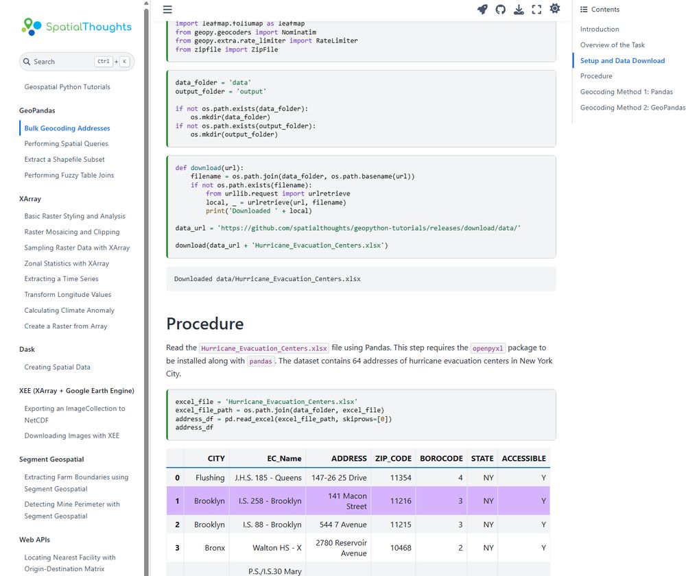
Geospatial Python Tutorials
Welcome to Spatial Analysis and Remote Sensing Tutorials by Spatial Thoughts. These tutorials complement our Python courses and are suitable for learners who want to advance their skills.
buff.ly
February 28, 2025 at 8:05 AM
𝗚𝗲𝗼𝘀𝗽𝗮𝘁𝗶𝗮𝗹 𝗣𝘆𝘁𝗵𝗼𝗻 𝗧𝘂𝘁𝗼𝗿𝗶𝗮𝗹𝘀
SpatialThoughts provides tutorials covering a broad range of geospatial topics and technologies, e.g., #GeoPandas, #XArray, #dask, and more. Each technology is described in a notebook with step-by-step explanation.
Check it out: buff.ly/4ha3HOo
SpatialThoughts provides tutorials covering a broad range of geospatial topics and technologies, e.g., #GeoPandas, #XArray, #dask, and more. Each technology is described in a notebook with step-by-step explanation.
Check it out: buff.ly/4ha3HOo