


Alejandro Pineda
@pinedaalejandro.bsky.social
PhD Architect and urban planner. My research focuses on shrinking cities and place attachment in Japan.
https://linktr.ee/Pinedaalejandrojuan
https://linktr.ee/Pinedaalejandrojuan
Despite being early on a weekday morning, many neighbors, some with their kids, were there for breakfast. I am glad to have found this place! As a bonus, some pictures of me enjoying breakfast there.
#Sweetspots
#Sweetspots


October 10, 2025 at 11:41 AM
Despite being early on a weekday morning, many neighbors, some with their kids, were there for breakfast. I am glad to have found this place! As a bonus, some pictures of me enjoying breakfast there.
#Sweetspots
#Sweetspots
The renovation is simple—maintaining the building structure and focusing on cleaning the facade, inner walls, and backyard—but very effective in creating a comfortable and inviting community space.
#Placemaking
#Placemaking


October 10, 2025 at 11:41 AM
The renovation is simple—maintaining the building structure and focusing on cleaning the facade, inner walls, and backyard—but very effective in creating a comfortable and inviting community space.
#Placemaking
#Placemaking
More information (in Japanese) about the city walkable plan and this project here:
note.com/infra_junrei...
#Himeji #Japan
note.com/infra_junrei...
#Himeji #Japan

インフラ巡礼 in 姫路市 ウォーカブルなまちの実現に向けて現場で働く人にインタビュー!<大手前通り再整備事業編>|インフラ巡礼|国土交通省 総合政策局 社会資本整備政策課・公共事業企画調整課
にこちゃん きらちゃん、姫路市って行ったことある? きらちゃん うん!行ったことあるよ! 姫路市は兵庫県の都市で、 県内では人口が神戸市に次いで2番目に多い都市なんだよね。 げんきくん そうそう。 特に姫路城は有名で、日本で初めて選ばれた世界遺産の一つなんだ! 姫路城はJR姫路駅北口から徒歩で行ける距離に立地しているよ! きらちゃん JR姫路駅は駅前広場の再整備が進み、平成27年に完成。 今では大...
note.com
October 8, 2025 at 12:24 PM
More information (in Japanese) about the city walkable plan and this project here:
note.com/infra_junrei...
#Himeji #Japan
note.com/infra_junrei...
#Himeji #Japan
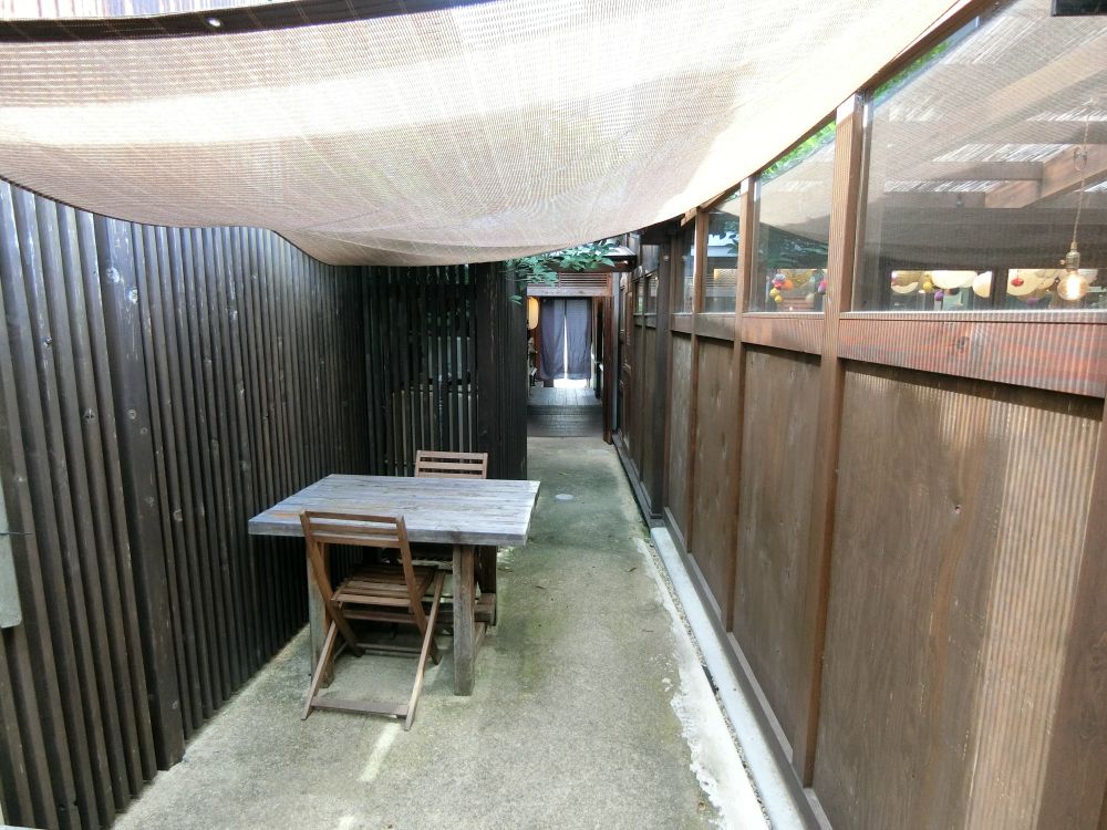
I managed to visit one of these renovation projects: an abandoned house that has been renovated into a lovely café (I will write about it in a future post!).


October 8, 2025 at 12:24 PM
I managed to visit one of these renovation projects: an abandoned house that has been renovated into a lovely café (I will write about it in a future post!).
This improved connection with the shotengais and many surrounding narrow alleys is one of the project's strongest points. I managed to see some everyday urban scenes that I had overlooked in my previous trips.


October 8, 2025 at 12:24 PM
This improved connection with the shotengais and many surrounding narrow alleys is one of the project's strongest points. I managed to see some everyday urban scenes that I had overlooked in my previous trips.
This project is part of the "Himeji Walkable Promotion Plan" adopted in March 2021. The plan integrates the renovation of Otomemae Street with the eastern and western shotengais (shopping streets), where it also performs some building-renovation initiatives.


October 8, 2025 at 12:24 PM
This project is part of the "Himeji Walkable Promotion Plan" adopted in March 2021. The plan integrates the renovation of Otomemae Street with the eastern and western shotengais (shopping streets), where it also performs some building-renovation initiatives.
One of the project's main ideas is to showcase greenery and seasonal flowers that invite visitors to pause and draw their eyes downward from the castle to the street-level landscape. Most of these flower beds are maintained by local neighborhoods and nearby businesses.


October 8, 2025 at 12:24 PM
One of the project's main ideas is to showcase greenery and seasonal flowers that invite visitors to pause and draw their eyes downward from the castle to the street-level landscape. Most of these flower beds are maintained by local neighborhoods and nearby businesses.
The government designed the sidewalks on Otomemae Street to be among Japan's first Hokomichi (pedestrian-friendly roads). It widened the sidewalks to 16.1 meters to accommodate wooden decks, flexible furniture, and food trucks for events, open-air cafés, and exhibitions.


October 8, 2025 at 12:24 PM
The government designed the sidewalks on Otomemae Street to be among Japan's first Hokomichi (pedestrian-friendly roads). It widened the sidewalks to 16.1 meters to accommodate wooden decks, flexible furniture, and food trucks for events, open-air cafés, and exhibitions.
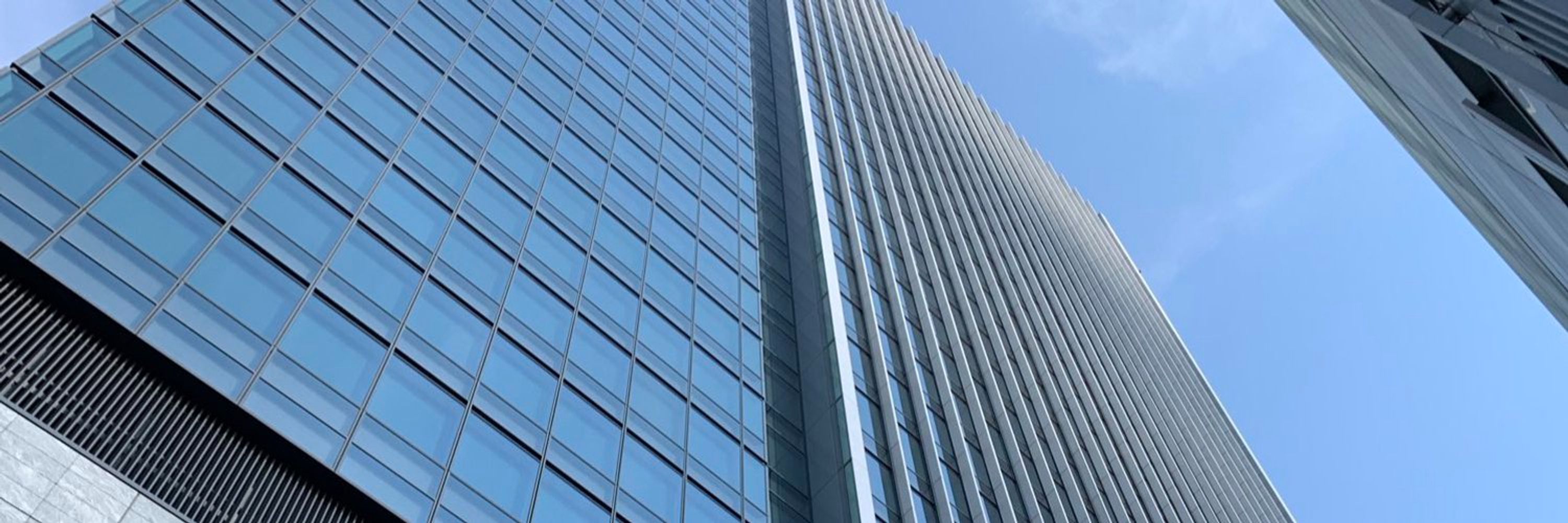
When I first visited the area before 2011, the area around the station had a lot of traffic jams. In 2015, the city reformed this area and prioritized foot traffic through ground-level and elevated walkways. This post is from my visit in 2024, after the redevelopment project:


October 8, 2025 at 12:24 PM
When I first visited the area before 2011, the area around the station had a lot of traffic jams. In 2015, the city reformed this area and prioritized foot traffic through ground-level and elevated walkways. This post is from my visit in 2024, after the redevelopment project:
Viewed together, all of these works serve as time capsules that reveal how people lived, moved, traded, and conceived of place during moments of radical transformation.
October 3, 2025 at 12:39 PM
Viewed together, all of these works serve as time capsules that reveal how people lived, moved, traded, and conceived of place during moments of radical transformation.
Most maps produced between the late Edo and early Meiji periods focus on the modernization of specific cities such as Nagasaki (and the island of Dejima), Sakai, and especially Edo (now Tokyo). They chart the shift to a connected, industrializing nation street by street.


October 3, 2025 at 12:39 PM
Most maps produced between the late Edo and early Meiji periods focus on the modernization of specific cities such as Nagasaki (and the island of Dejima), Sakai, and especially Edo (now Tokyo). They chart the shift to a connected, industrializing nation street by street.
Later works during the Edo period integrated foreign cartographic ideas into Japanese traditions, such as woodblock print maps created by ukiyo-e artists and traditional-style drawings of the Japanese archipelago. Here are some examples.


October 3, 2025 at 12:39 PM
Later works during the Edo period integrated foreign cartographic ideas into Japanese traditions, such as woodblock print maps created by ukiyo-e artists and traditional-style drawings of the Japanese archipelago. Here are some examples.
Early maps often followed Buddhist cosmographies, such as the Bankoku sōzu, and later adopted of a Western styles of visualization. These are early representations of Japan, painted on a two-fold screen and the back of a metallic mirror.


October 3, 2025 at 12:39 PM
Early maps often followed Buddhist cosmographies, such as the Bankoku sōzu, and later adopted of a Western styles of visualization. These are early representations of Japan, painted on a two-fold screen and the back of a metallic mirror.


掲載された地図は精緻かつ美麗で、実際に現地を訪れてさらに深く学びたいという思いを強く抱かせてくれます!
September 4, 2025 at 10:05 AM
掲載された地図は精緻かつ美麗で、実際に現地を訪れてさらに深く学びたいという思いを強く抱かせてくれます!