


Muskoka GIS
@muskokagis.bsky.social
The District of Muskoka GIS department. GIS = Geographic Information Systems = MAPS! Visit our GeoHub page for lots of cool maps, apps, and open data.
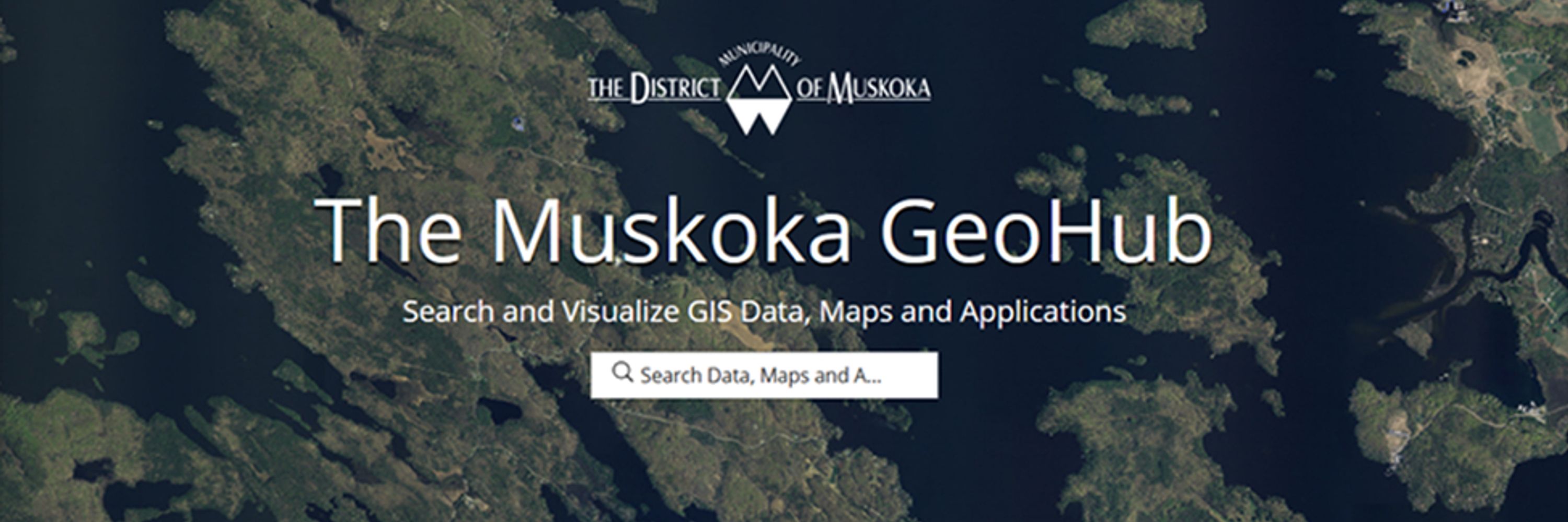
#Muskoka #Geomatics is celebrating #GISDay2025 in two ways: presenting at the Bracebridge Library tonight @ 6pm, and this morning we released the new Trails Explorer 2.0 app on the Muskoka #GeoHub! map.muskoka.on.ca @bracebridgelibrary.ca

November 19, 2025 at 2:13 PM
#Muskoka #Geomatics is celebrating #GISDay2025 in two ways: presenting at the Bracebridge Library tonight @ 6pm, and this morning we released the new Trails Explorer 2.0 app on the Muskoka #GeoHub! map.muskoka.on.ca @bracebridgelibrary.ca
For #GISDay, #Muskoka Geomatics is presenting the GeoHub Online Mapping Portal at the #Bracebridge Library
services.bracebridgelibrary.ca/event/14378682
@bracebridgelibrary.ca
services.bracebridgelibrary.ca/event/14378682
@bracebridgelibrary.ca

Muskoka GeoHub: Online Mapping Portal
Muskoka's GIS Project Coordinator Stuart Paul will showcase the GeoHub mapping portal. Learn what is available and how to use it. Maps include floodplain, topo, LiDAR, historic atlas & a dozen more!
services.bracebridgelibrary.ca
November 14, 2025 at 2:14 PM
For #GISDay, #Muskoka Geomatics is presenting the GeoHub Online Mapping Portal at the #Bracebridge Library
services.bracebridgelibrary.ca/event/14378682
@bracebridgelibrary.ca
services.bracebridgelibrary.ca/event/14378682
@bracebridgelibrary.ca
District of Muskoka Early Years and Child Care department worked with MuskokaGIS to create a dashboard of Early Development Instrument data from 2023 which measures and reports on children’s developmental health. map.muskoka.on.ca

November 7, 2025 at 8:40 PM
District of Muskoka Early Years and Child Care department worked with MuskokaGIS to create a dashboard of Early Development Instrument data from 2023 which measures and reports on children’s developmental health. map.muskoka.on.ca
Muskoka Geohub Users:
Our public GeoHub website host is experiencing technical issues this morning making it intermittently inaccessible. This is outside of our control, and we are waiting for the fix to come through. Sorry for the inconvenience.
Our public GeoHub website host is experiencing technical issues this morning making it intermittently inaccessible. This is outside of our control, and we are waiting for the fix to come through. Sorry for the inconvenience.
April 4, 2025 at 3:59 PM
Muskoka Geohub Users:
Our public GeoHub website host is experiencing technical issues this morning making it intermittently inaccessible. This is outside of our control, and we are waiting for the fix to come through. Sorry for the inconvenience.
Our public GeoHub website host is experiencing technical issues this morning making it intermittently inaccessible. This is outside of our control, and we are waiting for the fix to come through. Sorry for the inconvenience.
The #Muskoka #GeoHub has new floodwater features! The Floodline and Lidar app now shows live lake level lines for 7 major lakes, updated hourly, and the hydrograph tab shows the current level compared to operating zones with 20yrs historical data! map.muskoka.on.ca
@muskokawatershed.bsky.social
@muskokawatershed.bsky.social


April 3, 2025 at 8:17 PM
The #Muskoka #GeoHub has new floodwater features! The Floodline and Lidar app now shows live lake level lines for 7 major lakes, updated hourly, and the hydrograph tab shows the current level compared to operating zones with 20yrs historical data! map.muskoka.on.ca
@muskokawatershed.bsky.social
@muskokawatershed.bsky.social
Amazing enhancement to the Floodline and LiDAR Mapping 2.0 app on the #Muskoka #GeoHub! View real-time and historical hydrograph data showing lake water levels! map.muskoka.on.ca arcg.is/1fWWLX3

March 3, 2025 at 9:36 PM
Amazing enhancement to the Floodline and LiDAR Mapping 2.0 app on the #Muskoka #GeoHub! View real-time and historical hydrograph data showing lake water levels! map.muskoka.on.ca arcg.is/1fWWLX3
Celebrate World LiDAR Day by exploring the LiDAR Discovery storymap on the #Muskoka GeoHub.
storymaps.arcgis.com/stories/fbca...
#WorldLiDARDay2025 #lidarday
storymaps.arcgis.com/stories/fbca...
#WorldLiDARDay2025 #lidarday

LiDAR Discovery
Explore the amazing detail of the Muskoka LiDAR surveys
storymaps.arcgis.com
February 12, 2025 at 9:19 PM
Celebrate World LiDAR Day by exploring the LiDAR Discovery storymap on the #Muskoka GeoHub.
storymaps.arcgis.com/stories/fbca...
#WorldLiDARDay2025 #lidarday
storymaps.arcgis.com/stories/fbca...
#WorldLiDARDay2025 #lidarday
The fan-favourite 1879 Muskoka Atlas app has been given a well needed overhaul! Try it out on the #Muskoka GeoHub! map.muskoka.on.ca
If you are new to the Atlas, it is full of #historical maps, sketches, and descriptions of Muskoka from over 140 years ago!
@muskoka411.bsky.social
If you are new to the Atlas, it is full of #historical maps, sketches, and descriptions of Muskoka from over 140 years ago!
@muskoka411.bsky.social

February 5, 2025 at 4:18 PM
The fan-favourite 1879 Muskoka Atlas app has been given a well needed overhaul! Try it out on the #Muskoka GeoHub! map.muskoka.on.ca
If you are new to the Atlas, it is full of #historical maps, sketches, and descriptions of Muskoka from over 140 years ago!
@muskoka411.bsky.social
If you are new to the Atlas, it is full of #historical maps, sketches, and descriptions of Muskoka from over 140 years ago!
@muskoka411.bsky.social
Reposted by Muskoka GIS

Very excited for tomorrow's Esri Canada webinar "GIS for Climate Champions: Turning Data into Action". My colleagues Madison Mackey and Michelle Brake are very passionate about how GIS is an important tool in fighting climate change. And they are awesome presenters!
Register below. Be there!
Register below. Be there!

GIS for Climate Champions: Turning Data into Action
Join us for an enlightening webinar on climate change where you'll explore diverse data sources, learn analysis techniques, and discover how to showcase your findings in web applications. Perfect for ...
www.esri.ca
November 27, 2024 at 8:22 PM
Very excited for tomorrow's Esri Canada webinar "GIS for Climate Champions: Turning Data into Action". My colleagues Madison Mackey and Michelle Brake are very passionate about how GIS is an important tool in fighting climate change. And they are awesome presenters!
Register below. Be there!
Register below. Be there!
"Muskoka's Natural Capital Inventory" app has so much new content to offer our users:
- Project story
- Hi-res landcover mapping
- Thermal 1st / 2nd order streams
- Wetlands by category
- Dashboard of sub-watersheds
- Wildlife habitat app
- Open data
map.muskoka.on.ca
- Project story
- Hi-res landcover mapping
- Thermal 1st / 2nd order streams
- Wetlands by category
- Dashboard of sub-watersheds
- Wildlife habitat app
- Open data
map.muskoka.on.ca

November 26, 2024 at 2:09 PM
"Muskoka's Natural Capital Inventory" app has so much new content to offer our users:
- Project story
- Hi-res landcover mapping
- Thermal 1st / 2nd order streams
- Wetlands by category
- Dashboard of sub-watersheds
- Wildlife habitat app
- Open data
map.muskoka.on.ca
- Project story
- Hi-res landcover mapping
- Thermal 1st / 2nd order streams
- Wetlands by category
- Dashboard of sub-watersheds
- Wildlife habitat app
- Open data
map.muskoka.on.ca
Reposted by Muskoka GIS

#Connect2Nature - Another Misty Morning
This shot taken in the #Muskoka region, north of Toronto, Ontario in 2015. These wispy pines, lakes, and exposed bedrock make the area a spectacular place to visit.
#Nature #Photography
This shot taken in the #Muskoka region, north of Toronto, Ontario in 2015. These wispy pines, lakes, and exposed bedrock make the area a spectacular place to visit.
#Nature #Photography

November 22, 2024 at 3:09 AM
#Connect2Nature - Another Misty Morning
This shot taken in the #Muskoka region, north of Toronto, Ontario in 2015. These wispy pines, lakes, and exposed bedrock make the area a spectacular place to visit.
#Nature #Photography
This shot taken in the #Muskoka region, north of Toronto, Ontario in 2015. These wispy pines, lakes, and exposed bedrock make the area a spectacular place to visit.
#Nature #Photography
Happy #GISDay! We have lots to share with #Muskoka and the #mapping community. The three new apps on the Muskoka #GeoHub are (drumroll please)...
1. Floodline and LiDAR Mapping 2.0
2. Muskoka's Natural Capital Inventory
3. Topographic Map 2.0
Visit map.muskoka.on.ca
1. Floodline and LiDAR Mapping 2.0
2. Muskoka's Natural Capital Inventory
3. Topographic Map 2.0
Visit map.muskoka.on.ca

November 20, 2024 at 4:02 PM
Happy #GISDay! We have lots to share with #Muskoka and the #mapping community. The three new apps on the Muskoka #GeoHub are (drumroll please)...
1. Floodline and LiDAR Mapping 2.0
2. Muskoka's Natural Capital Inventory
3. Topographic Map 2.0
Visit map.muskoka.on.ca
1. Floodline and LiDAR Mapping 2.0
2. Muskoka's Natural Capital Inventory
3. Topographic Map 2.0
Visit map.muskoka.on.ca
Tomorrow is International #GISDay! We will be celebrating with presentations to high school geography classes, and by releasing THREE new apps on the #Muskoka #GeoHub! Stay tuned...
map.muskoka.on.ca
map.muskoka.on.ca

November 19, 2024 at 6:04 PM
Tomorrow is International #GISDay! We will be celebrating with presentations to high school geography classes, and by releasing THREE new apps on the #Muskoka #GeoHub! Stay tuned...
map.muskoka.on.ca
map.muskoka.on.ca