


August 2nd of 2022 - a tornado warned supercell putting on a beautiful lightning show near Danbury, Wisconsin
December 10, 2025 at 4:10 AM
August 2nd of 2022 - a tornado warned supercell putting on a beautiful lightning show near Danbury, Wisconsin
wish I took more videos during this part of the tornado - 7-8-2020, Ashby, Minnesota
December 10, 2025 at 3:32 AM
wish I took more videos during this part of the tornado - 7-8-2020, Ashby, Minnesota
a weak tornado near Marble Rock, Iowa tears the roof off of a barn - August 27th of 2021
December 9, 2025 at 1:50 AM
a weak tornado near Marble Rock, Iowa tears the roof off of a barn - August 27th of 2021
the forward flank core of a supercell thunderstorm near Lake Crystal, Minnesota on June 2nd of 2020
December 4, 2025 at 5:19 PM
the forward flank core of a supercell thunderstorm near Lake Crystal, Minnesota on June 2nd of 2020
a supercell thunderstorm gearing up to produce a tornado as the RFD surges in from the left - near Scottsbluff, Nebraska on June 23rd of 2023
December 4, 2025 at 5:07 PM
a supercell thunderstorm gearing up to produce a tornado as the RFD surges in from the left - near Scottsbluff, Nebraska on June 23rd of 2023
a developing low level mesocyclone and crazy uptick in CG lightning activity roughly 10 minutes prior to tornadogenesis - 6/25/24 near Madison, Nebraska (this storm also produced an anticyclonic tornado, possibly 2, and a hybrid/landspout tornado, and very large hail)
December 4, 2025 at 3:46 AM
a developing low level mesocyclone and crazy uptick in CG lightning activity roughly 10 minutes prior to tornadogenesis - 6/25/24 near Madison, Nebraska (this storm also produced an anticyclonic tornado, possibly 2, and a hybrid/landspout tornado, and very large hail)
approaching a rapidly strengthening tornado in central Minnesota on 7/8/2020
November 30, 2025 at 1:33 AM
approaching a rapidly strengthening tornado in central Minnesota on 7/8/2020
March 31st of 2023 near Hedrick, Iowa
an extremely fast moving and powerful tornado during a high risk tornado outbreak across eastern Iowa
an extremely fast moving and powerful tornado during a high risk tornado outbreak across eastern Iowa
November 24, 2025 at 3:19 AM
March 31st of 2023 near Hedrick, Iowa
an extremely fast moving and powerful tornado during a high risk tornado outbreak across eastern Iowa
an extremely fast moving and powerful tornado during a high risk tornado outbreak across eastern Iowa
a tornadic supercell just west of the Missouri River on the border of North Dakota and South Dakota between Selfridge, ND and McLaughlin, SD - this storm produced multiple tornadoes west of the river before the real show began a few hours later near Mound City, SD - 8/28/2024
November 19, 2025 at 4:06 AM
a tornadic supercell just west of the Missouri River on the border of North Dakota and South Dakota between Selfridge, ND and McLaughlin, SD - this storm produced multiple tornadoes west of the river before the real show began a few hours later near Mound City, SD - 8/28/2024
a large and extremely dangerous tornado
- 6/17/2014 near Coleridge, Nebraska
- 6/17/2014 near Coleridge, Nebraska
November 19, 2025 at 3:18 AM
a large and extremely dangerous tornado
- 6/17/2014 near Coleridge, Nebraska
- 6/17/2014 near Coleridge, Nebraska
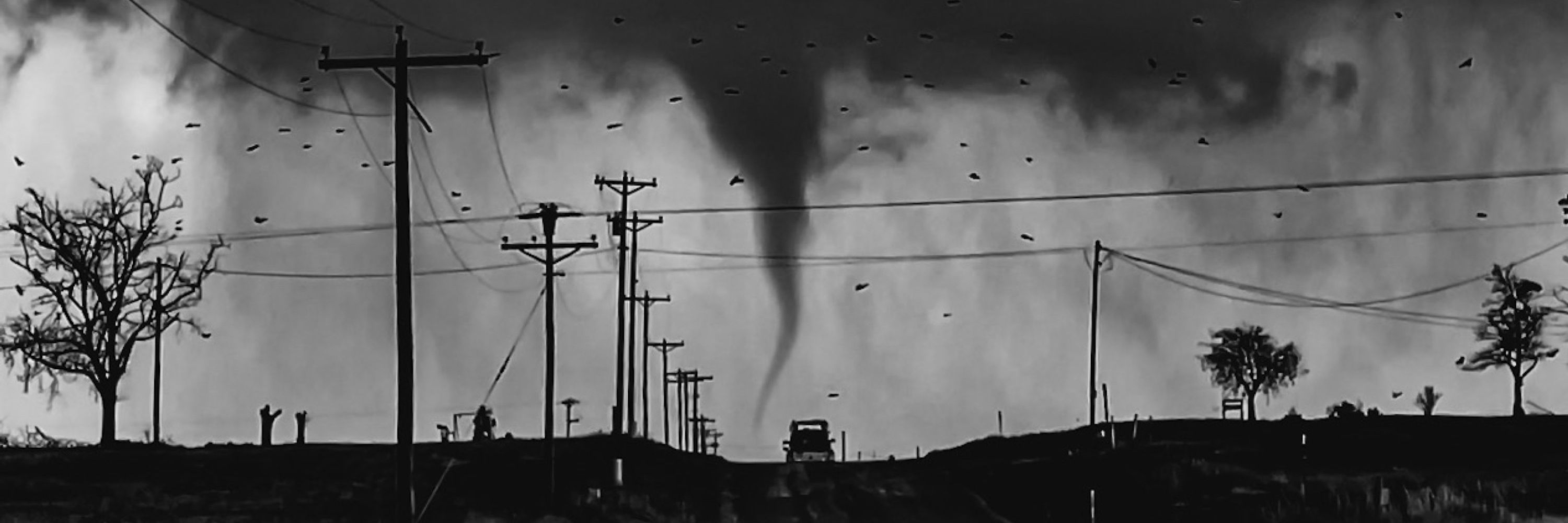
a violent EF-4 tornado gets ready to cross a county highway near Ashby, Minnesota - July 8th of 2020
November 9, 2025 at 2:18 AM
a violent EF-4 tornado gets ready to cross a county highway near Ashby, Minnesota - July 8th of 2020
being west of tornadoes >
November 3, 2025 at 9:28 PM
being west of tornadoes >