


Light Pollution Map
@lightpollutionmap.app
🚀 Founder @ LightPollutionMap.app
🔭 Building the world’s most detailed, interactive global light‑pollution map
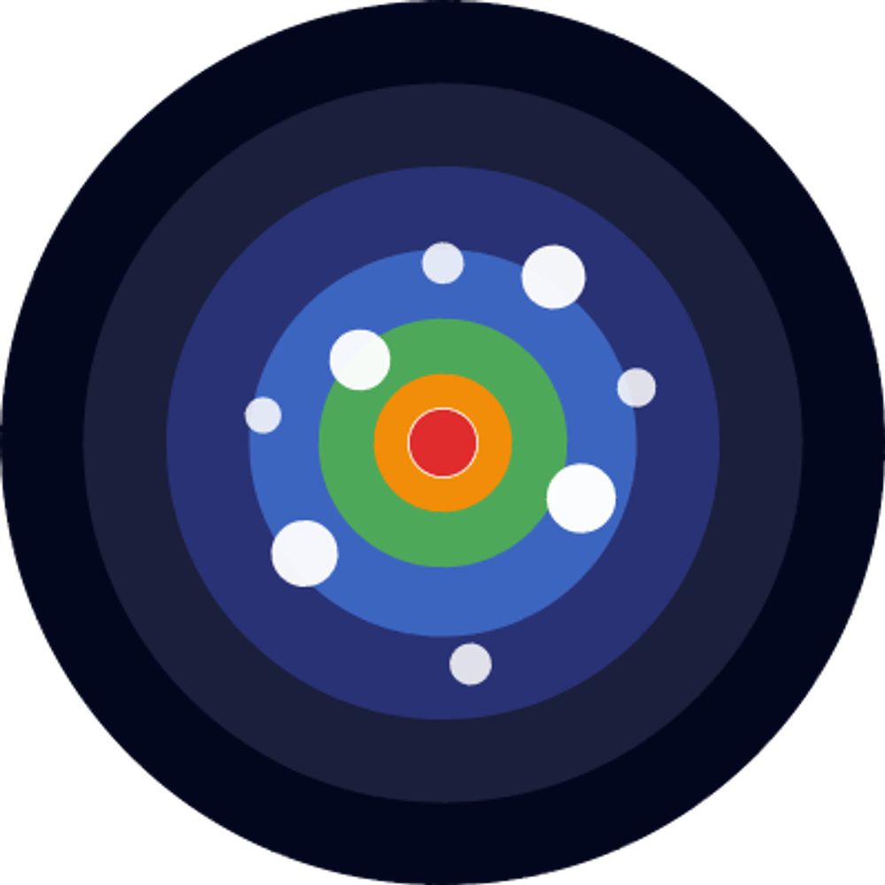
🌌 Visualize Bortle classes, SQM values & certified Dark‑Sky places
📱 Fully mobile‑optimized + free forever
🌍 Plan your next stargazing trip
🔭 Building the world’s most detailed, interactive global light‑pollution map
🌌 Visualize Bortle classes, SQM values & certified Dark‑Sky places
📱 Fully mobile‑optimized + free forever
🌍 Plan your next stargazing trip
Thanks for the feedback, a fix has been made.
July 23, 2025 at 5:11 PM
Thanks for the feedback, a fix has been made.
With all this light pollution, it's good enough to get a shot
June 3, 2025 at 3:30 AM
With all this light pollution, it's good enough to get a shot
Tell me about it! Can't even see the stars anymore.
June 3, 2025 at 3:29 AM
Tell me about it! Can't even see the stars anymore.
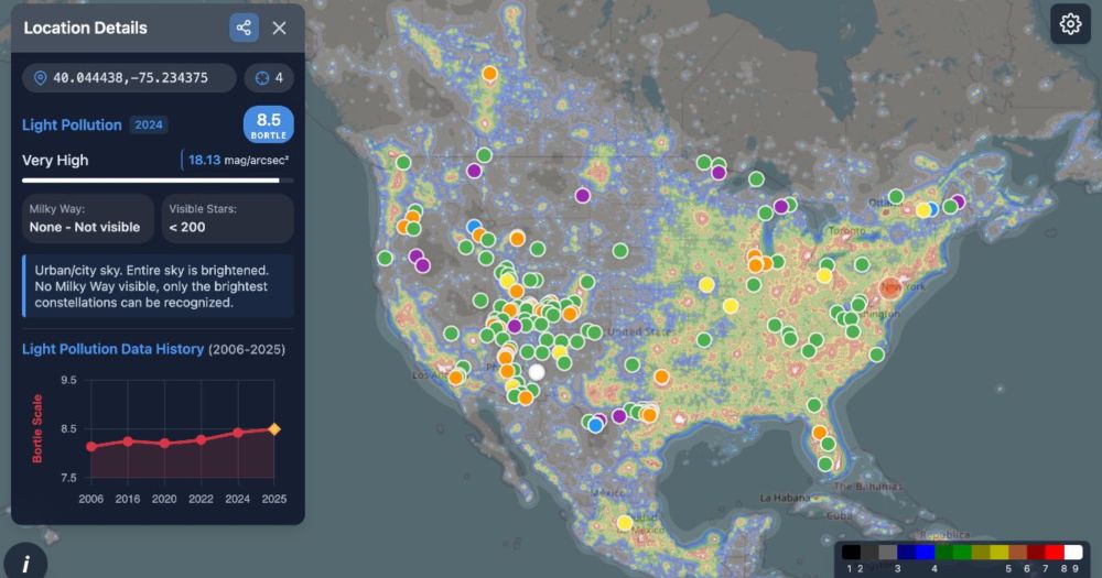
I created light pollution maps using the latest data for 2024: lightpollutionmap.app

Light Pollution Map | Bortle Scale & Dark Sky (2025)
Explore the most accurate 2025 light pollution map web app. Check Bortle Scale and SQM data, and discover dark-sky, Milky Way, and aurora spots near you.
lightpollutionmap.app
June 3, 2025 at 2:06 AM
I created light pollution maps using the latest data for 2024: lightpollutionmap.app
Cada año aumenta la contaminación lumínica, aquí están las últimas cifras para 2024 lightpollutionmap.app/es/
Mapa de Contaminación Lumínica 2025 – Cielo Oscuro y Bortle
Consulta el mapa de contaminación lumínica más preciso de 2025 con escala Bortle, SQM y cielos oscuros. Encuentra lugares para ver estrellas y auroras.
lightpollutionmap.app
May 31, 2025 at 7:43 AM
Cada año aumenta la contaminación lumínica, aquí están las últimas cifras para 2024 lightpollutionmap.app/es/
Many countries and regions have started establishing more dark sky parks, which at the very least shows that people are becoming aware of the importance of preserving dark skies.
May 31, 2025 at 7:10 AM
Many countries and regions have started establishing more dark sky parks, which at the very least shows that people are becoming aware of the importance of preserving dark skies.