


John Marquee
@johnmarquee.bsky.social
Observer. OSINT/IMINT. Geolocation. GIS. Usual caveats.
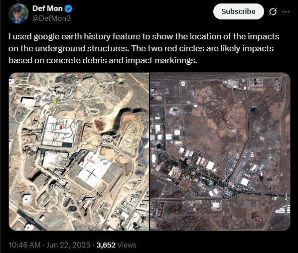
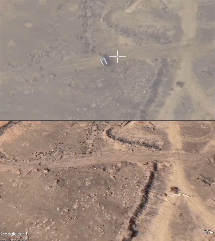
It looks like there were two entry points after all - visible on high-resolution imagery - that align with underground structures.
June 22, 2025 at 5:56 PM
It looks like there were two entry points after all - visible on high-resolution imagery - that align with underground structures.
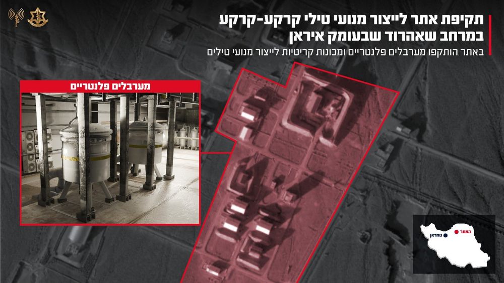
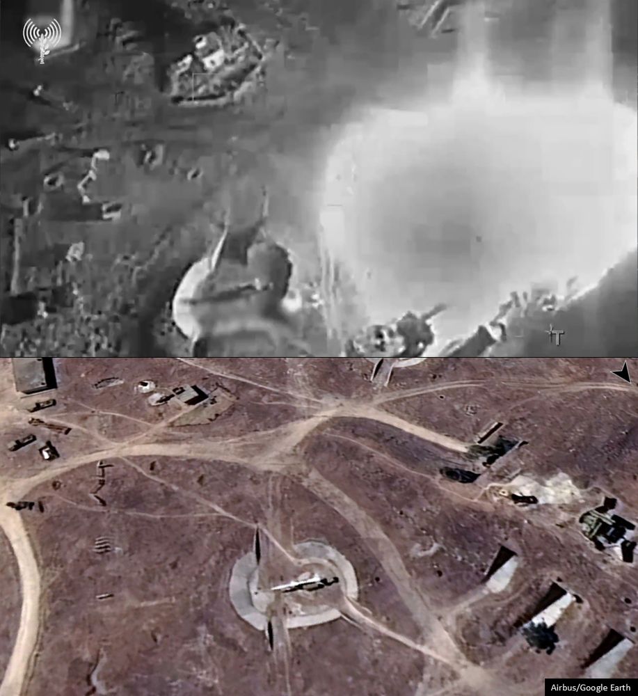
IDF has now posted a video claiming to describe what they struck at Shahrud:
x.com/idfonline/st...
x.com/idfonline/st...
June 22, 2025 at 5:36 PM
IDF has now posted a video claiming to describe what they struck at Shahrud:
x.com/idfonline/st...
x.com/idfonline/st...
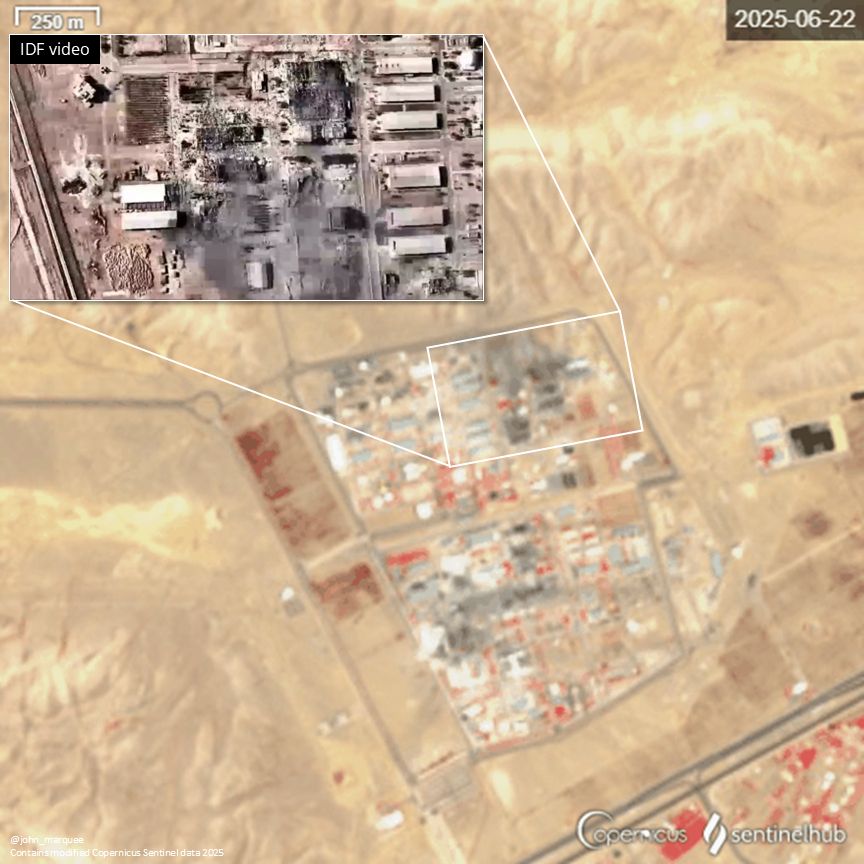
Before/after low-resolution satellite imagery (via Copernicus Sentinel-2) of damage to support facility structures at Shahroud Space Center. The structure on the right side of the highlighted area was previously targeted by Israel in October 2024 and subsequently rebuilt.
June 22, 2025 at 5:24 PM
Before/after low-resolution satellite imagery (via Copernicus Sentinel-2) of damage to support facility structures at Shahroud Space Center. The structure on the right side of the highlighted area was previously targeted by Israel in October 2024 and subsequently rebuilt.
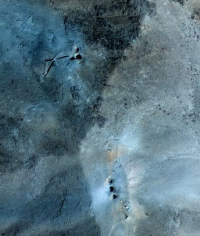
With the GBU-57 there isn't much visible on the surface - see the high-resolution imagery from Fordow.
June 22, 2025 at 1:23 PM
With the GBU-57 there isn't much visible on the surface - see the high-resolution imagery from Fordow.
Before/after false color low-resolution satellite imagery of Natanz following the US strike reportedly with two GBU-57 'bunker buster' bombs.
June 22, 2025 at 1:14 PM
Before/after false color low-resolution satellite imagery of Natanz following the US strike reportedly with two GBU-57 'bunker buster' bombs.
Some of the damage visible in the false color satellite imagery was shown in an IDF video yesterday.
June 22, 2025 at 1:12 PM
Some of the damage visible in the false color satellite imagery was shown in an IDF video yesterday.
Before/after false color low-resolution satellite imagery of the Isfahan Nuclear Technology Center following Israeli and US strikes. Any possible damage to the tunnel entrances would likely not be visible at this resolution.
June 22, 2025 at 1:12 PM
Before/after false color low-resolution satellite imagery of the Isfahan Nuclear Technology Center following Israeli and US strikes. Any possible damage to the tunnel entrances would likely not be visible at this resolution.
15.64022, 32.55183

December 23, 2024 at 4:09 PM
15.64022, 32.55183
(Probable) Geolocation of North Korean SPH being transported by rail in Chita, Zabaykalsky Krai, Russia.
52.02835, 113.49426
Difficult to be completely sure on this one; I welcome more input.
52.02835, 113.49426
Difficult to be completely sure on this one; I welcome more input.

December 19, 2024 at 10:58 PM
(Probable) Geolocation of North Korean SPH being transported by rail in Chita, Zabaykalsky Krai, Russia.
52.02835, 113.49426
Difficult to be completely sure on this one; I welcome more input.
52.02835, 113.49426
Difficult to be completely sure on this one; I welcome more input.
Geolocation of Israeli airstrike on a Syrian air defense site near Damascus.
33.35143, 36.54928
33.35143, 36.54928
December 17, 2024 at 7:04 PM
Geolocation of Israeli airstrike on a Syrian air defense site near Damascus.
33.35143, 36.54928
33.35143, 36.54928
Geolocation of Israeli airstrike on a Syrian air defense site west of Homs.
34.7078, 36.5510
34.7078, 36.5510
December 13, 2024 at 9:17 PM
Geolocation of Israeli airstrike on a Syrian air defense site west of Homs.
34.7078, 36.5510
34.7078, 36.5510
Mine are still flowering in the greenhouse, excited to see how long the season can be pushed this year.

November 7, 2024 at 7:01 PM
Mine are still flowering in the greenhouse, excited to see how long the season can be pushed this year.
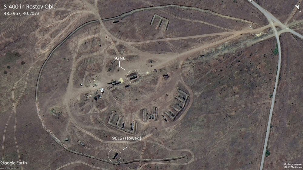
S-400 deployed near Kamensk-Shakhtinsky in Rostov Oblast as seen in a mid-July Airbus image.
48.2967, 40.2073
48.2967, 40.2073
August 26, 2024 at 9:43 PM
S-400 deployed near Kamensk-Shakhtinsky in Rostov Oblast as seen in a mid-July Airbus image.
48.2967, 40.2073
48.2967, 40.2073
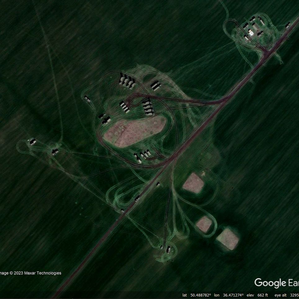
More images from the original VK post


August 19, 2024 at 3:39 PM
More images from the original VK post
Geolocation of Zubr-class LCAC/Project 1232.2 Evgeniy Kocheshkov spotted on Sentinel-2 at Batareynaya Bay about 60km west of St. Petersburg after a visit to Kronstadt for the FLEET-2024/ФЛОТ-2024 international maritime defense expo.
59.9735, 29.1263
59.9735, 29.1263

August 19, 2024 at 3:38 PM
Geolocation of Zubr-class LCAC/Project 1232.2 Evgeniy Kocheshkov spotted on Sentinel-2 at Batareynaya Bay about 60km west of St. Petersburg after a visit to Kronstadt for the FLEET-2024/ФЛОТ-2024 international maritime defense expo.
59.9735, 29.1263
59.9735, 29.1263


I wonder if it's the same one that showed up on Google Earth south of the city.
August 11, 2023 at 7:25 PM
I wonder if it's the same one that showed up on Google Earth south of the city.