


Jan Beutel
@janbeutel.bsky.social
Passionate about mountains, cryosphere, natural hazards and technology to help with all that adaptation before us, professor
@uniinnsbruck, UIAGM mountain guide
@uniinnsbruck, UIAGM mountain guide
Danke das hab ich schon gesehen aber wenn ma das Full screen zeigt ist es sehr grob gerastert….
November 21, 2025 at 11:55 AM
Danke das hab ich schon gesehen aber wenn ma das Full screen zeigt ist es sehr grob gerastert….
Marcus, gibt es einen link zum download dieser grafiken in guter aufloesung (high res oder PDF) fuer vortrage etc???
November 21, 2025 at 10:59 AM
Marcus, gibt es einen link zum download dieser grafiken in guter aufloesung (high res oder PDF) fuer vortrage etc???

Check out the video abstract
November 14, 2025 at 4:47 PM
Check out the video abstract

Of course this is many magnitudes smaller than #Blatten and the Klein Nesthorn ridge collapse. But hey, the GNSS monitoring technology developed here truly delivered and consequently lives were saved.
Congrats team: @uniinnsbruck.bsky.social @slfdavos.bsky.social @rwth.bsky.social @tum.de
Congrats team: @uniinnsbruck.bsky.social @slfdavos.bsky.social @rwth.bsky.social @tum.de
November 14, 2025 at 4:47 PM
Of course this is many magnitudes smaller than #Blatten and the Klein Nesthorn ridge collapse. But hey, the GNSS monitoring technology developed here truly delivered and consequently lives were saved.
Congrats team: @uniinnsbruck.bsky.social @slfdavos.bsky.social @rwth.bsky.social @tum.de
Congrats team: @uniinnsbruck.bsky.social @slfdavos.bsky.social @rwth.bsky.social @tum.de
Same ballpark as the media conf yesterday (9mio) and great we can have such analysis do quickly
June 1, 2025 at 2:05 PM
Same ballpark as the media conf yesterday (9mio) and great we can have such analysis do quickly
Samidha, this is from the seismic networks accessible via FDSN. mass movements are tracked and cataloged by SED since a couple of years:
seismo.ethz.ch/en/earthquak...
seismo.ethz.ch/en/earthquak...
SED | Switzerland
Earthquakes Switzerland
seismo.ethz.ch
May 31, 2025 at 10:03 AM
Samidha, this is from the seismic networks accessible via FDSN. mass movements are tracked and cataloged by SED since a couple of years:
seismo.ethz.ch/en/earthquak...
seismo.ethz.ch/en/earthquak...
That's because i already had a sip at the 🍺before the 📸
May 30, 2025 at 8:41 PM
That's because i already had a sip at the 🍺before the 📸
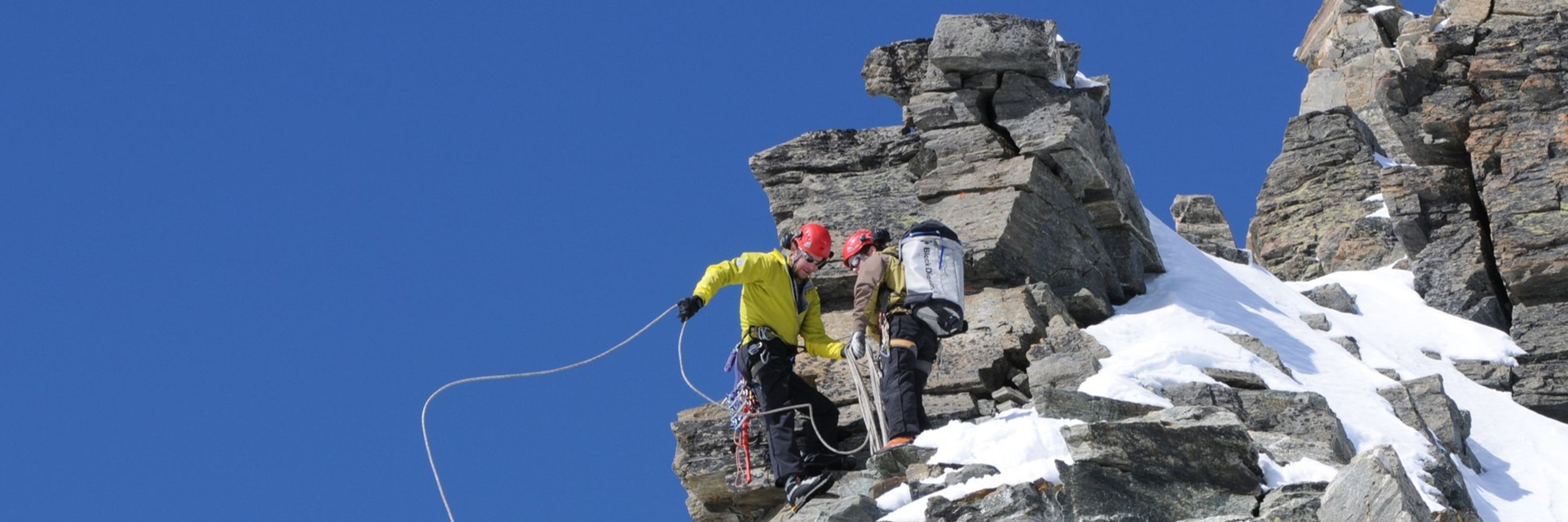
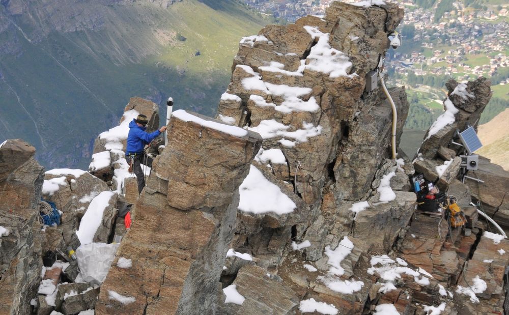
The evac was based on pre-failure analysis of an imminent, very large rockfall. An in-situ GNSS sensor installed on friday 16th on the ridge as well as a first large rockfall caused the evac decision monday. Fun fact, the GNSS fell with one of the first rockfall events monday afternoon.

May 30, 2025 at 8:24 PM
The evac was based on pre-failure analysis of an imminent, very large rockfall. An in-situ GNSS sensor installed on friday 16th on the ridge as well as a first large rockfall caused the evac decision monday. Fun fact, the GNSS fell with one of the first rockfall events monday afternoon.
And no: "...Emergency managers had been observing increased glacier melt at Birch Glacier, ordering hundreds of villagers to evacuate after debris from the mountain behind the glacier crumbled days before the catastrophic collapse."
May 30, 2025 at 8:24 PM
And no: "...Emergency managers had been observing increased glacier melt at Birch Glacier, ordering hundreds of villagers to evacuate after debris from the mountain behind the glacier crumbled days before the catastrophic collapse."
Its an awkward article mixing different quotes, specifics and non-specifics as well as non truths. only one example: "...can melt permafrost..." - well if solid ground melted that would be lava i'm afraid. also
May 30, 2025 at 8:24 PM
Its an awkward article mixing different quotes, specifics and non-specifics as well as non truths. only one example: "...can melt permafrost..." - well if solid ground melted that would be lava i'm afraid. also
All these events register nicely on the map. This is the biggest rockfall event and the seismic signal geolocates just at the base of the ridge. Also the geological situation and the permafrost question is illustrated (darker violet/blue means permafrost is more likely than yellow).

May 30, 2025 at 6:24 AM
All these events register nicely on the map. This is the biggest rockfall event and the seismic signal geolocates just at the base of the ridge. Also the geological situation and the permafrost question is illustrated (darker violet/blue means permafrost is more likely than yellow).
somehow i like this pointy hill. only why?😀
May 29, 2025 at 5:52 PM
somehow i like this pointy hill. only why?😀
Methods that were groundbreaking in basic research are now butter and bread go-to-methods - in real time: 15:24h event happens, 15:30h E sent email request to SED to quickly check magnitude because of deteriorating visibility, 15:39 we KNOW it's M=3.1
May 29, 2025 at 2:04 PM
Methods that were groundbreaking in basic research are now butter and bread go-to-methods - in real time: 15:24h event happens, 15:30h E sent email request to SED to quickly check magnitude because of deteriorating visibility, 15:39 we KNOW it's M=3.1