


EUMETSAT
@eumetsat.int
European operational #satellite agency for monitoring weather, #climate and the environment from #space 🛰
eumetsat.int
eumetsat.int
🆕 Short course: Visualising Fires in Spain with Sentinel-3 Data
🗓️ 25 November
🕐 12:00 – 13:30 UTC
📍 Online
This EUMETSAT short course will explore how S-3 data can be used to monitor & visualise recent wildfire activity across Spain and Europe. 🔥
Find out more and register here 👉 bit.ly/4qG2sfB
🗓️ 25 November
🕐 12:00 – 13:30 UTC
📍 Online
This EUMETSAT short course will explore how S-3 data can be used to monitor & visualise recent wildfire activity across Spain and Europe. 🔥
Find out more and register here 👉 bit.ly/4qG2sfB

November 13, 2025 at 1:03 PM
🆕 Short course: Visualising Fires in Spain with Sentinel-3 Data
🗓️ 25 November
🕐 12:00 – 13:30 UTC
📍 Online
This EUMETSAT short course will explore how S-3 data can be used to monitor & visualise recent wildfire activity across Spain and Europe. 🔥
Find out more and register here 👉 bit.ly/4qG2sfB
🗓️ 25 November
🕐 12:00 – 13:30 UTC
📍 Online
This EUMETSAT short course will explore how S-3 data can be used to monitor & visualise recent wildfire activity across Spain and Europe. 🔥
Find out more and register here 👉 bit.ly/4qG2sfB
As #Copernicus Sentinel-6B prepares for launch, EUMETSAT’s Hayley Evers-King shares why measuring sea level from space is a true team effort - and how this mission will set the global standard for observing our changing oceans.
Find out more about our next satellite here: bit.ly/449DD1U
Find out more about our next satellite here: bit.ly/449DD1U


November 13, 2025 at 10:23 AM
As #Copernicus Sentinel-6B prepares for launch, EUMETSAT’s Hayley Evers-King shares why measuring sea level from space is a true team effort - and how this mission will set the global standard for observing our changing oceans.
Find out more about our next satellite here: bit.ly/449DD1U
Find out more about our next satellite here: bit.ly/449DD1U
Trees are nature’s carbon keepers - and satellites help us watch over them. 🌳
By tracking vegetation growth & forest health from space, scientists can see how much carbon dioxide plants are absorbing and where reforestation efforts are working.
Find out more from our new case study: bit.ly/43n8wjk
By tracking vegetation growth & forest health from space, scientists can see how much carbon dioxide plants are absorbing and where reforestation efforts are working.
Find out more from our new case study: bit.ly/43n8wjk

November 12, 2025 at 9:58 AM
Trees are nature’s carbon keepers - and satellites help us watch over them. 🌳
By tracking vegetation growth & forest health from space, scientists can see how much carbon dioxide plants are absorbing and where reforestation efforts are working.
Find out more from our new case study: bit.ly/43n8wjk
By tracking vegetation growth & forest health from space, scientists can see how much carbon dioxide plants are absorbing and where reforestation efforts are working.
Find out more from our new case study: bit.ly/43n8wjk
As we prepare for the launch of Copernicus Sentinel-6B, meet Dr Remko Scharroo - EUMETSAT’s Altimetry Project Scientist.
His work ensures precise sea level measurements that help us track a changing ocean with accuracy and continuity from space. 🎚️🌊
Read more about it here: bit.ly/4p1AWaC
His work ensures precise sea level measurements that help us track a changing ocean with accuracy and continuity from space. 🎚️🌊
Read more about it here: bit.ly/4p1AWaC

November 11, 2025 at 8:51 AM
As we prepare for the launch of Copernicus Sentinel-6B, meet Dr Remko Scharroo - EUMETSAT’s Altimetry Project Scientist.
His work ensures precise sea level measurements that help us track a changing ocean with accuracy and continuity from space. 🎚️🌊
Read more about it here: bit.ly/4p1AWaC
His work ensures precise sea level measurements that help us track a changing ocean with accuracy and continuity from space. 🎚️🌊
Read more about it here: bit.ly/4p1AWaC
Save the date!
The final session is on 3 December and will cover ISLET service: using the cloud resources of the Destination Earth Data Lake.
You can already register at destination-earth.eu/event/islet-...
The final session is on 3 December and will cover ISLET service: using the cloud resources of the Destination Earth Data Lake.
You can already register at destination-earth.eu/event/islet-...

November 10, 2025 at 5:31 PM
Save the date!
The final session is on 3 December and will cover ISLET service: using the cloud resources of the Destination Earth Data Lake.
You can already register at destination-earth.eu/event/islet-...
The final session is on 3 December and will cover ISLET service: using the cloud resources of the Destination Earth Data Lake.
You can already register at destination-earth.eu/event/islet-...
The next webinar on the #DestinationEarth Data Lake takes place on Wednesday 19 November. This second webinar covers STACK and HOOK services – tools and applications for data processing and analysis.
Register at destination-earth.eu/event/stack-...
#DestinE
🧵[1/2]
Register at destination-earth.eu/event/stack-...
#DestinE
🧵[1/2]

November 10, 2025 at 5:31 PM
The next webinar on the #DestinationEarth Data Lake takes place on Wednesday 19 November. This second webinar covers STACK and HOOK services – tools and applications for data processing and analysis.
Register at destination-earth.eu/event/stack-...
#DestinE
🧵[1/2]
Register at destination-earth.eu/event/stack-...
#DestinE
🧵[1/2]
Sentinel-6B is launching very soon from the Vandenberg Space Force Base in California! 🚀
Mark your calendars:
📆 16 Nov from 21:12 local time (17 Nov 06:12 CET, 05:12 UTC)
Data from the satellite will be crucial for climate monitoring & ocean & seasonal forecasts. Find out more here: bit.ly/4qRVLXS
Mark your calendars:
📆 16 Nov from 21:12 local time (17 Nov 06:12 CET, 05:12 UTC)
Data from the satellite will be crucial for climate monitoring & ocean & seasonal forecasts. Find out more here: bit.ly/4qRVLXS

November 10, 2025 at 10:50 AM
Sentinel-6B is launching very soon from the Vandenberg Space Force Base in California! 🚀
Mark your calendars:
📆 16 Nov from 21:12 local time (17 Nov 06:12 CET, 05:12 UTC)
Data from the satellite will be crucial for climate monitoring & ocean & seasonal forecasts. Find out more here: bit.ly/4qRVLXS
Mark your calendars:
📆 16 Nov from 21:12 local time (17 Nov 06:12 CET, 05:12 UTC)
Data from the satellite will be crucial for climate monitoring & ocean & seasonal forecasts. Find out more here: bit.ly/4qRVLXS
📅Data Access Services: new webinar series!
Session 1: 26 November 2025 11:30-12:30 UTC
Accessing & downloading data programmatically
trainingevents.eumetsat.int/trui/events/...
Session 2: 28 November 2025 12:00-13:00 UTC
New features of our Python library
trainingevents.eumetsat.int/trui/events/...
Session 1: 26 November 2025 11:30-12:30 UTC
Accessing & downloading data programmatically
trainingevents.eumetsat.int/trui/events/...
Session 2: 28 November 2025 12:00-13:00 UTC
New features of our Python library
trainingevents.eumetsat.int/trui/events/...

November 7, 2025 at 1:00 PM
📅Data Access Services: new webinar series!
Session 1: 26 November 2025 11:30-12:30 UTC
Accessing & downloading data programmatically
trainingevents.eumetsat.int/trui/events/...
Session 2: 28 November 2025 12:00-13:00 UTC
New features of our Python library
trainingevents.eumetsat.int/trui/events/...
Session 1: 26 November 2025 11:30-12:30 UTC
Accessing & downloading data programmatically
trainingevents.eumetsat.int/trui/events/...
Session 2: 28 November 2025 12:00-13:00 UTC
New features of our Python library
trainingevents.eumetsat.int/trui/events/...
Over 2 days Meteosat-12 tracked a powerful thunderstorm moving from the Azores towards Portugal & mainland Spain. ⚡
Developing overnight btwn 4-5 Nov over the Atlantic southwest of Portugal, this animation reveals how the FCI & LI provide unmatched insight into severe weather, even far from land.
Developing overnight btwn 4-5 Nov over the Atlantic southwest of Portugal, this animation reveals how the FCI & LI provide unmatched insight into severe weather, even far from land.
November 7, 2025 at 11:06 AM
Over 2 days Meteosat-12 tracked a powerful thunderstorm moving from the Azores towards Portugal & mainland Spain. ⚡
Developing overnight btwn 4-5 Nov over the Atlantic southwest of Portugal, this animation reveals how the FCI & LI provide unmatched insight into severe weather, even far from land.
Developing overnight btwn 4-5 Nov over the Atlantic southwest of Portugal, this animation reveals how the FCI & LI provide unmatched insight into severe weather, even far from land.
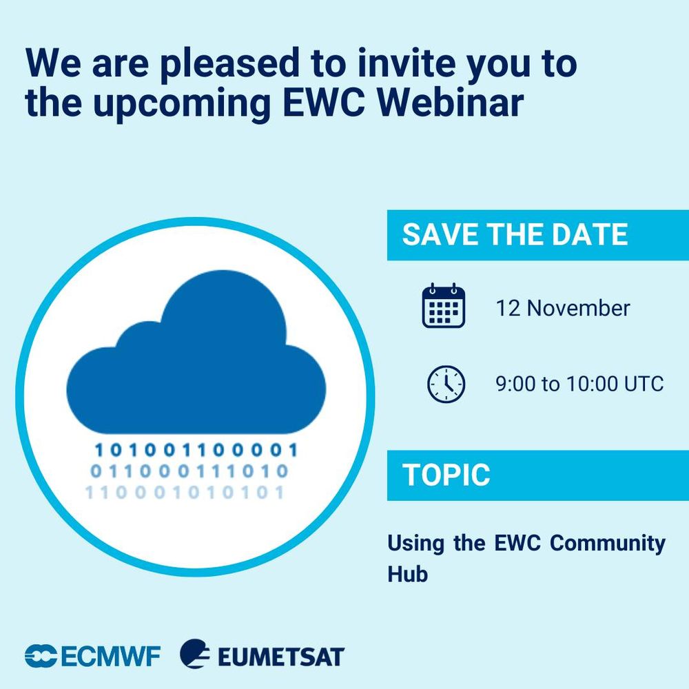
⚠️Last chance to apply!
💻Using the EWC Community Hub
📅12 November 2025, 09:00-10:00 UTC
ℹ️Our third European Weather Cloud webinar of 2025, delivered with the team at @ecmwf.int, will guide users on how to effectively use the EWC.
⚠️Applications close Monday: trainingevents.eumetsat.int/trui/events/2
💻Using the EWC Community Hub
📅12 November 2025, 09:00-10:00 UTC
ℹ️Our third European Weather Cloud webinar of 2025, delivered with the team at @ecmwf.int, will guide users on how to effectively use the EWC.
⚠️Applications close Monday: trainingevents.eumetsat.int/trui/events/2

November 7, 2025 at 9:01 AM
⚠️Last chance to apply!
💻Using the EWC Community Hub
📅12 November 2025, 09:00-10:00 UTC
ℹ️Our third European Weather Cloud webinar of 2025, delivered with the team at @ecmwf.int, will guide users on how to effectively use the EWC.
⚠️Applications close Monday: trainingevents.eumetsat.int/trui/events/2
💻Using the EWC Community Hub
📅12 November 2025, 09:00-10:00 UTC
ℹ️Our third European Weather Cloud webinar of 2025, delivered with the team at @ecmwf.int, will guide users on how to effectively use the EWC.
⚠️Applications close Monday: trainingevents.eumetsat.int/trui/events/2
The Copernicus Sentinel-6B satellite is launching soon and will help us understand our oceans even better 🌊
In this video, experts from @mercatorocean.bsky.social & GEO Blue Planet explain how satellite observations are key to understanding & protecting our planet’s future.
Watch now: bit.ly/47WdMNf
In this video, experts from @mercatorocean.bsky.social & GEO Blue Planet explain how satellite observations are key to understanding & protecting our planet’s future.
Watch now: bit.ly/47WdMNf

November 6, 2025 at 9:42 AM
The Copernicus Sentinel-6B satellite is launching soon and will help us understand our oceans even better 🌊
In this video, experts from @mercatorocean.bsky.social & GEO Blue Planet explain how satellite observations are key to understanding & protecting our planet’s future.
Watch now: bit.ly/47WdMNf
In this video, experts from @mercatorocean.bsky.social & GEO Blue Planet explain how satellite observations are key to understanding & protecting our planet’s future.
Watch now: bit.ly/47WdMNf
Hello Sentinel-1D! 👋
Yesterday the satellite launched into orbit, and Meteosat-12's FCI instrument was ready to capture the moment from space.
Below: views in the 0.6µm channel (L) and (R) Rocket Plume RGB, revealing the rocket’s exhaust plume in the both visible and infrared range. 🚀
Yesterday the satellite launched into orbit, and Meteosat-12's FCI instrument was ready to capture the moment from space.
Below: views in the 0.6µm channel (L) and (R) Rocket Plume RGB, revealing the rocket’s exhaust plume in the both visible and infrared range. 🚀


November 5, 2025 at 10:45 AM
Hello Sentinel-1D! 👋
Yesterday the satellite launched into orbit, and Meteosat-12's FCI instrument was ready to capture the moment from space.
Below: views in the 0.6µm channel (L) and (R) Rocket Plume RGB, revealing the rocket’s exhaust plume in the both visible and infrared range. 🚀
Yesterday the satellite launched into orbit, and Meteosat-12's FCI instrument was ready to capture the moment from space.
Below: views in the 0.6µm channel (L) and (R) Rocket Plume RGB, revealing the rocket’s exhaust plume in the both visible and infrared range. 🚀
Our Q3 2025 Global Weather video is here! 🌍
See how major weather events looked from space in Jul–Sept, with storms coloured from light yellow - deep red by intensity.
As always, its thanks to our partners we get these stunning global views. Watch the planet’s weather in motion:
🔗 bit.ly/3LmbYoc
See how major weather events looked from space in Jul–Sept, with storms coloured from light yellow - deep red by intensity.
As always, its thanks to our partners we get these stunning global views. Watch the planet’s weather in motion:
🔗 bit.ly/3LmbYoc

November 4, 2025 at 12:57 PM
Our Q3 2025 Global Weather video is here! 🌍
See how major weather events looked from space in Jul–Sept, with storms coloured from light yellow - deep red by intensity.
As always, its thanks to our partners we get these stunning global views. Watch the planet’s weather in motion:
🔗 bit.ly/3LmbYoc
See how major weather events looked from space in Jul–Sept, with storms coloured from light yellow - deep red by intensity.
As always, its thanks to our partners we get these stunning global views. Watch the planet’s weather in motion:
🔗 bit.ly/3LmbYoc
Image of the week: Typhoon #Kalmaegi 🛰️
Captured on 3 Nov by Sentinel-3, this striking image shows Typhoon Kalmaegi (also known as Tino) swirling over the Pacific Ocean, east of the Philippines.
The storm has since brought intense winds & heavy rain across the country. Find out more: bit.ly/4nBzuuu
Captured on 3 Nov by Sentinel-3, this striking image shows Typhoon Kalmaegi (also known as Tino) swirling over the Pacific Ocean, east of the Philippines.
The storm has since brought intense winds & heavy rain across the country. Find out more: bit.ly/4nBzuuu

November 4, 2025 at 8:48 AM
Image of the week: Typhoon #Kalmaegi 🛰️
Captured on 3 Nov by Sentinel-3, this striking image shows Typhoon Kalmaegi (also known as Tino) swirling over the Pacific Ocean, east of the Philippines.
The storm has since brought intense winds & heavy rain across the country. Find out more: bit.ly/4nBzuuu
Captured on 3 Nov by Sentinel-3, this striking image shows Typhoon Kalmaegi (also known as Tino) swirling over the Pacific Ocean, east of the Philippines.
The storm has since brought intense winds & heavy rain across the country. Find out more: bit.ly/4nBzuuu
💻 Using the EWC Community Hub
📅 12 November 2025, 09:00-10:00 UTC
ℹ️ Our third European Weather Cloud webinar of 2025, delivered with the team at @ecmwf.int, will demonstrate the new easy-access platform.
⚠️ Applications close in one week: trainingevents.eumetsat.int/trui/events/...
📅 12 November 2025, 09:00-10:00 UTC
ℹ️ Our third European Weather Cloud webinar of 2025, delivered with the team at @ecmwf.int, will demonstrate the new easy-access platform.
⚠️ Applications close in one week: trainingevents.eumetsat.int/trui/events/...
November 3, 2025 at 2:25 PM
💻 Using the EWC Community Hub
📅 12 November 2025, 09:00-10:00 UTC
ℹ️ Our third European Weather Cloud webinar of 2025, delivered with the team at @ecmwf.int, will demonstrate the new easy-access platform.
⚠️ Applications close in one week: trainingevents.eumetsat.int/trui/events/...
📅 12 November 2025, 09:00-10:00 UTC
ℹ️ Our third European Weather Cloud webinar of 2025, delivered with the team at @ecmwf.int, will demonstrate the new easy-access platform.
⚠️ Applications close in one week: trainingevents.eumetsat.int/trui/events/...
This is the first in a series of webinars, with the next two sessions covering:
19 November - tools and applications for data processing and analysis
3 December - using the cloud resources of the Destination Earth Data Lake
Full details and registration at: destination-earth.eu/event/webina...
19 November - tools and applications for data processing and analysis
3 December - using the cloud resources of the Destination Earth Data Lake
Full details and registration at: destination-earth.eu/event/webina...

November 3, 2025 at 11:30 AM
This is the first in a series of webinars, with the next two sessions covering:
19 November - tools and applications for data processing and analysis
3 December - using the cloud resources of the Destination Earth Data Lake
Full details and registration at: destination-earth.eu/event/webina...
19 November - tools and applications for data processing and analysis
3 December - using the cloud resources of the Destination Earth Data Lake
Full details and registration at: destination-earth.eu/event/webina...
Join us for a webinar on the #DestinationEarth Data Lake!
On Wed 5 Nov 12:30–14:00
🌟Discover the mission and vision of the #DestinE Data Lake
🌟Explore the Harmonised Data Access service
🌟Get hands-on with JupyterLab
🌟Investigate a real use case
Register at destination-earth.eu/event/webina...
🧵[1/2]
On Wed 5 Nov 12:30–14:00
🌟Discover the mission and vision of the #DestinE Data Lake
🌟Explore the Harmonised Data Access service
🌟Get hands-on with JupyterLab
🌟Investigate a real use case
Register at destination-earth.eu/event/webina...
🧵[1/2]
November 3, 2025 at 11:30 AM
Join us for a webinar on the #DestinationEarth Data Lake!
On Wed 5 Nov 12:30–14:00
🌟Discover the mission and vision of the #DestinE Data Lake
🌟Explore the Harmonised Data Access service
🌟Get hands-on with JupyterLab
🌟Investigate a real use case
Register at destination-earth.eu/event/webina...
🧵[1/2]
On Wed 5 Nov 12:30–14:00
🌟Discover the mission and vision of the #DestinE Data Lake
🌟Explore the Harmonised Data Access service
🌟Get hands-on with JupyterLab
🌟Investigate a real use case
Register at destination-earth.eu/event/webina...
🧵[1/2]
Spooky timing? 👀 On Halloween last year, our Lightning Imager became operational, and is now capturing Europe’s storms. ⚡
Its data is helping forecasters across Europe, including in Poland, track lightning’s unpredictable path and predict extreme weather more accurately. Read more: bit.ly/491iaf7
Its data is helping forecasters across Europe, including in Poland, track lightning’s unpredictable path and predict extreme weather more accurately. Read more: bit.ly/491iaf7
October 31, 2025 at 1:29 PM
Spooky timing? 👀 On Halloween last year, our Lightning Imager became operational, and is now capturing Europe’s storms. ⚡
Its data is helping forecasters across Europe, including in Poland, track lightning’s unpredictable path and predict extreme weather more accurately. Read more: bit.ly/491iaf7
Its data is helping forecasters across Europe, including in Poland, track lightning’s unpredictable path and predict extreme weather more accurately. Read more: bit.ly/491iaf7
🛰️ From above, the world looks a little spooky this season...
👻 Ghost River
🎃 Pumpkin Island
💀 Skeleton Coast
🌋 Hell’s Gate
Can you guess where in the world these locations are - and why they sound so haunting?
📷 Copernicus Sentinel-2
👻 Ghost River
🎃 Pumpkin Island
💀 Skeleton Coast
🌋 Hell’s Gate
Can you guess where in the world these locations are - and why they sound so haunting?
📷 Copernicus Sentinel-2


October 31, 2025 at 9:30 AM
🛰️ From above, the world looks a little spooky this season...
👻 Ghost River
🎃 Pumpkin Island
💀 Skeleton Coast
🌋 Hell’s Gate
Can you guess where in the world these locations are - and why they sound so haunting?
📷 Copernicus Sentinel-2
👻 Ghost River
🎃 Pumpkin Island
💀 Skeleton Coast
🌋 Hell’s Gate
Can you guess where in the world these locations are - and why they sound so haunting?
📷 Copernicus Sentinel-2
More impressions of the event at our Flickr account: flic.kr/s/aHBqjCzcNo

October 30, 2025 at 3:50 PM
More impressions of the event at our Flickr account: flic.kr/s/aHBqjCzcNo
The final day of the EUMETSAT Climate Symposium highlighted collaboration, innovation, and the future of climate data.
Thanks to everybody who joined us these last few days!
If you couldn't make it, learn more about our climate monitoring here: www.eumetsat.int/what-we-moni...
Thanks to everybody who joined us these last few days!
If you couldn't make it, learn more about our climate monitoring here: www.eumetsat.int/what-we-moni...


October 30, 2025 at 3:50 PM
The final day of the EUMETSAT Climate Symposium highlighted collaboration, innovation, and the future of climate data.
Thanks to everybody who joined us these last few days!
If you couldn't make it, learn more about our climate monitoring here: www.eumetsat.int/what-we-moni...
Thanks to everybody who joined us these last few days!
If you couldn't make it, learn more about our climate monitoring here: www.eumetsat.int/what-we-moni...
Ever wondered how Europe keeps an eye on our planet?
With satellites! 🛰️👀
EUMETSAT also operate several satellites on behalf of the EU's #Copernicus Programme, monitoring oceans, air, & climate - providing data we all rely on.
Watch our new animation to see how it works from space: bit.ly/4nsOjzy
With satellites! 🛰️👀
EUMETSAT also operate several satellites on behalf of the EU's #Copernicus Programme, monitoring oceans, air, & climate - providing data we all rely on.
Watch our new animation to see how it works from space: bit.ly/4nsOjzy

October 30, 2025 at 2:01 PM
Ever wondered how Europe keeps an eye on our planet?
With satellites! 🛰️👀
EUMETSAT also operate several satellites on behalf of the EU's #Copernicus Programme, monitoring oceans, air, & climate - providing data we all rely on.
Watch our new animation to see how it works from space: bit.ly/4nsOjzy
With satellites! 🛰️👀
EUMETSAT also operate several satellites on behalf of the EU's #Copernicus Programme, monitoring oceans, air, & climate - providing data we all rely on.
Watch our new animation to see how it works from space: bit.ly/4nsOjzy
This animation from METimage btwn 26–29 Oct (~15 UTC) shows Hurricane Melissa’s path across the Caribbean.
During this period #Melissa rapidly intensified to Cat. 5 strength before making landfall in Jamaica, then moved on to Cuba, bringing severe rain, flooding & widespread damage to both regions.
During this period #Melissa rapidly intensified to Cat. 5 strength before making landfall in Jamaica, then moved on to Cuba, bringing severe rain, flooding & widespread damage to both regions.
October 30, 2025 at 10:02 AM
This animation from METimage btwn 26–29 Oct (~15 UTC) shows Hurricane Melissa’s path across the Caribbean.
During this period #Melissa rapidly intensified to Cat. 5 strength before making landfall in Jamaica, then moved on to Cuba, bringing severe rain, flooding & widespread damage to both regions.
During this period #Melissa rapidly intensified to Cat. 5 strength before making landfall in Jamaica, then moved on to Cuba, bringing severe rain, flooding & widespread damage to both regions.
Day 2 of the EUMETSAT Climate Symposium explored how satellite data can tackle future climate challenges.
Experts from DWD, MeteoSwiss, MétéoFrance, ECMWF, ESA & EUMETSAT shared insights on marine, hydrology, agriculture, and collaborative research-to-operations approaches. 🛰️
Experts from DWD, MeteoSwiss, MétéoFrance, ECMWF, ESA & EUMETSAT shared insights on marine, hydrology, agriculture, and collaborative research-to-operations approaches. 🛰️


October 29, 2025 at 3:56 PM
Day 2 of the EUMETSAT Climate Symposium explored how satellite data can tackle future climate challenges.
Experts from DWD, MeteoSwiss, MétéoFrance, ECMWF, ESA & EUMETSAT shared insights on marine, hydrology, agriculture, and collaborative research-to-operations approaches. 🛰️
Experts from DWD, MeteoSwiss, MétéoFrance, ECMWF, ESA & EUMETSAT shared insights on marine, hydrology, agriculture, and collaborative research-to-operations approaches. 🛰️
Global mean sea level isn’t just rising - it’s rising faster. 📈
Altimetry expert Vinca Rosmorduc explains how satellites track sea level changes and why that matters in our latest article: bit.ly/4huOHft
Data from satellites like Sentinel-6B - launching soon - will be key for what’s ahead. 🌊🛰️
Altimetry expert Vinca Rosmorduc explains how satellites track sea level changes and why that matters in our latest article: bit.ly/4huOHft
Data from satellites like Sentinel-6B - launching soon - will be key for what’s ahead. 🌊🛰️

October 29, 2025 at 9:44 AM
Global mean sea level isn’t just rising - it’s rising faster. 📈
Altimetry expert Vinca Rosmorduc explains how satellites track sea level changes and why that matters in our latest article: bit.ly/4huOHft
Data from satellites like Sentinel-6B - launching soon - will be key for what’s ahead. 🌊🛰️
Altimetry expert Vinca Rosmorduc explains how satellites track sea level changes and why that matters in our latest article: bit.ly/4huOHft
Data from satellites like Sentinel-6B - launching soon - will be key for what’s ahead. 🌊🛰️