


Carl-August W. / Basalt Weaver
@basaltweaver.bsky.social
Earth-science artist
All my links: https://linktr.ee/carlaugustw
All my links: https://linktr.ee/carlaugustw
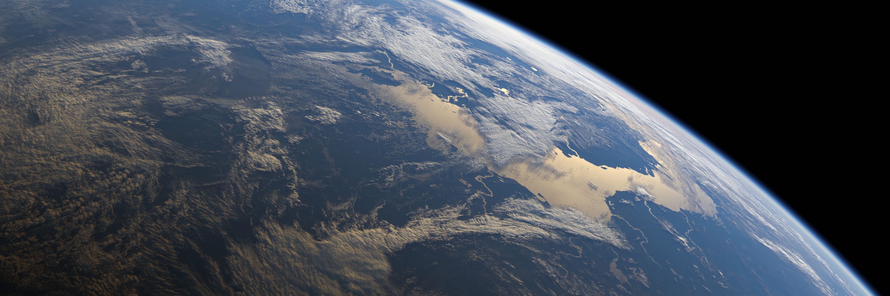
algal bloom

November 24, 2025 at 4:41 PM
algal bloom
WIP something something Tethys ocean

November 23, 2025 at 10:41 PM
WIP something something Tethys ocean

November 17, 2025 at 6:03 PM

RIP rudist :'(

November 13, 2025 at 4:11 PM
RIP rudist :'(
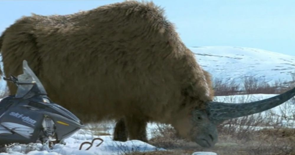
Third shot feels very reminiscent of the arctic wolf scene in PE3

November 11, 2025 at 8:19 AM
Third shot feels very reminiscent of the arctic wolf scene in PE3
fine, here's a slither of promo


November 2, 2025 at 9:22 PM
fine, here's a slither of promo
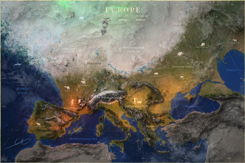
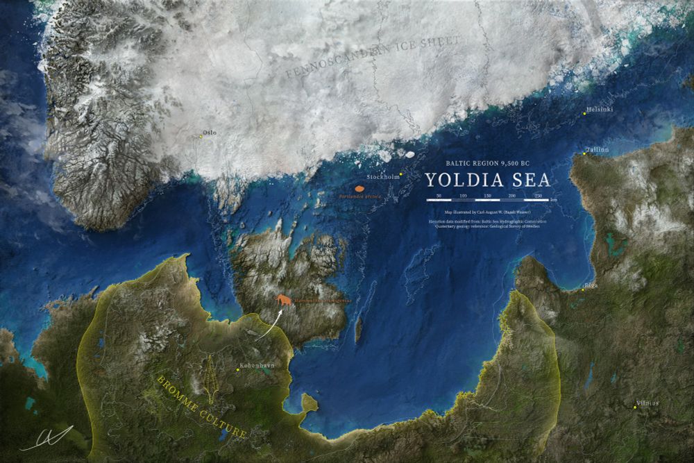
Here: the highest local coastline, 190 m above sea level. Doesn't get more ice age than that!
Happy??
Happy??

November 2, 2025 at 6:59 PM
Here: the highest local coastline, 190 m above sea level. Doesn't get more ice age than that!
Happy??
Happy??

spotted in the wild 👀

October 15, 2025 at 10:36 AM
spotted in the wild 👀
A fine addition to my collection: Mesozoic Art 2! There is an art style for everyone in here, absolutely magnificent stuff!! #Paleoart4ever


September 30, 2025 at 6:36 AM
A fine addition to my collection: Mesozoic Art 2! There is an art style for everyone in here, absolutely magnificent stuff!! #Paleoart4ever
ya forgot the good one
August 25, 2025 at 7:51 AM
ya forgot the good one
also confirmed to be covering the Clovis culture in the end-Pleistocene episode

August 24, 2025 at 7:15 AM
also confirmed to be covering the Clovis culture in the end-Pleistocene episode
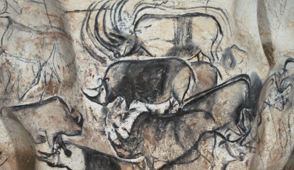
Paleo-art some 30,000 years before it was cool
[Chauvet]
[Chauvet]

August 10, 2025 at 4:54 PM
Paleo-art some 30,000 years before it was cool
[Chauvet]
[Chauvet]
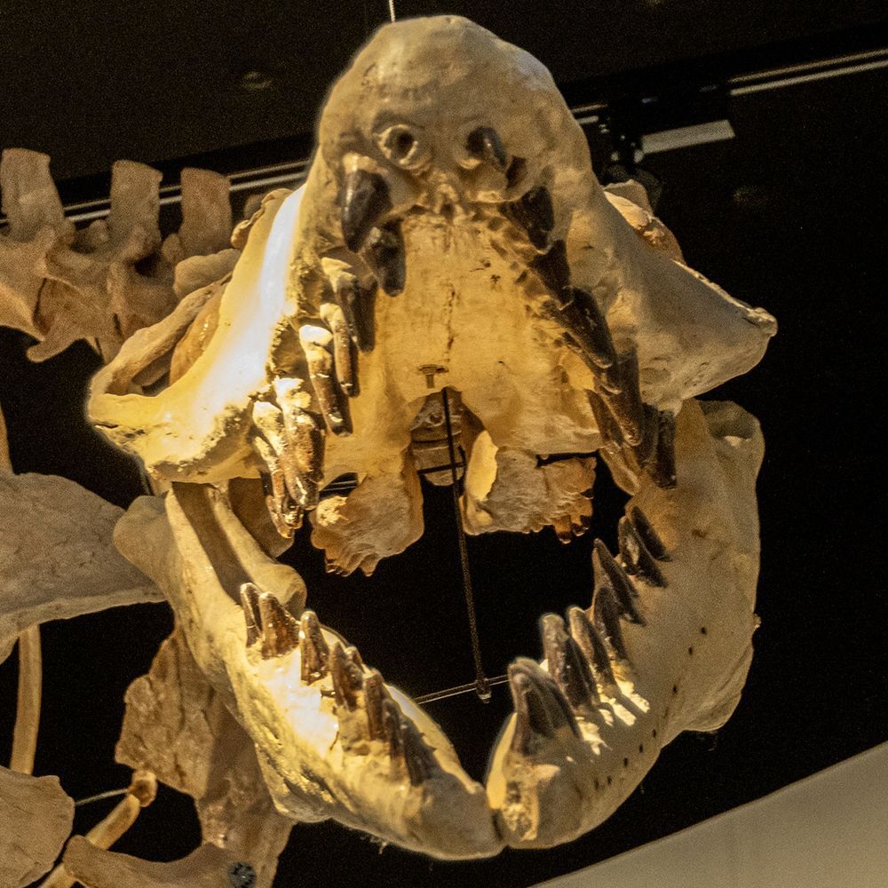
New? this photo has been out for like 2 years now. Anyways, might as well ad the other angles while we're at it
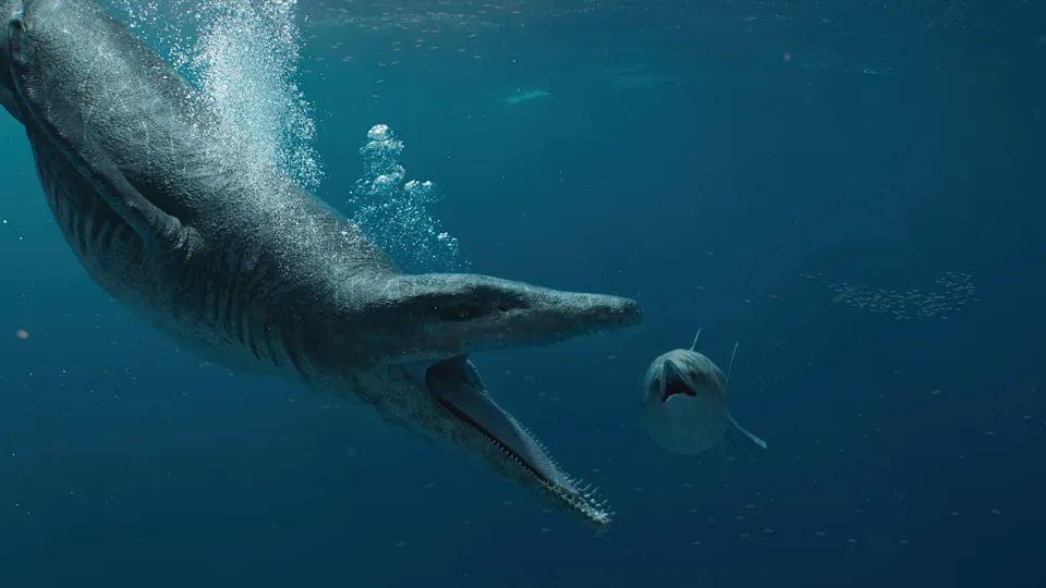
It might make a lucrative meal for some flying and/or aquatic scavengers...
It might make a lucrative meal for some flying and/or aquatic scavengers...


August 9, 2025 at 7:10 PM
New? this photo has been out for like 2 years now. Anyways, might as well ad the other angles while we're at it
It might make a lucrative meal for some flying and/or aquatic scavengers...
It might make a lucrative meal for some flying and/or aquatic scavengers...
19 years, come to think of it
August 3, 2025 at 7:45 PM
19 years, come to think of it
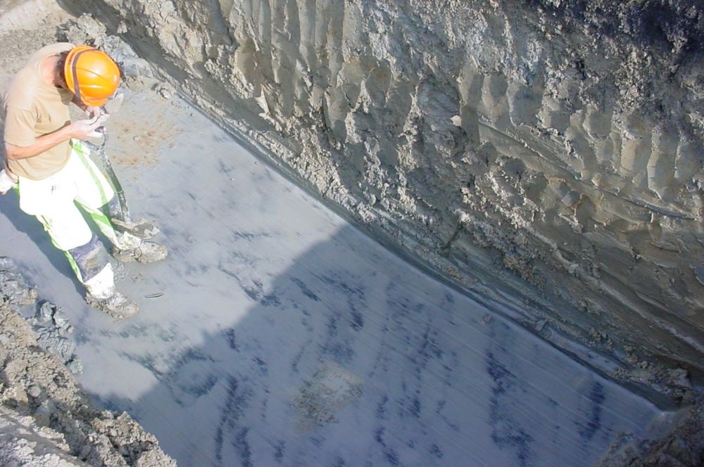
yup, this why many of us here in Sweden walk on fine post-glacial marine sediment, which can trigger landslides relatively easily.
July 23, 2025 at 9:02 PM
yup, this why many of us here in Sweden walk on fine post-glacial marine sediment, which can trigger landslides relatively easily.
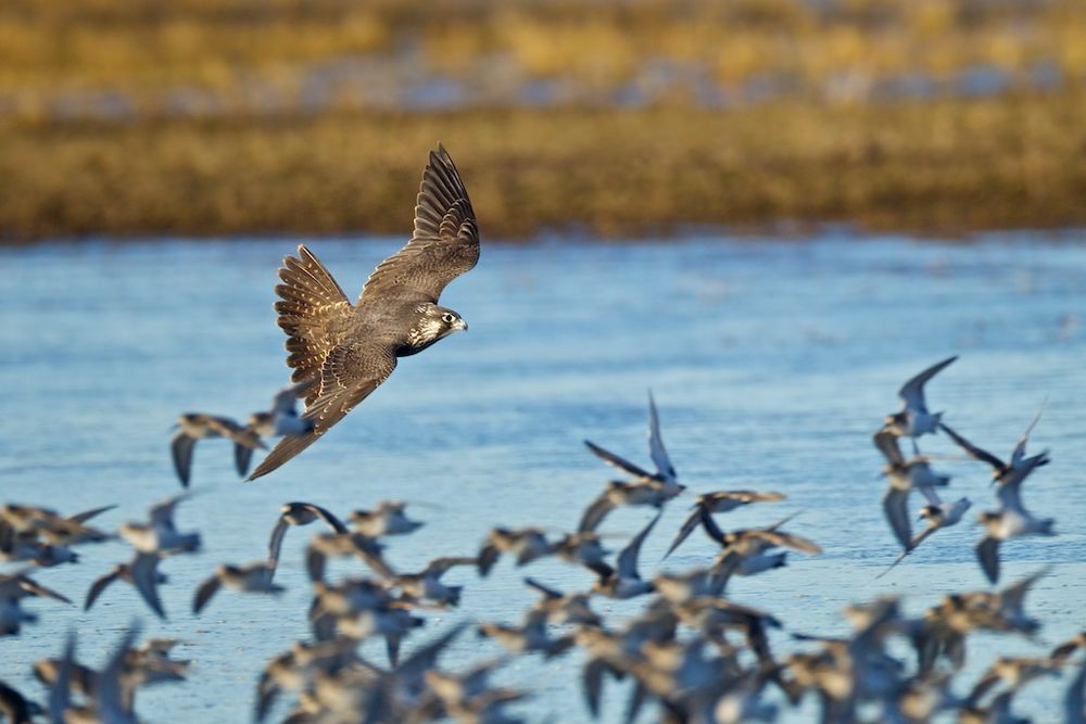
peregrine hunting shorebirds
July 16, 2025 at 10:45 AM
peregrine hunting shorebirds
oh, when I first glanced at this I thought we were on the coast looking down towards the sea, not in it looking up! silly me

July 14, 2025 at 4:45 AM
oh, when I first glanced at this I thought we were on the coast looking down towards the sea, not in it looking up! silly me
Certainly heavily inspired by this but amazing nonetheless

July 11, 2025 at 5:00 AM
Certainly heavily inspired by this but amazing nonetheless
Got me a pretty little kids book on Early Jurassic dinosaurs - by @stavrossk.bsky.social


June 25, 2025 at 8:06 AM
Got me a pretty little kids book on Early Jurassic dinosaurs - by @stavrossk.bsky.social