


Harry Stranger
@spacefromspace.com
Satellite images past and present 🛰️
Building an archive of interactive declassified spy satellite images 🕵️
https://spacefromspace.com/declassified-satellite-images
Building an archive of interactive declassified spy satellite images 🕵️
https://spacefromspace.com/declassified-satellite-images
Pinned
Harry Stranger
@spacefromspace.com
· Nov 20


Hi Bluesky! I'm Harry, a satellite imagery nerd covering current and past spaceflight-related events (sometimes other topics too.)
I run spacefromspace.com, a site where you can explore satellite images past and present for free.
I'll be sharing cool images and some stories along the way here! 🛰️
I run spacefromspace.com, a site where you can explore satellite images past and present for free.
I'll be sharing cool images and some stories along the way here! 🛰️
Reposted by Harry Stranger

This old map of Strait of Gibraltar from 1966 was captured by a spy satellite. Look how much these areas have changed!
Explore and compare it here: soaratlas.com/maps/global-...
Explore and compare it here: soaratlas.com/maps/global-...
November 28, 2025 at 1:00 AM
This old map of Strait of Gibraltar from 1966 was captured by a spy satellite. Look how much these areas have changed!
Explore and compare it here: soaratlas.com/maps/global-...
Explore and compare it here: soaratlas.com/maps/global-...
Continuing my (roughly) monthly captures of Florida's Space Coast launch pads, here's a thread of satellite imagery captured on the morning of November 26 showing all pads between LC-39A and LC-36.
Thread:
Thread:

November 26, 2025 at 10:28 PM
Continuing my (roughly) monthly captures of Florida's Space Coast launch pads, here's a thread of satellite imagery captured on the morning of November 26 showing all pads between LC-39A and LC-36.
Thread:
Thread:
Introduce yourself with four spaceships.


November 26, 2025 at 12:06 AM
Introduce yourself with four spaceships.
Reposted by Harry Stranger

Part 2 of my article is up:
thespacereview.com/article/5107/1
thespacereview.com/article/5107/1

November 25, 2025 at 11:40 AM
Part 2 of my article is up:
thespacereview.com/article/5107/1
thespacereview.com/article/5107/1
Reposted by Harry Stranger
Announcing Georeferencer.ai - Powered by Soar.
A powerful tool that simplifies georeferencing for everyone!
#MappingTools #Cartography #Georeference #Mapping
A powerful tool that simplifies georeferencing for everyone!
#MappingTools #Cartography #Georeference #Mapping

November 24, 2025 at 12:00 PM
Announcing Georeferencer.ai - Powered by Soar.
A powerful tool that simplifies georeferencing for everyone!
#MappingTools #Cartography #Georeference #Mapping
A powerful tool that simplifies georeferencing for everyone!
#MappingTools #Cartography #Georeference #Mapping
A very cool high off-nadir CORONA spy satellite image taken looking west as it was passing over Turkey.
The boot of Italy can be seen in the distance with Greece in the foreground.
Taken on August 10, 1967 during mission 1043.
The boot of Italy can be seen in the distance with Greece in the foreground.
Taken on August 10, 1967 during mission 1043.

November 25, 2025 at 12:01 AM
A very cool high off-nadir CORONA spy satellite image taken looking west as it was passing over Turkey.
The boot of Italy can be seen in the distance with Greece in the foreground.
Taken on August 10, 1967 during mission 1043.
The boot of Italy can be seen in the distance with Greece in the foreground.
Taken on August 10, 1967 during mission 1043.
My nervous system isn't a fan of severe thunderstorms down here, but they sure as hell put on an epic light show from a distance. From last night.


November 23, 2025 at 9:57 PM
My nervous system isn't a fan of severe thunderstorms down here, but they sure as hell put on an epic light show from a distance. From last night.
👀🗺️
November 23, 2025 at 9:18 PM
👀🗺️
Captured 53 years ago today, this KH-9 HEXAGON spy satellite image shows the fourth and final (to fly) Soviet N1 rocket on it's launch pad two days before its failed launch.
spacefromspace.com/declassified...
spacefromspace.com/declassified...

November 21, 2025 at 8:56 PM
Captured 53 years ago today, this KH-9 HEXAGON spy satellite image shows the fourth and final (to fly) Soviet N1 rocket on it's launch pad two days before its failed launch.
spacefromspace.com/declassified...
spacefromspace.com/declassified...
Reposted by Harry Stranger
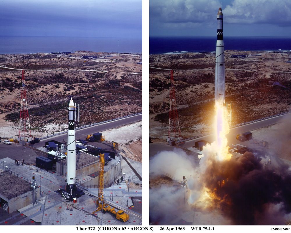
My part 2 article on satellite mapping will include this image of Istanbul, Turkey, taken in 1962 by an ARGON satellite. These images were used to create and update maps of areas around the world and to revise the geodetic surveys. Thanks to Harry Stranger for locating some nice ARGON images.

November 21, 2025 at 4:20 AM
My part 2 article on satellite mapping will include this image of Istanbul, Turkey, taken in 1962 by an ARGON satellite. These images were used to create and update maps of areas around the world and to revise the geodetic surveys. Thanks to Harry Stranger for locating some nice ARGON images.
Reposted by Harry Stranger
Just submitted part 2 of my article on the development of satellite mapping in the 1960s. Until it appears on Monday, you can enjoy part 1, which features a story about horse poop.
thespacereview.com/article/5104/1
thespacereview.com/article/5104/1
November 21, 2025 at 4:12 AM
Just submitted part 2 of my article on the development of satellite mapping in the 1960s. Until it appears on Monday, you can enjoy part 1, which features a story about horse poop.
thespacereview.com/article/5104/1
thespacereview.com/article/5104/1
New York City as captured by a KH-9 HEXAGON spy satellite in 1974 and Maxar/Vantor ~45 years later.
Images sources:
www.flickr.com/photos/19484...
storage.pardot.com/1084652/1731...
Images sources:
www.flickr.com/photos/19484...
storage.pardot.com/1084652/1731...


November 21, 2025 at 12:44 AM
New York City as captured by a KH-9 HEXAGON spy satellite in 1974 and Maxar/Vantor ~45 years later.
Images sources:
www.flickr.com/photos/19484...
storage.pardot.com/1084652/1731...
Images sources:
www.flickr.com/photos/19484...
storage.pardot.com/1084652/1731...
Reposted by Harry Stranger

Interesting post on oblique imagery from Vantor (née Maxar): go.vantor.com/Imagery-Lead...

November 20, 2025 at 11:23 PM
Interesting post on oblique imagery from Vantor (née Maxar): go.vantor.com/Imagery-Lead...
Captured less than 8hrs ago, this 30cm satellite imagery gives a good overview of Blue Origin's & SpaceX's manufacturing facilities on the Space Coast.
The full interactive image is also free to view on @soaratlas.bsky.social : soaratlas.com/maps/139975
See more below.
The full interactive image is also free to view on @soaratlas.bsky.social : soaratlas.com/maps/139975
See more below.


November 20, 2025 at 11:49 PM
Captured less than 8hrs ago, this 30cm satellite imagery gives a good overview of Blue Origin's & SpaceX's manufacturing facilities on the Space Coast.
The full interactive image is also free to view on @soaratlas.bsky.social : soaratlas.com/maps/139975
See more below.
The full interactive image is also free to view on @soaratlas.bsky.social : soaratlas.com/maps/139975
See more below.
Reposted by Harry Stranger
See how Port Said has evolved over the decades: 1966 vs Today!
soaratlas.com/maps/139838?...
See anything we didn't? 👆
soaratlas.com/maps/139838?...
See anything we didn't? 👆
November 20, 2025 at 12:01 PM
See how Port Said has evolved over the decades: 1966 vs Today!
soaratlas.com/maps/139838?...
See anything we didn't? 👆
soaratlas.com/maps/139838?...
See anything we didn't? 👆
Reposted by Harry Stranger
My new article is up, and it includes a great story about a horse: thespacereview.com/article/5104/1

November 18, 2025 at 1:54 AM
My new article is up, and it includes a great story about a horse: thespacereview.com/article/5104/1
While working on a KH-7 GAMBIT satellite image of Bahrain from 1967 I noticed a large amount of arrows marked on the northern coast. If anyone knows what these are I'd be interested to learn!


November 17, 2025 at 10:35 PM
While working on a KH-7 GAMBIT satellite image of Bahrain from 1967 I noticed a large amount of arrows marked on the northern coast. If anyone knows what these are I'd be interested to learn!
Reposted by Harry Stranger
My next article in The Space Review will be about early mapping satellite programs. Part 1 is on the classified ARGON program (see the camera). It took this photo of Long Island in 1964 (thanks to Harry Stranger). Pt. 2 will be about overlapping programs, pt. 3 will be about replacing ARGON.


November 16, 2025 at 9:08 PM
My next article in The Space Review will be about early mapping satellite programs. Part 1 is on the classified ARGON program (see the camera). It took this photo of Long Island in 1964 (thanks to Harry Stranger). Pt. 2 will be about overlapping programs, pt. 3 will be about replacing ARGON.
Reposted by Harry Stranger
From 1960s spy-satellite photos to SpaceX launch pads today...
This mapper hit 1,000+ uploads, turning a passion into a massive global archive.
Read More 👉: about.soaratlas.com/blogs/the-ma...
#Mapping #GIS #OSINT #EarthObservation
This mapper hit 1,000+ uploads, turning a passion into a massive global archive.
Read More 👉: about.soaratlas.com/blogs/the-ma...
#Mapping #GIS #OSINT #EarthObservation
November 16, 2025 at 12:00 PM
From 1960s spy-satellite photos to SpaceX launch pads today...
This mapper hit 1,000+ uploads, turning a passion into a massive global archive.
Read More 👉: about.soaratlas.com/blogs/the-ma...
#Mapping #GIS #OSINT #EarthObservation
This mapper hit 1,000+ uploads, turning a passion into a massive global archive.
Read More 👉: about.soaratlas.com/blogs/the-ma...
#Mapping #GIS #OSINT #EarthObservation
Port Said, Egypt - December 12, 1966
(including your friendly neighbourhood SAM site)
spacefromspace.com/declassified...
(including your friendly neighbourhood SAM site)
spacefromspace.com/declassified...


November 16, 2025 at 12:07 AM
Port Said, Egypt - December 12, 1966
(including your friendly neighbourhood SAM site)
spacefromspace.com/declassified...
(including your friendly neighbourhood SAM site)
spacefromspace.com/declassified...
A high resolution satellite image of New Glenn standing on the pad at LC-36 on Wednesday before it's incredible mission the following day.


November 14, 2025 at 11:02 AM
A high resolution satellite image of New Glenn standing on the pad at LC-36 on Wednesday before it's incredible mission the following day.
Reposted by Harry Stranger
My new article is up:
thespacereview.com/article/5093/1
thespacereview.com/article/5093/1

November 4, 2025 at 12:01 PM
My new article is up:
thespacereview.com/article/5093/1
thespacereview.com/article/5093/1
Reposted by Harry Stranger
🚨 BREAKING: new satellite image from @Vantortech reveals the aftermath of Hurricane Melissa in Jamaica.
The destruction is hard to comprehend.
soaratlas.com/maps/139537?...
👆 We’ve georeferenced the maps so you can compare the full impact yourself.
#HurricaneMelissa #Jamaica #EarthObservation
The destruction is hard to comprehend.
soaratlas.com/maps/139537?...
👆 We’ve georeferenced the maps so you can compare the full impact yourself.
#HurricaneMelissa #Jamaica #EarthObservation
October 30, 2025 at 1:29 AM
🚨 BREAKING: new satellite image from @Vantortech reveals the aftermath of Hurricane Melissa in Jamaica.
The destruction is hard to comprehend.
soaratlas.com/maps/139537?...
👆 We’ve georeferenced the maps so you can compare the full impact yourself.
#HurricaneMelissa #Jamaica #EarthObservation
The destruction is hard to comprehend.
soaratlas.com/maps/139537?...
👆 We’ve georeferenced the maps so you can compare the full impact yourself.
#HurricaneMelissa #Jamaica #EarthObservation
Reposted by Harry Stranger
My other article is up: thespacereview.com/article/5087/1

October 28, 2025 at 4:08 PM
My other article is up: thespacereview.com/article/5087/1
My gallery of interactive declassified spy satellite images has just crossed 600 images!
spacefromspace.com/declassified...
spacefromspace.com/declassified...


October 28, 2025 at 1:18 AM
My gallery of interactive declassified spy satellite images has just crossed 600 images!
spacefromspace.com/declassified...
spacefromspace.com/declassified...