


Puget Sound Storm Watch
@psswanthony.bsky.social
PSSW - Serving the Sound since 2013.
Run by Anthony Croyle out of Milton, WA.
Ko-Fi: https://ko-fi.com/pugetsoundstormwatch
Run by Anthony Croyle out of Milton, WA.
Ko-Fi: https://ko-fi.com/pugetsoundstormwatch


Going live on Facebook and YouTube tonight at 5 to talk about Thanksgiving inclement weather!
youtube.com/live/84iosnr...
youtube.com/live/84iosnr...

11/24/25 Live Thanksgiving Weather Talk
YouTube video by Puget Sound Storm Watch
youtube.com
November 25, 2025 at 12:11 AM
Going live on Facebook and YouTube tonight at 5 to talk about Thanksgiving inclement weather!
youtube.com/live/84iosnr...
youtube.com/live/84iosnr...

It could be a bit windy around the area Wednesday night or Thursday morning in time for some Thanksgiving travel. Several models in semi-decent agreement on position, timing, and strength of a surface low offshore. #wawx
November 23, 2025 at 9:57 PM
It could be a bit windy around the area Wednesday night or Thursday morning in time for some Thanksgiving travel. Several models in semi-decent agreement on position, timing, and strength of a surface low offshore. #wawx
There are days like today where the models completely bomb the forecast. Virtually no wind gusts south of SeaTac where models showed 20-30 MPH at times. #wawx

November 23, 2025 at 5:03 PM
There are days like today where the models completely bomb the forecast. Virtually no wind gusts south of SeaTac where models showed 20-30 MPH at times. #wawx
Light shower activity north of the Puget Sound this morning. As night falls, the activity will begin to spread along the coast and make its way inland in time for sunrise. Still looks breezy but nothing to run home about. #wawx

November 22, 2025 at 4:52 PM
Light shower activity north of the Puget Sound this morning. As night falls, the activity will begin to spread along the coast and make its way inland in time for sunrise. Still looks breezy but nothing to run home about. #wawx
The new 00z NAM 3 km model takes a chunk off of the max wind gusts around Western Washington Sunday morning. Still looking like 30-35 MPH wind gusts south of Seattle followed by a westerly surge for Whidbey Island. However, no longer showing 40 MPH for isolated areas. #wawx

November 22, 2025 at 3:18 AM
The new 00z NAM 3 km model takes a chunk off of the max wind gusts around Western Washington Sunday morning. Still looking like 30-35 MPH wind gusts south of Seattle followed by a westerly surge for Whidbey Island. However, no longer showing 40 MPH for isolated areas. #wawx
This morning's run of the high-res NAM model shows a blustery day on tap for Western Washington on Sunday. Just a heads up, if you have Christmas decorations set up, this should be the first official wind test. #wawx

November 21, 2025 at 6:19 PM
This morning's run of the high-res NAM model shows a blustery day on tap for Western Washington on Sunday. Just a heads up, if you have Christmas decorations set up, this should be the first official wind test. #wawx
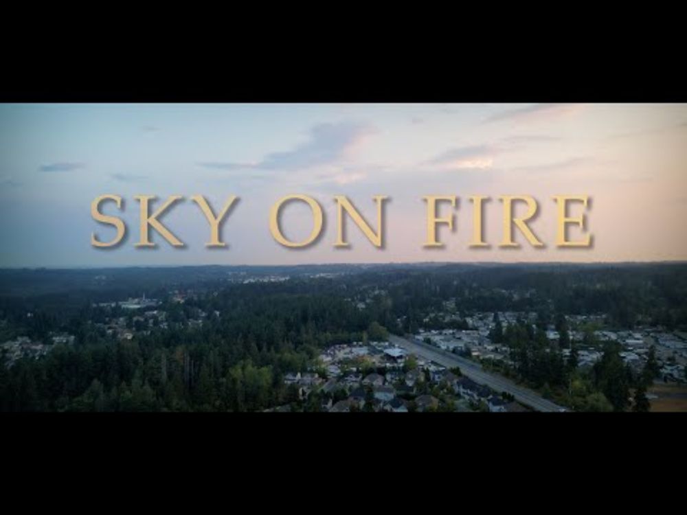
"Sky On Fire" Drone Reel
YouTube video by Puget Sound Storm Watch
youtu.be
November 20, 2025 at 10:17 PM
I'll be hosting another informational live stream on YouTube at 4 PM to go over several points of interest weather-wise!
youtube.com/live/dvvZiJU...
youtube.com/live/dvvZiJU...

11/19/25 Live Weather Discussion
YouTube video by Puget Sound Storm Watch
youtube.com
November 19, 2025 at 11:25 PM
I'll be hosting another informational live stream on YouTube at 4 PM to go over several points of interest weather-wise!
youtube.com/live/dvvZiJU...
youtube.com/live/dvvZiJU...
Another lull in the active weather pattern over the Pacific Northwest coming up this week. A transient ridge turns into a strong ridge on Wednesday. Fog potential is there too. #wawx
November 18, 2025 at 4:35 PM
Another lull in the active weather pattern over the Pacific Northwest coming up this week. A transient ridge turns into a strong ridge on Wednesday. Fog potential is there too. #wawx

Reposted by Puget Sound Storm Watch
Urban & Small Stream Flood Advisory in effect across the Puget Sound area and Central Cascades through 3:15 PM today. Expect street flooding, ponding, and rises on small streams & creeks. Be safe out there! #wawx

SEW issues Flood Advisory for King, Kitsap, Mason, Pierce, Snohomish, Thurston [WA] till Nov 14, 3:15 PM PST Link

November 14, 2025 at 6:23 PM
Urban & Small Stream Flood Advisory in effect across the Puget Sound area and Central Cascades through 3:15 PM today. Expect street flooding, ponding, and rises on small streams & creeks. Be safe out there! #wawx
It currently looks like we'll forfeit our windstorm chance tomorrow into Friday. Southern Oregon takes it instead! It could get quite breezy with some passing fronts going into this weekend around here. #wawx
November 12, 2025 at 3:39 PM
It currently looks like we'll forfeit our windstorm chance tomorrow into Friday. Southern Oregon takes it instead! It could get quite breezy with some passing fronts going into this weekend around here. #wawx

November 12, 2025 at 2:00 AM
Looking more likely now that there will be no wind storm in Western Washington this Thursday. However, it could still be a breezy day Friday as a front likely moves through the area. #wawx
November 12, 2025 at 12:40 AM
Looking more likely now that there will be no wind storm in Western Washington this Thursday. However, it could still be a breezy day Friday as a front likely moves through the area. #wawx
First run of the NAM 3 km that's somewhat in range of Thursday. Maybe Oregon/California will get the storm and WA misses out? Looking like that in this solution. #wawx
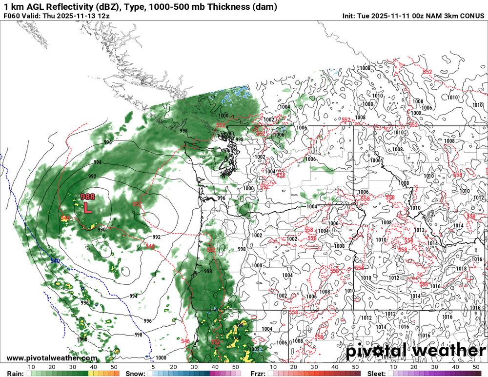
November 11, 2025 at 2:57 AM
First run of the NAM 3 km that's somewhat in range of Thursday. Maybe Oregon/California will get the storm and WA misses out? Looking like that in this solution. #wawx
Something to keep eyes on Thursday afternoon. A potential mid-latitude cyclone making landfall somewhere along the WA coast. There's still lots of details to iron out, so this is a baseline for now. #wawx

November 10, 2025 at 3:30 PM
Something to keep eyes on Thursday afternoon. A potential mid-latitude cyclone making landfall somewhere along the WA coast. There's still lots of details to iron out, so this is a baseline for now. #wawx
Could be a toasty one out there by autumn standards today by game time. The National Blend of Models shows several spots, especially closer to those east wind gaps, hitting or exceeding 60 degrees today. #wawx

November 9, 2025 at 6:26 PM
Could be a toasty one out there by autumn standards today by game time. The National Blend of Models shows several spots, especially closer to those east wind gaps, hitting or exceeding 60 degrees today. #wawx
Some spots of east King county could see those pesky easterly winds return overnight. The 00z Euro shows up to 44 MPH gusts in mainly remote areas, but 36-42 MPH for some populated areas. #wawx

November 8, 2025 at 3:17 PM
Some spots of east King county could see those pesky easterly winds return overnight. The 00z Euro shows up to 44 MPH gusts in mainly remote areas, but 36-42 MPH for some populated areas. #wawx


Strong rotation signature showing up off the coast after a tornado warning in Pacific county earlier. Waterspout potential with this one. #wawx

November 6, 2025 at 1:30 AM
Strong rotation signature showing up off the coast after a tornado warning in Pacific county earlier. Waterspout potential with this one. #wawx
Reposted by Puget Sound Storm Watch
🌪️ Radar scan near Ilwaco, WA at the time a likely tornado/waterspout moved onshore off the Columbia River. That’s about as clear as it gets! Huge shoutout to @seattlewxguy.bsky.social, @markskaggs10.bsky.social, and @markstewarr.bsky.social for chasing and photographing this!! #wawx

November 6, 2025 at 1:22 AM
🌪️ Radar scan near Ilwaco, WA at the time a likely tornado/waterspout moved onshore off the Columbia River. That’s about as clear as it gets! Huge shoutout to @seattlewxguy.bsky.social, @markskaggs10.bsky.social, and @markstewarr.bsky.social for chasing and photographing this!! #wawx