


The Northern Ireland Place-Name Project
@placenamesni.bsky.social
Researching local place-names and providing councils with authoritative Irish forms for signage. Funded by DfC and based in Irish & Celtic Studies at QUB.
Pinned
Experience
placenamesni.org
We are the Northern Ireland Place-Name Project, based in Irish & Celtic Studies at QUB since 1987. Funded by DfC since 2023, we research the origins and meanings of local names and support councils with Irish forms for signage. Explore our searchable corpus at placenamesni.org.

We are deeply saddened to learn of the passing of our friend Dr Gordon McCoy, former UPNS Secretary and a valued scholar of the Irish language, anthropology, and place-names. Gordon’s work with Turas, his Gaelic maps of Belfast and East Belfast, and his research.
Ar dheis Dé go raibh a anam uasal.
Ar dheis Dé go raibh a anam uasal.
November 14, 2025 at 5:01 PM
We are deeply saddened to learn of the passing of our friend Dr Gordon McCoy, former UPNS Secretary and a valued scholar of the Irish language, anthropology, and place-names. Gordon’s work with Turas, his Gaelic maps of Belfast and East Belfast, and his research.
Ar dheis Dé go raibh a anam uasal.
Ar dheis Dé go raibh a anam uasal.
Important notice from the committee of the Ulster Place Name Society 👇


November 12, 2025 at 6:46 PM
Important notice from the committee of the Ulster Place Name Society 👇
Reposted by The Northern Ireland Place-Name Project

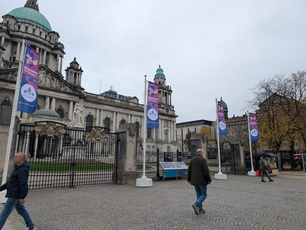
Tá Béal Feirste ag ullmhú d'Oireachtas na Samhna 2025!
Ceannaigh ticéad anseo: www.antoireachtas.ie/oireachtas-n...
#OnaS25
Ceannaigh ticéad anseo: www.antoireachtas.ie/oireachtas-n...
#OnaS25
October 17, 2025 at 4:14 PM
Tá Béal Feirste ag ullmhú d'Oireachtas na Samhna 2025!
Ceannaigh ticéad anseo: www.antoireachtas.ie/oireachtas-n...
#OnaS25
Ceannaigh ticéad anseo: www.antoireachtas.ie/oireachtas-n...
#OnaS25
Reposted by The Northern Ireland Place-Name Project
Seoladh mór @leabharbreac.bsky.social ag @oirnagaeilge.bsky.social
3pm go dtí 5pm Dé hAoine 31 Deireadh Fómhair, sa gCultúrlann (sa Dánlann ar chúl an tsiopa leabhar, An Ceathrú Póilí)
3pm go dtí 5pm Dé hAoine 31 Deireadh Fómhair, sa gCultúrlann (sa Dánlann ar chúl an tsiopa leabhar, An Ceathrú Póilí)

October 18, 2025 at 3:52 PM
Seoladh mór @leabharbreac.bsky.social ag @oirnagaeilge.bsky.social
3pm go dtí 5pm Dé hAoine 31 Deireadh Fómhair, sa gCultúrlann (sa Dánlann ar chúl an tsiopa leabhar, An Ceathrú Póilí)
3pm go dtí 5pm Dé hAoine 31 Deireadh Fómhair, sa gCultúrlann (sa Dánlann ar chúl an tsiopa leabhar, An Ceathrú Póilí)
It is possible that Laoch of Cill Ó Laoch ‘church of the descendants of Laoch’ (Killyleagh) is a variant spelling of Luighdheach, a genitive form of Lughaidh which was a popular name in early Ireland. The ruins of the medieval parish church are north of the town centre. www.bbc.com/news/article...

Prince Andrew: Killyleagh has its say over his baron title - BBC News
The prince is relinquishing all of his royal titles - one of which is Baron Killyleagh.
www.bbc.com
October 21, 2025 at 4:30 PM
It is possible that Laoch of Cill Ó Laoch ‘church of the descendants of Laoch’ (Killyleagh) is a variant spelling of Luighdheach, a genitive form of Lughaidh which was a popular name in early Ireland. The ruins of the medieval parish church are north of the town centre. www.bbc.com/news/article...
Páirc an tSeandúin - Shandon Park with seandún meaning ‘old fort’ www.bbc.com/news/article...

Irish language: Bilingual street sign damaged with angle grinder
The white sign to Shandon Park was cut with an angle grinder with the Irish language removed.
www.bbc.com
October 12, 2025 at 5:56 AM
Páirc an tSeandúin - Shandon Park with seandún meaning ‘old fort’ www.bbc.com/news/article...
Reposted by The Northern Ireland Place-Name Project

Cloud-capped #Mournes from the townland of Magherasaul/Machaire Sabhall ‘plain of barns', @placenamesni.bsky.social
#CountyDown
#SpéirGhorm
Corrected from earlier post.
#CountyDown
#SpéirGhorm
Corrected from earlier post.

October 9, 2025 at 11:01 AM
Cloud-capped #Mournes from the townland of Magherasaul/Machaire Sabhall ‘plain of barns', @placenamesni.bsky.social
#CountyDown
#SpéirGhorm
Corrected from earlier post.
#CountyDown
#SpéirGhorm
Corrected from earlier post.
In the townland of Doagh, Co. Antrim, the Irish element dumhach ‘mound’ refers to a Norman motte, but in the four Co. Derry townlands named Doaghs (parish of Magilligan), the same element refers to the sand dunes along Magilligan Strand all the way to Magilligan Point.


September 30, 2025 at 10:30 AM
In the townland of Doagh, Co. Antrim, the Irish element dumhach ‘mound’ refers to a Norman motte, but in the four Co. Derry townlands named Doaghs (parish of Magilligan), the same element refers to the sand dunes along Magilligan Strand all the way to Magilligan Point.
linenhall.com/event/place-... save the date!

Place-naming and Place-sharing in Northern Ireland - The Linen Hall, Belfast
As part of the celebrations for Oireachtas na Samhna, The Linen Hall is delighted to welcome Professor Mícheál Ó Mainnín, Dr Frances Kane, and Dr Brian Devlin for a fascinating talk on the history and...
linenhall.com
September 29, 2025 at 7:04 PM
linenhall.com/event/place-... save the date!
Reposted by The Northern Ireland Place-Name Project
Morning sky over Raholp, Saul, Slieve Patrick. Wow!
#Lecale #LeathCathail
#CountyDown
#SpéirGhorm
#Skyscape
Possible: Ráth Cholpa ‘fort of the steer’, source @placenamesni.bsky.social
#Lecale #LeathCathail
#CountyDown
#SpéirGhorm
#Skyscape
Possible: Ráth Cholpa ‘fort of the steer’, source @placenamesni.bsky.social

September 29, 2025 at 6:18 AM
Morning sky over Raholp, Saul, Slieve Patrick. Wow!
#Lecale #LeathCathail
#CountyDown
#SpéirGhorm
#Skyscape
Possible: Ráth Cholpa ‘fort of the steer’, source @placenamesni.bsky.social
#Lecale #LeathCathail
#CountyDown
#SpéirGhorm
#Skyscape
Possible: Ráth Cholpa ‘fort of the steer’, source @placenamesni.bsky.social
Ravara (Ráth Bhearach ‘fort of heifers) is ’referred to as Balliravarragh in 1605. The parish of Dromara is also named after heifers: bearach. No ringfort appears to survive.
On my off-main roads travels near Saintfield, I see a road marked Ravara - from where might this derive, please, @placenamesni.bsky.social
We are the Northern Ireland Place-Name Project, based in Irish & Celtic Studies at QUB since 1987. Funded by DfC since 2023, we research the origins and meanings of local names and support councils with Irish forms for signage. Explore our searchable corpus at placenamesni.org.
September 18, 2025 at 6:49 AM
Ravara (Ráth Bhearach ‘fort of heifers) is ’referred to as Balliravarragh in 1605. The parish of Dromara is also named after heifers: bearach. No ringfort appears to survive.
Despite its appearance, Ahoghill isn't 'a hill for hogs', but a transliteration of Achadh Eochaille ‘field of the yew wood’ (see also Youghal, Cork). However we do have plenty of pig-hills like in Cornamuck (corr na muc), Tullymuck (Tulaigh muc) and Crocknamuck (Cnoc na muc)
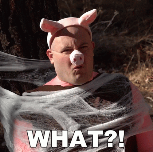
a man in a pig costume says what ?
ALT: a man in a pig costume says what ?
media.tenor.com
September 15, 2025 at 1:01 PM
Despite its appearance, Ahoghill isn't 'a hill for hogs', but a transliteration of Achadh Eochaille ‘field of the yew wood’ (see also Youghal, Cork). However we do have plenty of pig-hills like in Cornamuck (corr na muc), Tullymuck (Tulaigh muc) and Crocknamuck (Cnoc na muc)
Reposted by The Northern Ireland Place-Name Project
9 Sept: Feast Ss Mochta mac Dergain of Druim, Fer Dá Chrích, Dar Erca, Fíalán "the Miraculous", Dímmán & Conall the sage "son of Oengus". "druim"=back, ridge. In c. 2,400 Irish townlands, anglicised drum/drom/drim ( @placenamesni.bsky.social )! 📷Drumlins, Ballymorran, Strangford, Down ©Albert Bridge

September 9, 2025 at 6:01 AM
9 Sept: Feast Ss Mochta mac Dergain of Druim, Fer Dá Chrích, Dar Erca, Fíalán "the Miraculous", Dímmán & Conall the sage "son of Oengus". "druim"=back, ridge. In c. 2,400 Irish townlands, anglicised drum/drom/drim ( @placenamesni.bsky.social )! 📷Drumlins, Ballymorran, Strangford, Down ©Albert Bridge
Craobh ‘tree, branch’ appears as both ‘creeve’ and ‘crew’. The hill of Craobh Thulcha at Crew, Antrim was the site of two famous battles between the rival peoples of Uí Néill and Ulaid. To emphasise their victory in 1099, the Uí Néill party cut down the sacred tree of the Ulaid.

September 9, 2025 at 12:28 PM
Craobh ‘tree, branch’ appears as both ‘creeve’ and ‘crew’. The hill of Craobh Thulcha at Crew, Antrim was the site of two famous battles between the rival peoples of Uí Néill and Ulaid. To emphasise their victory in 1099, the Uí Néill party cut down the sacred tree of the Ulaid.
Reposted by The Northern Ireland Place-Name Project
Had the pleasure today of getting up close and personal with some of John O’Donvan’s handiwork and his edits for the names of Tory Island with an excellent session hosted by the wonderful Crystal Bennes @ria.ie 😍


September 8, 2025 at 3:53 PM
Had the pleasure today of getting up close and personal with some of John O’Donvan’s handiwork and his edits for the names of Tory Island with an excellent session hosted by the wonderful Crystal Bennes @ria.ie 😍
We are delighted to be partnering with the Andersonstown News with a regular piece on our local place-names. Kicking off with Divis. belfastmedia.com/writing-on-t...

Writing on the Wall/An Scríbhinn ar an Bhalla
Tá an Ghaeilge i bhfad níos feiceálaí anois ar chomharthaí sráidainmneacha ar fud Bhéal Feirste ná mar a bhí riamh. Toradh é seo ar pholasaí nua a thug Comhairle Cathrach Bhéal Feirste isteach in 2022...
belfastmedia.com
September 8, 2025 at 11:30 AM
We are delighted to be partnering with the Andersonstown News with a regular piece on our local place-names. Kicking off with Divis. belfastmedia.com/writing-on-t...
Did you know that the city of Derry was once an island? The area now known as the Bogside was originally underwater. The Foyle flowed round the island, and was first settled as the river diverted. It dried out into marshland: hence the name Bogside.

September 8, 2025 at 11:15 AM
Did you know that the city of Derry was once an island? The area now known as the Bogside was originally underwater. The Foyle flowed round the island, and was first settled as the river diverted. It dried out into marshland: hence the name Bogside.
Reposted by The Northern Ireland Place-Name Project
Writing for the OS memoirs, John O’Donovan comments “what a pit-y that the Irish were so fond of calling places after such pits as the pit of Queen Meve” 😂 @irelandmapped.bsky.social
Rising to 687 metres, Sawel Mountain is the highest peak of the Sperrins, sitting on the border of Counties Derry and Tyrone. The full name of the mountain is Samhail Phite Méabha ‘likeness to Maeve’s vulva’ and is said to be used metaphorically to refer to a hollow on the side of the mountain.

September 5, 2025 at 2:58 PM
Writing for the OS memoirs, John O’Donovan comments “what a pit-y that the Irish were so fond of calling places after such pits as the pit of Queen Meve” 😂 @irelandmapped.bsky.social
Rising to 687 metres, Sawel Mountain is the highest peak of the Sperrins, sitting on the border of Counties Derry and Tyrone. The full name of the mountain is Samhail Phite Méabha ‘likeness to Maeve’s vulva’ and is said to be used metaphorically to refer to a hollow on the side of the mountain.
September 5, 2025 at 2:19 PM
Rising to 687 metres, Sawel Mountain is the highest peak of the Sperrins, sitting on the border of Counties Derry and Tyrone. The full name of the mountain is Samhail Phite Méabha ‘likeness to Maeve’s vulva’ and is said to be used metaphorically to refer to a hollow on the side of the mountain.
Baile (usually ‘bally’) originally meant ‘place’, later 'a piece of land belonging to an individual or group, but gradually took on wider meanings; land-measure, homestead, home, abode, town, village, place' In medieval texts the word was used to refer to a passage in a book and a part of the body!

September 5, 2025 at 11:39 AM
Baile (usually ‘bally’) originally meant ‘place’, later 'a piece of land belonging to an individual or group, but gradually took on wider meanings; land-measure, homestead, home, abode, town, village, place' In medieval texts the word was used to refer to a passage in a book and a part of the body!
Macha ‘pasture’ in Armagh (Ard Mhacha ‘height of Macha’) is the name of a land-goddess who represents sovereignty in the myths of the ancient Ulstermen. Armagh is also where Patrick built his great stone church in 445AD, making Armagh the Ecclesiastical Capital of Ireland.
Ard Mhacha Abu
September 4, 2025 at 9:48 AM
Macha ‘pasture’ in Armagh (Ard Mhacha ‘height of Macha’) is the name of a land-goddess who represents sovereignty in the myths of the ancient Ulstermen. Armagh is also where Patrick built his great stone church in 445AD, making Armagh the Ecclesiastical Capital of Ireland.
Reposted by The Northern Ireland Place-Name Project

The super folks at @belfastsociety.org have annihnced this year's lectures. Some absolute stonkers I've marked in to attend, one being @profkdlilley.bsky.social on Oct 8th retracing OS surveyors ( for all of us who live for the OS Memoirs!)
Venue: Old Museum,College Sq N.
Venue: Old Museum,College Sq N.
September 3, 2025 at 9:48 AM
The super folks at @belfastsociety.org have annihnced this year's lectures. Some absolute stonkers I've marked in to attend, one being @profkdlilley.bsky.social on Oct 8th retracing OS surveyors ( for all of us who live for the OS Memoirs!)
Venue: Old Museum,College Sq N.
Venue: Old Museum,College Sq N.
Dubhais, consisting of dubh (black) and ais (ridge), is the longstanding Irish name of Divis mountain. However, recent reconsideration by the Placenames team of the pronunciation of Divis in English suggests the slender variant Duibhis is much more likely to be the original local name.
An exciting new venture from our friends @profkdlilley.bsky.social and @niscifest.bsky.social on our very own doorstep. Looking forward to the programme of events that they have planned belfastmedia.com/celebrating-...

Celebrating 200 years since first mapping survey of Divis Mountain took place
A NEW community heritage project has been launched which will shine a light on the rich and fascinating heritage of the Ordnance Survey in Ireland.
belfastmedia.com
September 3, 2025 at 12:10 PM
Dubhais, consisting of dubh (black) and ais (ridge), is the longstanding Irish name of Divis mountain. However, recent reconsideration by the Placenames team of the pronunciation of Divis in English suggests the slender variant Duibhis is much more likely to be the original local name.