


Mapbox
@mapbox.com
Mapbox powers navigation for people, packages, and vehicles everywhere.
www.mapbox.com
www.mapbox.com
Pinned
Mapbox
@mapbox.com
· Oct 1

It’s happening again in November. 30 days and 30 themes for maps. Take part, learn something new and have fun. That’s what #30DayMapChallenge is about 🌎

🌎 We’re excited to be part of this year’s #30DayMapChallenge created by @tjukanov.bsky.social, a global celebration of creativity, cartography, and community. The official prompts for the 2025 challenge are now live, with mapping starting in one month.
#30DayMapChallenge #BuiltWithMapbox
#30DayMapChallenge #BuiltWithMapbox
Learn how to build an Android marker app using a custom Mapbox style and tileset, with embedded data and interactive markers. This walkthrough focuses on how to implement a custom style with interactive markers directly into your app, making your maps easier to reuse across platforms.
January 20, 2026 at 4:15 PM
Learn how to build an Android marker app using a custom Mapbox style and tileset, with embedded data and interactive markers. This walkthrough focuses on how to implement a custom style with interactive markers directly into your app, making your maps easier to reuse across platforms.
The latest Mapbox Standard release adds architectural building facades, expanded custom color options, and night mode icons, giving teams more flexibility to shape maps that inform, orient, and delight users in both 2D and 3D.

Mapbox Standard delivers new architectural detail and custom colors
The latest Mapbox Standard map style update brings stunning 3D architectural detail and fully customizable color options, creating a dynamic, flexible basemap.
www.mapbox.com
January 19, 2026 at 2:01 PM
The latest Mapbox Standard release adds architectural building facades, expanded custom color options, and night mode icons, giving teams more flexibility to shape maps that inform, orient, and delight users in both 2D and 3D.
Build a fully functional React Native mapping app using @rnmapbox/maps, the community-maintained wrapper for Mapbox Maps SDKs on iOS and Android.
You’ll have an app showing a styled map, a custom marathon route, and live user location, ready to extend into production features:
You’ll have an app showing a styled map, a custom marathon route, and live user location, ready to extend into production features:

Getting Started with Maps in React Native | Help
Create a React Native app that displays a Mapbox map, configures the Standard style, displays data, and shows user location.
buff.ly
January 16, 2026 at 5:03 PM
Build a fully functional React Native mapping app using @rnmapbox/maps, the community-maintained wrapper for Mapbox Maps SDKs on iOS and Android.
You’ll have an app showing a styled map, a custom marathon route, and live user location, ready to extend into production features:
You’ll have an app showing a styled map, a custom marathon route, and live user location, ready to extend into production features:
Blaise is building modern on-demand transit software for small transit agencies, rural municipalities, and nonprofits — places where traditional fixed-route transit is too costly or inefficient to operate.

Blaise Transit builds with Mapbox
Blaise Transit delivers reliable on-demand mobility for communities and transit agencies, with Mapbox reverse geocoding and routing driving a 183% ridership increase.
www.mapbox.com
January 15, 2026 at 5:00 PM
Blaise is building modern on-demand transit software for small transit agencies, rural municipalities, and nonprofits — places where traditional fixed-route transit is too costly or inefficient to operate.
Building AI-powered apps doesn’t have to start from scratch.
This blog walks developers through how to build a ChatGPT App powered by Mapbox, combining natural language interaction with location intelligence.
This blog walks developers through how to build a ChatGPT App powered by Mapbox, combining natural language interaction with location intelligence.
January 14, 2026 at 7:30 PM
Building AI-powered apps doesn’t have to start from scratch.
This blog walks developers through how to build a ChatGPT App powered by Mapbox, combining natural language interaction with location intelligence.
This blog walks developers through how to build a ChatGPT App powered by Mapbox, combining natural language interaction with location intelligence.
🌍 In case you missed it — we released 10 million square kilometers of updated satellite imagery on the mapbox.satellite tileset.
The update integrates 30 cm basemaps from Vantor for unparalleled resolution and accuracy.
Learn more here: buff.ly/g0RG36m
#BuiltWithMapbox #SatellityImagery
The update integrates 30 cm basemaps from Vantor for unparalleled resolution and accuracy.
Learn more here: buff.ly/g0RG36m
#BuiltWithMapbox #SatellityImagery

January 13, 2026 at 5:02 PM
🌍 In case you missed it — we released 10 million square kilometers of updated satellite imagery on the mapbox.satellite tileset.
The update integrates 30 cm basemaps from Vantor for unparalleled resolution and accuracy.
Learn more here: buff.ly/g0RG36m
#BuiltWithMapbox #SatellityImagery
The update integrates 30 cm basemaps from Vantor for unparalleled resolution and accuracy.
Learn more here: buff.ly/g0RG36m
#BuiltWithMapbox #SatellityImagery
This beginner-level tutorial walks you through adding custom data to a style, styling it at different zoom levels, and bringing that style into your map so you can interact with its features — all using Mapbox Studio, the in-browser editor for creating custom map styles.
January 1, 2026 at 3:03 PM
This beginner-level tutorial walks you through adding custom data to a style, styling it at different zoom levels, and bringing that style into your map so you can interact with its features — all using Mapbox Studio, the in-browser editor for creating custom map styles.
Speed and precision matter when data guides decisions. That’s why DataKind turned to Mapbox.
Mapbox Boundaries powers fast, accurate rendering of census tracts, ZIP codes, counties, and congressional districts—eliminating performance bottlenecks caused by slow TIGERweb calls: buff.ly/JOCjQVY
Mapbox Boundaries powers fast, accurate rendering of census tracts, ZIP codes, counties, and congressional districts—eliminating performance bottlenecks caused by slow TIGERweb calls: buff.ly/JOCjQVY

December 30, 2025 at 5:04 PM
Speed and precision matter when data guides decisions. That’s why DataKind turned to Mapbox.
Mapbox Boundaries powers fast, accurate rendering of census tracts, ZIP codes, counties, and congressional districts—eliminating performance bottlenecks caused by slow TIGERweb calls: buff.ly/JOCjQVY
Mapbox Boundaries powers fast, accurate rendering of census tracts, ZIP codes, counties, and congressional districts—eliminating performance bottlenecks caused by slow TIGERweb calls: buff.ly/JOCjQVY
📊 50% faster load times.
📈 58% increase in monthly active users.
✔️ 15% rendering error eliminated.
Mapbox Boundaries has been transformative for DataKind, powering more inclusive and effective data tools for the nonprofits they serve.
Learn more: buff.ly/JOCjQVY
#BuiltwithMapbox
📈 58% increase in monthly active users.
✔️ 15% rendering error eliminated.
Mapbox Boundaries has been transformative for DataKind, powering more inclusive and effective data tools for the nonprofits they serve.
Learn more: buff.ly/JOCjQVY
#BuiltwithMapbox

December 22, 2025 at 5:04 PM
📊 50% faster load times.
📈 58% increase in monthly active users.
✔️ 15% rendering error eliminated.
Mapbox Boundaries has been transformative for DataKind, powering more inclusive and effective data tools for the nonprofits they serve.
Learn more: buff.ly/JOCjQVY
#BuiltwithMapbox
📈 58% increase in monthly active users.
✔️ 15% rendering error eliminated.
Mapbox Boundaries has been transformative for DataKind, powering more inclusive and effective data tools for the nonprofits they serve.
Learn more: buff.ly/JOCjQVY
#BuiltwithMapbox
🚀 2025 was a big year for everyone building with Mapbox.
We launched our new Location AI offerings, added more ways to customize the Mapbox Standard style, rolled out a new Console, shipped new 3D landmarks and icons, updated 670k sq km of aerial imagery – and so much more!
We launched our new Location AI offerings, added more ways to customize the Mapbox Standard style, rolled out a new Console, shipped new 3D landmarks and icons, updated 670k sq km of aerial imagery – and so much more!

Mapbox Year In Review: Thank you for a remarkable 2025
Mapbox celebrates our community, partners, events, and debut of new Location AI tools. Thank you for an incredible 2025.
www.mapbox.com
December 18, 2025 at 4:00 PM
🚀 2025 was a big year for everyone building with Mapbox.
We launched our new Location AI offerings, added more ways to customize the Mapbox Standard style, rolled out a new Console, shipped new 3D landmarks and icons, updated 670k sq km of aerial imagery – and so much more!
We launched our new Location AI offerings, added more ways to customize the Mapbox Standard style, rolled out a new Console, shipped new 3D landmarks and icons, updated 670k sq km of aerial imagery – and so much more!
REVER powers the world’s largest motorcycle riding community – with an experience built on Mapbox.
With Mapbox Navigation, REVER delivers the same high-performance map experience across iOS, Android, and web.
Learn how REVER built with Mapbox: buff.ly/MPFa47B
#BuiltWithMapbox
With Mapbox Navigation, REVER delivers the same high-performance map experience across iOS, Android, and web.
Learn how REVER built with Mapbox: buff.ly/MPFa47B
#BuiltWithMapbox

December 17, 2025 at 4:05 PM
REVER powers the world’s largest motorcycle riding community – with an experience built on Mapbox.
With Mapbox Navigation, REVER delivers the same high-performance map experience across iOS, Android, and web.
Learn how REVER built with Mapbox: buff.ly/MPFa47B
#BuiltWithMapbox
With Mapbox Navigation, REVER delivers the same high-performance map experience across iOS, Android, and web.
Learn how REVER built with Mapbox: buff.ly/MPFa47B
#BuiltWithMapbox
Build Android mapping apps that work without a network connection.
This tutorial walks you through managing offline maps in your Android app using the Mapbox Maps SDK for Android, giving your users fast, reliable map experiences no matter where they are.
This tutorial walks you through managing offline maps in your Android app using the Mapbox Maps SDK for Android, giving your users fast, reliable map experiences no matter where they are.
December 16, 2025 at 4:03 PM
Build Android mapping apps that work without a network connection.
This tutorial walks you through managing offline maps in your Android app using the Mapbox Maps SDK for Android, giving your users fast, reliable map experiences no matter where they are.
This tutorial walks you through managing offline maps in your Android app using the Mapbox Maps SDK for Android, giving your users fast, reliable map experiences no matter where they are.
Our latest webinar showed how to simplify custom data workflows with the new Mapbox Data Workbench — a powerful way to upload, preview, and edit your data directly on the Mapbox platform.
The full webinar recording is available on YouTube: buff.ly/MiQIgGS
#BuiltWithMapbox
The full webinar recording is available on YouTube: buff.ly/MiQIgGS
#BuiltWithMapbox

December 15, 2025 at 6:00 PM
Our latest webinar showed how to simplify custom data workflows with the new Mapbox Data Workbench — a powerful way to upload, preview, and edit your data directly on the Mapbox platform.
The full webinar recording is available on YouTube: buff.ly/MiQIgGS
#BuiltWithMapbox
The full webinar recording is available on YouTube: buff.ly/MiQIgGS
#BuiltWithMapbox
When REVER evaluated mapping providers, the gaps were obvious: weak offline performance, limited customization, and maps that didn’t capture the detail that motorcycle riders rely on.
Discover how REVER built the leading motorcycle ride app experience with Mapbox: buff.ly/mhsWFQf
#BuiltWithMapbox
Discover how REVER built the leading motorcycle ride app experience with Mapbox: buff.ly/mhsWFQf
#BuiltWithMapbox

December 9, 2025 at 4:02 PM
When REVER evaluated mapping providers, the gaps were obvious: weak offline performance, limited customization, and maps that didn’t capture the detail that motorcycle riders rely on.
Discover how REVER built the leading motorcycle ride app experience with Mapbox: buff.ly/mhsWFQf
#BuiltWithMapbox
Discover how REVER built the leading motorcycle ride app experience with Mapbox: buff.ly/mhsWFQf
#BuiltWithMapbox
The Mapbox platform continuously improves with new products and features. Request early access to beta offerings and explore the latest release announcements at buff.ly/swjtS93.
Start experimenting with what we’re shipping next and help to shape new features.
#BuiltWithMapbox
Start experimenting with what we’re shipping next and help to shape new features.
#BuiltWithMapbox

December 8, 2025 at 5:03 PM
The Mapbox platform continuously improves with new products and features. Request early access to beta offerings and explore the latest release announcements at buff.ly/swjtS93.
Start experimenting with what we’re shipping next and help to shape new features.
#BuiltWithMapbox
Start experimenting with what we’re shipping next and help to shape new features.
#BuiltWithMapbox
Create a store locator map that lets customers browse locations from a sidebar and tap markers to see more details.
This tutorial covers everything you need to get started: integrating Mapbox GL JS, importing GeoJSON, creating custom interactive markers, and building a sidebar with store listing.
This tutorial covers everything you need to get started: integrating Mapbox GL JS, importing GeoJSON, creating custom interactive markers, and building a sidebar with store listing.
December 5, 2025 at 5:01 PM
Create a store locator map that lets customers browse locations from a sidebar and tap markers to see more details.
This tutorial covers everything you need to get started: integrating Mapbox GL JS, importing GeoJSON, creating custom interactive markers, and building a sidebar with store listing.
This tutorial covers everything you need to get started: integrating Mapbox GL JS, importing GeoJSON, creating custom interactive markers, and building a sidebar with store listing.
With the Mapbox Navigation SDK, REVER delivered one of its most requested upgrades: turn-by-turn navigation. Riders get clear, voice-guided directions so they can focus on the road: buff.ly/mhsWFQf
#BuiltWithMapbox
#BuiltWithMapbox

December 3, 2025 at 5:05 PM
With the Mapbox Navigation SDK, REVER delivered one of its most requested upgrades: turn-by-turn navigation. Riders get clear, voice-guided directions so they can focus on the road: buff.ly/mhsWFQf
#BuiltWithMapbox
#BuiltWithMapbox
Mapbox just released 670,000+ sq km of updated aerial imagery across major cities in the US and Europe — giving businesses clearer, more current views of the world.
With 10–20 cm pixel resolution and 4M+ new pixels, your users see crisp detail that enhances the moments that matter most:
With 10–20 cm pixel resolution and 4M+ new pixels, your users see crisp detail that enhances the moments that matter most:

December 2, 2025 at 5:04 PM
Mapbox just released 670,000+ sq km of updated aerial imagery across major cities in the US and Europe — giving businesses clearer, more current views of the world.
With 10–20 cm pixel resolution and 4M+ new pixels, your users see crisp detail that enhances the moments that matter most:
With 10–20 cm pixel resolution and 4M+ new pixels, your users see crisp detail that enhances the moments that matter most:
If you bring your own data to Mapbox, this is the tool you’ve been waiting for.
The new Data Workbench makes it much simpler to upload and manage your custom data: you can transform, tile, and edit your data right inside the Mapbox platform.
Register now: buff.ly/Ucbbldk
#BuiltWithMapbox
The new Data Workbench makes it much simpler to upload and manage your custom data: you can transform, tile, and edit your data right inside the Mapbox platform.
Register now: buff.ly/Ucbbldk
#BuiltWithMapbox
December 1, 2025 at 4:30 PM
If you bring your own data to Mapbox, this is the tool you’ve been waiting for.
The new Data Workbench makes it much simpler to upload and manage your custom data: you can transform, tile, and edit your data right inside the Mapbox platform.
Register now: buff.ly/Ucbbldk
#BuiltWithMapbox
The new Data Workbench makes it much simpler to upload and manage your custom data: you can transform, tile, and edit your data right inside the Mapbox platform.
Register now: buff.ly/Ucbbldk
#BuiltWithMapbox
#30DayMapChallenge Day 30 — Makeover
During BUILD with Mapbox, in the “Streamlined Map Development Part 2” session, Mathew Anthony showcased an impressive before-and-after — cleaning up styling, simplifying layers, and turning a busy map into a sharp design: buff.ly/p0oJGjg
#BuiltWithMapbox
During BUILD with Mapbox, in the “Streamlined Map Development Part 2” session, Mathew Anthony showcased an impressive before-and-after — cleaning up styling, simplifying layers, and turning a busy map into a sharp design: buff.ly/p0oJGjg
#BuiltWithMapbox
November 30, 2025 at 6:01 PM
#30DayMapChallenge Day 30 — Makeover
During BUILD with Mapbox, in the “Streamlined Map Development Part 2” session, Mathew Anthony showcased an impressive before-and-after — cleaning up styling, simplifying layers, and turning a busy map into a sharp design: buff.ly/p0oJGjg
#BuiltWithMapbox
During BUILD with Mapbox, in the “Streamlined Map Development Part 2” session, Mathew Anthony showcased an impressive before-and-after — cleaning up styling, simplifying layers, and turning a busy map into a sharp design: buff.ly/p0oJGjg
#BuiltWithMapbox
#30DayMapChallenge Day 29 — Raster
Check out this demo by Kenji Shima showing off the new Mapbox Japan Weather Layers. Toggle raster tilesets, swap projections, and experiment with particle animations — all powered by Mapbox: buff.ly/H7MW6gG
#BuiltWithMapbox #GeoVisualization
Check out this demo by Kenji Shima showing off the new Mapbox Japan Weather Layers. Toggle raster tilesets, swap projections, and experiment with particle animations — all powered by Mapbox: buff.ly/H7MW6gG
#BuiltWithMapbox #GeoVisualization
November 29, 2025 at 4:01 PM
#30DayMapChallenge Day 29 — Raster
Check out this demo by Kenji Shima showing off the new Mapbox Japan Weather Layers. Toggle raster tilesets, swap projections, and experiment with particle animations — all powered by Mapbox: buff.ly/H7MW6gG
#BuiltWithMapbox #GeoVisualization
Check out this demo by Kenji Shima showing off the new Mapbox Japan Weather Layers. Toggle raster tilesets, swap projections, and experiment with particle animations — all powered by Mapbox: buff.ly/H7MW6gG
#BuiltWithMapbox #GeoVisualization
#30DayMapChallenge Day 28 — Black
Inspired by Giambattista Nolli’s iconic 1748 plan of Rome, this style reimagines the mostly-black ichnographic aesthetic that defined one of history’s most influential maps.
Browse the gallery of map styles: buff.ly/W2h3qno
#BuiltWithMapbox
Inspired by Giambattista Nolli’s iconic 1748 plan of Rome, this style reimagines the mostly-black ichnographic aesthetic that defined one of history’s most influential maps.
Browse the gallery of map styles: buff.ly/W2h3qno
#BuiltWithMapbox


November 28, 2025 at 4:01 PM
#30DayMapChallenge Day 28 — Black
Inspired by Giambattista Nolli’s iconic 1748 plan of Rome, this style reimagines the mostly-black ichnographic aesthetic that defined one of history’s most influential maps.
Browse the gallery of map styles: buff.ly/W2h3qno
#BuiltWithMapbox
Inspired by Giambattista Nolli’s iconic 1748 plan of Rome, this style reimagines the mostly-black ichnographic aesthetic that defined one of history’s most influential maps.
Browse the gallery of map styles: buff.ly/W2h3qno
#BuiltWithMapbox
Native Land Digital offers an interactive way to explore the histories and territories of Indigenous peoples around the world. Built with Mapbox, the Native Land Digital maps help people to learn about ancestral lands, Indigenous place names and languages, and historical treaties.
November 28, 2025 at 3:02 PM
Native Land Digital offers an interactive way to explore the histories and territories of Indigenous peoples around the world. Built with Mapbox, the Native Land Digital maps help people to learn about ancestral lands, Indigenous place names and languages, and historical treaties.
#30DayMapChallenge Day 27 — Boundaries
The team at DataKind uses the Mapbox Boundaries datasets to build scalable tools that visualize geographic disparities and inform smarter interventions in housing, food access, and community support.
Learn more: buff.ly/82rUwlt
#BuiltWithMapbox
The team at DataKind uses the Mapbox Boundaries datasets to build scalable tools that visualize geographic disparities and inform smarter interventions in housing, food access, and community support.
Learn more: buff.ly/82rUwlt
#BuiltWithMapbox
November 27, 2025 at 5:03 PM
#30DayMapChallenge Day 27 — Boundaries
The team at DataKind uses the Mapbox Boundaries datasets to build scalable tools that visualize geographic disparities and inform smarter interventions in housing, food access, and community support.
Learn more: buff.ly/82rUwlt
#BuiltWithMapbox
The team at DataKind uses the Mapbox Boundaries datasets to build scalable tools that visualize geographic disparities and inform smarter interventions in housing, food access, and community support.
Learn more: buff.ly/82rUwlt
#BuiltWithMapbox
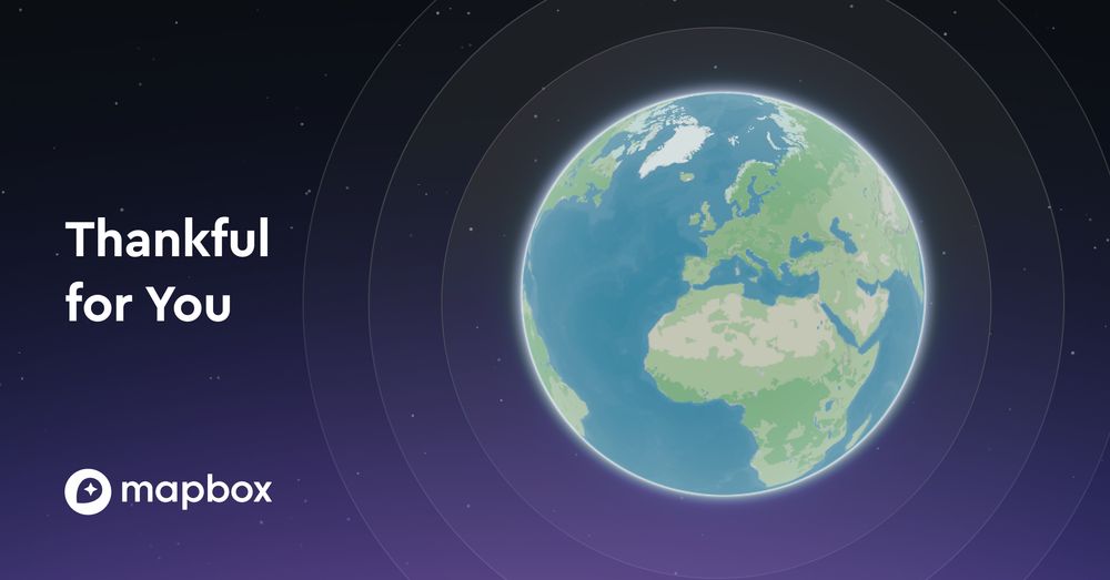
We’re grateful for every developer, designer, engineer, and creator who chooses to build with Mapbox.
Your ideas shape the products people use every day, and our community is stronger because of you.
Thank you for building the future with us.
#BuiltWithMapbox
Your ideas shape the products people use every day, and our community is stronger because of you.
Thank you for building the future with us.
#BuiltWithMapbox
November 27, 2025 at 3:04 PM
We’re grateful for every developer, designer, engineer, and creator who chooses to build with Mapbox.
Your ideas shape the products people use every day, and our community is stronger because of you.
Thank you for building the future with us.
#BuiltWithMapbox
Your ideas shape the products people use every day, and our community is stronger because of you.
Thank you for building the future with us.
#BuiltWithMapbox