


John Dehls
@john.dehls.net
Applying InSAR to landslides and other stuff at the Geological Survey of Norway (NGU). Opinions here are my own, not necessarily my employer's.
Hey #inuitart experts. I purchased this qiviut wall hanging in Yellowknife in 1993. It used to have a tag on it with the name of the artist, as well as the community she came from, but it is lost. I would very much like to know more about the artist. Does anyone recognise the signature or the style?


January 4, 2026 at 5:52 PM
Hey #inuitart experts. I purchased this qiviut wall hanging in Yellowknife in 1993. It used to have a tag on it with the name of the artist, as well as the community she came from, but it is lost. I would very much like to know more about the artist. Does anyone recognise the signature or the style?
⏰ Deadline extended!
The #ISPRS2026 abstract submission deadline is now 17 November.
Check out our Special Session on Cooperation on Ground Motion Monitoring for DRR & Resilience 👇
www.isprs2026toronto.com/special-sess...
#InSAR #DisasterRiskReduction #ISPRS2026
The #ISPRS2026 abstract submission deadline is now 17 November.
Check out our Special Session on Cooperation on Ground Motion Monitoring for DRR & Resilience 👇
www.isprs2026toronto.com/special-sess...
#InSAR #DisasterRiskReduction #ISPRS2026

November 4, 2025 at 8:15 AM
⏰ Deadline extended!
The #ISPRS2026 abstract submission deadline is now 17 November.
Check out our Special Session on Cooperation on Ground Motion Monitoring for DRR & Resilience 👇
www.isprs2026toronto.com/special-sess...
#InSAR #DisasterRiskReduction #ISPRS2026
The #ISPRS2026 abstract submission deadline is now 17 November.
Check out our Special Session on Cooperation on Ground Motion Monitoring for DRR & Resilience 👇
www.isprs2026toronto.com/special-sess...
#InSAR #DisasterRiskReduction #ISPRS2026
Reposted by John Dehls

Full of leading scientific institutions, Trondheim could be a natural laboratory for world-class collective transport.
But progress remains constrained by car-centric policies that support electried, privately-owned cars. The thinking: Green cars = Green economic growth. A cosmetic solution.
But progress remains constrained by car-centric policies that support electried, privately-owned cars. The thinking: Green cars = Green economic growth. A cosmetic solution.

October 15, 2025 at 6:58 AM
Full of leading scientific institutions, Trondheim could be a natural laboratory for world-class collective transport.
But progress remains constrained by car-centric policies that support electried, privately-owned cars. The thinking: Green cars = Green economic growth. A cosmetic solution.
But progress remains constrained by car-centric policies that support electried, privately-owned cars. The thinking: Green cars = Green economic growth. A cosmetic solution.
On this International Day for Disaster Risk Reduction, iddrr.undrr.org, I'd like to call attention once again to our idea of an InSAR-based global ground motion service, and our upcoming special session at ISPRS in Toronto. Abstract deadline is Nov 3. www.isprs2026toronto.com/special-sess...
October 13, 2025 at 2:08 PM
On this International Day for Disaster Risk Reduction, iddrr.undrr.org, I'd like to call attention once again to our idea of an InSAR-based global ground motion service, and our upcoming special session at ISPRS in Toronto. Abstract deadline is Nov 3. www.isprs2026toronto.com/special-sess...

We had tremendous response to our initiative for a Global Ground Motion Service at #GP2025 this spring.
The technology is proven. The data exists. Let's go global.
x.com/NorwayInGene...
The technology is proven. The data exists. Let's go global.
x.com/NorwayInGene...
September 22, 2025 at 11:51 AM
We had tremendous response to our initiative for a Global Ground Motion Service at #GP2025 this spring.
The technology is proven. The data exists. Let's go global.
x.com/NorwayInGene...
The technology is proven. The data exists. Let's go global.
x.com/NorwayInGene...
From earlier this year at #GP2025: x.com/NorwayInGene...
September 22, 2025 at 11:46 AM
From earlier this year at #GP2025: x.com/NorwayInGene...
I’d like to call your attention to a Special Session Drew Rotheram-Clarke (GSC) and I are co-chairing at #ISPRS2026 Toronto:
👉 “Cooperation on Ground Motion Monitoring for Disaster Risk Reduction and Resilience.”
👉 www.isprs2026toronto.com/special-sess...
#DRR #InSAR
👉 “Cooperation on Ground Motion Monitoring for Disaster Risk Reduction and Resilience.”
👉 www.isprs2026toronto.com/special-sess...
#DRR #InSAR

ISPRS 2026 Special Sessions
Discover ISPRS 2026 Special Sessions – expert-led, in-depth discussions on emerging topics in photogrammetry, remote sensing, and spatial information sciences.
www.isprs2026toronto.com
September 22, 2025 at 11:39 AM
I’d like to call your attention to a Special Session Drew Rotheram-Clarke (GSC) and I are co-chairing at #ISPRS2026 Toronto:
👉 “Cooperation on Ground Motion Monitoring for Disaster Risk Reduction and Resilience.”
👉 www.isprs2026toronto.com/special-sess...
#DRR #InSAR
👉 “Cooperation on Ground Motion Monitoring for Disaster Risk Reduction and Resilience.”
👉 www.isprs2026toronto.com/special-sess...
#DRR #InSAR

July 30, 2025 at 9:05 AM
CLICKBAIT VOICE
We processed radar images...
You won't believe how much the ground moved!
HAIKU VOICE
Silent satellites.
Unwrapped phase reveals secrets.
The land shifts unseen.
CONSPIRACY VOICE
Supposed "scientists" claim ground deformation,
based on "interferograms" from secret radar images.
We processed radar images...
You won't believe how much the ground moved!
HAIKU VOICE
Silent satellites.
Unwrapped phase reveals secrets.
The land shifts unseen.
CONSPIRACY VOICE
Supposed "scientists" claim ground deformation,
based on "interferograms" from secret radar images.


April 28, 2025 at 11:09 AM
CLICKBAIT VOICE
We processed radar images...
You won't believe how much the ground moved!
HAIKU VOICE
Silent satellites.
Unwrapped phase reveals secrets.
The land shifts unseen.
CONSPIRACY VOICE
Supposed "scientists" claim ground deformation,
based on "interferograms" from secret radar images.
We processed radar images...
You won't believe how much the ground moved!
HAIKU VOICE
Silent satellites.
Unwrapped phase reveals secrets.
The land shifts unseen.
CONSPIRACY VOICE
Supposed "scientists" claim ground deformation,
based on "interferograms" from secret radar images.
Reposted by John Dehls
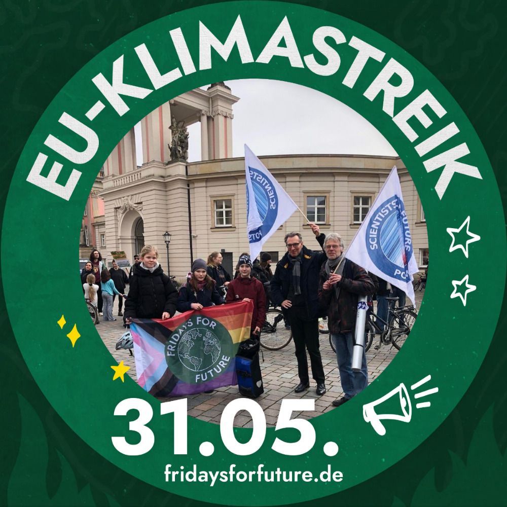
More than 10,000 scientists living, working or educated in Germany have already signed this appeal by @de.scientists4future.org to the members of the newly elected parliament to step up efforts for climate protection. Click here www.bayceer.uni-bayreuth.de/s4f/de/top/o... if you'd like to join.

March 18, 2025 at 8:25 AM
More than 10,000 scientists living, working or educated in Germany have already signed this appeal by @de.scientists4future.org to the members of the newly elected parliament to step up efforts for climate protection. Click here www.bayceer.uni-bayreuth.de/s4f/de/top/o... if you'd like to join.
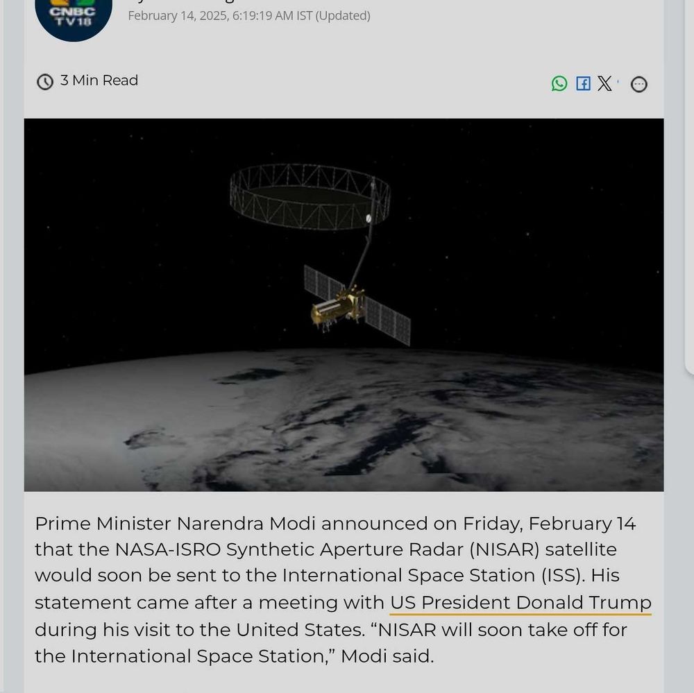
Finally a predicted launch date for #NISAR (May 20). It will be a relief to see this happen, given the current political and financial chaos. I just hope the ground segment funding remains in place. www.spacelaunchschedule.com/launch/gslv-...
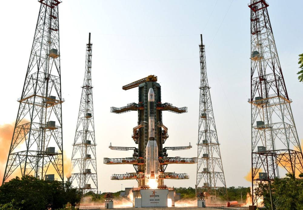
PSLV NISAR (NASA-ISRO Synthetic Aperture Radar) GSLV Mk II Rocket Launch
The NASA-ISRO Synthetic Aperture Radar, or NISAR satellite, will use advanced radar imaging to map the elevation of Earth's land and ice masses 4 to 6 times a month at resolutions of 5 to 10 meters. I...
www.spacelaunchschedule.com
March 11, 2025 at 1:06 PM
Finally a predicted launch date for #NISAR (May 20). It will be a relief to see this happen, given the current political and financial chaos. I just hope the ground segment funding remains in place. www.spacelaunchschedule.com/launch/gslv-...
I hope not! Let's stick to the Sun-synchronous, near-polar orbit plan 😅
February 15, 2025 at 8:29 AM
I hope not! Let's stick to the Sun-synchronous, near-polar orbit plan 😅
Breathing a sigh of relief just now. www.esa.int/Applications...
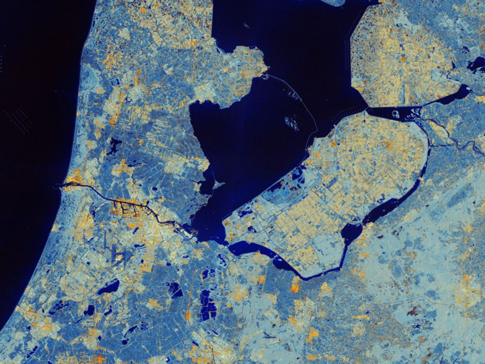
Sentinel-1C captures first radar images
Less than a week after its launch, the Copernicus Sentinel-1C satellite has delivered its first radar images of Earth – offering a glimpse into its capabilities for environmental monitoring. These ini...
www.esa.int
December 10, 2024 at 1:44 PM
Breathing a sigh of relief just now. www.esa.int/Applications...