


Ian Brown
@ianabrown.bsky.social
Scientist in Stockholm.
Mostly Earth observation.
Snow, radar, climate, plants.
Rugby ref and Scotland supporter.
Mostly Earth observation.
Snow, radar, climate, plants.
Rugby ref and Scotland supporter.
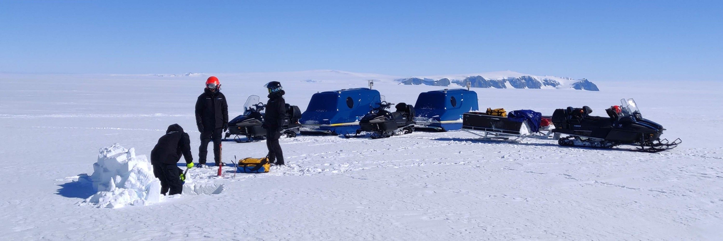
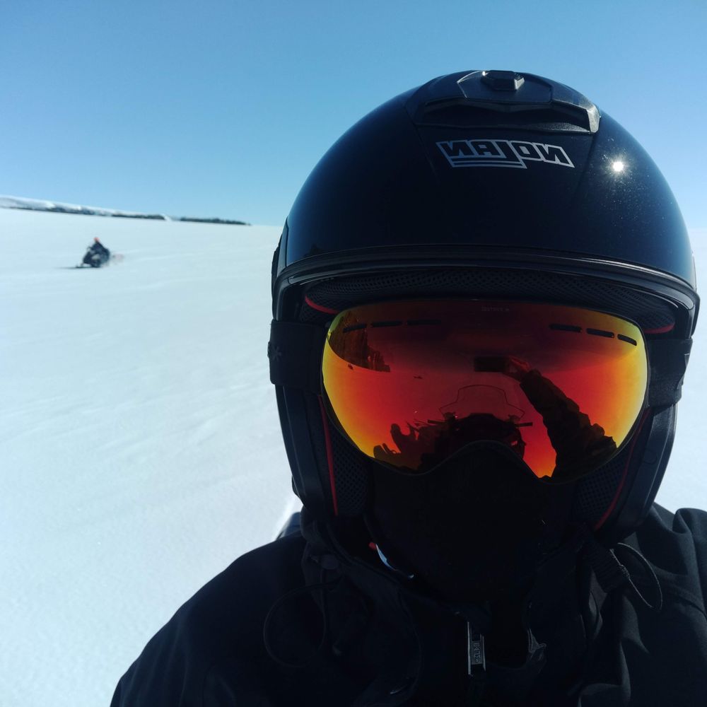
PhD studentship @stockholm-uni.bsky.social in #remotesensing of #antarctica
du.varbi.com/what:job/job...
Part of the International project #iQ2300
du.varbi.com/what:job/job...
Part of the International project #iQ2300
du.varbi.com
September 10, 2025 at 10:50 AM
PhD studentship @stockholm-uni.bsky.social in #remotesensing of #antarctica
du.varbi.com/what:job/job...
Part of the International project #iQ2300
du.varbi.com/what:job/job...
Part of the International project #iQ2300
New paper alert 📢
Greiser et al.
"Bark beetles as climate engineers"
shorturl.at/BxoVS
@linegreis.bsky.social
Greiser et al.
"Bark beetles as climate engineers"
shorturl.at/BxoVS
@linegreis.bsky.social
ScienceDirect.com | Science, health and medical journals, full text articles and books.
shorturl.at
September 5, 2025 at 8:57 AM
New paper alert 📢
Greiser et al.
"Bark beetles as climate engineers"
shorturl.at/BxoVS
@linegreis.bsky.social
Greiser et al.
"Bark beetles as climate engineers"
shorturl.at/BxoVS
@linegreis.bsky.social
Reposted by Ian Brown
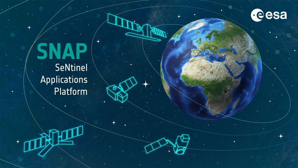
🚀SNAP 12 is here! 🌍
Marking 10 years of ESA's Sentinel App Platform with powerful new features:
🛰️Sentinel-1C support
⚙️JDK 21
🌐ETAD: smarter SLCs, interferograms & auto-download
🌍REACTIV, InSAR, OLCI/SLSTR
📦New vector tools
👉 step.esa.int/main/snap-12...
#EO #RemoteSensing #SentinelData #ESA #SNAP
Marking 10 years of ESA's Sentinel App Platform with powerful new features:
🛰️Sentinel-1C support
⚙️JDK 21
🌐ETAD: smarter SLCs, interferograms & auto-download
🌍REACTIV, InSAR, OLCI/SLSTR
📦New vector tools
👉 step.esa.int/main/snap-12...
#EO #RemoteSensing #SentinelData #ESA #SNAP
May 8, 2025 at 12:14 PM
🚀SNAP 12 is here! 🌍
Marking 10 years of ESA's Sentinel App Platform with powerful new features:
🛰️Sentinel-1C support
⚙️JDK 21
🌐ETAD: smarter SLCs, interferograms & auto-download
🌍REACTIV, InSAR, OLCI/SLSTR
📦New vector tools
👉 step.esa.int/main/snap-12...
#EO #RemoteSensing #SentinelData #ESA #SNAP
Marking 10 years of ESA's Sentinel App Platform with powerful new features:
🛰️Sentinel-1C support
⚙️JDK 21
🌐ETAD: smarter SLCs, interferograms & auto-download
🌍REACTIV, InSAR, OLCI/SLSTR
📦New vector tools
👉 step.esa.int/main/snap-12...
#EO #RemoteSensing #SentinelData #ESA #SNAP
Wow! 🌨️🏞️🤯

New research reveals that much of the spring runoff in the Western U.S. is not from recent snowmelt but from snow that fell 3–15 years ago. This challenges existing water models and has significant implications for water management.
#Hydrology
#Groundwater
#WaterResources
#ClimateScience
🧪⚒️
#Hydrology
#Groundwater
#WaterResources
#ClimateScience
🧪⚒️

Spring runoff is older than you think: Study reveals years-long underground journey
Growing communities and extensive agriculture throughout the Western United States rely on meltwater that spills out of snow-capped mountains every spring. The models for predicting the amount of this...
phys.org
May 7, 2025 at 6:13 AM
Wow! 🌨️🏞️🤯
NASA budget details: spacenews.com/white-house-...
A 50% cut to Earth Sciences proposed 😞
A 50% cut to Earth Sciences proposed 😞
spacenews.com
May 6, 2025 at 4:03 PM
NASA budget details: spacenews.com/white-house-...
A 50% cut to Earth Sciences proposed 😞
A 50% cut to Earth Sciences proposed 😞
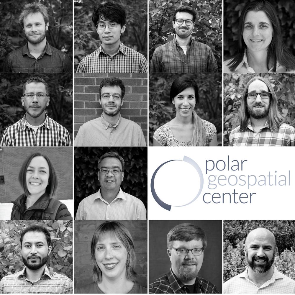
Reposted by Ian Brown

Effective immediately, the PGC is no longer accepting new NSF-supported requests due to a lack of renewal funding. Current work is wrapping up. Please contact your NSF program officer if impacted. We’re grateful to have supported your polar research. Read our full statement at www.pgc.umn.edu
May 5, 2025 at 9:33 PM
Effective immediately, the PGC is no longer accepting new NSF-supported requests due to a lack of renewal funding. Current work is wrapping up. Please contact your NSF program officer if impacted. We’re grateful to have supported your polar research. Read our full statement at www.pgc.umn.edu
Congratulations to @esa.int on the launch of #biomass. Looking forward to some great new advances in #EarthObservation #remotesensing
April 30, 2025 at 4:31 AM
Congratulations to @esa.int on the launch of #biomass. Looking forward to some great new advances in #EarthObservation #remotesensing

A big yellow ball has appeared in the sky 😲

March 28, 2025 at 6:44 AM
A big yellow ball has appeared in the sky 😲
Reposted by Ian Brown
🚨 New position alert! 🚨
Climate and ice sheet modelling at DMI, come and work with me and my colleague Christian Rodehacke on coupled ice sheet - climate models. 3 year position in #HorzionEurope #LiquidIce
candidate.hr-manager.net/ApplicationI...
Climate and ice sheet modelling at DMI, come and work with me and my colleague Christian Rodehacke on coupled ice sheet - climate models. 3 year position in #HorzionEurope #LiquidIce
candidate.hr-manager.net/ApplicationI...

Scientist for Modeling Ice Sheet–Climate Interaction
Are you interested in working with climate and ice sheet models? And motivated by understanding climate change in the Arctic and Antarctic regions? Here is a gr
candidate.hr-manager.net
March 19, 2025 at 1:03 PM
🚨 New position alert! 🚨
Climate and ice sheet modelling at DMI, come and work with me and my colleague Christian Rodehacke on coupled ice sheet - climate models. 3 year position in #HorzionEurope #LiquidIce
candidate.hr-manager.net/ApplicationI...
Climate and ice sheet modelling at DMI, come and work with me and my colleague Christian Rodehacke on coupled ice sheet - climate models. 3 year position in #HorzionEurope #LiquidIce
candidate.hr-manager.net/ApplicationI...

Caption competition anyone?

February 3, 2025 at 8:12 AM
Caption competition anyone?
Sentinel-1C launches tomorrow at 22:20 CET. S1-B died in 2021 in the middle of our field work 🙄
🤞🤞🤞
🤞🤞🤞
December 3, 2024 at 1:09 PM
Sentinel-1C launches tomorrow at 22:20 CET. S1-B died in 2021 in the middle of our field work 🙄
🤞🤞🤞
🤞🤞🤞
It just rained so hard my goretex jacket couldn't hold out. We're so wet that on the way home we happily waded across mires and weren't fussed at stream crossings.
#fieldwork
#fieldwork
August 4, 2024 at 3:03 PM
It just rained so hard my goretex jacket couldn't hold out. We're so wet that on the way home we happily waded across mires and weren't fussed at stream crossings.
#fieldwork
#fieldwork
Reposted by Ian Brown
New paper out ! #plants #meadows #landscapeecology #maps 🧪🌍
#openaccess
onlinelibrary.wiley.com/share/ZZKTIE...
#openaccess
onlinelibrary.wiley.com/share/ZZKTIE...
Habitat loss and isolation threaten specialist flora in Baltic coastal meadows
You have to enable JavaScript in your browser's settings in order to use the eReader.
onlinelibrary.wiley.com
July 23, 2024 at 3:35 PM
New paper out ! #plants #meadows #landscapeecology #maps 🧪🌍
#openaccess
onlinelibrary.wiley.com/share/ZZKTIE...
#openaccess
onlinelibrary.wiley.com/share/ZZKTIE...
New paper alert! 🚨📢
Weather impacts on #drone #photogrammetry:
- seasonal and weather effects on accuracy
- canopy height model and DEMs evaluated
- reference #lidar dataset with #dGPS control points
with @linegreis.bsky.social
#UAV #forest #remotesensing
dx.doi.org/10.1111/avsc...
Weather impacts on #drone #photogrammetry:
- seasonal and weather effects on accuracy
- canopy height model and DEMs evaluated
- reference #lidar dataset with #dGPS control points
with @linegreis.bsky.social
#UAV #forest #remotesensing
dx.doi.org/10.1111/avsc...

Seasonal optimisation of drone‐based photogrammetry in a heterogeneous boreal landscape
In this study we show how weather and flight parameters affect photogrammetric surveys from drones. Using a commercial (off-the-shelf) drone we surveyed a mixed boreal forest site in summer, autumn a...
dx.doi.org
July 23, 2024 at 10:57 AM
New paper alert! 🚨📢
Weather impacts on #drone #photogrammetry:
- seasonal and weather effects on accuracy
- canopy height model and DEMs evaluated
- reference #lidar dataset with #dGPS control points
with @linegreis.bsky.social
#UAV #forest #remotesensing
dx.doi.org/10.1111/avsc...
Weather impacts on #drone #photogrammetry:
- seasonal and weather effects on accuracy
- canopy height model and DEMs evaluated
- reference #lidar dataset with #dGPS control points
with @linegreis.bsky.social
#UAV #forest #remotesensing
dx.doi.org/10.1111/avsc...

The rain in Sthlm is gods disapproval at our 4hr long årsstämma last night.
May 24, 2024 at 4:48 AM
The rain in Sthlm is gods disapproval at our 4hr long årsstämma last night.
Brilliant, witty speech by Fredrik Backman on creativity, procrastination and being Scandinavian.
youtu.be/NSuSyZ92Cjg?...
youtu.be/NSuSyZ92Cjg?...

Fredrik Backman on Creative Anxiety and Procrastination
At the Simon & Schuster centennial, author Fredrik Backman discusses the highs and lows of being an author, from attempting to get along with the voices in y...
youtu.be
May 19, 2024 at 2:20 PM
Brilliant, witty speech by Fredrik Backman on creativity, procrastination and being Scandinavian.
youtu.be/NSuSyZ92Cjg?...
youtu.be/NSuSyZ92Cjg?...
First rugby match of the new season. Almost no one had to go to hospital.
May 18, 2024 at 2:51 PM
First rugby match of the new season. Almost no one had to go to hospital.

Reposted by Ian Brown

Where does it rain?
Total rainfall in ERA5 for 1950-2023
Range: 69mm (Sahara) to 2km (Papua)
Total rainfall in ERA5 for 1950-2023
Range: 69mm (Sahara) to 2km (Papua)

April 26, 2024 at 11:02 AM
Where does it rain?
Total rainfall in ERA5 for 1950-2023
Range: 69mm (Sahara) to 2km (Papua)
Total rainfall in ERA5 for 1950-2023
Range: 69mm (Sahara) to 2km (Papua)
Reposted by Ian Brown
My place is hiring! www.jobs.manchester.ac.uk/Job/JobDetai...
April 20, 2024 at 9:05 AM
My place is hiring! www.jobs.manchester.ac.uk/Job/JobDetai...
Aaand that's why I need to refill the feeder so often. We live on the fifth floor btw.

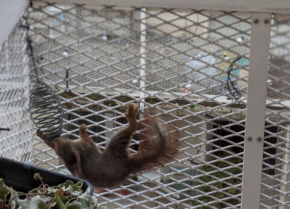
April 17, 2024 at 6:06 AM
Aaand that's why I need to refill the feeder so often. We live on the fifth floor btw.