


Richard Heatwave Berler
@heatwavekgns.bsky.social
I love weather! CBS Duluth, MN May 23, 1976-80, KGNS Laredo, TX Feb 14, 1980-now. NCEI/NWS coop site 415060 June 10, 1985 to December 31, 2023. NWS Jefferson Award. AMS CBM#18
Yakima, Washington has been to 71F today, only 3rd time as high as 70F on a December day with records going back to 1946. The other 2 such days was 5 days ago!, and December 1, 2021.
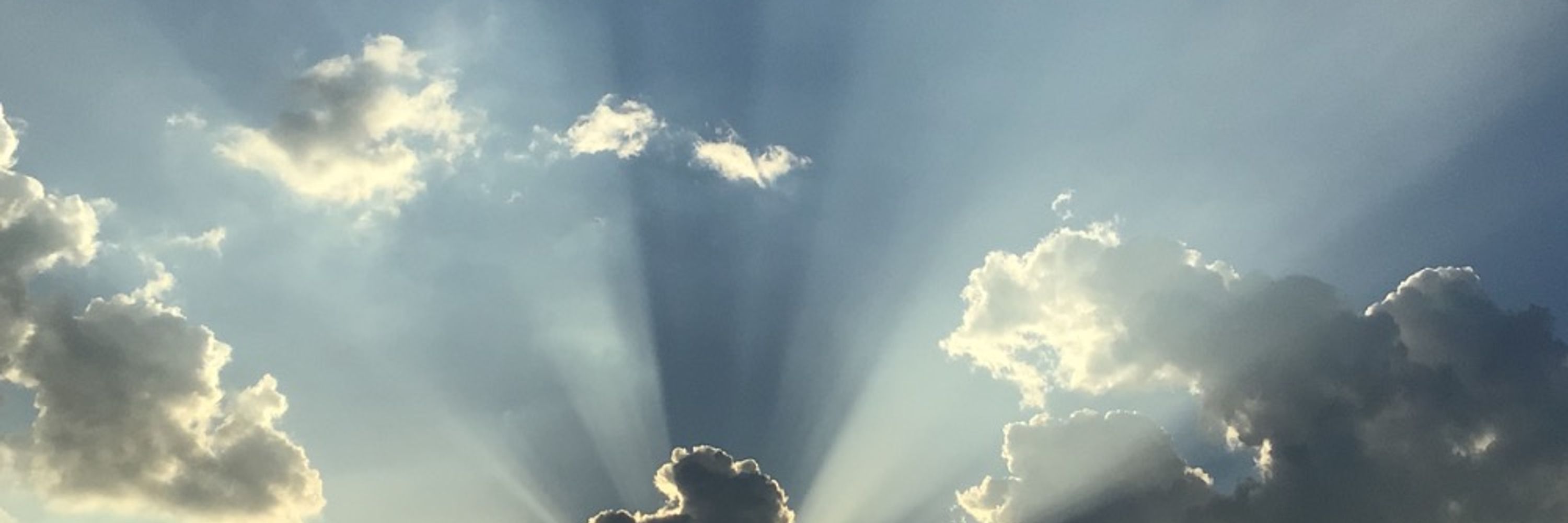
Monday 4:26 pm: Big Picture Weathermap: A cool airmass remains in control of south Texas weather. A wind shift boundary will form Tuesday as the leading edge of warmer moist gulf air. 60's Tuesday. The warmer winds will reach west to Laredo Wednesday, ~70F, 80F warmth Thursday.

December 15, 2025 at 11:22 PM
Yakima, Washington has been to 71F today, only 3rd time as high as 70F on a December day with records going back to 1946. The other 2 such days was 5 days ago!, and December 1, 2021.
Monday 4:26 pm: Big Picture Weathermap: A cool airmass remains in control of south Texas weather. A wind shift boundary will form Tuesday as the leading edge of warmer moist gulf air. 60's Tuesday. The warmer winds will reach west to Laredo Wednesday, ~70F, 80F warmth Thursday.
December 15, 2025 at 10:28 PM
Monday 4:26 pm: Big Picture Weathermap: A cool airmass remains in control of south Texas weather. A wind shift boundary will form Tuesday as the leading edge of warmer moist gulf air. 60's Tuesday. The warmer winds will reach west to Laredo Wednesday, ~70F, 80F warmth Thursday.
Monday 11:55 am: The layer of moist air above our cool airmass has thinned out from the east, allowing for the low cloud to mix away as far west as our area. Partly cloudy, may have some periods of cloudier skies, high 50’s to ~60F.

December 15, 2025 at 5:55 PM
Monday 11:55 am: The layer of moist air above our cool airmass has thinned out from the east, allowing for the low cloud to mix away as far west as our area. Partly cloudy, may have some periods of cloudier skies, high 50’s to ~60F.
Monday 8:19 am: A cool airmass remains capped by a thin layer of moist air. A mainly cloudy cool combination, a few breaks in the cloud possible in the afternoon. Upper 50’s this afternoon.

December 15, 2025 at 2:19 PM
Monday 8:19 am: A cool airmass remains capped by a thin layer of moist air. A mainly cloudy cool combination, a few breaks in the cloud possible in the afternoon. Upper 50’s this afternoon.
Sunday 4:25 pm: Big Picture Weathermap: A large, much cooler airmass will be our weather control through Tuesday. Moist gulf air above 3,000' altitude caps the cold air, bringing a gray, chilly period. Mid 40's dawn, mid/high 50's Monday afternoon.

December 14, 2025 at 10:27 PM
Sunday 4:25 pm: Big Picture Weathermap: A large, much cooler airmass will be our weather control through Tuesday. Moist gulf air above 3,000' altitude caps the cold air, bringing a gray, chilly period. Mid 40's dawn, mid/high 50's Monday afternoon.
Sunday 9:09 am: The leading edge of a colder airmass is now flowing into our area. Patches of showers possible during today, a few briefly heavier ones now in Zapata County. Temperatures will drop into the 50’s this afternoon.


December 14, 2025 at 3:10 PM
Sunday 9:09 am: The leading edge of a colder airmass is now flowing into our area. Patches of showers possible during today, a few briefly heavier ones now in Zapata County. Temperatures will drop into the 50’s this afternoon.
Saturday 11:21 pm: Leading edge of cool airmass now passing through the Austin area and entering the Hill Country. Should arrive in Laredo ~7-8 am. 60’s when front arrives, breezy, patches of showers, 50’s during the afternoon.


December 14, 2025 at 5:22 AM
Saturday 11:21 pm: Leading edge of cool airmass now passing through the Austin area and entering the Hill Country. Should arrive in Laredo ~7-8 am. 60’s when front arrives, breezy, patches of showers, 50’s during the afternoon.
Saturday 3:03 pm: Low cloud mixed away as drier airmass stirred in from above!

December 13, 2025 at 9:04 PM
Saturday 3:03 pm: Low cloud mixed away as drier airmass stirred in from above!
Saturday 2:51 pm: Cloud is mixing out, partly cloudy this afternoon, high 60’s. Cold front arrives Sunday morning, chance of showers, 50’s am, upper 50’s to near 60 pm.

December 13, 2025 at 8:56 PM
Saturday 2:51 pm: Cloud is mixing out, partly cloudy this afternoon, high 60’s. Cold front arrives Sunday morning, chance of showers, 50’s am, upper 50’s to near 60 pm.
Saturday 1:31 pm: Western edge of cloud deck in Webb and Zapata counties has stopped mixing away from the west, May take a bit longer to mix away in our part of Webb County. How high into the 70’s will be determined by how quickly the cloud mixes away.

December 13, 2025 at 7:32 PM
Saturday 1:31 pm: Western edge of cloud deck in Webb and Zapata counties has stopped mixing away from the west, May take a bit longer to mix away in our part of Webb County. How high into the 70’s will be determined by how quickly the cloud mixes away.
@vortexjeff.bsky.social Saturday 12:34 pm: Nice band of snow!

December 13, 2025 at 6:33 PM
@vortexjeff.bsky.social Saturday 12:34 pm: Nice band of snow!
Saturday 12:25 pm: Low cloud mixing away from the edges, should clear up between 1 and 2 pm, upper 70’s late afternoon.


December 13, 2025 at 6:25 PM
Saturday 12:25 pm: Low cloud mixing away from the edges, should clear up between 1 and 2 pm, upper 70’s late afternoon.
Saturday 12:15 pm: Just Because Department: A look at weather systems across much of the northern hemisphere Saturday 6 am CST/12 UTC.


December 13, 2025 at 6:15 PM
Saturday 12:15 pm: Just Because Department: A look at weather systems across much of the northern hemisphere Saturday 6 am CST/12 UTC.
Saturday 9:54 am: Dry warm air above our moist gulf air will stir in, mixing low cloud/fog away early afternoon. Enough sun to reach upper 70’s. Much cooler airmass from Great Plains arrives early/mid Sunday morning, slight shower chance, 60’s dawn, high 50’s to 60 pm.

December 13, 2025 at 3:55 PM
Saturday 9:54 am: Dry warm air above our moist gulf air will stir in, mixing low cloud/fog away early afternoon. Enough sun to reach upper 70’s. Much cooler airmass from Great Plains arrives early/mid Sunday morning, slight shower chance, 60’s dawn, high 50’s to 60 pm.
Friday 3:50 pm: Big Picture Weathermap: Warm air will continue Saturday as front in north Texas will stall to our north. A shallow layer of moist gulf air will be sufficient for low cloud, possible fog late tonight/Saturday morning, 60’s dawn. Some sun, upper 70’s/~80F pm.

December 12, 2025 at 9:51 PM
Friday 3:50 pm: Big Picture Weathermap: Warm air will continue Saturday as front in north Texas will stall to our north. A shallow layer of moist gulf air will be sufficient for low cloud, possible fog late tonight/Saturday morning, 60’s dawn. Some sun, upper 70’s/~80F pm.
Friday 3:20 pm: Amazing to see the shallow layer of saturated air, capped by warm dry air over Fresno. Compare with forecast sounding near Yosemite, high above the Central Valley fog!


December 12, 2025 at 9:21 PM
Friday 3:20 pm: Amazing to see the shallow layer of saturated air, capped by warm dry air over Fresno. Compare with forecast sounding near Yosemite, high above the Central Valley fog!
Friday 10:03 am: Warm moist air has returned in the lower atmosphere with low cloud. Drier air above will stir in, mixing the low cloud away midday/early pm. Enough afternoon sun to reach upper 70’s to low 80’s.

December 12, 2025 at 4:05 PM
Friday 10:03 am: Warm moist air has returned in the lower atmosphere with low cloud. Drier air above will stir in, mixing the low cloud away midday/early pm. Enough afternoon sun to reach upper 70’s to low 80’s.
Thursday 4:07 pm: Big Picture Weathermap: Warm air is expanding east and north into our area as a mild airmass exits to the east. Patches of fog, possibly dense at dawn as a very shallow layer of gulf air returns, capped by warm dry air above. Clearing late morning, upper 70's.

December 11, 2025 at 10:08 PM
Thursday 4:07 pm: Big Picture Weathermap: Warm air is expanding east and north into our area as a mild airmass exits to the east. Patches of fog, possibly dense at dawn as a very shallow layer of gulf air returns, capped by warm dry air above. Clearing late morning, upper 70's.
Thursday 8:57 am: Cool air is exiting to our east. Today will be a transitional day toward warmer air expanding north and east into our area Friday. Sunny, low/mid 70’s today. 80F warmth Friday.

December 11, 2025 at 2:58 PM
Thursday 8:57 am: Cool air is exiting to our east. Today will be a transitional day toward warmer air expanding north and east into our area Friday. Sunny, low/mid 70’s today. 80F warmth Friday.
Wednesday 11:48 pm: Miami and Yuma at 66F, warmest in continental U.S. (excepting Key West)…and Wenatchee, Washington! Warm air is flowing from the Pacific through Washington state into western Nebraska. Further east, cold air flowing out of Canada into mid Mississippi Valley.

December 11, 2025 at 5:49 AM
Wednesday 11:48 pm: Miami and Yuma at 66F, warmest in continental U.S. (excepting Key West)…and Wenatchee, Washington! Warm air is flowing from the Pacific through Washington state into western Nebraska. Further east, cold air flowing out of Canada into mid Mississippi Valley.
Wednesday 5:55 pm: Just Because Department: A shallow layer of saturated air is over the California’s Central Valley. Very little mixing of the dry warm air above, a foggy day in the bowl of the valley! Freezing fog dawn in Charleston, SC in razor thin layer of sub freezing air!


December 10, 2025 at 11:57 PM
Wednesday 5:55 pm: Just Because Department: A shallow layer of saturated air is over the California’s Central Valley. Very little mixing of the dry warm air above, a foggy day in the bowl of the valley! Freezing fog dawn in Charleston, SC in razor thin layer of sub freezing air!
Wednesday 4:33 pm: Just Because Department: Yakima, Washington has been to at least 71F, previous record for December 10 was 64F in 1946. Only other December 70+F day was 72F December 1, 2021. Sudden rise in temperature as warm front passed through with arrival of southwest wind!

December 10, 2025 at 10:35 PM
Wednesday 4:33 pm: Just Because Department: Yakima, Washington has been to at least 71F, previous record for December 10 was 64F in 1946. Only other December 70+F day was 72F December 1, 2021. Sudden rise in temperature as warm front passed through with arrival of southwest wind!
Wednesday 4:08 pm: Big Picture Weathermap: A mild Rocky Mountain airmass will bring low 70's with bright sunshine Thursday after an upper 40's dawn. Not as warm as today's 83F.

December 10, 2025 at 10:09 PM
Wednesday 4:08 pm: Big Picture Weathermap: A mild Rocky Mountain airmass will bring low 70's with bright sunshine Thursday after an upper 40's dawn. Not as warm as today's 83F.
Wednesday 9:04 am: Warm air is spreading into our area from northern Mexico bringing 80F warmth today. Sun through milky white thin cirrus clouds. Mild dry Rocky Mountain air has moved into the central Great Plains and will bring low/mid 70’s Thursday.

December 10, 2025 at 3:06 PM
Wednesday 9:04 am: Warm air is spreading into our area from northern Mexico bringing 80F warmth today. Sun through milky white thin cirrus clouds. Mild dry Rocky Mountain air has moved into the central Great Plains and will bring low/mid 70’s Thursday.
Wednesday 12:17 am: A bit breezy in Aberdeen, South Dakota, gusts >70 mph ~10 pm.


December 10, 2025 at 6:17 AM
Wednesday 12:17 am: A bit breezy in Aberdeen, South Dakota, gusts >70 mph ~10 pm.