The view of Two Harbors (one of the lowest points on the island) shows the transition from clouds on the west, to clear sky on the east. @nbcla.com

The view of Two Harbors (one of the lowest points on the island) shows the transition from clouds on the west, to clear sky on the east. @nbcla.com
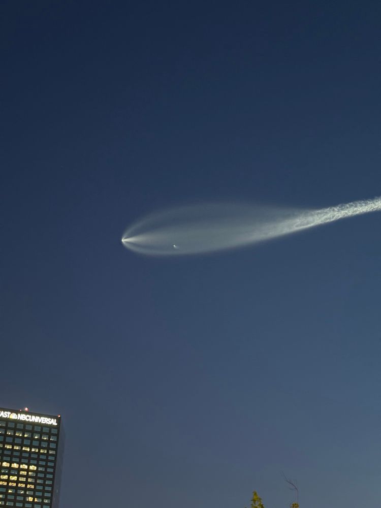
We are looking at low clouds and fog around the area at the time, so view of the reentry plasma trail might limited.

We are looking at low clouds and fog around the area at the time, so view of the reentry plasma trail might limited.
earthquake.usgs.gov/earthquakes/...
earthquake.usgs.gov/earthquakes/...


Deeper marine layer today meant the clouds/fog pushed farther inland. Here's a clearing comparison between yesterday and today. @nbcla.com

Deeper marine layer today meant the clouds/fog pushed farther inland. Here's a clearing comparison between yesterday and today. @nbcla.com
Apr 1 is considered to be the "peak" of the state's snowpack, which acts as a water bank account through the next several months. As snow melts, the runoff is captured by a network of reservoirs.
This year we are at 96% of average, still considered a healthy snowpack.


Apr 1 is considered to be the "peak" of the state's snowpack, which acts as a water bank account through the next several months. As snow melts, the runoff is captured by a network of reservoirs.
This year we are at 96% of average, still considered a healthy snowpack.
We are much cooler across the region today compared to yesterday at this time. Cooling continues into the weekend, along with drizzle and light rain chances.
Next week looks cool as well. @nbcla.com #LosAngeles #CAwx #SouthernCalifornia

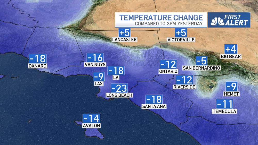
We are much cooler across the region today compared to yesterday at this time. Cooling continues into the weekend, along with drizzle and light rain chances.
Next week looks cool as well. @nbcla.com #LosAngeles #CAwx #SouthernCalifornia
Everyone will get much cooler tomorrow as the pattern starts to shift back to more of what we would see during winter.


Everyone will get much cooler tomorrow as the pattern starts to shift back to more of what we would see during winter.
Full report: www.nhc.noaa.gov/pdf/NHC_Veri...

Full report: www.nhc.noaa.gov/pdf/NHC_Veri...


Life threatening debris flows are imminent or occurring.
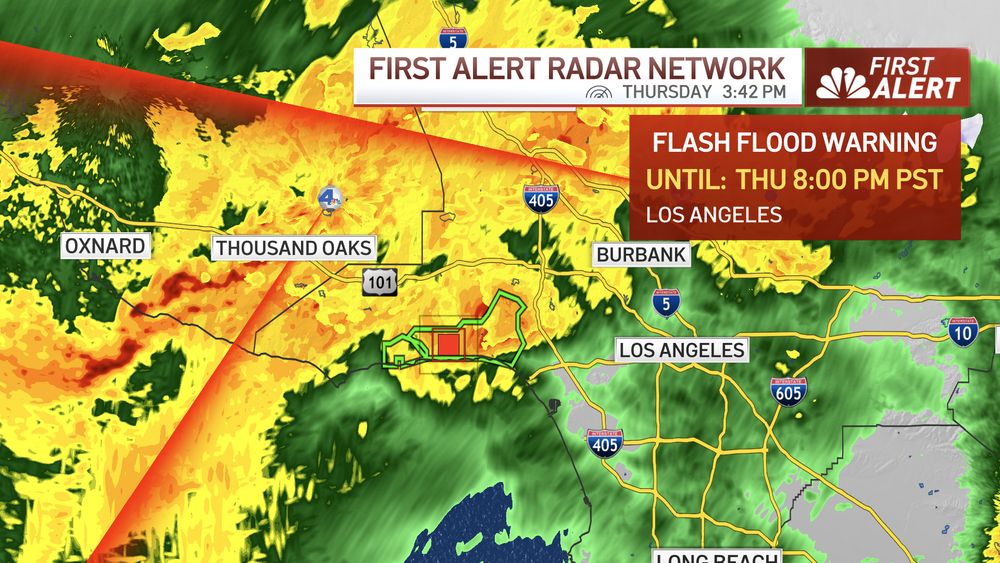
Life threatening debris flows are imminent or occurring.
After the front moves through, this system is mostly done. We will get a few lingering showers overnight into early Friday morning, but not expecting things to be intense.
After the front moves through, this system is mostly done. We will get a few lingering showers overnight into early Friday morning, but not expecting things to be intense.
This will likely bring the heaviest rainfall of the day, and our concern for possible flooding problems as well as mudslides/debris flows near the burn scars.

This will likely bring the heaviest rainfall of the day, and our concern for possible flooding problems as well as mudslides/debris flows near the burn scars.

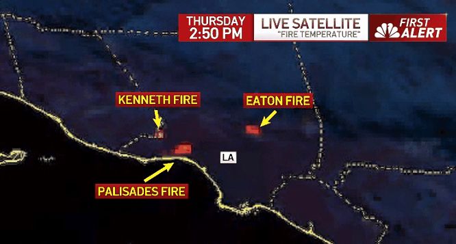
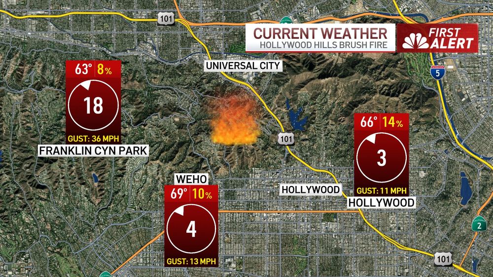

Stay out of the area and listen to all official evacuation orders. Have your go bag ready!
If you see fire approaching or don't feel safe, LEAVE!
@nbcla.bsky.social

Stay out of the area and listen to all official evacuation orders. Have your go bag ready!
If you see fire approaching or don't feel safe, LEAVE!
@nbcla.bsky.social
If you feel unsafe, leave! Do not wait to be told to evacuate.
Do not try to defend your property with a garden hose, it won’t do anything in a situation like this. @nbcla.bsky.social
If you feel unsafe, leave! Do not wait to be told to evacuate.
Do not try to defend your property with a garden hose, it won’t do anything in a situation like this. @nbcla.bsky.social


