


Bram van 't Veen
@bramvantveen.bsky.social
Severe storms and radar | Creator of radar viewer NLradar | MSc Climate Physics | Working with radar data for @essl-ecss.bsky.social.
Something exciting that I'm currently working on is adding vertical cross-sections to the ESSL Radar Displayer. And one of the more interesting phenomena that I've seen in them is debris fallout from the tops of storms with violent tornadoes. Here is an example of precisely 4 years ago today:
December 10, 2025 at 7:06 PM
Something exciting that I'm currently working on is adding vertical cross-sections to the ESSL Radar Displayer. And one of the more interesting phenomena that I've seen in them is debris fallout from the tops of storms with violent tornadoes. Here is an example of precisely 4 years ago today:
Reposted by Bram van 't Veen
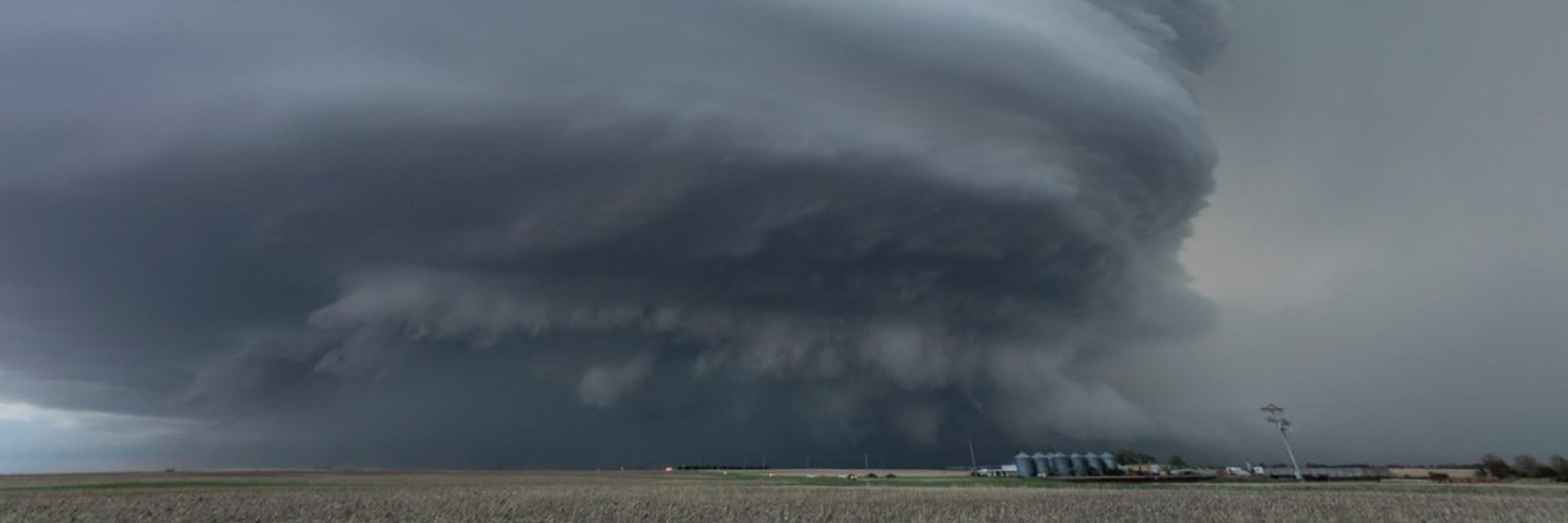
That's certainly a surprise for December 6th


December 6, 2025 at 11:42 PM
That's certainly a surprise for December 6th
Reposted by Bram van 't Veen

In normal Jersey things, 3 waterspouts were spotted off the coast earlier today.
www.facebook.com/groups/jerse...
www.facebook.com/groups/jerse...

December 4, 2025 at 8:58 PM
In normal Jersey things, 3 waterspouts were spotted off the coast earlier today.
www.facebook.com/groups/jerse...
www.facebook.com/groups/jerse...
Reposted by Bram van 't Veen

New video of the tornado in Apulia from yesterday. So far we managed to find a 1.5 km long path in the populated area, but NOBODY documented the countryside north of there. A 5-7+ km path is very plausible
December 3, 2025 at 5:21 PM
New video of the tornado in Apulia from yesterday. So far we managed to find a 1.5 km long path in the populated area, but NOBODY documented the countryside north of there. A 5-7+ km path is very plausible
Reposted by Bram van 't Veen
Today Apulia has never been this Great Plains-esque. Insane supercell and tornado in the Manduria area (we're working on the damage... frustrating is quite reductive). Videos by Fausto Perretti and Giuseppe Mauro (below)
December 2, 2025 at 7:35 PM
Today Apulia has never been this Great Plains-esque. Insane supercell and tornado in the Manduria area (we're working on the damage... frustrating is quite reductive). Videos by Fausto Perretti and Giuseppe Mauro (below)
Reposted by Bram van 't Veen

Perfect demonstration of the fact that you don't need straight hodographs to get left-moving supercells
(In this case, storms are rooted at ~2km)
(In this case, storms are rooted at ~2km)


November 29, 2025 at 2:50 AM
Perfect demonstration of the fact that you don't need straight hodographs to get left-moving supercells
(In this case, storms are rooted at ~2km)
(In this case, storms are rooted at ~2km)
Looking back at a great #ECSS conference last week, where I also gave my first conference talk. It was great to meet people that I so far had only met online, and to reconnect with many others! Also first time I saw in person a number of big names in svr storms from the US @essl-ecss.bsky.social


November 24, 2025 at 9:33 AM
Looking back at a great #ECSS conference last week, where I also gave my first conference talk. It was great to meet people that I so far had only met online, and to reconnect with many others! Also first time I saw in person a number of big names in svr storms from the US @essl-ecss.bsky.social
Reposted by Bram van 't Veen
From 4/27/2011, a short multi-tilt storm-following loop from ARMOR of the Hackleburg tornado. Some pretty incredible temporal resolution is possible like this when you interleave the different tilts! You get some shakiness but overall this turned out quite incredible. Love the merger stream!
November 22, 2025 at 1:36 AM
From 4/27/2011, a short multi-tilt storm-following loop from ARMOR of the Hackleburg tornado. Some pretty incredible temporal resolution is possible like this when you interleave the different tilts! You get some shakiness but overall this turned out quite incredible. Love the merger stream!
Reposted by Bram van 't Veen
In the end, today we confirmed five tornadoes (landfalling waterspouts), three of which can be rated (IF0.5, IF1 and IF1.5). Two more additional possible tornadoes occurred, but those will have to wait

November 15, 2025 at 6:11 PM
In the end, today we confirmed five tornadoes (landfalling waterspouts), three of which can be rated (IF0.5, IF1 and IF1.5). Two more additional possible tornadoes occurred, but those will have to wait
Reposted by Bram van 't Veen

A tornado🌪️ wreaks havoc at a campsite in #Albufeira, Portugal. One person has died and several are injured.
November 15, 2025 at 2:38 PM
A tornado🌪️ wreaks havoc at a campsite in #Albufeira, Portugal. One person has died and several are injured.
Reposted by Bram van 't Veen

November 15, 2025 at 12:14 PM
Reposted by Bram van 't Veen
The greatest atmospheric ballet! Large, highly visible snow mesovortices rolling down a convergence band over Lake Michigan on 2024/01/19. Perhaps the most beautiful radar data NEXRAD has ever produced. This is a 14 hour loop showing the ridiculously high number of them that developed sequentially
November 11, 2025 at 1:44 AM
The greatest atmospheric ballet! Large, highly visible snow mesovortices rolling down a convergence band over Lake Michigan on 2024/01/19. Perhaps the most beautiful radar data NEXRAD has ever produced. This is a 14 hour loop showing the ridiculously high number of them that developed sequentially
Reposted by Bram van 't Veen

Appears a destructive tornado struck the city of Rio Bonito do Iguaçu, Paraná, Brazil this afternoon with a severe weather outbreak. Profile from neighboring Argentina shows extreme low level shear for South American standards. 50 kt winds at 1 km AGL. www.facebook.com/reel/1345539...

November 7, 2025 at 10:54 PM
Appears a destructive tornado struck the city of Rio Bonito do Iguaçu, Paraná, Brazil this afternoon with a severe weather outbreak. Profile from neighboring Argentina shows extreme low level shear for South American standards. 50 kt winds at 1 km AGL. www.facebook.com/reel/1345539...
Reposted by Bram van 't Veen
8 months ago I had a vision: what if we had a unified, track-based dataset of all severe events?
Still a lot of improvements I can make to the algorithm itself, but otherwise, looks like we have one now. I can't wait to see what we can do with this 👀
Still a lot of improvements I can make to the algorithm itself, but otherwise, looks like we have one now. I can't wait to see what we can do with this 👀
November 7, 2025 at 7:42 PM
8 months ago I had a vision: what if we had a unified, track-based dataset of all severe events?
Still a lot of improvements I can make to the algorithm itself, but otherwise, looks like we have one now. I can't wait to see what we can do with this 👀
Still a lot of improvements I can make to the algorithm itself, but otherwise, looks like we have one now. I can't wait to see what we can do with this 👀
Reposted by Bram van 't Veen
Tornado tracks by rating (left) and duration (right)
While highly rated/long-tracked tornadoes are biased towards the Southeast, long-duration tors are found even up to the High Plains.
Credit to @theasandmael.bsky.social for her incredible dataset!!
While highly rated/long-tracked tornadoes are biased towards the Southeast, long-duration tors are found even up to the High Plains.
Credit to @theasandmael.bsky.social for her incredible dataset!!


November 6, 2025 at 4:35 PM
Tornado tracks by rating (left) and duration (right)
While highly rated/long-tracked tornadoes are biased towards the Southeast, long-duration tors are found even up to the High Plains.
Credit to @theasandmael.bsky.social for her incredible dataset!!
While highly rated/long-tracked tornadoes are biased towards the Southeast, long-duration tors are found even up to the High Plains.
Credit to @theasandmael.bsky.social for her incredible dataset!!
Reposted by Bram van 't Veen

🌪️Publication du rapport sur la tornade qui a frappé le Val-d'Oise le 20 octobre : urlr.me/kbHN6A Intensité EF2 et trajectoire totale de 21 km. 4 autres tornades ont été observées le même jour ; les rapports viennent d'être publiés également.

November 2, 2025 at 9:50 AM
🌪️Publication du rapport sur la tornade qui a frappé le Val-d'Oise le 20 octobre : urlr.me/kbHN6A Intensité EF2 et trajectoire totale de 21 km. 4 autres tornades ont été observées le même jour ; les rapports viennent d'être publiés également.
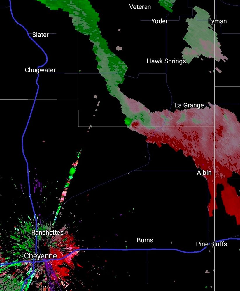
Late yesterday evening featured some strongly rotating storms over the Irish Sea, which were nicely captured by the Dublin radar. Had they occurred over land, we would likely have seen tornado reports.
November 1, 2025 at 5:57 PM
Late yesterday evening featured some strongly rotating storms over the Irish Sea, which were nicely captured by the Dublin radar. Had they occurred over land, we would likely have seen tornado reports.
Reposted by Bram van 't Veen
OTD in 1964 one of Sicily's black tornado days: a first twister developed in the sea and impacted the town of Santa Croce Camerina, where it killed 5 people and injured 70+. Cars were lofted and homes/farms destroyed (rating pending, further documentation can be gathered)


October 31, 2025 at 10:34 AM
OTD in 1964 one of Sicily's black tornado days: a first twister developed in the sea and impacted the town of Santa Croce Camerina, where it killed 5 people and injured 70+. Cars were lofted and homes/farms destroyed (rating pending, further documentation can be gathered)
Reposted by Bram van 't Veen

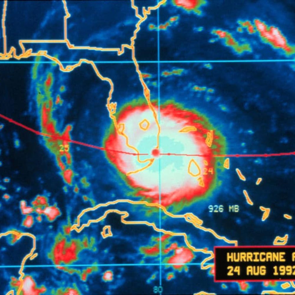
NEW: Devastating imagery from Jamaica, before & after Category 5 Hurricane Melissa.
Black River — near total destruction.
Black River — near total destruction.
October 29, 2025 at 8:28 PM
NEW: Devastating imagery from Jamaica, before & after Category 5 Hurricane Melissa.
Black River — near total destruction.
Black River — near total destruction.
Reposted by Bram van 't Veen

Multi-panel view of the last few days of Hurricane Melissa:
↖️ GOES-19 infrared brightness temp
↗️ GOES-19 visible satellite
↙️ Hurricane hunter planes & flight paths
↘️ Recon-derived flight level wind swath
⬇️ Estimated minimum pressure from recon dropsondes
↖️ GOES-19 infrared brightness temp
↗️ GOES-19 visible satellite
↙️ Hurricane hunter planes & flight paths
↘️ Recon-derived flight level wind swath
⬇️ Estimated minimum pressure from recon dropsondes
October 29, 2025 at 10:14 PM
Multi-panel view of the last few days of Hurricane Melissa:
↖️ GOES-19 infrared brightness temp
↗️ GOES-19 visible satellite
↙️ Hurricane hunter planes & flight paths
↘️ Recon-derived flight level wind swath
⬇️ Estimated minimum pressure from recon dropsondes
↖️ GOES-19 infrared brightness temp
↗️ GOES-19 visible satellite
↙️ Hurricane hunter planes & flight paths
↘️ Recon-derived flight level wind swath
⬇️ Estimated minimum pressure from recon dropsondes
Reposted by Bram van 't Veen

Annotating a long 3+ day loop of #Hurricane #Melissa from Kingston, #Jamaica radar.
2️⃣ periods appear where an eyewall replacement cycle, #ERC, looked underway. In both cases, inner eyewall stayed intact & outer bands merged, resulting in a larger eye & strengthening after.
A remarkable evolution 🌀
2️⃣ periods appear where an eyewall replacement cycle, #ERC, looked underway. In both cases, inner eyewall stayed intact & outer bands merged, resulting in a larger eye & strengthening after.
A remarkable evolution 🌀
October 30, 2025 at 6:54 AM
Annotating a long 3+ day loop of #Hurricane #Melissa from Kingston, #Jamaica radar.
2️⃣ periods appear where an eyewall replacement cycle, #ERC, looked underway. In both cases, inner eyewall stayed intact & outer bands merged, resulting in a larger eye & strengthening after.
A remarkable evolution 🌀
2️⃣ periods appear where an eyewall replacement cycle, #ERC, looked underway. In both cases, inner eyewall stayed intact & outer bands merged, resulting in a larger eye & strengthening after.
A remarkable evolution 🌀
The start point of the path here nicely matches up with the location where the presumed TDS first appeared, increasing confidence that it was indeed a TDS.
Note by the way that the strong looking couplet on the third image is a dealiasing failure. First image provides most useful doppler data.
Note by the way that the strong looking couplet on the third image is a dealiasing failure. First image provides most useful doppler data.


October 28, 2025 at 8:47 AM
The start point of the path here nicely matches up with the location where the presumed TDS first appeared, increasing confidence that it was indeed a TDS.
Note by the way that the strong looking couplet on the third image is a dealiasing failure. First image provides most useful doppler data.
Note by the way that the strong looking couplet on the third image is a dealiasing failure. First image provides most useful doppler data.
Reposted by Bram van 't Veen

🟢 Am 23.10.2025 zog ein #Tornado durch #Siebersbach bei #Sulzbach an der #Murr (Baden-#Württemberg). Es kam zu teils erheblichen Sach- und Vegetationsschäden entlang einer über einen Kilometer langen Schneise, die das #Lautertal quert.
⬇️ Analyse:
www.torkud.de/post/vsieber...
⬇️ Analyse:
www.torkud.de/post/vsieber...


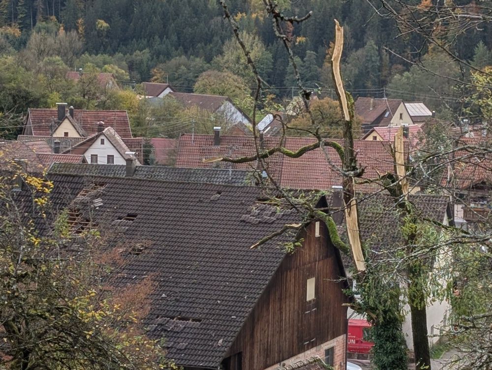
October 28, 2025 at 7:04 AM
🟢 Am 23.10.2025 zog ein #Tornado durch #Siebersbach bei #Sulzbach an der #Murr (Baden-#Württemberg). Es kam zu teils erheblichen Sach- und Vegetationsschäden entlang einer über einen Kilometer langen Schneise, die das #Lautertal quert.
⬇️ Analyse:
www.torkud.de/post/vsieber...
⬇️ Analyse:
www.torkud.de/post/vsieber...
Reposted by Bram van 't Veen
October 27th, 1913:
An outbreak of at least eight tornadoes impacted England and Wales. One tornado caused estimated F3 damage to the Taff Valley towns of Abercynon and Edwardsville, where many houses were unroofed.
1/2
An outbreak of at least eight tornadoes impacted England and Wales. One tornado caused estimated F3 damage to the Taff Valley towns of Abercynon and Edwardsville, where many houses were unroofed.
1/2

October 27, 2025 at 12:20 PM
October 27th, 1913:
An outbreak of at least eight tornadoes impacted England and Wales. One tornado caused estimated F3 damage to the Taff Valley towns of Abercynon and Edwardsville, where many houses were unroofed.
1/2
An outbreak of at least eight tornadoes impacted England and Wales. One tornado caused estimated F3 damage to the Taff Valley towns of Abercynon and Edwardsville, where many houses were unroofed.
1/2
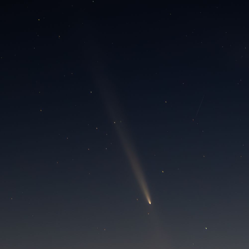
Possible tornado in SW Germany yesterday. And possibly with a radar-detected TDS, as there is a small CC hole at the location of reported damage.
At least this CC hole is not from ground clutter (as is the case for quite some of the green spots in the RGB), as it's not visible at surrounding times.
At least this CC hole is not from ground clutter (as is the case for quite some of the green spots in the RGB), as it's not visible at surrounding times.


October 24, 2025 at 9:56 AM
Possible tornado in SW Germany yesterday. And possibly with a radar-detected TDS, as there is a small CC hole at the location of reported damage.
At least this CC hole is not from ground clutter (as is the case for quite some of the green spots in the RGB), as it's not visible at surrounding times.
At least this CC hole is not from ground clutter (as is the case for quite some of the green spots in the RGB), as it's not visible at surrounding times.