Florida Tropics
@floridatropics1.bsky.social
790 followers 36 following 1.7K posts
Florida Wx throughout the year, with a special focus on the tropics during Hurricane Season. For official information, please refer to the NWS & NHC.
Posts Media Videos Starter Packs
floridatropics1.bsky.social
18z Google Deep Mind ensembles. Yes, that's one member showing 891mb. Highly unlikely, but shows the potential in the Caribbean right now.
floridatropics1.bsky.social
Not really a surprise, but the water in the Caribbean is boiling. Temperatures are between 88 and 90 degrees across much of the area.
floridatropics1.bsky.social
The afternoon ensembles (Euro, Google Deep Mind, GFS) are more active compared to the overnight runs. And look at Google with a 902mb member.
floridatropics1.bsky.social
Good morning! Overnight ensembles continue to show some signs of life in the Caribbean in the next 10 days. GFS are most bullish, with the Euro and Google Deep Mind not as much. Will be watching closely.
floridatropics1.bsky.social
Here are the 18z GFS and Google Deep Mind ensembles for the east Atlantic wave. Lots to watch over the next two weeks.
floridatropics1.bsky.social
And here's the 12z Euro ensembles through the next 10 days. A little more concentrated on a westward path.
floridatropics1.bsky.social
The 12z GFS and Google Deep Mind ensembles for the next 13 days. What a mess.
floridatropics1.bsky.social
The latest Global Tropics Hazards Outlook. Need to watch the Caribbean closely next week but look at how nice the following week looks!
floridatropics1.bsky.social
The overnight ensembles (Google Deep Mind, Euro, GFS) show that development of the wave may not occur until it enters the Caribbean. The question becomes will it cruise westward towards Central America or be lifted northwestward?
floridatropics1.bsky.social
Good morning! Back into the grind after a long weekend. NHC not marking anything yet in the outlook related to the eastern Atlantic wave. Lorenzo is annoying the fish but that's about it.
floridatropics1.bsky.social
From NWS Jacksonville: Give yourself some extra commute time for tomorrow (Tuesday) morning!⌚

Dense Fog 🌫️is expected to develop around sunrise Tuesday morning with widespread visibility less than a mile & some areas a 1/4 mile or less.

Here's a map of where chances of Dense Fog are the highest.
floridatropics1.bsky.social
12z Euro, GFS and Google Deep Mind ensembles for the new wave in the Atlantic. GFS trying to turn it early while Euro and Google want to take it westward.
floridatropics1.bsky.social
Looks like we have a new flood of record at Barnegat Bay at Waretown along the Jersey Shore. Water continues to rise at this location.
floridatropics1.bsky.social
The 12z Canadian goes the opposite route and develops the system early, taking it on a northwest path towards the Leeward Islands.
floridatropics1.bsky.social
12z GFS a week from today has the system starting to take shape in the eastern Caribbean. Lorenzo is to the northeast going out to sea.
floridatropics1.bsky.social
Watching the system behind Lorenzo as it appears that it will move westward across the Atlantic and attempt to develop near the Windward Islands. The Euro ensembles are most enthused with this potential. The globals all show development but very divergent paths.
floridatropics1.bsky.social
Good morning! Lorenzo has formed as of 5 AM in the open Atlantic.
floridatropics1.bsky.social
JUST IN: The New York City Columbus Day Parade has been cancelled due to the nor'easter and state of emergency currently in effect.
floridatropics1.bsky.social
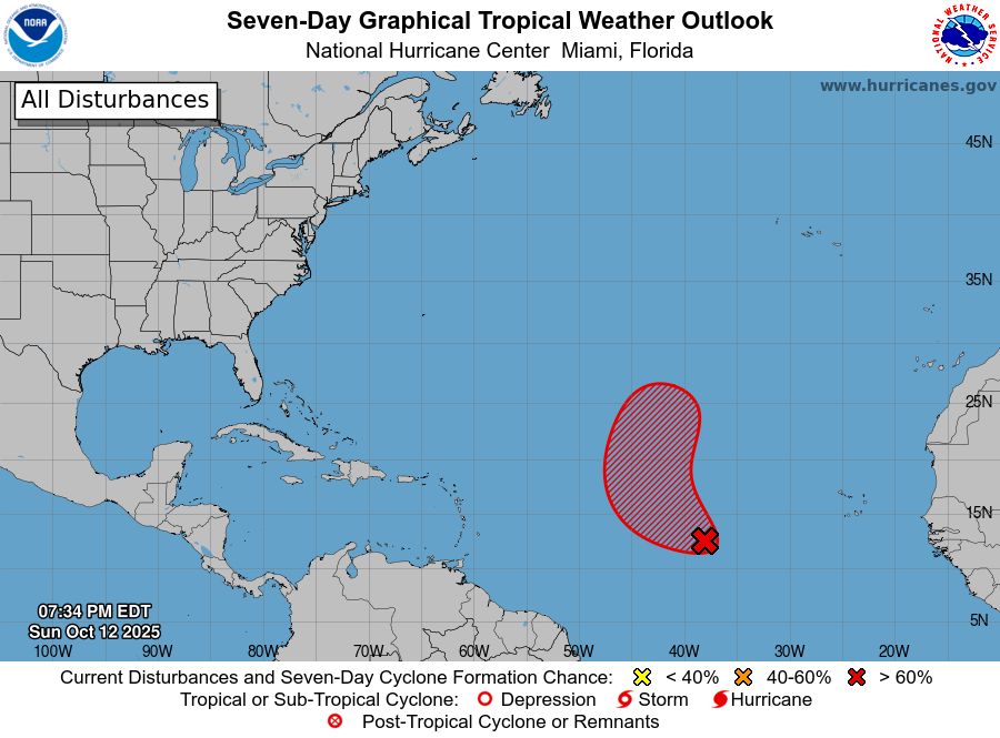
#97L has increased in organization today and now has a 70% chance of development in the open Atlantic. No threat to any land.
floridatropics1.bsky.social
JUST IN: New York declares a state of emergency for New York City, Long Island & the Hudson Valley as impacts begin from the nor'easter.
floridatropics1.bsky.social
JUST IN: a voluntary evacuation order has been issued for Bowers, Delaware, due to expected coastal flooding from the nor'easter. Residents east of Whitwell Delight Road can seek shelter at the Magnolia Fire Company.
floridatropics1.bsky.social
12z model roundup for the potential Caribbean system. Canadian and ICON have a tropical storm east of the Windward Islands a week from today, while GFS and Euro do not. The GFS does form the system later on.
floridatropics1.bsky.social
JUST IN: NJ Transit is suspended service as of 1 PM on the Atlantic City Rail Line, as well as the North Jersey Coast Line between Bay Head and Long Branch, due to anticipated flooding.
floridatropics1.bsky.social
Moderate coastal flooding now being reported in Atlantic City, NJ. At this level, widespread flooding of roadways begins with many roads becoming impassable in Brigantine and Atlantic City.
floridatropics1.bsky.social
Coastal flooding in Duck, NC (Outer Banks) has reached major stage. The forecasted crest of 7.2 feet would tie the third-highest level on record.