


#firstsnow #winter in #london #lndont #ontario #canada #snow #smile #lol #potd #Evergreen #tree #forestcity #sunny but #cold #onstar #weathernetwork #happyTuesday #tuesday #tuesdayvibe @donalddhaene1961 in @officialstyleicon for @ejaf #style #icon #styleicon

November 11, 2025 at 3:06 PM
#firstsnow #winter in #london #lndont #ontario #canada #snow #smile #lol #potd #Evergreen #tree #forestcity #sunny but #cold #onstar #weathernetwork #happyTuesday #tuesday #tuesdayvibe @donalddhaene1961 in @officialstyleicon for @ejaf #style #icon #styleicon


Jeudi #Montreal #photos #photography #Quebec #Canada @Monmontreal @Montreal @meteomedia @weathernetwork


November 7, 2025 at 12:33 AM
Jeudi #Montreal #photos #photography #Quebec #Canada @Monmontreal @Montreal @meteomedia @weathernetwork

Yellowknife alert 🌧️: Mild and rainy to start the weekend (+ 6 °C) but the shift is on—temps dipping below freezing for nights early next week. Don’t pack away your winter layers just yet! #NWTWeather #ArcticClimate @environmentca @weathernetwork

November 1, 2025 at 2:45 PM
Yellowknife alert 🌧️: Mild and rainy to start the weekend (+ 6 °C) but the shift is on—temps dipping below freezing for nights early next week. Don’t pack away your winter layers just yet! #NWTWeather #ArcticClimate @environmentca @weathernetwork
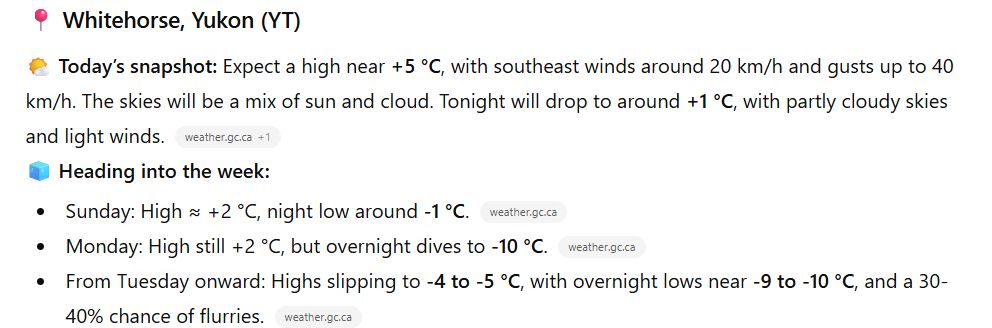
Heads-up Whitehorse: This weekend we’re holding onto the + °C side of things, but come Monday the chill starts in earnest. Watch for overnight lows near -10 °C by early next week. Stay cosy out there! #YukonWeather #YukonForecast @environmentca @weathernetwork
November 1, 2025 at 2:44 PM
Heads-up Whitehorse: This weekend we’re holding onto the + °C side of things, but come Monday the chill starts in earnest. Watch for overnight lows near -10 °C by early next week. Stay cosy out there! #YukonWeather #YukonForecast @environmentca @weathernetwork
Arctic Canada update: Inuvik, Cambridge Bay and Iqaluit are already seeing polar chill creeping in; infrared satellite imagery shows cloud‑cover pattern shifting. Visible imagery may fade as daylight shortens. @environmentca @weathernetwork @WMO #ArcticWx #TrueNorthExpWx


October 30, 2025 at 3:09 PM
Arctic Canada update: Inuvik, Cambridge Bay and Iqaluit are already seeing polar chill creeping in; infrared satellite imagery shows cloud‑cover pattern shifting. Visible imagery may fade as daylight shortens. @environmentca @weathernetwork @WMO #ArcticWx #TrueNorthExpWx
Atlantic Canada: a coastal low is nudging off the Maritimes — Halifax may see showers, St. John’s blustery winds, and Happy Valley‑Goose Bay sees wrapping cloud‑bands. Marine interests should stay alert. @environmentca @weathernetwork @WMO #AtlanticWx #TrueNorthExpWx


October 30, 2025 at 3:08 PM
Atlantic Canada: a coastal low is nudging off the Maritimes — Halifax may see showers, St. John’s blustery winds, and Happy Valley‑Goose Bay sees wrapping cloud‑bands. Marine interests should stay alert. @environmentca @weathernetwork @WMO #AtlanticWx #TrueNorthExpWx
In Ontario & Quebec: Toronto & Montreal are seeing mild autumn skies, changing fast; up north around Timmins & Kuujjuaq cooler air advancing, clouds increasing. A mix of seasons in one region. @environmentca @weathernetwork @WMO #ONwx #QCwx #TrueNorthExpWx youtu.be/Liy11g1D2s4


October 30, 2025 at 3:06 PM
In Ontario & Quebec: Toronto & Montreal are seeing mild autumn skies, changing fast; up north around Timmins & Kuujjuaq cooler air advancing, clouds increasing. A mix of seasons in one region. @environmentca @weathernetwork @WMO #ONwx #QCwx #TrueNorthExpWx youtu.be/Liy11g1D2s4
West‑coast watchers: breezy conditions build across the coastal mountains, with heavier cloud cover drifting into the Interior near Kelowna and Prince George. Expect some showers, cooler temps creeping in. Stay weather‑aware. @environmentca @weathernetwork @WMO #BCwx #TrueNorthExpWx


October 30, 2025 at 3:02 PM
West‑coast watchers: breezy conditions build across the coastal mountains, with heavier cloud cover drifting into the Interior near Kelowna and Prince George. Expect some showers, cooler temps creeping in. Stay weather‑aware. @environmentca @weathernetwork @WMO #BCwx #TrueNorthExpWx

Maritime flying: Low pressure off Nova Scotia bringing gusty winds into Halifax, St John’s sees clearing skies, Happy Valley–Goose Bay under stable high. Pilots: expect cross-winds near Halifax, seas moderate off Atlantic. @environmentca @weathernetwork @WMO #AtlanticWX #flightops

October 30, 2025 at 2:46 PM
Maritime flying: Low pressure off Nova Scotia bringing gusty winds into Halifax, St John’s sees clearing skies, Happy Valley–Goose Bay under stable high. Pilots: expect cross-winds near Halifax, seas moderate off Atlantic. @environmentca @weathernetwork @WMO #AtlanticWX #flightops
Central Canada Outlook: Toronto/ Montreal region under moist south-westerly flow — isolated showers possible. Timmins fair and stable; Kuujjuaq cool with stratiform cloud deck. Pilots: prepare for possible low-level moisture in central region, cold altitudes north. @environmentca @weathernetwork


October 30, 2025 at 2:46 PM
Central Canada Outlook: Toronto/ Montreal region under moist south-westerly flow — isolated showers possible. Timmins fair and stable; Kuujjuaq cool with stratiform cloud deck. Pilots: prepare for possible low-level moisture in central region, cold altitudes north. @environmentca @weathernetwork
Prairies update: A broad high-pressure ridge dominates Calgary & Edmonton with light winds and excellent VFR, Regina sees some late day cumulus growth, Thompson trending stable. Pilots: expect clear vis, moderate shear aloft near dusk. @environmentca @weathernetwork @WMO #PrairieWx #avgeek


October 30, 2025 at 2:44 PM
Prairies update: A broad high-pressure ridge dominates Calgary & Edmonton with light winds and excellent VFR, Regina sees some late day cumulus growth, Thompson trending stable. Pilots: expect clear vis, moderate shear aloft near dusk. @environmentca @weathernetwork @WMO #PrairieWx #avgeek
Campus #Montreal #photos #photography #Quebec #Canada @Monmontreal @Montreal @meteomedia @weathernetwork


October 29, 2025 at 7:36 PM
Campus #Montreal #photos #photography #Quebec #Canada @Monmontreal @Montreal @meteomedia @weathernetwork
5️⃣ Arctic Canada
Frigid high pressure dominates. Cambridge Bay clear but -30°C wind chills. Iqaluit: light snow, blowing snow risk. Inuvik: patchy stratus. Smooth air above 8,000 ft. #ArcticWx #PolarAviation @environmentca @weathernetwork @WMO
Frigid high pressure dominates. Cambridge Bay clear but -30°C wind chills. Iqaluit: light snow, blowing snow risk. Inuvik: patchy stratus. Smooth air above 8,000 ft. #ArcticWx #PolarAviation @environmentca @weathernetwork @WMO

October 29, 2025 at 2:22 PM
5️⃣ Arctic Canada
Frigid high pressure dominates. Cambridge Bay clear but -30°C wind chills. Iqaluit: light snow, blowing snow risk. Inuvik: patchy stratus. Smooth air above 8,000 ft. #ArcticWx #PolarAviation @environmentca @weathernetwork @WMO
Frigid high pressure dominates. Cambridge Bay clear but -30°C wind chills. Iqaluit: light snow, blowing snow risk. Inuvik: patchy stratus. Smooth air above 8,000 ft. #ArcticWx #PolarAviation @environmentca @weathernetwork @WMO
4️⃣ Atlantic Canada
A marine low deepens offshore. Expect gusty NE winds, coastal rain, and low visibility around Halifax and St. John’s. Goose Bay: snow bands forming inland. #AtlanticWx #MaritimesWeather @environmentca @weathernetwork @WMO
A marine low deepens offshore. Expect gusty NE winds, coastal rain, and low visibility around Halifax and St. John’s. Goose Bay: snow bands forming inland. #AtlanticWx #MaritimesWeather @environmentca @weathernetwork @WMO

October 29, 2025 at 2:20 PM
4️⃣ Atlantic Canada
A marine low deepens offshore. Expect gusty NE winds, coastal rain, and low visibility around Halifax and St. John’s. Goose Bay: snow bands forming inland. #AtlanticWx #MaritimesWeather @environmentca @weathernetwork @WMO
A marine low deepens offshore. Expect gusty NE winds, coastal rain, and low visibility around Halifax and St. John’s. Goose Bay: snow bands forming inland. #AtlanticWx #MaritimesWeather @environmentca @weathernetwork @WMO
3️⃣ Ontario & Quebec
Low pressure tracks east bringing widespread rain, low ceilings, and IFR conditions for Toronto–Montreal corridor. Timmins to Kuujjuaq sees mixed precipitation. Watch for LLWS. #ONwx #QCwx #AviationWx @environmentca @weathernetwork @WMO
Low pressure tracks east bringing widespread rain, low ceilings, and IFR conditions for Toronto–Montreal corridor. Timmins to Kuujjuaq sees mixed precipitation. Watch for LLWS. #ONwx #QCwx #AviationWx @environmentca @weathernetwork @WMO


October 29, 2025 at 2:19 PM
3️⃣ Ontario & Quebec
Low pressure tracks east bringing widespread rain, low ceilings, and IFR conditions for Toronto–Montreal corridor. Timmins to Kuujjuaq sees mixed precipitation. Watch for LLWS. #ONwx #QCwx #AviationWx @environmentca @weathernetwork @WMO
Low pressure tracks east bringing widespread rain, low ceilings, and IFR conditions for Toronto–Montreal corridor. Timmins to Kuujjuaq sees mixed precipitation. Watch for LLWS. #ONwx #QCwx #AviationWx @environmentca @weathernetwork @WMO
2️⃣ Prairies
Strong westerlies sweep across Alberta to Manitoba. Expect gusty crosswinds and patchy turbulence near Calgary and Edmonton. Clear breaks between frontal waves. #PrairiesWx #PilotWeather @environmentca @weathernetwork @WMO @TrueNorthExpWx
Strong westerlies sweep across Alberta to Manitoba. Expect gusty crosswinds and patchy turbulence near Calgary and Edmonton. Clear breaks between frontal waves. #PrairiesWx #PilotWeather @environmentca @weathernetwork @WMO @TrueNorthExpWx

October 29, 2025 at 2:18 PM
2️⃣ Prairies
Strong westerlies sweep across Alberta to Manitoba. Expect gusty crosswinds and patchy turbulence near Calgary and Edmonton. Clear breaks between frontal waves. #PrairiesWx #PilotWeather @environmentca @weathernetwork @WMO @TrueNorthExpWx
Strong westerlies sweep across Alberta to Manitoba. Expect gusty crosswinds and patchy turbulence near Calgary and Edmonton. Clear breaks between frontal waves. #PrairiesWx #PilotWeather @environmentca @weathernetwork @WMO @TrueNorthExpWx
1️⃣ British Columbia
Pacific moisture pushes inland. Expect coastal showers near Vancouver, snow over mountain passes, and cool, unsettled skies for Kelowna and Prince George. Icing potential aloft. #BCwx #AviationWeather @environmentca @weathernetwork @WMO @ExploreWx youtu.be/FY_IrlB5-0c
Pacific moisture pushes inland. Expect coastal showers near Vancouver, snow over mountain passes, and cool, unsettled skies for Kelowna and Prince George. Icing potential aloft. #BCwx #AviationWeather @environmentca @weathernetwork @WMO @ExploreWx youtu.be/FY_IrlB5-0c


October 29, 2025 at 2:17 PM
1️⃣ British Columbia
Pacific moisture pushes inland. Expect coastal showers near Vancouver, snow over mountain passes, and cool, unsettled skies for Kelowna and Prince George. Icing potential aloft. #BCwx #AviationWeather @environmentca @weathernetwork @WMO @ExploreWx youtu.be/FY_IrlB5-0c
Pacific moisture pushes inland. Expect coastal showers near Vancouver, snow over mountain passes, and cool, unsettled skies for Kelowna and Prince George. Icing potential aloft. #BCwx #AviationWeather @environmentca @weathernetwork @WMO @ExploreWx youtu.be/FY_IrlB5-0c
7️⃣ Surface Map – Canada
From Arctic highs to Atlantic lows, Canada’s weather is a tale of contrasts. Calm skies in the Prairies; rain and wind sweep the East. Fly smart, plan fuel wisely. 🍁 #DontGetLeftBehind true-north-explorers.ca @environmentca @weathernetwork
From Arctic highs to Atlantic lows, Canada’s weather is a tale of contrasts. Calm skies in the Prairies; rain and wind sweep the East. Fly smart, plan fuel wisely. 🍁 #DontGetLeftBehind true-north-explorers.ca @environmentca @weathernetwork

October 29, 2025 at 2:11 PM
7️⃣ Surface Map – Canada
From Arctic highs to Atlantic lows, Canada’s weather is a tale of contrasts. Calm skies in the Prairies; rain and wind sweep the East. Fly smart, plan fuel wisely. 🍁 #DontGetLeftBehind true-north-explorers.ca @environmentca @weathernetwork
From Arctic highs to Atlantic lows, Canada’s weather is a tale of contrasts. Calm skies in the Prairies; rain and wind sweep the East. Fly smart, plan fuel wisely. 🍁 #DontGetLeftBehind true-north-explorers.ca @environmentca @weathernetwork
6️⃣ Surface Map – North America
Frontal systems stretch coast to coast: a deep low over the Midwest, highs in the west. Expect rain bands, gusty winds, and strong pressure gradients. 🌧️ #DontGetLeftBehind true-north-explorers.ca @environmentca @weathernetwork
Frontal systems stretch coast to coast: a deep low over the Midwest, highs in the west. Expect rain bands, gusty winds, and strong pressure gradients. 🌧️ #DontGetLeftBehind true-north-explorers.ca @environmentca @weathernetwork

October 29, 2025 at 2:10 PM
6️⃣ Surface Map – North America
Frontal systems stretch coast to coast: a deep low over the Midwest, highs in the west. Expect rain bands, gusty winds, and strong pressure gradients. 🌧️ #DontGetLeftBehind true-north-explorers.ca @environmentca @weathernetwork
Frontal systems stretch coast to coast: a deep low over the Midwest, highs in the west. Expect rain bands, gusty winds, and strong pressure gradients. 🌧️ #DontGetLeftBehind true-north-explorers.ca @environmentca @weathernetwork
5️⃣ 850 mb Map – North America
A low-level jet channels warm, moist air northward into the Mississippi Valley—fuel for convection later today. Turbulence and LLWS likely near the front. ⚡ #DontGetLeftBehind true-north-explorers.ca @environmentca @weathernetwork
A low-level jet channels warm, moist air northward into the Mississippi Valley—fuel for convection later today. Turbulence and LLWS likely near the front. ⚡ #DontGetLeftBehind true-north-explorers.ca @environmentca @weathernetwork

October 29, 2025 at 2:05 PM
5️⃣ 850 mb Map – North America
A low-level jet channels warm, moist air northward into the Mississippi Valley—fuel for convection later today. Turbulence and LLWS likely near the front. ⚡ #DontGetLeftBehind true-north-explorers.ca @environmentca @weathernetwork
A low-level jet channels warm, moist air northward into the Mississippi Valley—fuel for convection later today. Turbulence and LLWS likely near the front. ⚡ #DontGetLeftBehind true-north-explorers.ca @environmentca @weathernetwork
4️⃣ 700 mb Map – North America
Moisture at 700 mb deepens over the Great Lakes while drier air filters west. Expect layered clouds and light icing in frontal zones. Stay vigilant in descent. 🧊 #DontGetLeftBehind true-north-explorers.ca @environmentca @weathernetwork
Moisture at 700 mb deepens over the Great Lakes while drier air filters west. Expect layered clouds and light icing in frontal zones. Stay vigilant in descent. 🧊 #DontGetLeftBehind true-north-explorers.ca @environmentca @weathernetwork

October 29, 2025 at 2:04 PM
4️⃣ 700 mb Map – North America
Moisture at 700 mb deepens over the Great Lakes while drier air filters west. Expect layered clouds and light icing in frontal zones. Stay vigilant in descent. 🧊 #DontGetLeftBehind true-north-explorers.ca @environmentca @weathernetwork
Moisture at 700 mb deepens over the Great Lakes while drier air filters west. Expect layered clouds and light icing in frontal zones. Stay vigilant in descent. 🧊 #DontGetLeftBehind true-north-explorers.ca @environmentca @weathernetwork
3️⃣ 500 mb Vorticity Map – North America
Positive vorticity spins over the Pacific NW, triggering lift and cloud bands downstream. Dynamic weather ahead for the central plains. Pilots, plan alternates! ☁️✈️ #DontGetLeftBehind true-north-explorers.ca @environmentca @weathernetwork
Positive vorticity spins over the Pacific NW, triggering lift and cloud bands downstream. Dynamic weather ahead for the central plains. Pilots, plan alternates! ☁️✈️ #DontGetLeftBehind true-north-explorers.ca @environmentca @weathernetwork

October 29, 2025 at 2:03 PM
3️⃣ 500 mb Vorticity Map – North America
Positive vorticity spins over the Pacific NW, triggering lift and cloud bands downstream. Dynamic weather ahead for the central plains. Pilots, plan alternates! ☁️✈️ #DontGetLeftBehind true-north-explorers.ca @environmentca @weathernetwork
Positive vorticity spins over the Pacific NW, triggering lift and cloud bands downstream. Dynamic weather ahead for the central plains. Pilots, plan alternates! ☁️✈️ #DontGetLeftBehind true-north-explorers.ca @environmentca @weathernetwork
2️⃣ 500 mb Thickness Map – North America
Thickness lines tighten over the Rockies—colder air dives south while ridging builds east. Energy aloft hints at storm development by the weekend. Watch those gradients! 🌪️ #DontGetLeftBehind true-north-explorers.ca @environmentca @weathernetwork
Thickness lines tighten over the Rockies—colder air dives south while ridging builds east. Energy aloft hints at storm development by the weekend. Watch those gradients! 🌪️ #DontGetLeftBehind true-north-explorers.ca @environmentca @weathernetwork

October 29, 2025 at 2:02 PM
2️⃣ 500 mb Thickness Map – North America
Thickness lines tighten over the Rockies—colder air dives south while ridging builds east. Energy aloft hints at storm development by the weekend. Watch those gradients! 🌪️ #DontGetLeftBehind true-north-explorers.ca @environmentca @weathernetwork
Thickness lines tighten over the Rockies—colder air dives south while ridging builds east. Energy aloft hints at storm development by the weekend. Watch those gradients! 🌪️ #DontGetLeftBehind true-north-explorers.ca @environmentca @weathernetwork