


Tyler Stanfield
@tylerjstanfield.bsky.social
Oklahoma & Virginia Tech alum | Specialized in GIS, tropical meteorology, and climate teleconnections.
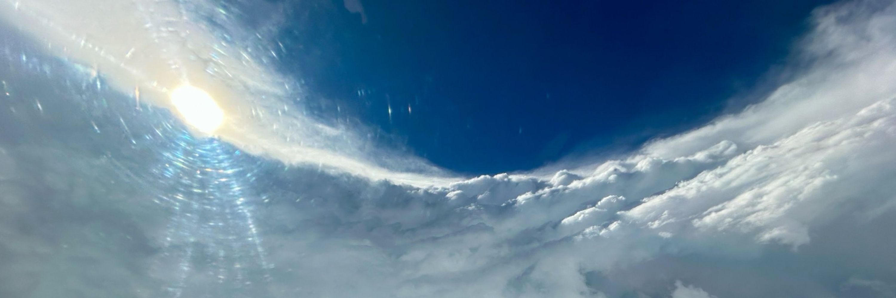
Overlooking Pearl River near Bogalusa, LA @vincentledvina.bsky.social


November 12, 2025 at 4:50 AM
Overlooking Pearl River near Bogalusa, LA @vincentledvina.bsky.social
West of Lumberton, MS

November 12, 2025 at 3:21 AM
West of Lumberton, MS
This is the most sinking motion (+VP200) observed over Africa in AMJ since 2015.
MJO phase 5-7 has been favored recently which is a mixed bag for subseasonal TC favorability of the Atlantic.
SW Atlantic & subtropics appear to be the hot spots for TCs generally.
Plots: @webberweather.bsky.social
MJO phase 5-7 has been favored recently which is a mixed bag for subseasonal TC favorability of the Atlantic.
SW Atlantic & subtropics appear to be the hot spots for TCs generally.
Plots: @webberweather.bsky.social


July 7, 2025 at 3:35 PM
This is the most sinking motion (+VP200) observed over Africa in AMJ since 2015.
MJO phase 5-7 has been favored recently which is a mixed bag for subseasonal TC favorability of the Atlantic.
SW Atlantic & subtropics appear to be the hot spots for TCs generally.
Plots: @webberweather.bsky.social
MJO phase 5-7 has been favored recently which is a mixed bag for subseasonal TC favorability of the Atlantic.
SW Atlantic & subtropics appear to be the hot spots for TCs generally.
Plots: @webberweather.bsky.social
90-day avg VP200 anomalies since April show how forcing aloft has evolved from spring into summer.
🟢 Rising motion over west Africa has waned
🟤 Sinking motion has increased over West IO (-IOD)
🟢 Rising has increased over maritime continent (-ENSO)
🟤 Sinking has increased over the Amazon
🟢 Rising motion over west Africa has waned
🟤 Sinking motion has increased over West IO (-IOD)
🟢 Rising has increased over maritime continent (-ENSO)
🟤 Sinking has increased over the Amazon
July 7, 2025 at 3:30 PM
90-day avg VP200 anomalies since April show how forcing aloft has evolved from spring into summer.
🟢 Rising motion over west Africa has waned
🟤 Sinking motion has increased over West IO (-IOD)
🟢 Rising has increased over maritime continent (-ENSO)
🟤 Sinking has increased over the Amazon
🟢 Rising motion over west Africa has waned
🟤 Sinking motion has increased over West IO (-IOD)
🟢 Rising has increased over maritime continent (-ENSO)
🟤 Sinking has increased over the Amazon
Deep convection east of the center of #Chantal is causing stronger pressure falls which is elongating and pulling the low-level center NE closer to the tilted mid-level center of the storm.
This is how TCs attempt to remedy the negative effects of wind shear and reorganize.
This is how TCs attempt to remedy the negative effects of wind shear and reorganize.

July 5, 2025 at 4:30 PM
Deep convection east of the center of #Chantal is causing stronger pressure falls which is elongating and pulling the low-level center NE closer to the tilted mid-level center of the storm.
This is how TCs attempt to remedy the negative effects of wind shear and reorganize.
This is how TCs attempt to remedy the negative effects of wind shear and reorganize.
TS #Chantal has gradually deepened since the last recon flight yesterday despite being quite lopsided due to SW wind shear.
While the west side is barren, the eastern side will be capable of gusty winds in excess of 50 mph and heavy rainfall as it moves into the Carolinas on Sunday.
While the west side is barren, the eastern side will be capable of gusty winds in excess of 50 mph and heavy rainfall as it moves into the Carolinas on Sunday.
July 5, 2025 at 3:52 PM
TS #Chantal has gradually deepened since the last recon flight yesterday despite being quite lopsided due to SW wind shear.
While the west side is barren, the eastern side will be capable of gusty winds in excess of 50 mph and heavy rainfall as it moves into the Carolinas on Sunday.
While the west side is barren, the eastern side will be capable of gusty winds in excess of 50 mph and heavy rainfall as it moves into the Carolinas on Sunday.
#Invest92L continues to gradually organize and AF recon has identified a closed surface center on the west edge of the deep convection.
A subtropical or tropical cyclone is forming, and some strengthening could occur before SE US landfall this weekend.
Next 🌀 name is Chantal.
A subtropical or tropical cyclone is forming, and some strengthening could occur before SE US landfall this weekend.
Next 🌀 name is Chantal.
July 4, 2025 at 7:36 PM
#Invest92L continues to gradually organize and AF recon has identified a closed surface center on the west edge of the deep convection.
A subtropical or tropical cyclone is forming, and some strengthening could occur before SE US landfall this weekend.
Next 🌀 name is Chantal.
A subtropical or tropical cyclone is forming, and some strengthening could occur before SE US landfall this weekend.
Next 🌀 name is Chantal.
Convection continues to become more concentrated and organized on the tail-end of a decaying front, and a broad low is developing as a result.
Despite SW shear, dry air, and limited time over water, a TC could develop over the weekend before impacting the SE US with heavy rain and gusty winds.
Despite SW shear, dry air, and limited time over water, a TC could develop over the weekend before impacting the SE US with heavy rain and gusty winds.
July 4, 2025 at 2:45 PM
Convection continues to become more concentrated and organized on the tail-end of a decaying front, and a broad low is developing as a result.
Despite SW shear, dry air, and limited time over water, a TC could develop over the weekend before impacting the SE US with heavy rain and gusty winds.
Despite SW shear, dry air, and limited time over water, a TC could develop over the weekend before impacting the SE US with heavy rain and gusty winds.
Global models are gradually coming into better agreement that another shorter-lived TC could develop from the tail-end of a stalling front off the SE CONUS this weekend.
Moderate SW wind shear, dry air, and land interaction will be impediments to development/strengthening of a TC.
Moderate SW wind shear, dry air, and land interaction will be impediments to development/strengthening of a TC.
July 3, 2025 at 3:10 PM
Global models are gradually coming into better agreement that another shorter-lived TC could develop from the tail-end of a stalling front off the SE CONUS this weekend.
Moderate SW wind shear, dry air, and land interaction will be impediments to development/strengthening of a TC.
Moderate SW wind shear, dry air, and land interaction will be impediments to development/strengthening of a TC.
In Bay of Campeche fashion, the curvature of the coast is enhancing sfc vorticity & a small low is developing near the coast under the deep convection.
This weak low will rotate up the wave axis, paralleling the Veracruz coast, buying itself time for TCG.
Next 🌀 name is Barry.
This weak low will rotate up the wave axis, paralleling the Veracruz coast, buying itself time for TCG.
Next 🌀 name is Barry.
June 28, 2025 at 5:46 PM
In Bay of Campeche fashion, the curvature of the coast is enhancing sfc vorticity & a small low is developing near the coast under the deep convection.
This weak low will rotate up the wave axis, paralleling the Veracruz coast, buying itself time for TCG.
Next 🌀 name is Barry.
This weak low will rotate up the wave axis, paralleling the Veracruz coast, buying itself time for TCG.
Next 🌀 name is Barry.
The Atlantic is on the verge of its quietest start since 2014 with 0 storms thus far.
About the only chance for development the next 7 days comes from this lingering trough SE of Bermuda.
Models are latching onto a weak low developing from this convection, but it will struggle to be well-defined.
About the only chance for development the next 7 days comes from this lingering trough SE of Bermuda.
Models are latching onto a weak low developing from this convection, but it will struggle to be well-defined.
June 22, 2025 at 4:08 AM
The Atlantic is on the verge of its quietest start since 2014 with 0 storms thus far.
About the only chance for development the next 7 days comes from this lingering trough SE of Bermuda.
Models are latching onto a weak low developing from this convection, but it will struggle to be well-defined.
About the only chance for development the next 7 days comes from this lingering trough SE of Bermuda.
Models are latching onto a weak low developing from this convection, but it will struggle to be well-defined.
It appears the more active East Pacific has won the CAG tug of war with the Caribbean and a TC will consolidate near Central America in the coming days.
📈 There are some hints of rapid intensification being possible if a more compact TC can form before landfall in Mexico.
The next 🌀 name is Erick.
📈 There are some hints of rapid intensification being possible if a more compact TC can form before landfall in Mexico.
The next 🌀 name is Erick.
June 15, 2025 at 6:50 PM
It appears the more active East Pacific has won the CAG tug of war with the Caribbean and a TC will consolidate near Central America in the coming days.
📈 There are some hints of rapid intensification being possible if a more compact TC can form before landfall in Mexico.
The next 🌀 name is Erick.
📈 There are some hints of rapid intensification being possible if a more compact TC can form before landfall in Mexico.
The next 🌀 name is Erick.
East Pacific tropics have been active in response to upward motion associated with a CCKW.
This CCKW will soon cross into the Caribbean where it will enhance gyre activity near Central America.
Land interaction will likely impede TC formation, but it remains possible a brief TC forms in 5-7 days.
This CCKW will soon cross into the Caribbean where it will enhance gyre activity near Central America.
Land interaction will likely impede TC formation, but it remains possible a brief TC forms in 5-7 days.
June 11, 2025 at 6:11 PM
East Pacific tropics have been active in response to upward motion associated with a CCKW.
This CCKW will soon cross into the Caribbean where it will enhance gyre activity near Central America.
Land interaction will likely impede TC formation, but it remains possible a brief TC forms in 5-7 days.
This CCKW will soon cross into the Caribbean where it will enhance gyre activity near Central America.
Land interaction will likely impede TC formation, but it remains possible a brief TC forms in 5-7 days.
4) With increased stability and cooler east Atlantic, it is reasonable to expect an increased chance for homegrown storms that develop closer to the North American continent.
This is fairly common in the early and late season anyways, but we may see more storms wait to develop until closer to land.
This is fairly common in the early and late season anyways, but we may see more storms wait to develop until closer to land.


June 2, 2025 at 12:55 AM
4) With increased stability and cooler east Atlantic, it is reasonable to expect an increased chance for homegrown storms that develop closer to the North American continent.
This is fairly common in the early and late season anyways, but we may see more storms wait to develop until closer to land.
This is fairly common in the early and late season anyways, but we may see more storms wait to develop until closer to land.
2) Cooling tropics and 3) warming mid-lats are a negative for TC activity as the Hadley cell stretches into summer.
This reduces vertical instability and intensity of convection over the tropics, inhibiting TC intensity and longevity. This was an important factor in analog year selection.
This reduces vertical instability and intensity of convection over the tropics, inhibiting TC intensity and longevity. This was an important factor in analog year selection.

June 2, 2025 at 12:55 AM
2) Cooling tropics and 3) warming mid-lats are a negative for TC activity as the Hadley cell stretches into summer.
This reduces vertical instability and intensity of convection over the tropics, inhibiting TC intensity and longevity. This was an important factor in analog year selection.
This reduces vertical instability and intensity of convection over the tropics, inhibiting TC intensity and longevity. This was an important factor in analog year selection.
The key factors driving the 2025 season:
1) El Niño is unlikely to develop this fall. Cool ENSO neutral conditions are favored.
While this generally helps Atlantic hurricane activity, the lack of ENSO influence will make tracking MJO activity more important during the season.
1) El Niño is unlikely to develop this fall. Cool ENSO neutral conditions are favored.
While this generally helps Atlantic hurricane activity, the lack of ENSO influence will make tracking MJO activity more important during the season.

June 2, 2025 at 12:55 AM
The key factors driving the 2025 season:
1) El Niño is unlikely to develop this fall. Cool ENSO neutral conditions are favored.
While this generally helps Atlantic hurricane activity, the lack of ENSO influence will make tracking MJO activity more important during the season.
1) El Niño is unlikely to develop this fall. Cool ENSO neutral conditions are favored.
While this generally helps Atlantic hurricane activity, the lack of ENSO influence will make tracking MJO activity more important during the season.
June 1st marks the official start of the 2025 #HurricaneSeason in the North Atlantic.
While I no longer am writing seasonal forecast discussions, I do have some thoughts about the upcoming season.
This season is favored to be near the 1991-2020 avg (14 storms, 7 hurricanes, & 3 major hurricanes).
While I no longer am writing seasonal forecast discussions, I do have some thoughts about the upcoming season.
This season is favored to be near the 1991-2020 avg (14 storms, 7 hurricanes, & 3 major hurricanes).

June 2, 2025 at 12:18 AM
June 1st marks the official start of the 2025 #HurricaneSeason in the North Atlantic.
While I no longer am writing seasonal forecast discussions, I do have some thoughts about the upcoming season.
This season is favored to be near the 1991-2020 avg (14 storms, 7 hurricanes, & 3 major hurricanes).
While I no longer am writing seasonal forecast discussions, I do have some thoughts about the upcoming season.
This season is favored to be near the 1991-2020 avg (14 storms, 7 hurricanes, & 3 major hurricanes).
Parts of south LA are waking up to their coldest morning ever recorded.
Lafayette 4°F (all-time record)
Baton Rogue 7°F (2nd lowest on record)
Slidell 8°F (all-time record)
Lake Charles 6°F (2nd lowest)
New Iberia 2°F (all-time record)
1899 record still stands at BTR and LCH.
Lafayette 4°F (all-time record)
Baton Rogue 7°F (2nd lowest on record)
Slidell 8°F (all-time record)
Lake Charles 6°F (2nd lowest)
New Iberia 2°F (all-time record)
1899 record still stands at BTR and LCH.

January 22, 2025 at 2:03 PM
Parts of south LA are waking up to their coldest morning ever recorded.
Lafayette 4°F (all-time record)
Baton Rogue 7°F (2nd lowest on record)
Slidell 8°F (all-time record)
Lake Charles 6°F (2nd lowest)
New Iberia 2°F (all-time record)
1899 record still stands at BTR and LCH.
Lafayette 4°F (all-time record)
Baton Rogue 7°F (2nd lowest on record)
Slidell 8°F (all-time record)
Lake Charles 6°F (2nd lowest)
New Iberia 2°F (all-time record)
1899 record still stands at BTR and LCH.
Today marks the last day of #HurricaneSeason.
𝟐𝟎𝟐𝟒 𝐒𝐞𝐚𝐬𝐨𝐧 𝐑𝐞𝐜𝐚𝐩:
18 Named Storms
11 Hurricanes
5 Major Hurricanes
161.6 ACE (12th highest since 1951)
>$220 billion in damage (2nd highest)
𝐒𝐭𝐫𝐨𝐧𝐠𝐞𝐬𝐭 𝐒𝐭𝐨𝐫𝐦:
🌀 Milton 180 Mph | 897 mb
𝐂𝐨𝐬𝐭𝐥𝐢𝐞𝐬𝐭 𝐒𝐭𝐨𝐫𝐦:
🌀 Helene >$120 billion (early estimates)
𝟐𝟎𝟐𝟒 𝐒𝐞𝐚𝐬𝐨𝐧 𝐑𝐞𝐜𝐚𝐩:
18 Named Storms
11 Hurricanes
5 Major Hurricanes
161.6 ACE (12th highest since 1951)
>$220 billion in damage (2nd highest)
𝐒𝐭𝐫𝐨𝐧𝐠𝐞𝐬𝐭 𝐒𝐭𝐨𝐫𝐦:
🌀 Milton 180 Mph | 897 mb
𝐂𝐨𝐬𝐭𝐥𝐢𝐞𝐬𝐭 𝐒𝐭𝐨𝐫𝐦:
🌀 Helene >$120 billion (early estimates)


November 30, 2024 at 3:42 PM
Today marks the last day of #HurricaneSeason.
𝟐𝟎𝟐𝟒 𝐒𝐞𝐚𝐬𝐨𝐧 𝐑𝐞𝐜𝐚𝐩:
18 Named Storms
11 Hurricanes
5 Major Hurricanes
161.6 ACE (12th highest since 1951)
>$220 billion in damage (2nd highest)
𝐒𝐭𝐫𝐨𝐧𝐠𝐞𝐬𝐭 𝐒𝐭𝐨𝐫𝐦:
🌀 Milton 180 Mph | 897 mb
𝐂𝐨𝐬𝐭𝐥𝐢𝐞𝐬𝐭 𝐒𝐭𝐨𝐫𝐦:
🌀 Helene >$120 billion (early estimates)
𝟐𝟎𝟐𝟒 𝐒𝐞𝐚𝐬𝐨𝐧 𝐑𝐞𝐜𝐚𝐩:
18 Named Storms
11 Hurricanes
5 Major Hurricanes
161.6 ACE (12th highest since 1951)
>$220 billion in damage (2nd highest)
𝐒𝐭𝐫𝐨𝐧𝐠𝐞𝐬𝐭 𝐒𝐭𝐨𝐫𝐦:
🌀 Milton 180 Mph | 897 mb
𝐂𝐨𝐬𝐭𝐥𝐢𝐞𝐬𝐭 𝐒𝐭𝐨𝐫𝐦:
🌀 Helene >$120 billion (early estimates)

November 20, 2024 at 12:29 AM
🌀 Typhoon Man-Yi likely nearing Category 5 intensity based off latest satellite imagery.
Terrible timing for rapid intensification right before landfall in the Philippines.
Terrible timing for rapid intensification right before landfall in the Philippines.


November 16, 2024 at 12:37 AM
🌀 Typhoon Man-Yi likely nearing Category 5 intensity based off latest satellite imagery.
Terrible timing for rapid intensification right before landfall in the Philippines.
Terrible timing for rapid intensification right before landfall in the Philippines.
🌀 Man-yi in the West Pacific is well on its way to becoming the 3rd Super Typhoon (4th typhoon in total) to strike the Philippines in less than 10 days.
Quite uncommon to see such a well choreographed train of typhoons that track over nearly the same area.
Quite uncommon to see such a well choreographed train of typhoons that track over nearly the same area.
November 15, 2024 at 10:50 PM
🌀 Man-yi in the West Pacific is well on its way to becoming the 3rd Super Typhoon (4th typhoon in total) to strike the Philippines in less than 10 days.
Quite uncommon to see such a well choreographed train of typhoons that track over nearly the same area.
Quite uncommon to see such a well choreographed train of typhoons that track over nearly the same area.
🚂🌀 West Pacific Typhoon Train
Yet another typhoon is gathering strength in the WPAC and aiming toward Luzon, Philippines. Man-yi is forecast to be the 4th typhoon in just 10 days to impact the area.
Super Typhoon Yinxing 11/7
Typhoon Toraji 11/11
Super Typhoon Usagi 11/14
Yet another typhoon is gathering strength in the WPAC and aiming toward Luzon, Philippines. Man-yi is forecast to be the 4th typhoon in just 10 days to impact the area.
Super Typhoon Yinxing 11/7
Typhoon Toraji 11/11
Super Typhoon Usagi 11/14
November 14, 2024 at 3:36 PM
🚂🌀 West Pacific Typhoon Train
Yet another typhoon is gathering strength in the WPAC and aiming toward Luzon, Philippines. Man-yi is forecast to be the 4th typhoon in just 10 days to impact the area.
Super Typhoon Yinxing 11/7
Typhoon Toraji 11/11
Super Typhoon Usagi 11/14
Yet another typhoon is gathering strength in the WPAC and aiming toward Luzon, Philippines. Man-yi is forecast to be the 4th typhoon in just 10 days to impact the area.
Super Typhoon Yinxing 11/7
Typhoon Toraji 11/11
Super Typhoon Usagi 11/14